Welcome to our ongoing effort to catalog citizen science and other public participation in scientific research (PPSR) projects for UC California Naturalists and other citizen scientists. We invite you to browse the listed projects or enter key words (like birds, youth, invasive, coast, Alameda, etc.) in the search box above to find projects in your area. It's a great way to stay involved and keep developing your skills as a natural scientist!
A vast majority of the information in the database was gathered from project websites and may be out of date. We encourage you to contact projects directly to get involved and learn about most recent opportunities. If you work with a listed project and would like to add to, update, or correct the information we have, please email cghdixon@ucdavis.edu. Also, please consider filling out the "PPSR perspectives" survey. Click here to access the survey, which will help guide this project in the coming year.
If you know of a project not on our list, please go to the "tell us about a project" link on the left so we can list the project here. Thanks for your help!
Special thanks goes to the National Science Foundation Informal Science Education program and the Stephen J. Bechtel, Jr. Foundation for supporting this database of projects.
Pacific Flyway Shorebird Survey
-
Organization NamePoint Blue
-
Project Website
-
Organization Website
-
PartnersCalifornia Avian Data Center (CADC), a regional node of the Avian Knowledge Network (AKN)
-
Contact NameKhara Strum
-
Contact Emailkstrum@prbo.org
-
Contact Phone707-781-2555
-
Other Contact Information
SF Bay Research Center: http://www.prbo.org/cms/600
prbo@prbo.org -
Project Purpose (taken from project materials)
To learn about species population trends, subsequently which shorebird species are at greatest risk, and which habitats they most depend upon.
This study will help elucidate the importance of San Francisco Bay and Central Valley wetlands as wintering grounds for shorebirds and other waterbirds along the Pacific Flyway. The annual PFSS will help fill existing information gaps and provide guidance to resource managers on how best to conserve shorebird habitats in the face of environmental change, including urbanization, extreme weather and climate variation, agricultural flooding, and wetland restoration and management.
-
Participant Activities
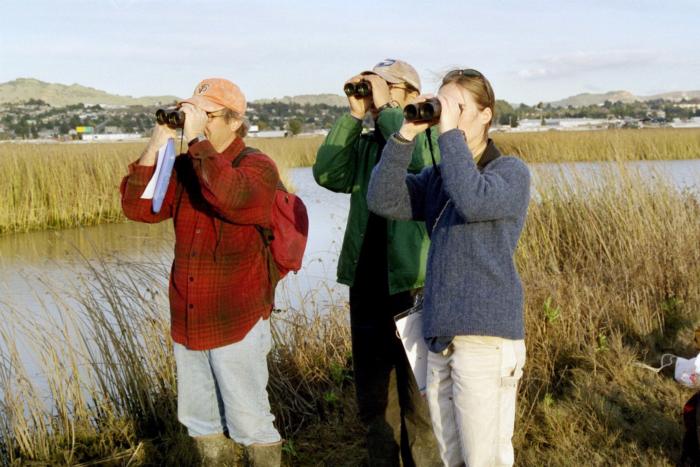
Between November 15th and December 15th, participants scour the San Francisco Bay and Central Valley to count shorebirds.
- Training: Attend a protocol training session prior to the survey and get your site assignment.
- Scouting: Become familiar with your site, make sure you know the access points and how long it will take to cover the area.
- Survey: One day between November 15th and December 15th.
-
Data Entry
-
Other
-
-
Other Participant ActivitiesN / A
-
System Studied
-
Birds
-
-
Geographic ScopeRegional
-
RegionAll (see 'geographic scope')
-
LocationBay Area and beyond
-
Location - MapN / A
-
Time Commitment
-
Once a year
-
-
Volunteer Qualifications
Best candidates for the project will:
- have their own optics (binoculars and scope)
- posess reliable transportation
- be willing to follow a protocol and enter data online into CADC
- have computer knowledge and skills
- have a passion for and dedication to shorebird conservation
- be excited about making a long-term committment to the project
-
Volunteer Training
5-6 hours one day for training.
Resources regarding protocol, maps, etc. are also accessible on the website under resources, along with tips for project leaders, as well as for observers (counting, bird ID slides, etc.)
-
Cost to ParticipantN / A
-
How will the findings be used?
- Data is currently available online in the Explore Data section. All data is stored in the California Avian Data Center.
- San Francisco Bay survey data have been integrated with GIS habitat data from the San Francisco Estuary Institute to correlate habitat parameters with the census information.
- Central Valley survey data have provided information used in key management decisions in regards to managed wetlands and agricultural practice beneficial to shorebirds, particularly in rice fields. (link to Central Valley flyer)
- reports and publications produced using the data are available on the project website.
-
Other InformationN / A
-
Photo

-
last update:9/11/12
If you work with this project and would like to add to or update the information below, please email cghdixon@ucdavis.edu.
If you know of a project not on our list, please go to the "tell us about a project" link on the left so we can list the project here. Thanks for your help!
This database is focused on projects in California focused on the environment. For opportunities outside California, as well as national projects that don't have a California-specific components, check http://www.birds.cornell.edu/citscitoolkit/projects.

