- Author: UC Berkeley Department of Environmental Science, Policy and Management
Land use change in agricultural frontiers can have far-reaching social and environmental implications, such as habitat loss, water contamination, or worker demographic shifts — particularly when it involves the rapid expansion of a new industry such as cannabis production. A recent study published in Landscape and Urban Planning offers an interdisciplinary perspective on the drivers of cannabis production in rural areas, using interviews with farmers and spatial modeling to uncover key factors.
Led by researchers from UC Berkeley's Department of Environmental Science, Policy, and Management (ESPM) and the...
- Author: Mackenzie Smith
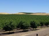
Two UCANR Cooperative Extension specialists have recently launched CalLands, a powerful online tool that can help users understand how land ownership impacts California's croplands.
To build the CalLands' interactive website, Luke Macaulay and Van Butsic — both assistant UC Cooperative Extension specialists based in UC Berkeley's Department of Environmental Science, Policy, and Management — combined satellite-generated maps of land cover created by the U.S. Department of Agriculture with publicly...
- Author: Julie Van Scoy
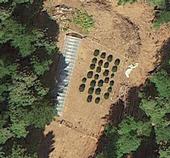
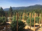
As policy liberalization rapidly transforms the multi-billion-dollar cannabis agriculture industry in the United States, the need for regulation and assessment of environmental impacts becomes increasingly apparent.
A recent study led by UC Cooperative Extension specialist Van Butsic used high resolution satellite imagery to conduct a systematic survey of cannabis production and to explore its potential ecological consequences.
Published this spring in Environmental Research Letters, the study...
- Author: Brenda Dawson
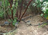
While the legality of California’s medical marijuana dispensaries is being debated in courtrooms, a UC Cooperative Extension forestry and wildlands ecology advisor says there are a number of issues related to the unregulated land-use practices of illicit cannabis growing that have not been addressed.
“As a forest ecologist, I spend a lot of time outdoors, and I talk to thousands of people every year about forest-related subject matter,” says Greg Giusti. “And you can’t talk to anybody today on the North Coast without the topic of cannabis growing and cannabis impacts on land coming up.”
In Lake and Mendocino counties, Giusti performs research and shares...
- Author: Janet Byron
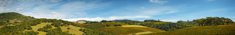
Geographic information system (GIS) models developed at UC Davis are being used to pinpoint the best farmland for conservation in the Central Valley. A new landscape-scale method, described in a recent issue of California Agriculture journal, was applied in Fresno County, and the approach is being extended regionally in the San Joaquin Valley.
“Policy programs and local planning agencies must assess farmland before implementing policies and programs aimed at farmland conservation,” lead author Evan Schmidt wrote in California Agriculture. “The application of GIS to existing land-assessment practices can update...

