- Author: Sabrina L. Drill
In September and October 2021, over 100 land, resource, and fire professionals and community members came together to learn about fire in Southern California with UCANR and the Council for Watershed Health. Over the course of three days, over 60 federal, state, county, and local government, power and water utilities, and climate, fire, and resource scientists and professional discussed what climate change means for fire weather, how soil and water are affected by fire, how plants and animals factor in to fire damage and cycles, and how municipalities and utilities are working to manage risk. You can view the presentations and catch up with our Wildfire 101 resources at https://www.watershedhealth.org/2021-wildfire-symposium

- Author: Sabrina L. Drill

Kudos to the Ventura County Fire Department, Conejo Open Space Conservation Agency, National Park Service, US Forest Service, and California State Parks for addressing this very important gap in fire preparedness information. I remember on my first solo backpacking trip near Mt. Whitney waking up one morning to the smell of smoke, and cutting my trip a few nights short to get out of there (turned out the fire was in Monterey County, but the smoke blew inland).
From the guide - "The Ready, Set, Go! Trail Users program is about being prepared (ready), situational awareness – knowing what's going on around you (set) – and getting out of harm's way (go!). By following a few simple steps, trail users can enjoy the natural beauty of Ventura County without putting themselves in the path of a wildfire."
Tips include when, where, and how to safely have a campfire or use a stove, and steps to prepare before your trip:
"• Before you leave, tell someone when and where you will be. This is especially important if you will be travelling alone. Be sure to take a fully charged cell phone and some sort of signaling device with you. This could be as simple as a whistle or a mirror. • Take protective clothing including long pants and long sleeves made of a natural fiber, a bandana to filter smoky air and a hat to keep embers from falling on your head. • Have good maps with you and pre-plan your escape routes. A fire could block your path and prevent you from going out the same way you came in."
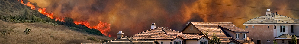
- Author: Sabrina L. Drill
The Los Angeles Fire Department has updated containment of the Palisades Fire to 72%, and just under 1200 acres. In addition, an suspect has been detained and charged with felony arson by the LA County DA's office. If you'd like to learn more about, or support, Malibu/Topanga's volunteer arson watch, visit http://www.arsonwatch.com/. ANR's resources on fire recovery can be found here. 
- Author: Sabrina L. Drill
At the recent 2021 Hansen Symposium - Climate Change:What Does it Mean for Southern California, UCCE Extension Fire Specialist Max Moritz, Central Coast Range and Natural Resources Advisor Matthew Shapero, and yours truly, Urban Natural Resources Advisor LA/Ventura Sabrina Drill discussed the impacts of and ways to adapt to climate change and wildfire at the regional, subdivision, rangelands, and home scale. Watch our presentations here! You can also learn about how climate change is affecting our weather and fire risk from Dr. Daniel Swain and learn about how YOU can get involved through our Climate Stewards program from the first day of the symposium, and hear about how agriculture is adapting to climate change from the second day.
- Author: Sabrina L. Drill
Looking for information in the wake of the Woolsey and Hill fires? For information about county resources for debris removal, erosion management, and how to access support for housing, financial support, and support for agricultural resource recovery, you can visit http://venturacountyrecovers.org/. To find diaster assistance centers in Los Angeles County, visit https://www.lacounty.gov/woolseyfire-disaster-assistance-centers/. For specific questions related to applying for aid, policy, and legal issues, you can also visit Pepperdine Law's Disaster Relief Clinic at https://law.pepperdine.edu/experiential-learning/clinical-education/clinics/disaster-relief-clinic/ . They are not there to represent plantiffs in legal action, but can provide guidance on how to seek representation.
You can find a great deal of technical information in the Ventura County Fires Info Facebook Group, and learn about and share resources at the Woolsey and Hill Fire Info Facebook Group. University of California is providing these links as a (hopefully) helpful service, but does not vet or stand behind any particular information users share there.

