- Author: Ben Faber
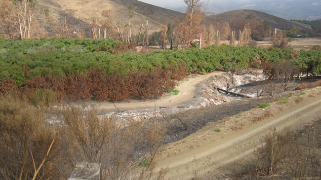
Are you interested in climate-smart solutions for your agricultural or forestry operation? USDA offers voluntary programs and services to help you build soil health, sequester carbon, reduce greenhouse gas emissions, enhance productivity and commodity marketability, and mitigate the impacts of climate change while building resilience to strengthen your operation.
Check it out
- Author: Ben Faber
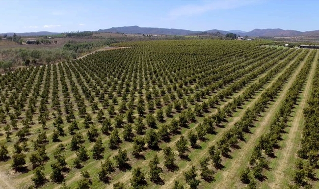
WASHINGTON, June 26, 2019 – USDA's Natural Resources Conservation Service (NRCS) and the University of California at Davis Soil Resource Laboratory today announced the release of the iOS and Android SoilWeb app, version 2.0. The app now has a cleaner and more modern interface with GPS-location-based links to access detailed digital soil survey data (SSURGO) published by the NRCS for most of the United States. The newly updated SoilWeb smartphone application is available as a free download on Google Play  and Apple App Store
  .
.
“SoilWeb reached a new milestone this year when it was integrated with Google Maps and designed to scale across any device, desktop, tablet or smart phone,” said NRCS Chief Matthew Lohr. “SoilWeb app is a portable interface to authoritative digital soil survey data from NRCS, giving users access to practical detailed scientific soil information on the go.”
The SoilWeb app provides users with information relating to soil types that are associated with their location. The images are then linked to information about the different types of soil profiles, soil taxonomy, land classification, hydraulic and erosion ratings and soil suitability ratings. Identifying soil types is important to understanding land for agricultural production purposes and determining flooding frequencies and suitable locations for roads or septic tanks. SoilWeb provides gardeners, landscapers and realtors with information relating to soil types and how to optimally use the soil. Although soil survey information can be used for general farm, local, and wider area planning, a professional onsite evaluation may be needed to supplement this information in some cases.
“SoilWeb is a great way to understand the landscape you live in,” said Anthony O'Geen, UC Davis Professor and Cooperative Extension Specialist in the Department of Land, Air and Water Resources. “Producing food, constructing structures and maintaining landscapes all depend on this little understood, but critical outermost layer of the earth's crust, the soil.”
The app gives access to valuable scientific data through modern technology. All the soil information in SoilWeb was collected from the National Cooperative Soil Survey, organized by the NRCS, and accesses soil survey information the agency has been collecting since the 1890s. The resulting database, the largest such in the world, makes it possible for soil scientists to generate specialized maps using computer-aided techniques.
O'Geen developed SoilWeb with NRCS Soil Scientist Dylan Beaudette, in 2010 when Beaudette was a Ph.D. student at UC Davis. The app was a popular download, but by 2017 was no longer in compliance with requirements set by Apple and Google. Frequent users of SoilWeb had to rely on the web-based version from 2017 to June 2019. Any users with the older version on their phone can do a simple update to access the newest version. The app is a product of a 14-year partnership between NRCS and UC Davis College of Land, Air and Water Resources.
- Author: Ben Faber
Here is a really good introduction to the use of the on-line Soil Survey from USDA. Maybe it is easier to follow than blogs I have posted in the past.
WASHINGTON — “Soil don't get no respect,” Rodney Dangerfield might have said (but didn't). Perhaps you know your state bird or flower, but do you know your state soil?
Well, in recent years soil has begun to get more respect. Since the celebration of the Soil Survey Centennial back in 1999, each state has been given its own official state soil. It was in 1899 that the U. S. Department of Agriculture started its survey of all the soils in the country.
SOILS COME IN MANY ‘Flavours'
You might wonder what a “soil survey” really is. Isn't it all just dirt — some perhaps stickier, or redder or deeper — that lies beneath forest, meadow, farm, home and garden?
There you go again. Not enough respect.
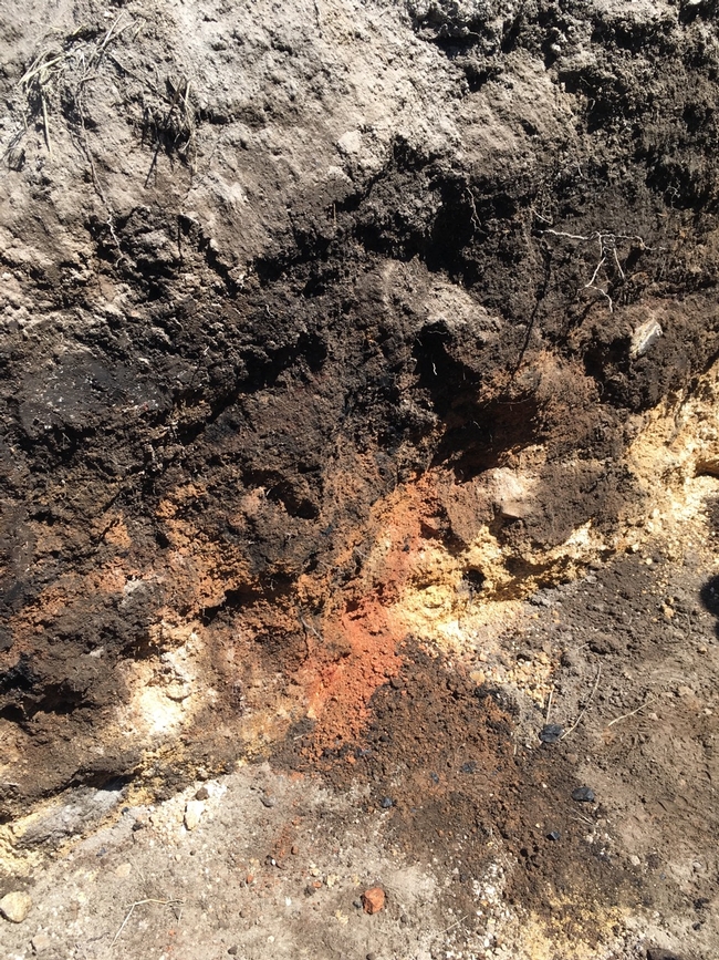
In fact, soils are distinctive, as different from each other as robins are from blue jays. These differences are hard to appreciate, of course, because soil is mostly underground, hidden from view. But if you were to dig some holes a few feet deep and then look carefully at their inside surfaces, you would find that soils are made up of layers of varying thickness, called horizons. One soil might differ from the next not only in the thickness of its horizons, but also in their appearance and feel.
Horizons might be as white as chalk, as red as rust, or as dark brown as chocolate. A horizon might be cement-hard, gritty with sand, or stuff for sculpture. And if you were to tease the dirt along one edge of the hole so it falls away naturally — wow! — each horizon would reveal its particles clumped together in arrangements like plates, blocks or prisms. Such information, and more, has allowed soils to be classified, much as birds, flowers and other living things are.
CLASSIFYING SOILS
Modern soil classification goes back only a few decades, when all the world's soils were grouped taxonomically into a dozen “orders.” Differences among orders reflect the formative influence of a particular combination of climate, plants and animals, topography, time and original rock material.
Just as all vertebrate animals are huddled together by biologists into smaller groupings (mammals, say) and those groupings into still smaller ones, so each soil order is divided and subdivided to include more distinctly different soils. At the end of the dividing and subdividing, you end up with a “soil series” identified with a proper name — like the Haven series in my vegetable garden, for example.
YOUR STATE'S AND BACKYARD'S SOIL
A particular soil becomes an official state soil by being widespread within the state; being distinctive chemically or physically; having some degree of name recognition; and, of course, getting a legislative stamp of approval. Examples include soils like West Virginia's Monongahela soil, Texas' Houston Black soil, California's San Joaquin soil and New York's Honeoye soil.
The job, now, of these “ambassadors” of the benevolent underworld is to rekindle awareness of soil's value as a natural resource that can only be renewed very slowly. Soil provides food, shelter, clothing and more, yet it is being lost at alarming rates to everything from blacktop to erosion.
Out in the garden this spring, dig a hole deep and wide enough that you can see and appreciate at least some of the various and distinctive horizons.
Then, if you want the name and a detailed description of that soil — or any soil — look at the maps and descriptions in the Soil Survey Reports issued by the U. S. Department of Agriculture, Natural Resource Conservation Service (NRCS). Search online for “soil survey nrcs” and you'll find links to soil maps for counties throughout the U.S. Or go to the link to “web soil survey.” At this site, you can type in a street address around which you “draw” your area of interest (AOI). The site will delineate the names and descriptions of soils within that AOI.
And of course this is available as an app at:
https://casoilresource.lawr.ucdavis.edu/soilweb-apps/
Online:
www.leereich.com/blog
leereich.com
http://www.leereich.com/2016/06/edens-gardens.html
- Author: Ben Faber
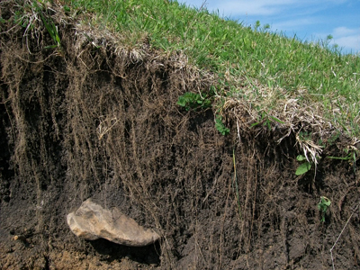
USDA's Farm Service Agency (FSA) offers disaster assistance and low-interest loan programs to assist agricultural producers in their recovery efforts following wildfires or other qualifying natural disasters. Available programs and loans include:
- Non-Insured Crop Disaster Assistance Program (NAP)
- - provides financial assistance to producers of non-insurable crops when low yields, loss of inventory, or prevented planting occur due to natural disasters including excessive wind and qualifying drought (includes native grass for grazing). Eligible producers must have purchased NAP coverage for 2017 crops. A notice of loss must be filed within 15 calendar days of when the loss is apparent or 15 calendar days after the normal harvest date.
- Livestock Indemnity Program (LIP)
- - offers payments to eligible producers for livestock death losses in excess of normal mortality due to adverse weather. Eligible losses may include those determined by FSA to have been caused by hurricanes, floods, blizzards, wildfires, tropical storms, tornados lightning, extreme heat, and extreme cold. Producers will be required to provide verifiable documentation of death losses resulting from an eligible adverse weather event and must submit a notice of loss to their local FSA office within 30 calendar days of when the loss of livestock is apparent.
- Tree Assistance Program (TAP)
- – provides assistance to eligible orchardists and nursery tree growers for qualifying tree, shrub and vine losses due to natural disasters including excessive wind and qualifying drought.
- Emergency Assistance for Livestock, Honeybees, and Farm-Raised Fish Program (ELAP)
- - provides emergency relief for losses due to feed or water shortages, disease, adverse weather, or other conditions, which are not adequately addressed by other disaster programs. ELAP covers physically damaged or destroyed livestock feed that was purchased or mechanically harvested forage or feedstuffs intended for use as feed for the producer's eligible livestock. In order to be considered eligible, harvested forage must be baled; forage that is only cut, raked or windrowed is not eligible. ELAP also covers up to 150 lost grazing days in instances when a producer has been forced to remove livestock from a grazing pasture due to wildfire and for beekeepers, ELAP covers beehive losses (the physical structure) in instances where the hive has been destroyed by a natural disaster including flooding, high winds and tornadoes. Producers must submit a notice of loss to their local FSA office within 30 calendar days of when the loss is apparent.
- Emergency Loan Program
- – available to producers with agriculture operations located in a county under a primary or contiguous Presidential or Secretarial disaster designation. These low interest loans help producers recover from production and physical losses.
- Emergency Conservation Program (ECP)
- - provides emergency funding for farmers and ranchers to rehabilitate land severely damaged by natural disasters; includes fence loss.
- HayNet
- - is an Internet-based Hay and Grazing Net Ad Service allowing farmers and ranchers to share ‘Need Hay' ads and ‘Have Hay' ads online. Farmers also can use another feature to post advertisements for grazing land, specifically ads announcing the availability of grazing land or ads requesting a need for land to graze. www.fsa.usda.gov/haynet.
www.fsa.usda.gov/disaster
For more information on these programs, visit FSA online at www.fsa.usda.gov.
To find a local FSA office near you, visit
http://offices.usda.gov.
USDA is an equal opportunity lender, provider and employer.
- Author: Ben Faber
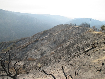
The USDA's Farm Service Agency and Natural Resources Conservation Service will have workshops to aid agricultural producers; including cattle, tree, nursery, vegetable, and berry farmers in filing for federal assistance programs. Appointments can be arranged now for filing applications during these workshops.
|
