Story map shows history of land under Hopland REC

Field research in agricultural and natural resource science has been ongoing at UC Research and Extension Centers for over 70 years, making an impact on the food we eat and the management practices we recommend. What afforded us the opportunity to have these living laboratories? The University of California is a land grant institution and is directly linked with the federal Morrill Act of 1862, also known as the Land-Grant College Act. The Act granted land mostly taken from indigenous tribes to states that used the proceeds from the sale of these lands to fund colleges specializing in agriculture and the mechanical arts.
A recent article in High Country News, “Land-Grab Universities,” provides interactive spatial data revealing the direct connection between the ~10.7 million acres of stolen Indigenous land and land-grant institutions. Many of these Morrill Act parcels were in California and, thanks to Andy Lyons at UC ANR's IGIS, we can readily view the overlap between UC land and these parcels in a geographic information system.
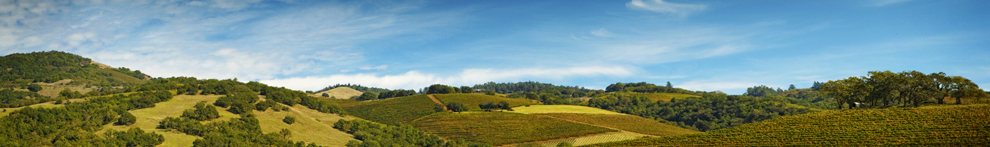
We created an ESRI Story Map to provide a synoptic history of the land that Hopland Research and Extension Center currently occupies before it became part of the University of California. The map is the result of a collaborative effort that included the UC ANR Native American Community Partnerships Work Group, the Tribal Historic Preservation Officer for the Hopland Band of Pomo Indians, Hopland REC staff, local long-time residents, and UC ANR IGIS. Our hope is that educators, researchers, land owners, and other Hopland community members will learn about the historical context in which Hopland REC was founded, and develop a sense of appreciation and admiration for the land we study, as well as the uncomfortable historical context which led to its current use and ownership.
This story map builds on an acknowledgement of the Shóqowa and Hopland People on whose traditional, ancestral, and unceded lands we work, educate and learn, and whose historical and spiritual relationship with these lands continues to this day. It contains some details on the Indigenous history, a brief history of the Spanish-Mexican land grant and other facts from the early colonial period, a timeline of notable events, and ways Hopland REC and neighboring Indigenous communities are collaborating to foster a sincere and mutually beneficial relationship for the land and the community.
Please explore Hopland REC's land history. If you are interested in building your own land history story map, see our methods in the reference section.
