- Posted By: Rob York
- Written by: Rob York (view the full blog at www.foreststeward.com)
Article reviewed: Impacts of fire exclusion and recent managed fire on forest structure in old growth Sierra Nevada mixed-conifer forests
By B.M. Collins, R.G. Everett, and S.L. Stephens. 2011. Published in Ecosphere, Volume 2(4):art51. doi:10.1890/ES11-00026.1
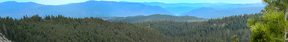
The plot line: These researchers found some rare vintage 1911 data that was collected in what is now Yosemite National Park. With what they think is reasonable confidence, they were able to relocate the 1911 areas and do a century-long re-measurement. The times of measurement in this case are especially relevant- 1911 conditions reflect what the forest looked like under an unaltered fire regime (i.e. before Euro-Americans came along and screwed things up). Because this particular forest has no history of harvesting and only recent reintroductions of fire, the re-measurement assesses long-term change as a result of fire suppression and evaluates the effectiveness of recent fires in re-establishing a forest structure that is similar to 1911. As many others have also found, they found that fire suppression dramatically altered forest structure over time, leading to much higher tree densities, and a decline in ponderosa pine traded for an increase in white fir. Areas that burned recently with moderate severity fires were much more similar in structure to 1911 conditions than areas that did not burn or that burned with low severity fires. They conclude that current restoration treatments are likely not creating forest structures that are similar to pre EuroAmerican times (they are still too dense), and that managers should consider the complex interaction of climate change with fire suppression when trying to create resilient forests.
Relevant quote: “While fires of lesser intensity likely will reduce surface fuels and understory trees which is important in reducing potential tree mortality from fire and possibly maintaining desired forest conditions once achieved initially, they may not be sufficient alone to achieve historical forest structure given the substantial tree establishment that occurred during the fire exclusion period.”
Relevance to landowners and stakeholders:
There are several ways to reconstruct what the forest looked like in the past (e.g. pictures, written accounts, backwards modeling, isotopes, pollen, etc.). All of the available methods have their problems with bias, but nothing beats raw data from measurements collected by actual people. This is assuming that the people took care in collecting the data objectively (i.e. they did not suffer from “majestic tree” bias by selecting areas to measure just because they had huge trees). The degree to which old data are useful is really a matter of how much you trust the original folks who did the measurements. In this case, the original folks did not have incentive to heavily bias their measurement, and it appears that they measured areas systematically, which should reduce bias. So as far as old data go, the data used in this study is pretty good. We are still not sure that they were totally unbiased because they were not doing research at the time, and therefore did not have the same level of quality assurance or precision checks that modern researchers do. While I am suspicious that these 1911 surveyors took as much care in measurements as I would expect from modern researchers, I nonetheless consider it likely that this old data is much better than the alternatives for reconstructing forest structure as of a century ago.
While reconstruction studies in the Sierra Nevada are all inexact, the overwhelming agreement among them overcomes their individual imprecision. This study agrees with what is now an abundance of work that has documented at least these very basic changes regarding the effects of fire suppression:
- Forests where only fire suppression has occurred are much denser than they were in the past (using any measure of density- canopy, # of trees per area, or basal area).
- There are lots more trees in the smaller and moderate size classes than there were in the past.
- White fir has increased in tree density, primarily because of increases in small and medium sized trees
- Ponderosa pine has decreased in relative density, primarily because of a lack of small and medium sized trees
Relevance to managers:
Managers will appreciate that the authors of this paper are very direct in providing management implications, yet they are also nuanced in describing how this research may inform decisions. They provide three implications:
- Treatments that attempt to recreate the forest structure of the past should avoid using average values for hard targets, and should instead consider recreating ranges of conditions or measures of variability
- The structural restoration targets that are currently being used are likely too conservative. If the objective of treatments are to recreate past structure, post treatment densities are too high.
- As managers move beyond the oversimplified approach of recreating past structure and instead incorporate the objective of building resilient forests, they will consider the effects of climate change along with the effects of fire suppression.
Areas that burned recently with moderate severity fires were closer to 1911 structure than areas that either had no fire or burned with low severity fire. Despite a lack of statistical significance, you can still see that even moderate severity fires did not reduce density to what the 1911 structure was. With higher sampling effort, they probably could have detected a difference (from the graph, it looks like areas burned with moderate severity fires had about 125 trees per hectare while 1911 density was about 80 trees per hectare). So for fire managers, this would indicate that fires following long periods of should be toward the moderate classification of severity if they are trying to recreate past structural conditions. Perhaps repeated low-severity fires will eventually lead to more similar conditions to the past, but we won’t know until we have a longer track record of conducting repeat burns.
This study further indicates to me that broadly-applied upper diameter limits (e.g. thou shalt not cut a tree greater than 24”) simply do not make sense. The authors point out that, while limiting tree removal to less than 12” diameter can make sense from the perspective of reducing fire severity, it can also mean that stand density in terms of basal area is much too high from either a structural restoration point of view or a forest resilience point of view.
Critique (I always have one, no matter how good the article is):
I was disappointed that they did not measure as many areas as they could have. They say they found 50 areas that were measured in 1911, but then only re-measure 30 of these areas because of “time and access constraints.” They make a big deal (appropriately) about how unique and important this data set is. If it is so important, why not spend the money and time to re-measure the whole thing? Further, they use the non-significance between 1911 forest and the moderately burned modern forest structure as evidence that the moderate severity fire re-created the 1911 structure. If you look at the data, however, the areas burned with moderate severity fire still had higher density (over 50% higher as far as I can tell from the graph). This difference may have been detectable with a few more plots measured. Finally, not measuring some of the areas makes me wonder if the more easy-to-access areas were measured first, thus introducing a possible bias.
I also wish they had reported basal area differences. Basal area is often a much more useful way of describing forest density, especially in the context of conducting restoration/resilience treatments.
All in all, however, it is a good study especially with respect to reconciling fuel reduction treatments (fire or thinning) with forest resilience treatments. And it is interesting to compare this reconstruction study with this one that I reviewed earlier.
- Posted By: Rob York
- Written by: Zev Balsen, PhD candidate in the Stephens lab at UC Berkeley
Article reviewed: Post-1935 changes in forest vegetation of Grand canyon National Park, Arizona, USA: Part 1 – ponderosa pine forest
By Vankat, J.L. 2011. Post-1935 changes in forest vegetation of Grand canyon National Prak, Arizona, USA: Part 1 – ponderosa pine forest. Published in Forest Ecology and Management, Vol 262 pp 309-235.
The plot line: In 1935 the National Park Service sampled hundreds of vegetation plots in Grand Canyon National Park (GCNP). In 2004, the author of this paper relocated and remeasured many of these plots. Ninety-nine of the plots were in ponderosa pine forest (PPF); these PPF plots were analyzed in this article. The author looked for changes in tree density and basal area between 1935 and 2004. Comparisons were made based on size class, species composition, and PPF subtype (dry, mesic, and moist).
Because dozens of comparisons were made, there was a battery of findings, with some species and forest types showing significant increases, some decreases, and others showing no change. Perhaps the most surprising finding was that when all PPF forest types were analyzed together, there was no change in tree density and basal area actually decreased. These results were accompanied by changes in species composition: The number of quaking aspen decreased by over 80% and the number of white fir increased by a shocking 631%.
When the three PPF subtypes were analyzed separately, a different set of changes were seen. Dry PPF forest, which is found at lower elevations and is transitional with pinyon-juniper vegetation, showed no statistically significant changes. Mesic plots, on the other hand, showed a large decrease in basal area, mostly due to loss of ponderosa pine in the medium size class. Despite this decrease in basal area, tree density did not decrease. This can be explained by a significant increase in the density of small trees, including a staggering 2351% increase in small white fir. Finally, moist PPF showed a large decrease in total tree density, mostly due to loss of quaking aspen. In these moist forests, quaking aspen went from being the most common tree in 1935 to being third most common after ponderosa pine and white fir in 2004.
In the second part of this article, the author attempted to place his findings in the context of other studies on historical forest structure in GCNP. Estimates of tree density and basal area at different dates were plotted and trend lines were fit to the graphs. The results in this section of the paper were highly variable. They suggested an increase since the 19th century in total density of saplings and trees. However, for just trees--excluding saplings--the graphs showed no clear trend.
Relevant quote: “Previous studies...in the Southwest indicated that historical dynamics...have involved increases in forest densities... However, this study -- the first to examine multi-decadal changes across a never-harvested Southwestern PPF landscape using resampled historical plots -- documents that changes...also have included decreases since 1935."
Relevance to landowners and stakeholders:
Historical forest information is crucial to our understanding of current forest conditions, management goals, and appropriate management techniques. However, previous studies in GCNP (and elsewhere) have relied on estimates from extrapolated data, reconstructions based on tree rings, and sampling of contemporary reference sites thought to represent historical conditions. These methods all have their own particular pitfalls that may introduce large uncertainties about historical conditions. For example, extrapolation of data depends on assumptions about rates of change. Thus it may be dangerously circular to use these studies to form conclusions about how forests have changed during the 20th century. Tree ring studies may have inaccuracies because of loss of evidence from older trees. Reference sites present problems because the current and recent impacts of climate, fire, and diseases can never exactly duplicate historical conditions. Because the paper discussed here relied on direct measurement of contemporary and historical plots, landowners may feel more confident about its findings.
The lack of increase in density in any of the PPF types or in overall PPF was surprising. One explanation is that forest densities had already increased by 1935. Another is that increases in small trees were offset by losses of larger trees. The larger trees may have suffered from competition with the smaller, vigorous trees. In either case, this paper highlights the insight that forest changes are not monotonic: even in the absence of fire or other disturbance, forests density may increase, decrease, or remain constant. Different forest types and subtypes may change at different rates and in different directions.
Relevance to managers:
This paper highlights some of the uncertainties about past PPF structure. Yet there are even greater uncertainties regarding the future. Climate, invasive species, fire, and societal pressure will have unpredictable, synergistic effects on forests. The author of this paper suggests that, in light of the uncertainty about both past and future, managers need to shift their focus away from emulating the "historical range of variation" (HRV) and instead think in terms of avoiding "thresholds of potential concern" (TPC). For example, future climate conditions may make it impossible to achieve the HRV in certain places. The TPC approach provides a much broader range of acceptable conditions.
Critique (I always have one, no matter how good the article is):
The first section of the paper describing the remeasured plots was well done and full of novel findings. The second section, in which the remeasurements were combined with other data on historical forest conditions, was weaker and detracted from the robust findings in the first section. The regressions in the second section were presented without any significance values. Presumably that is because each fit was based on only a few scattered points and they would not have been statistically significant. If that is the case, these graphs would have been better presented as eyeballed trends, without the R2 values and exact regression parameters.
Finally, the unique management history of GCNP suggests that this paper's findings might not translate well to areas outside of the park. Since the study site has never been harvested and has experienced some prescribed fire since the 1980s, its developmental trajectory might be quite different from forests in which timber has been cut and all fire has been suppressed.

