- Author: Amanda Anita Charles
Dear Colleagues & Community Partners,
The University of California Cooperative Extension (UCCE Sonoma) team is proud to present our 2023 Annual Report, highlighting the department's accomplishments through our innovative programs in Sonoma County. UCCE is the primary County department that extends science-based information to private landowners' in agriculture production and public land managers in natural resources management, along with youth development. We worked with our community partners to align our programmatic delivery with the County of Sonoma's strategic pillars, addressing three critical issues: climate smart agriculture, sustainable science, and community resiliency. We are grateful to our team & our community partners for all the great work we were able to accomplish together in 2023. The 2023 Annual report has been published digitally. View the full report online: UCCE Sonoma 2023 Annual Report
With appreciation,
Stephanie Larson
UCCE Sonoma Director
This article was published in June 2022 Edition of Sonoma Marin Farm News
What's Going on in the Insurance Industry
By Sashi Sabaratnam, UCCE Division Manager for Vegetation Management & Jason Majors, Director of Security and Fire Services for Jackson Family Wines
Here in Sonoma County, we are ground zero for the concurrent crises many around the state are facing: the wildfire crisis and the insurance affordability and availability crisis. (For this piece we won't get into housing and climate crises that are also concurrent.) So much is happening locally and at the state level, so this topic is a bit of a moving target. Expect things to change over the next year, but here is a overview of where we are now and what policy decisions are being contemplated.
Insurance Cancellations, Rate Hikes, and the FAIR Plan
According to actuarial research firm Milliman, the insurance availability crisis is the result of a
combination of factors that caused insurers to cancel policies or deny new applications:
- California regulations mandate that insurance be priced based on a historical average of catastrophe losses, with no consideration for predictive risk based on scientific data and current conditions. Oddly, predictive modeling is allowed for earthquakes, but not fires.
- Milliman estimated that the 2017 and 2018 fires alone wiped out 26 years' worth of insurance industry profits, leaving insurers with no way to recover those losses through pricing increases.
- Reinsurers also raised their rates, adding further financial pressure to insurers.
Instead of allowing the increased risk to be priced in over multiple years to cover losses, the California regulations perversely allowed steep price increases only once significant losses from wildfire occurred over multiple years, as was the case in Sonoma. Some owners were left with the insurance of last resort, the California FAIR plan, which is only intended to be a “temporary safety net,” has limited coverage, and can be hugely expensive.
Some Indication of Good News To Come
In the last year, the Department of Insurance has approved 91 personal homeowners insurance rate filings, a possible indication that insurers are more willing to rebuild the market. The Insurance Commissioner released the Safer From Wildfires Framework, an interagency partnership with the Office of Emergency Services to lay out science-based standards to help homeowners understand what they can do to mitigate wildfire risk. Various insurers also offered discounts through the program. Changing the pricing regulations may include considering underlying conditions and data within a catastrophe simulation model, also known as CAT modeling. If CAT modeling were allowed for fires as it is for earthquakes, insurers would be more likely to recover their costs over time, and also more likely to consider discounts if landowners perform mitigation work that can be shown to reduce the risk within their own modeling. Analysis by the California State Senate Insurance Committee seems to support CAT modeling, although it acknowledges this is not a perfect solution.
What's In the Works
The Department of Insurance is in the midst of a rulemaking hearing on the effect of wildfire mitigations and use of risk models. Until this is resolved, there will be uncertainty in the insurance market. Without changes in the pricing regulations, insurers will be unable to effectively price in the effects of mitigations performed by landowners, so this hearing somewhat puts the cart before the horse.
In addition, the Board of Forestry is working on regulations for AB 3074, which requires a five-foot non-combustible zone around structures in high severity fire risk zones. These regulations are using the same research from the Insurance Institute of Business & Home Safety that underpins the Safer From Wildfires Framework and the CalFire Zone Zero regulations required by AB 38.
What You Can Do
In addition to the mitigations we can do around our homes, those in agriculture can consider what wildfire mitigations are appropriate for their properties. Jason Majors, director of fire services for Jackson Family Wineries, offered these tips:
- Consider the timing of projects to limit possible ignitions. Looking at the weather and relative humidity, you may consider timing of “hot work” before 1 pm when it is cooler and planning the work when conditions are less favorable to fire.
- Be prepared to put out small fires. In the eventa fire does start, have the tools on hand to immediately put it out.
- Empower staff to call 911. The risk to rural communities from fire that started in ag land means it is important for staff to be empowered to call 911 and accurately report the address so the fire department can do their work to prevent the fire from spreading.
- Install a 1 ½” hose conversion fitting for water sources. Enabling on-site water sources to be used by the fire service could be as simple as zip-tying the conversion to the pipe and informing your fire department what is available.
- Maintain a relationship with your fire department. Making sure your fire department knows the resources available, including water and road access, could make all the difference in a fire.
It's also critically important to periodically evaluate whether we have enough insurance to cover replacement of our losses. As many in Sonoma County know, being underinsured in a disaster can be a startling blow.
Stay Tuned
Following the Department of Insurance rulemaking hearings and the upcoming election of the state insurance commissioner, there is a potential for some positive changes, including the ability to reconsider the insurance pricing regulations. It's hard to predict any specifics at this point, but it is likely that these changes will have significant effects on the availability and affordability of insurance for both homes and agriculture throughout the state.
Sources:
- https://us.milliman.com/en/insight/trial-by-wildfire-will-efforts-to-fix-home-insurance-in-california-stand-the-test-of-time
- California Code of Regulations § 2644.5: https://govt.westlaw.com/calregs/Document/I4909DB30D49211DEBC02831C6D6C108E? viewType=FullText&originationContext=documenttoc&transitionType=CategoryPageItem&contextData=(sc.Default)
- https://www.cfpnet.com/about-fair-plan/
- https://www.insurance.ca.gov/0250-insurers/0800-rate-filings/0100-rate-filing-lists/rate-filing-approvals/index.cfm
- https://www.insurance.ca.gov/01-consumers/200-wrr/saferfromwildfires.cfm
- https://www.insurance.ca.gov/01-consumers/105-type/95-guides/03-res/Insurers-Currently-Offering-Discounts.cfm
- https://legaldocs.insurance.ca.gov/publicdocs/RegulationHome
- https://sins.senate.ca.gov/sites/sins.senate.ca.gov/files/background_paper_for_feb_hearing.final_.2.10.20.pdf
- https://ibhs.org/wildfire/near-building-noncombustible-zone/
- Author: Michelle Nozzari
Dear Colleagues & Community Partners,
The University of California Cooperative Extension (UCCE Sonoma) team is proud to present our 2021 Annual Report, highlighting the department's accomplishments through our innovative programs in Sonoma County. UCCE Sonoma is the main County department that conducts private landowners' outreach, especially as it relates to agriculture production and natural resources management, along with youth development. We worked with our community partners to align our programmatic delivery with the County of Sonoma's strategic pillars: Climate Action and Resiliency & Racial Equity and Social Justice. We are grateful to our team & our community partners for all the great work we were able to accomplish together in 2021. The 2021 Annual report has been published using ArcGis storymaps. View the full report online: UCCE Sonoma 2021 Annual Report
With appreciation,
- Author: Ella Griffith
- Author: Lindsey Jasperse
Fire in Sonoma County
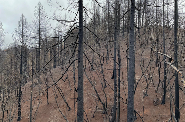
Today's forests are less healthy and more prone to severe wildfires due to decades of fire suppression, lack of vegetation management, changing land use patterns, and extreme events such as drought. With vegetation build-up, compounded with dry landscapes and warmer temperatures, fire behavior has started to change resulting in more and larger high severity wildfires. Additionally, over 50% of the population in Sonoma County lives in the Wildlife Urban Interface, or WUI, meaning that the majority of our communities are dispersed amongst natural and forested areas and thus are at high risk for wildfire.
A Coordinated Approach to Managing Fuels
Successful management requires collaboration between public and private stakeholders to mitigate fire risk across the landscape. Thus far, Sonoma County has focused on defensible space and home hardening; critical practices; however, there are few tools to assist private landowners and managers in evaluating and deciphering fire hazards on a large landscape scale. Fuel management can appear complicated, is often expensive to implement, and planning an approach for reducing fuels requires detailed information about the landscape. With thousands of individual land parcels in Sonoma County, landowners need tools and resources to support them in reducing fuels and managing for future wildfires.
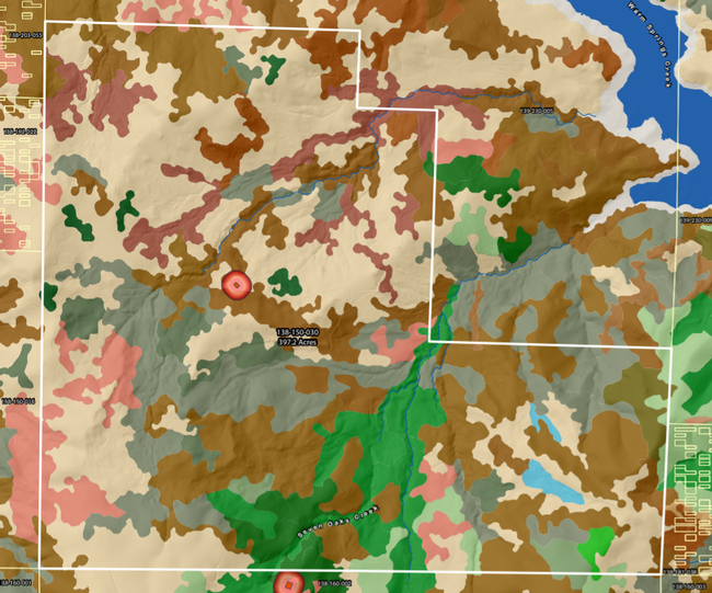
The Wildfire Fuel Mapper Toolkit
As wildfires increase in frequency and intensity, Sonoma County residents need to take steps to reduce fire risk across the region's diverse landscapes and communities to protect our people, our homes, and our natural resources. In order to do so, however, Sonoma County residents also need to be equipped with the necessary tools, resources, and information.
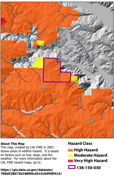
- Fire history
- Vegetation type and density
- Fuels such as fuel build-up
- CAL FIRE assessments of fire hazard level
- Slope and aspect
- Detailed aerial imagery
- Zoning and responsibility area designations
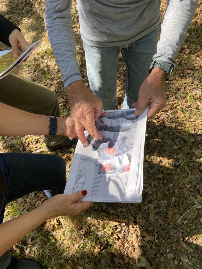
These maps can be used to achieve a number of different land management goals. They can help property owners assess fire hazards on their land and delineate management units. They can be used to create a vegetation management plan to improve forage quality and quantity available for livestock or wildlife. The map reports can be shared with professionals and specialists to get an overview of the property and understand the fire history of the parcel. They can even be used to highlight hazard severity and the need for treatment when applying to funding to supplement a fuel management plan.
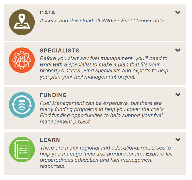
In addition to providing detailed information about fuels and fire hazards on a landscape, the Wildfire Fuel Mapper provides several other resources. These resources are designed to help landowners understand how to use their map reports and start taking action, whether it be conducting a prescribed burn, implementing grazing, or creating a formal management plan. These tools and resources connect users with:
- Funding and cost-share opportunities
- Educational and technical resources to learn more
- Materials to support creating a management plan, individual parcels or in a watershed
Wildfire Fuel Mapper Lake Sonoma Pilot Projects
The UCCE is currently testing the Wildfire Fuel Mapper in the Lake Sonoma watershed. We are conducting site visits with users to ground-truth the map reports and collecting feedback from both landowners and specialists throughout the region. Additionally, the UCCE is partnering with Circuit Rider to plan and implement 3-6 pilot projects using the Wildfire Fuel Mapper map reports. These pilot projects will be conducted by the Circuit Rider youth crews, and will demonstrate a variety of vegetation management strategies while promoting workforce development and professional skills for local youth.
Learn More & Get Started
As fires continue across Sonoma County, fuel management will be critical to protecting our communities now and in the future. The Wildfire Fuel Mapper provides landowners with the tools and resources needed to understand and begin managing fuels.
To learn more about the Wildfire Fuel Mapper, download your custom parcel or watershed report, and explore our interactive Story Map, visit: Wildfire Fuel Mapper. For further questions or to get involved, contact Dr. Stephanie Larson (slarson@ucanr.edu).
This project is a collaboration between University of California Cooperative Extension (UCCE), Pepperwood and Tukman Geospatial, with support from PG&E, the Thornton Foundation, and CAL FIRE.
