Geographic Information Systems (GIS) for Agriculture: Crop Focus Workshop
Tuesday, February 17, 2015, from 11:00am to 4:00pm
2801 Seconds Street, Davis Ca.
Click Here to Register
Click Here for Google Map Directions
Informatics and GIS Statewide Program - http://igis.ucanr.edu
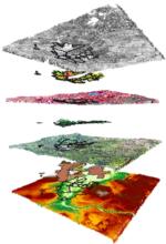
Goal: Provide overview of geospatial technology to agricultural practitioners and Cooperative Extension educators with hands on experience using on practical examples.


For information regarding the accompanying Web GIS workshop on February 18th go to Click Here.

Audience: Public and private resource professionals as well as UC Cooperative Extension Advisors and Specialists.
Requirement: Participants must bring a laptop computer with a recent version of either ArcGIS or Quantum GIS installed on it.
ArcGIS can be obtained for UC ANR owned computers free of charge at Click Here
Please download the ArcGIS software and request a user license several days in advance of the workshop to ensure that it is properly functioning before the workshop date.
Quantum GIS is a free and open source GIS program that can be downloaded at Click Here
(Note: The 32 bit Windows version of QGIS seems to be more glitch free than the 64 bit version, even on a 64 bit computer)
When & Where: February 18, 2015, from 11am to 4pm, with a one hour catered lunch break from 12pm to 1pm.
2801 Seconds Street, Davis Ca., in the Sacramento room. Directions and map link: Click Here
Cost: $30 for members of UC ANR (account # and contact information required), and $60 for non-UC affiliates.
The course cost will include a meal and refreshments. UC affiliate costs are covered through the IGIS Statewide Program.
Register: Click Here to register. Registration is limited to 25 participants, so please register early.
Contact: Sean Hogan, 530-750-1322, sdhogan@ucanr.edu

