

Michael Singer
Michael Singer
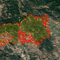
Riparian forests — the ribbons of trees that grow along river channels — play an important ecological role as refuges for endangered species in dry areas. But these natural havens are increasingly threatened by the changing frequency and intensity of drought, both of which are byproducts of climate change.
Scientists at UC Santa Barbara are studying how riparian forests respond to climate change that manifests as hotter and drier conditions over time. With $2.5 million in combined funding from three grants, Michael Singer, a researcher with UCSB's Earth Research Institute (ERI), and colleagues seek to understand the impact of nonstationary climate — trends in temperatures and precipitation — on riparian forests.
“As a river starts drying up, groundwater-dependent trees like those in a riparian forest might disappear, or the moisture within the soil might dry up, affecting more shallowly rooted trees and shrubs,” explained Singer, who also is a lecturer at Cardiff University in the United Kingdom.
Through the National Science Foundation's Geography and Spatial Sciences Program, one project — led by associate professor John Stella of the State University of New York College of Environmental Science and Forestry (SUNY-ESF) — is being conducted near UCSB in Ventura County's Santa Clara River Valley. A basin with competing water needs — ecological, urban and agricultural — the Santa Clara, because it goes dry, relies largely on subsurface groundwater. Continual pumping of groundwater from the aquifer for agriculture, when that aquifer is not recharged by rainfall, causes wells to go dry and forces pumping efforts to reach deeper and deeper.
Innovative new legislation in California, the Sustainable Groundwater Management Act (SGMA), shifts the management of groundwater resources from the state to local basins, requiring regional stakeholders to create action plans for managing water resources. With the grant, Singer and Stella will collaborate with UCSB geography professor Dar Roberts and The Nature Conservancy to develop an improved understanding of forest health along the Santa Clara River. They'll investigate matters including what happens to trees that are rooted at depths below the surface with diminishing groundwater, and their findings can be used to administer SGMA.
Through another NSF grant, in its Hydrologic Sciences Program, Singer, Stella and ERI director Kelly Caylor, also a professor in UCSB's Bren School of Environmental Science & Management, will study riparian forests along a major European river. The Rhône, which flows through France from Lake Geneva to the Mediterranean Sea, warms 2 degrees Celsius along its climate gradient. The researchers plan to measure the variation in temperature, precipitation and climate to model what might happen under climate change and determine how water availability to forests shifts due to climate and how trees are using water, as well as their corresponding growth and health outcomes over time.
The scientists also will core trees to determine their age and will extract cellulose from individual rings for isotopic analysis. Oxygen isotopes are used to distinguish water sources such as groundwater or rainfall, while carbon isotopes reveal how efficiently trees are using that water — a calculation of photosynthesis versus water loss.
The third project is funded by the Department of Defense through the Strategic Environmental Research and Development Program. Singer, Stella, Roberts and Caylor will develop a toolkit and provide quantitative support for land and water conservation management to promote the sustainability and resilience of riparian forest ecosystems located on DOD lands. The endeavor focuses on three dry area bases in drought-prone regions: Vandenberg Air Force Base near Lompoc; Marine Corps Base Camp Pendleton in San Diego County; and the driest, U.S. Army Fort Huachuca in southeastern Arizona.
“In all of these studies, we're developing water stress indicators, which can be physical manifestations such as dropping leaves or branches or trees becoming less green,” Singer explained. “Such markers can be seen in remote sensing imagery and tree-ring isotopes, but we're also looking at climate records for precipitation and temperature, along with numerical modeling to determine what type and how much water has been delivered to a basin in the first place. If we see trends that tell us the forest is really suffering, we hope to establish an early warning response window in which managers can act quickly before important patches of forests are lost.
“Combined, those various metrics give us a good idea of how well trees are doing,” Singer added. “We hope to integrate the results of these projects to eventually predict the thresholds of species collapse and perhaps even forest collapse. If we can identify what the dominant controls on those thresholds are climatically, we may be able to assess whether trends in temperature are more relevant than those for precipitation.”
Post fire inventories include a lot for ranchers, e.g. stock, forage, fence, buildings and equipment losses immediately come to mind. Equally important is an inventory of potential sediment sources from hill slopes, fire cut roads and riparian areas that will need mitigation to prevent soil loss and sediment movement into streams.
Rice straw as mulch, in bales for check dams and in the ubiquitous waddles all come into play for the recovery process. Sometimes the mulch is also used in reseeding sites too. The following sources of rice straw were put together by Rachel Elkins, pomology advisor and were forwarded to me by Greg Giusti, forestry and wildlands advisor - emeritus.
Paul Buttner of the California Rice Commission (https://twitter.com/PaulTheRiceGuy). His website is: http://www.ricestrawmarket.org/index.html. It is a buyer-seller website. His phone number is (916) 206-5340. His twitter page links to http://calrice.org with more contact information.
Ken Collins, a rice grower in Gridley (Butte County) is a large rice straw dealer. His phone number is (530) 682-6020.
EarthSavers makes straw wattles. They are in Woodland: http://www.earth-savers.com/.
Once you have an inventory of potential sediment sources identified, contact the Natural Resources Conservation Service (NRCS) for technical help with mitigation and design of erosion control structures. I've included Carol Mandel's contact information below. Many of these mitigation techniques will have cost share programs to help.
Carol Mandel
USDA Natural Resources Conservation Service
1252 Airport Park Blvd. Suite B-1
Ukiah CA 95482
Bus: (707) 468-9223
Email: carol.mandel@ca.usda.gov

KMZ-Map-RC
The reproductive host list for tree species affected by the polyphagous shot hole borer has topped...

monitoring PSHB in the arroyo
As discussed in previous issues of this newsletter, polyphagous shot hole borer (PSHB; Euwallacea sp.) is a new pest/fungal complex attacking a wide variety of host trees in Southern California, from avocado to common residential and street trees and native oaks and riparian species. The PSHB is morphologically identical to the tea shot hole borer, E. fornicatus, but a genetic analysis confirmed that this is a new species of ambrosia beetle. PSHB has been found to carry several symbiotic fungi, including new fungal species Fusarium euwallacea, andan undescribed Graphium species.It was first identified in 2003 in Whittier Narrows, an undeveloped riparian area in Los Angeles County, and was officially first linked to tree injury and mortality in a residential avocado in 2012. Since then, the pest complex, also referred to as Fusarium die-back, has spread throughout Southern California and is now present in Los Angeles, Orange, San Bernardino, Western Riverside, and San Diego counties. The population in San Diego County is a different genotype from that found in the rest of the region, possibly indicating a separate introduction. The pest/disease complex has caused significant impacts to the avocado industry in Israel, and is now spreading in commercial groves from Escondido to Fallbrook. It has caused injury and mortality of hundreds of ornamental trees in the urban areas, impacting roadways, botanical gardens, parks, and private residences, and impacts all major native riparian trees species. The official list of reproductive hosts, meaning trees that can support growth and reproduction of the beetles and fungi, includes 35 species with several having been confirmed in just the past few months.
The plant pathology, IPM, environmental horticulture, and natural resource management teams working on this pest at UCR and UC Cooperative Extension in San Diego, Orange, Los Angeles, and Ventura Counties have put together several useful tools that can help you manage this pest. These include a new field identification card set, a decision tree for tree removal, a guide to managing infested plant materials, and information about how to report an infested tree and how to collect samples for lab identification, as well as a continuously updated web-based map. You can find these at www.pshb.org.
To determine if your trees are affected by this pest:
o Your contact info (name, city, phone number, email)
o Suspect tree species
o Description of suspect tree's location (and/or GPS coordinates)
o Description of suspect tree's symptoms
o Photos of suspect tree and close-up photos of symptoms
To protect your trees, avoid movement of infested firewood and chipped material out of infested areas. Infested material should be chipped to under 1”, wrapped in clear plastic, and solarized on site for up to 6 mos (depending upon environmental conditions). Research is ongoing in the use of insecticides and fungicides, as well as exploration of the use of endophytic bacteria as a biocontrol agent. If you suspect that you have found this beetle or seen symptoms of the Fusarium dieback on your tree please contact the Ventura CE office, your pest control advisor or qualified arborist, or contact UC Extension Plant Pathologist Dr. Akif Eskalen by at akif.eskalen@ucr.edu. For more information visit www.pshb.org or http://eskalenlab.ucr.edu/avocado.html.
PSHB DAmage

PSHB damage
Author: Greg Giusti
Throughout northern coastal California, a great deal of information regarding water quality and fish habitat is being amassed that potentially could change how people view and utilize stream corridors. However, it is widely recognized among the scientific community that stream corridors are an important habitat component for a host of vertebrate and invertebrate species other than fish. Unfortunately, the current fish-centric approach to riparian protection and restoration has often resulted in a narrow discussion of stream corridor management that excludes non-fish species. For example, information detailing the use of oak woodland stream corridors by migratory songbirds in California’s oak woodlands is sorely lacking, limiting the ability of landowners and resource managers to make informed decisions regarding land use practices and policies and their effects on birds. It is important that we consider these other species when managing and restoring riparian areas, as their requirements may be different than those of the fish.
Spring 2012 marks the 20th consecutive year of a bird monitoring study on Parson’s Creek, an ephemeral (seasonal) tributary of the Russian River that traverses the UC Hopland Research and Extension Center (HREC). The goal of this ongoing project is to document resident and migratory bird use of stream corridors in mixed oak woodlands.


Table 1. Most commonly observed species in the Parson's Creek riparian corridor, HREC.
Ten Most Commonly Ten Most Commonly Observed
Observed Species Neo-Tropical Migratory Species
|
Oak Titmouse (125) Acorn Woodpecker (103) California Towhee (94) Western Scrub-Jay (78) European Starling (66) Black Phoebe (62) House Finch (59) Brewer's Blackbird (54) Nuttall's Woodpecker (52) Anna's Hummingbird (46) |
Bullock's Oriole (54) Orange-crowned Warbler (49) Violet-green Swallow (43) Ash-throated Flycatcher (37) Pacific-slope Flycatcher (33) Western Tanager (27) Lazuli Bunting (26) Warbling Vireo (25) Western Kingbird (24) Black-headed Brosbeak (22) |
Throughout the study period, an average of 29 species (ranging from 27 to 33) have been detected during the Fall. These species are primarily resident birds that utilize the stream corridor throughout the year. Spring counts averaged 43 species (ranging from 38 to 48). The difference in the average total number of species reflects the seasonal influx of neotropical migratory songbirds that arrive in California’s oak woodlands for the breeding season.
Some species may also be selectively utilizing only portions of the riparian corridor that exhibit special habitat features. For instance, one species in particular, the Black-throated Gray Warbler (Dendroica nigrescens), is consistently found only in those portions of the riparian area where the vegetation canopy is densest. This pattern of occurrence has remained consistent during the entire study period, and suggests that this species may have relatively narrow habitat requirements when compared to other neotropical migrants exploiting the stream corridor.

