
- Author: Jeannette E. Warnert
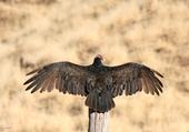
Omnipresent and homely, turkey vultures are a native California wildlife species that doesn't get a lot of research attention.
But UC Cooperative Extension advisor Greg Giusti has found a surprising level of interest from the public in his Northern California research project about turkey vultures' nesting preferences in oak woodland.
“Animals with cute fuzzy faces are far more attractive in our culture,” said Giusti, a wildland ecology expert. “Turkey vultures have been overlooked. Very little is known about their biology and environmental needs.”
Giusti worked with Robert Keiffer, superintendent...
- Author: Brook Gamble
"There are no passengers on spaceship earth. We are all crew" - Marshall McLuhan.
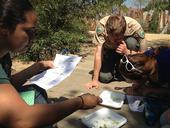
To understand and protect California's unique natural resources, we need all the information we can gather across many different disciplines. Citizen science is one crowd-sourced approach to gathering that information.
One of the first institutions to formally use the citizen science approach, Cornell Ornithology Lab, defines citizen science as projects in which volunteers partner with scientists to answer real-world questions. Another term to describe these projects, often used interchangeably, is “public participation in scientific research” (PPSR), which...

- Author: Jeannette E. Warnert
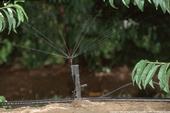
For more than a century, California farmers have extracted water from underground to irrigate crops during droughts or where surface water is not available. However, in recent decades, water reservoirs that accumulated over thousands of years underneath the state's valleys are being tapped with deeper and deeper wells that pull out more water than can be replenished in the winter.
The 2012-14 drought intensified the problem. Greater groundwater usage than recharge has left some rural homeowners' wells completely dry. Land is subsiding as clay layers that are interspersed between sandy and gravelly aquifers beneath the surface compress due to lower pore water pressure, which is responsible for keeping clay pores open.
To...

- Author: Pamela Kan-Rice
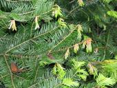
If you have a real Christmas tree, University of California pest management experts ask that you to recycle the tree to prevent the spread of insects and diseases that may harm our forests and landscape trees.
“Invasive insects, diseases and plant seeds can move on cut Christmas trees and other holiday greenery,” said Janice Alexander, UC Cooperative Extension forest health educator in Marin County. “These pests can escape out into backyards and neighboring forests to begin new populations, upsetting the balance of our native ecosystems. Proper purchasing and disposal of holiday greenery helps reduce that...
- Author: Missy Gable
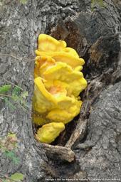
Mushrooms are popping up all over California thanks to the wet rainy weather we have had across the state recently. They seem to magically appear overnight, like umbrellas on a sunny beach day. This fascinating occurrence doesn't actually happen overnight as it may seem, but they appear once moisture becomes available. Mushrooms expand rapidly by absorbing water from the surrounding soil and consequently ‘pop' out of the ground.
Mushrooms are the fruiting body of a fungus and come in myriad shapes, sizes and colors. They are typically the only part of a fungus that can be seen because the mass of the organism is located underground.
There are approximately 14,000 different classified species of mushrooms, here...

