- Author: Sean Hogan
The Informatics and GIS program has scheduled its 2021 fall lineup of GIS and data workshops. All workshops (with one exception) are online and free, with required registration and additional information that can be found on the IGIS Training page. Additionally, all UC ANR employees and workshop alumni are eligible to sign up for IGIS Office Hours for a wide range of consultations on geospatial and data topics.
Introduction to ArcGIS Story Maps (IGIS, Virtual)
Friday, Oct. 8
1 - 4 p.m.
Story Maps for ArcGIS is a powerful and popular platform for creating websites that convey compelling narratives through text, media and maps. Story Maps are increasingly used for online extension, program reporting and presentations. This workshop will get you started and give you the tools to create your own Story Map.
Requirements: Participants must have an ArcGIS Online account set up prior to the workshop (free for all UC ANR employees, temporary accounts available for others). The Intro to AGOL workshop, or equivalent background, is a prerequisite for this workshop. Details and registration.
DroneCamp 2021 – (IGIS, In-person Flight Instruction)
Saturday, Oct. 16
Marina, CA
Cost $50
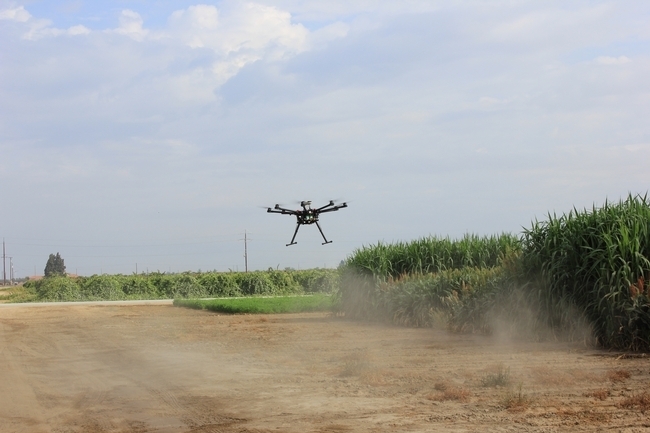
For participants of DroneCamp 2021, this half-day, in-person training will cover flight instruction at the Fort Ord Natural Reserve near Monterey. Morning and afternoon sessions available. Camping is available.
Requirements: No experience necessary. Drones will be provided. Documentation of COVID vaccination required. Details and registration.
Introduction to ArcGIS Pro (IGIS, Virtual)
Friday, Oct. 22
1 - 4 p.m.
ArcGIS Pro is ESRI's powerhouse desktop application for all things GIS. It can do everything from basic cartography to advanced geospatial modelling. This introduction will get you started creating maps with local and online GIS data.
Requirements: Participants must have ArcGIS Pro installed on their personal computer prior to the workshop. ArcGIS Pro is for Windows only. Licenses are free for all UC ANR employees, and temporary accounts available for others. No experience needed, but the ArcGIS Online workshop or equivalent experience is strongly encouraged. Details and registration.
Introduction ArcGIS Field Maps (IGIS, Virtual)
Friday, Nov. 5
1 - 4 p.m.
ArcGIS Field Maps is ESRI's most recent and most powerful platform for mobile data collection. It is the successor to ArcGIS Collector, which is being phased out. This hands-on workshop will explain how the platform works and guide participants through creating a mobile data collection app.
Requirements: Participants must have an ArcGIS Online account set up prior to the workshop (free for all UC ANR employees, temporary accounts available for others). The Intro to AGOL workshop, or equivalent background, is a prerequisite for this workshop. Details and registration.
Introduction to Jupyter Notebooks in ArcGIS (IGIS, Virtual)
Friday, Nov. 19
1 - 4 p.m. free online
Jupyter Notebooks are a user-friendly and interactive way to write Python code. ArcGIS Pro supports Juptyer notebooks natively, opening the door to a wide range of options for automation and extensibility. This workshop will get you started using Jupyter Notebooks in ArcGIS Pro to automate processes, tweak analyses and access online data.
Requirements: Basic familiarity with ArcGIS Pro is expected. Licenses for ArcGIS Pro are free for all UC ANR employees, and temporary accounts available for others. Experience with Python is helpful but not required. Details and registration.
Introduction to Cartography in ArcGIS Pro (IGIS, Virtual)
Friday, Dec. 10
1 - 4 p.m. free online
ArcGIS Pro is ESRI's premier desktop GIS application and is commonly used to produce maps ranging from clean and simple for publications and permits, to coffee-table book quality. This workshop will review the principles of sound cartography, and cover a range of tips and tricks for making functional and beautiful maps with ArcGIS Pro.
Requirements: Participants must have ArcGIS Pro installed on their personal computer prior to the workshop. Basic familiarity with ArcGIS Pro is expected. Licenses for ArcGIS Pro are free for all UC ANR employees, and temporary accounts available for others. Details and registration.
- Author: Pamela Kan-Rice
Informatics and GIS is offering a new series of online training for ArcGIS tools for spring 2021. The workshops will include introductions to:
- ArcGIS Online, for creating interactive web maps (Feb. 26)
- ArcGIS Field Maps, for mobile data collection (March 19)
- ArcGIS Story Maps, for creating eye-catching online stories and tours, supported by web maps and other visual content (April 2)
Please visit the IGIS training page, http://igis.ucanr.edu/Training/, for more information and to register for these new and exciting workshops.
- Author: Andy Lyons
IGIS and the California Naturalist Program are pleased to help celebrate the launch of a new information portal on climate adaptation. The California Adaptation Clearinghouse was officially launched at the California Adaptation Forum in August in Sacramento. The site was developed by the Governor's Office of Planning and Research (OPR) in collaboration with the UC Berkeley Geospatial Innovation Facility, CalNat and IGIS.
The Clearinghouse is a database-driven platform with a wealth of curated resources for climate adaptation. The site originated out of Senate Bill 246, which mandates OPR to provide resources on climate adaptation for local governments, regional planning agencies, and other practitioners working on adaptation and resilience. The database also contains sea-level rise resources collected by the Ocean Protection Council under Assembly Bill 2516. It's an amazing resource for anyone looking to strengthen climate change preparedness in their local government, community, or business.
The database includes numerous planning resources that have been developed and vetted by experts in the field. For example, the Urban Sustainability Directors Network has a how-to guide for local governments on developing equitable, community-driven climate preparedness plans, which you can find in the Clearinghouse. There are also examples of vulnerability assessments, local plans, and funding strategies. The majority of resources are hosted by other organizations, but unlike a Google search all the resources in the Clearinghouse have been reviewed, annotated, and cataloged by subject matter specialists.
To help find resources, the Clearinghouse has a number of search options, including more than a dozen topic categories adapted from Safeguarding California, the state's overall roadmap for building climate change resiliency. You can also search by Type of Impact (e.g., drought, sea level rise), Resource Type (e.g., case study, assessment, policy guidance), and of course an interactive map. Each resource has a descriptive blurb so you can quickly find what you need.
Adaptation planning can be information intensive, so the Tools and Data section of the website is devoted to helping people find data and crunch the numbers. Interested in rangelands? Check out the CA Landscape Conservation Cooperative's compiled Threat Assessments to California Rangelands. Sea level rise? Perhaps the CosMos modeling tool from USGS, or the Surging Seas tool from Climate Central. Like all resources, each tool and dataset has a user-friendly description, a technical summary, a bit about the data, and links to the source. One of our favorites is the California Energy Commission's Cal-Adapt, which includes both historical and projected climate data downscaled for California.
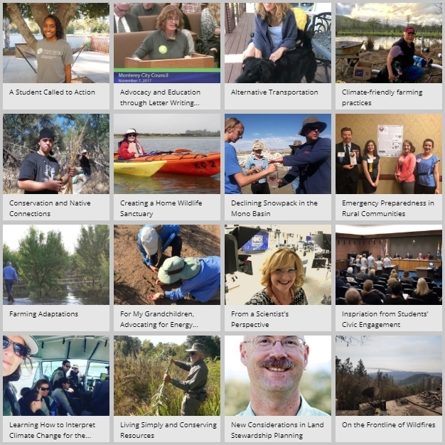
Providing a more personal perspective, the Clearinghouse also contains stories about climate adaptation from individuals, community groups, and businesses. The stories were collected by the UC ANR California Naturalist Program and their vast network of certified naturalists. The climate stories are diverse and compelling, from a concerned grandmother who becomes engaged in a community choice energy program, to a solar project engineer working to strengthen measures to prevent heat stroke in field staff. An interactive Story Map developed by IGIS helps users find stories from their area, some of which even have audio or video clips so you can hear the story in the speaker's own words.
Climate adaptation is complicated, but information portals like the Clearinghouse allow anyone to tap into the incredible amount of work that has already been done in California and elsewhere. Rather than reinvent the wheel, local agencies can build upon vetted guidelines from similar areas. We are all fortunate that the State of California has invested in a platform to share curated resources for the long-term, because climate adaptation is already part of the new normal. More resources are in the pipeline, so check it out and then check back often to see what's new.
- Author: Pamela Kan-Rice

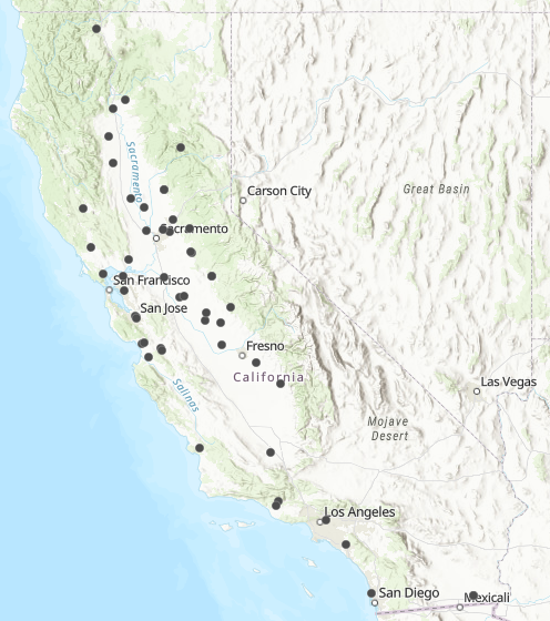
ANR business and office managers and assistants, IGIS (Robert Johnson, Sean Hogan and Shane Feirer) Program Support (Sherry Cooper) and Learning & Development (Jodi Azulai) collaborated to bring you this tool so that you can identify ANR training, workshop and meeting spaces across the state and identify information about:
- Number of rooms in facility
- Room capacity
- Room arrangement availabilities
- Accessibility
- Parking availability
- Nearest airports
- Local lodging information
- Catering recommendations
- Who to contact to reserve your location
- And other details
By using this map, you can also alleviate our very busy Program Support Unit and work directly with the location contact to help you reserve room(s). We would appreciate if you check out the information on your locations and see if you can provide us with any new details! To do so, contact Jodi Azulai at jlazulai@ucanr.edu or Robert Johnson at robjohnson@ucanr.edu.

Given limited personnel and a short time since startup, IGIS has made significant contributions throughout ANR. There is a great need for the program within and beyond ANR, and IGIS personnel have shown impressive results in reaching out to the wider ANR community and external partners.
Here is a summary of the direction and next steps I provided to the IGIS Program Director:
- IGIS should focus on expanding capacity and reach with drones and prioritize investing in new technology.
- IGIS will work with the REC Directors to develop a call process to identify science leads who are interested in taking over full ownership of one or more of the flux towers.
- IGIS should discontinue its involvement with cataloguing dark data, but work with ANR Communication Services and Information Technology office (CSIT) to inform ANR academics that digitized documents are available in the ANR repository.
- Associate Vice President Powers and I will meet with Program Director Kelly to further discuss the proposal to re-characterize IGIS from a statewide program to a statewide academic service.
- IGIS will develop a business plan to continue to scale up services that are in demand by UC ANR academics and offer services in a way that decreases reliance on central funds.
- IGIS should update its website to clearly articulate to whom resources and services are available. When IGIS is not able to provide a service, to the degree possible, it should act as a clearing house and refer clients to other providers.
- IGIS should incorporate evaluation methods that focus on the effectiveness of workshops and services and the extent of IGIS' reach.
I look forward to working with IGIS as it pursues these and other opportunities that may arise.
Glenda Humiston
Vice President


