- Author: Saoimanu Sope
Besides starting fires for the sake of research, Luca Carmignani, UC Cooperative Extension fire advisor for San Diego, Orange, Los Angeles, and Riverside counties, has started leveraging his connection to local UC campuses by providing opportunities for hands-on learning.
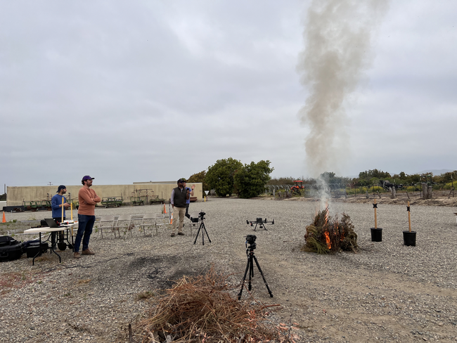
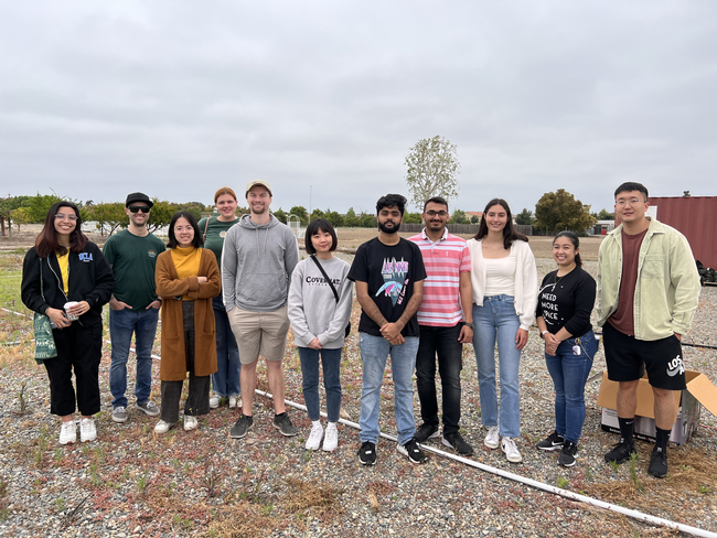
Early one morning in May, students and staff from UC Irvine and UC Riverside gathered at the South Coast Research and Extension Center to collect data for their own research projects. South Coast REC, located in Irvine, is part of a statewide network of research and education facilities operated by UC Agriculture and Natural Resources.
In one area of the field, graduate students picked leaves and twigs from dried shrubs, carefully placing them in a device that measures moisture content. In another area, a postdoctoral scholar set up a device that records levels of particulate matter, carbon dioxide and other air pollutants emitted by a fire.
Tirtha Banerjee, professor in the Department of Civil and Environmental Engineering at UC Irvine, coordinated the field day with Carmignani. The two first connected as members of iFireNet, an international network of networks that connect people to fire research, when Carmignani was a postdoctoral researcher at UC Berkeley.
Now, the two are collaborating to help environmental science and engineering students realize the potential of their research interests.
Jacquelynn Nguyen, a Ph.D. student in the Civil and Environmental Engineering department at UC Irvine, is interested in understanding how ash from wildfires and prescribed burns can be used as a treatment for per- and polyfluorinated substances. PFAS are a group of “forever chemicals” that can be found in heat-resistant materials – including fire extinguisher foam – and are extremely difficult to eliminate.
Before Nguyen could collect her ash samples, Carmignani needed to cautiously set the dried shrubs on fire, providing a realistic situation for data collection purposes.
“We're trying to figure out if the ashes from these fires can be used as activated carbon, which could be used as a treatment for PFAS,” said Nguyen. “We want to see if this treatment can basically absorb PFAS and prevent it from traveling into soil and groundwater.”
While Nguyen is concerned about the impact that wildfires have on the land, Soroush Neyestani, a postdoctoral scholar in the Environmental Sciences department at UC Riverside, is interested in its impact on the air quality.
During a fire, it's difficult to determine how much emissions are a result of flames versus smoldering, the process of burning slowly with smoke but no flames, and current air quality models do not provide accurate guidance on this matter. Using an air quality sensor, Neyestani wants to quantify the difference in emission levels during the two phases.
“There are assumptions that 50% of emissions come from smoldering, but every fire is different. Our main objective is to improve the accuracy of air-quality forecasting,” Neyestani said, noting his concern that these assumptions might not be realistic.
Although the field day was created with the students in mind, Carmignani used the opportunity to polish his own research efforts. Since fall 2022, he has been investigating the flammability of low-water use landscape plants based on various irrigation applications.
“Every time we burn, I feel like we get better. We get better data, and we conduct better analysis, and that's really important for us so that we can figure out how we can apply our research and measure its outcome,” said Carmignani.
In addition to welcoming more collaborations with UC campuses and other organizations, Carmignani is hopeful that these combined research efforts will spark an interest in wildfire awareness everywhere.
- Author: Pamela Kan-Rice
As the Beckwourth Complex Fire and Dixie Fire spread in Plumas and Lassen counties, Ryan Tompkins reminded residents of ways they could help limit damage.
“If you're under evacuation orders, abide by the evacuation notice, because lingering too long can complicate tactics of emergency responders,” said the University of California Cooperative Extension forestry and natural resources advisor, who recommends packing up important documents and valuables with an overnight bag in advance for a quick exit to safety.
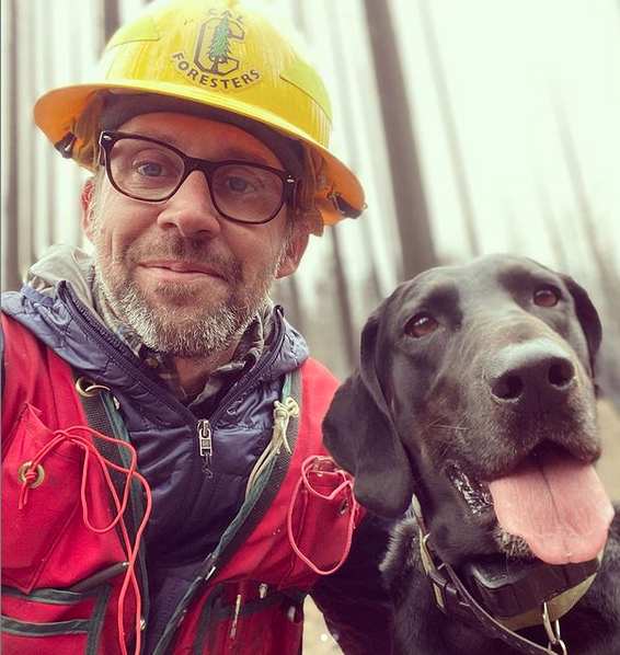
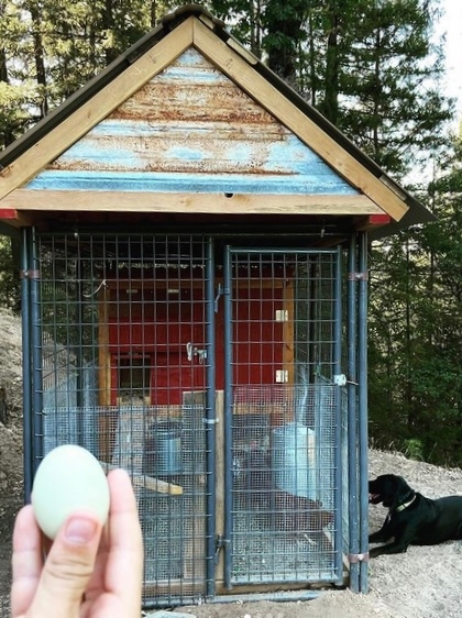
Plan for pets and livestock and water access for a quick response to falling embers that ignite fires. The Plumas County resident said he packed a “go bag” for his dog filled with dog food and other necessities. Every year, Tompkins clears defensible space around his house, including defensible space around his chicken coop in case a fire starts while he isn't home. During wildfire season, he keeps a shovel and a backpack sprayer filled with water staged near his woodshed for easy retrieval if a fire were to start in his yard. If Tompkins needs to evacuate, he switches his circuit box to his generator so any firefighters performing structure triage can access his well water when the power grid shuts down.
To document possessions for insurance purposes if the house burns, Tompkins recommends shooting video. “Just walk through the house with your phone shooting video and narrating to document the household assets.”
Residents outside of the wildfire evacuation area can take more steps to improve the odds their homes will survive a wildfire.
Even with fire imminent, there are several actions you can do to help prepare your home to withstand fire exposure. UC Cooperative Extension guidance can help residents prepare their home in the days or hours before wildfire exposure.
If you believe you have at least a couple of hours before fire exposure, review the area around your home and outbuildings for flammable items that could lead fire to the structures, said Yana Valachovic, UC Cooperative Extension forestry advisor in Humboldt and Del Norte counties.
She recommends the following:
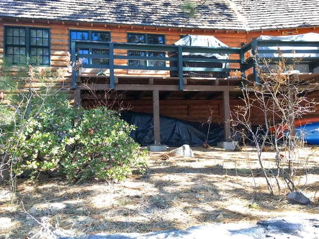
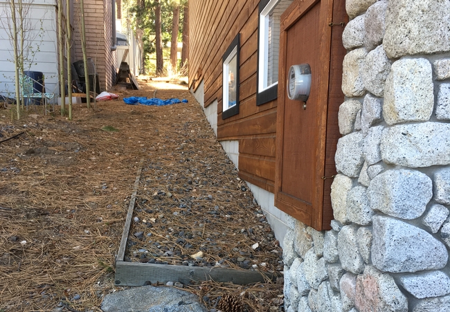
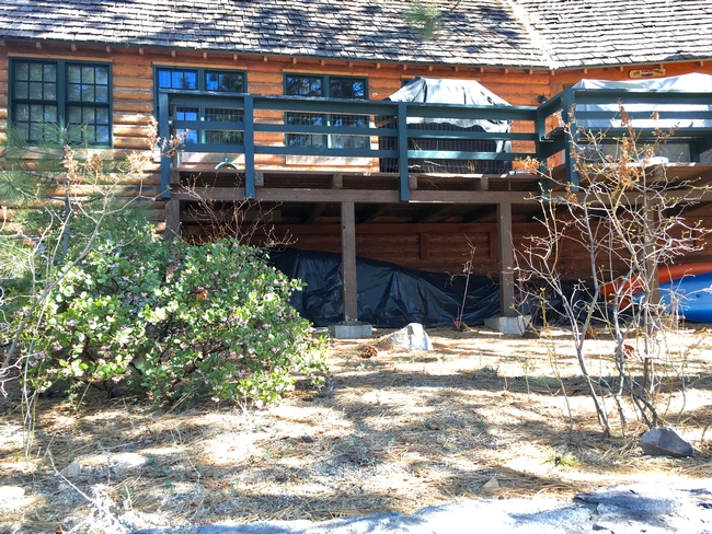
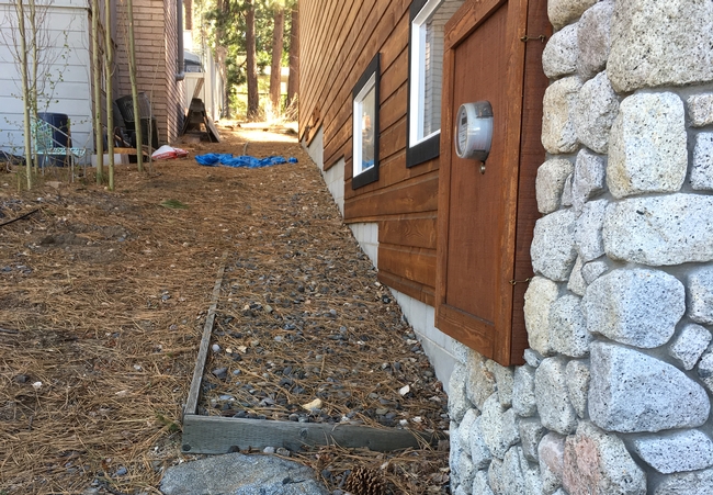
- Move combustible items inside or away from the buildings, especially within the first 5 feet of any structure or attached deck
- Clean gutters and other places where pine needles and leaves accumulate on or near the house
- Move BBQ propane tanks away from structures
- Bring in cushions from outside furniture
- Move doormats away from the house
- Seal vents (attic, foundation, drier, etc.) with plywood or heavy foil to prevent embers from entering
- Close all windows and pet doors
“The goal is to remove combustible items away from structures so that embers don't ignite these materials and result in flames touching the house,” Valachovic said. “Temporarily sealing up vents can help prevent embers, or small bits of burning vegetation, from being blown inside the home.”
If first responders get to your home, Valachovic says you can help them by leaving a ladder against the house, placing buckets or garbage cans of water around the home, and leaving connected garden hoses in easy-to-locate places. Also, leave out a shovel or other tool that could be used to put out small spot fires.
“After you have packed your essentials and your go bag, dress for the evacuation by wearing cotton or wool clothing, a hat, boots, bandanna or mask to protect your nose and mouth, and pack leather gloves,” she said. “These items will help you be prepared if you have to get out of your vehicle or move fallen trees during your escape to safety. Additionally, it may be helpful to pack a shovel, digging bar, chainsaw, or other tools just in case your evacuation route gets blocked.”
As you evacuate, Valachovic suggests leaving gates open or unlocked so first responders can access your property.
If time allows, turn on the lights in your house to increase visibility and leave a note on the door indicating where you went and who is with you. These instructions can help you reunite with your loved ones.
Thinking through these steps and implementing them if fire is near can help your home and your family survive wildfire. For more evacuation guidance, visit https://ucanr.edu/sites/fire/Safety/Evacuation.
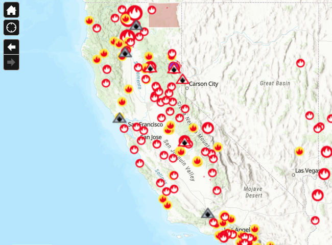
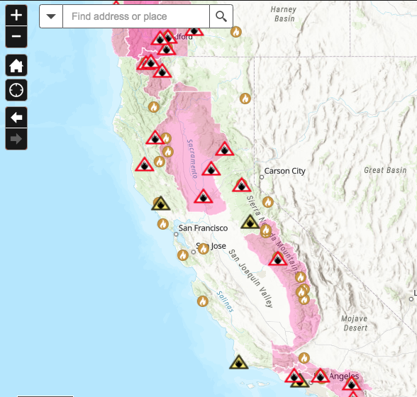
If you have more time to prepare for wildfires, UC Cooperative Extension provides more information at https://ucanr.edu/sites/fire/Prepare, including a fire map and tips for home hardening and defensible space strategies.
How to Harden Homes against Wildfire, a free 20-page publication by University of Nevada, Reno Extension, UC Cooperative Extension, Tahoe Resource Conservation District and CAL FIRE is also available online at http://ucanr.edu/HomeRetrofitGuide. It includes recommendations for 12 vulnerable components of homes in wildfire-prone areas, including roofs, gutters, vents, siding, windows, decks and fences.
- Author: Karen Giovannini
- Author: Stan Wise, South Dakota Soil Health Coalition
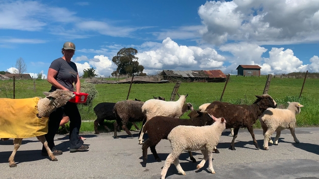
Improved soil health, increased profitability, and reduced spread of wildfire are among the many benefits that arise from keeping livestock on the landscape. Efforts are underway in California and South Dakota to connect landowners with livestock managers for their mutual benefit.
Farmers can increase the organic matter in their soil and reduce their fertilizer costs by allowing livestock to graze crop residue or cover crops on their land.
Nick Jorgensen, CEO of Jorgensen Land and Cattle in Ideal, SD, said that grazing every acre allows his operation to increase soil organic matter by up to 0.75% per year and cut fertilizer costs by $50 per acre with no yield loss.
Livestock managers can rest their pastures and reduce their feed costs by seeking out crop residue, cover crops and additional pasture or rangeland for their livestock to graze.
Jorgensen said that grazing cattle on all crop and cover crop acres cuts his feed and manure management costs by up to $2 per head per day.
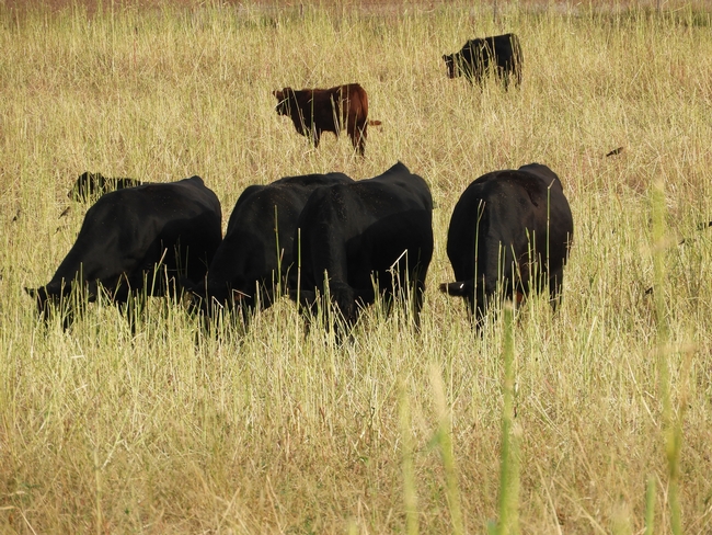
Grazing livestock is also a cost-effective way to reduce the accumulation of fire fuels on the landscape, helping to slow the spread of wildfires. This can be especially important for land that is too steep, rocky or remote for mowing or chemical treatment.
“I've noticed on several fires, including extreme fires, the fence lines where the fire just stopped. And the one variable, the one difference, was grazing,” CAL FIRE Battalion Chief Marshall Turbeville said.
As this year has proven, fire is a serious risk to California landowners. That's one reason University of California Cooperative Extension has launched Match.Graze. It's a map-based website designed to help livestock owners find pasture, rangeland, cover crops or crop residue available for grazing and help landowners find cattle, sheep, goats and other livestock to graze their land.
“Every property is different and requires thoughtful consideration of how it should best be grazed,” said Stephanie Larson, director of UCCE in Sonoma County, UCCE livestock and range management advisor and co-creator of the livestock-land matchmaking service. “UC Cooperative Extension is here to serve. Put Match.Graze to work, and let's prevent catastrophic fire while helping landowners and agriculture.”
California landowners and livestock managers can visit MatchGraze.com, set up a free account, create a pin on the map and find a grazing partner.
The California website is based on the South Dakota Grazing Exchange, the original site launched by the South Dakota Soil Health Coalition with work supported by Natural Resources Conservation Service, U.S. Department of Agriculture.
Many farms in South Dakota have moved away from livestock to focus on row crops. However, increased diversity and incorporating livestock are two key principles for good soil health management.
At www.sdgrazingexchange.com farmers can find livestock to graze their crop residue or cover crops in order to capture the soil health benefits for their cropland without having to own livestock. Similarly, ranchers can give their pastures and rangeland a rest and reduce their feed costs by finding farmers with cropland to graze.
The Match.Graze and SD Grazing Exchange websites are not limited to California and South Dakota. Users from anywhere in the nation can create accounts on either website and advertise their land and livestock. The more people who use the websites, the better resources they will become.
When landowners partner with ranchers to keep livestock on the landscape, everyone wins, so the SDSHC will work to help other states create Grazing Exchange websites and connect to the maps and users of Match.Graze and SD Grazing Exchange. For more information, contact Cindy Zenk, SDSHC coordinator, at (605) 280-4190 or sdsoilhealth@gmail.com.
- Author: Pamela Kan-Rice
Firefighting resources are stretched thin because of the amount of wildfire burning throughout California, which means first responders may not be immediately available to protect your home. If you are near, but not in a wildfire evacuation area yet, you can help improve the odds your home will survive.
“There are pre-evacuation steps that can really help your home survive wildfire,” said Yana Valachovic, a fire scientist with the University of California Cooperative Extension.
First make sure you are registered for the proper alerts in your area and follow all evacuation guidance. Pack and be ready to leave at a moment's notice. If at any time you feel unsafe or conditions change quickly, don't wait for an alert to evacuate: Move yourself, your family and pets or livestock to safety.
Even with fire imminent, there are several actions you can do to help prepare your home to withstand fire exposure. UC Cooperative Extension guidance can help residents prepare their home in the days or hours before wildfire exposure.
If you believe you have at least a couple of hours before fire exposure, review the area around your home and outbuildings for items that could lead fire to the structures:
- Move combustible items inside or away from the buildings, especially within the first 5 feet of any structure or attached deck
- Clean your gutters and other places of needle or leaf accumulations on or near the house
- Move BBQ propane tanks away from structures
- Bring in cushions from outside furniture
- Move doormats away from the house
- Seal vents (attic, foundation, drier, etc.) with plywood or heavy foil to prevent embers from entering
- Close all windows and pet doors
“The goal is to remove combustible items away from structures so that embers don't ignite these materials and result in flames touching the house,” Valachovic, UCCE forestry advisor, said. Sealing up vents can help prevent embers, or small bits of burning vegetation, from being blown inside the home.”
If first responders get to your home, Valachovic says you can help them out by leaving a ladder against the house, placing buckets or garbage cans of water around the home, and leaving connected garden hoses in easy-to-locate places. Also, leave out a shovel or other tool that could be helpful to put out small spot fires.
“After you have packed your essentials and your go bag, dress for the evacuation by wearing cotton or wool clothing, a hat, boots, bandanna or mask to protect your nose and mouth, and pack leather gloves,” she said. “These items will help you be prepared if you have to get out of your vehicle or move fallen trees during your escape to safety. Additionally, it may be helpful to pack a shovel, digging bar, chainsaw, or other tools just in case your evacuation route gets blocked.”
As you evacuate, leave gates open or unlocked so first responders can access your property.
If time allows, turn on the lights in your house to increase visibility and leave a note on the door indicating where you went and who is with you. These instructions can help you reunite with your loved ones.
Thinking through these steps and implementing them if fire is near, can help your home and your family survive wildfire. For more evacuation guidance, visit https://ucanr.edu/sites/fire/Safety/Evacuation.
If you have more time to prepare for wildfires, UC Cooperative Extension provides more information at https://ucanr.edu/sites/fire/Prepare, including a fire map and tips for home hardening and defensible space strategies.
When conditions improve, remember to prioritize and implement home hardening and defensible space actions to help prepare for future wildfire exposures.
“Ember-resistant construction relies on awareness of seemingly small details that can make your home vulnerable to embers, in addition to building with appropriate materials, and regular home and property maintenance,”Valachovic said.
- Author: Jeannette E. Warnert
After the destructive LNU Complex Fire burned through farms and ranches where Morgan Doran lives and works, he immediately volunteered to help families and local authorities take care of animal victims.
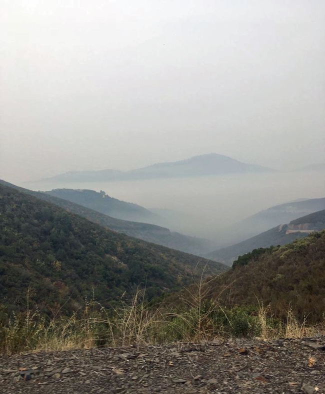
Nearly 300 animals – mainly horses, sheep, goats and alpacas – were killed during the LNU Complex Fire in Solano County. Some were hit by vehicles, others couldn't escape burning buildings.
“I helped locate animals that needed attention and shared burial and other disposal options and guidelines,” Doran said. He also created an online survey for dead or missing animal reporting.
Doran, also the director of UC Cooperative Extension in Sacramento, Solano and Yolo counties, and his staff and partner organizations – including the USDA Farm Service Agency, Natural Resources Conservation Districts, local resource conservation districts and county officials – have organized a free webinar to help local residents in fire recovery. The webinar is from 9 a.m. to 12:30 p.m. Thursday, Sept. 10. Pre-registration is required.
Topics to be covered are:
- Navigating the agency alphabet soup for disaster assistance
- Understanding wildland fire impacts
- Impact of fire on oak woodlands, what to expect and what to do
- Impact of fire on rangelands, what to expect and what to do
- Impact of fire on orchard trees, what to expect and what to do
- Impact of fire on vineyards and wine grapes, what to expect and what to do
- Erosion risks and mitigation measures
- USDA disaster programs and how to apply
Evacuating animals
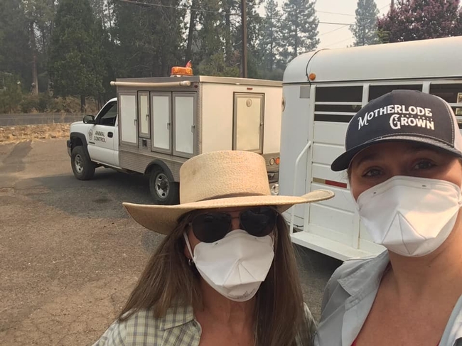
In areas where the Moc Fire burned near Moccasin, Calif., UC Cooperative Extension 4-H advisor in the Central Sierra, JoLynn Miller, joined partners to activate Team ELITE (Evacuation of Livestock in Tuolumne Emergencies) so trained volunteers could help move animals to safety and ensure they are fed and housed during the wildfire.
The organization was established in the wake of the 2015 Butte Fire, when officials recognized the need for coordinated animal evacuation planning. They drafted Miller, an experienced horsewoman and community volunteer, to spearhead the group.
“We work closely with and are dispatched by animal control during an emergency,” Miller said. “Team ELITE requires members to be trained in incident command systems and they are sworn Disaster Service Workers once they complete a Team ELITE orientation and training. The Moc Fire was the first fire where we've done evacuations.”
Team ELITE was placed on standby on Aug. 20. A few hours later, three teams were behind the fire lines.
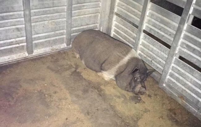
“Volunteers worked throughout the night to pick up animals,” Miller said. “The first night we had donkeys, chickens, horses, alpacas and pigs evacuated.” The animals were held at the Mother Lode Fairgrounds in Tuolumne County.
The team spent three days, Aug. 22-24, feeding and watering animals. Aug. 25 the evacuation orders were lifted and they helped families get their animals back home.
For more information about Team ELITE, see its Facebook page https://www.facebook.com/TeamELITEinformation/
Valuing the losses
Federal, county, CALFIRE and other officials routinely turn to UCCE experts to gather information about the impact of wildfire on agricultural lands.
Two UC Cooperative Extension rangeland advisors, Theresa Becchetti of Stanislaus and San Joaquin counties and Sheila Barry of San Mateo, Alameda, Santa Clara and Contra Costa counties, both cover areas burned by the SCU Fire.
In order for a disaster to be declared and for insurance payouts, a value must be attached to losses caused by the wildfire. In rangeland areas, components of the losses include hundreds of miles of fencing, forage, stock ponds and damage to the soil and seedbank that could impede grass growth for years. Livestock may also be lost in wildfires.
“In some respects, the SCU Fire was an invisible fire because it didn't threaten vineyards or redwoods – landscapes that get more attention. It is grassland, oak woodland and brushland. Some very small pockets of forest,” Barry said. “But it is actually the second largest fire in the state's history.”
Becchetti had previously developed a methodology for calculating forage losses. The two scientists were able to use the system for establishing the economic loss to ranchers and government agencies caused by the blaze. CALFIRE also used the information to inform the distribution of its firefighting resources.
“The Farm Service Agency has told us that the information we put together on the value of the area is enough for the local county committees to declare a disaster, which will release emergency cost share programs,” Becchetti said. “We are continuing conversations with the agencies in the four counties and starting to put information out for ranchers.”
UCCE will host meetings regarding fire recovery and disaster assistance programs. Visit local UC Cooperative Extension websites for details.

