- Author: Pamela Kan-Rice
- Author: Trina Wood
The same weather radar technology used to predict rain is now giving UC researchers the ability to track wild birds that could carry the avian influenza virus. Avian influenza, which kills chickens, turkeys and other birds, can take a significant economic toll on the poultry industry. In 2014- 2015, the United States experienced its worst bird flu outbreak in history, resulting in more than 48 million birds dying in 15 states, including California.
“We use the existing network of weather radar stations in the U.S. in the same way that radar is used to track rain, except that we process the data to allow us to interpret the radar signal bouncing off birds...
- Author: John Stumbos
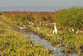
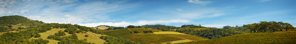
At times during the winter and early spring it looks like a vast inland sea between Sacramento and Davis. This is the Yolo Bypass, which shunts Sacramento River floodwater around the state capital during high flows. You drive over the bypass on a three-mile-long elevated stretch of Interstate 80 known as “the Causeway” (the Blecher-Freeman Memorial Causeway). The bypass is also the site of a lot of innovative fish and wildlife work.
From late fall through winter you can see thousands of ducks, geese and other waterfowl winging over the bypass’s flooded rice fields and the restored wetlands in the Vic Fazio Yolo Basin Wildlife Area. The Central Valley of California is one of the...

