- Author: Grace Fruto, UC Davis
- Author: Trina Kleist, UC Davis

Wildflower displays threatened
Northwest of Los Angeles, springtime brings native wildflowers to bloom in the Santa Monica Mountains. These beauties provide food for insects, maintain healthy soil and filter water seeping into the ground – in addition to offering breathtaking displays of color.
They're also good at surviving after wildfire, having adapted to it through millennia. But new research shows wildflowers that usually would burst back after a blaze and a good rain are losing out to the long-standing, double threat of city smog and nonnative weeds.
A recent study led by Justin Valliere, assistant professor in the UC Davis Department of Plant Sciences, found that native wildflowers and other plants that typically flourish following a fire were, instead, replaced by invasive plants on land that received the kind of nitrogen contained in vehicle emissions.

“Many native plants in fire-prone areas rely on fire, and some are entirely dependent on it. Some are even most abundant after a fire,” said Valliere, a UC Cooperative Extension specialist in invasive weed and restoration ecology. “But we found that these fire-following species may be especially vulnerable to the combination of nitrogen pollution and invasive plants.”
That's part of the reason why native plants in these mountains have been declining.
Seeds – banked in the soil and waiting to sprout
The problem faced by native plants can be compared to a drawn-down bank account: Funds withdrawn are not being replaced.
It starts with fire, an important ecological process, Valliere said. Flames burn through plants on the surface and return their nutrients to the soil. Seeds sleeping in the ground wait for the next rain to sprout, then use those nutrients to grow.
“Plant diversity is often highest in growing seasons immediately after a site burns,” he said.
But invading plants have many advantages over native ones. They often sprout earlier, grow faster and create more seeds, all while tolerating drought.
“They're like cheaters,” Valliere said. “They don't follow the same rules.”
Nitrogen, too, is an important piece of every plant's nutrition. They all get a fertilizing boost from nitrogen that floats up in vehicle emissions and falls to the ground. But the invaders use nitrogen and other nutrients to grow faster, winning the race for water and sunlight. As a result, fewer native plants reach maturity, producing fewer seeds that keep their populations thriving.
When the bank balance reaches zero
The 2013 Springs Fire gave Valliere a unique opportunity to study the combined impacts of wildfire and extra nitrogen. He and colleagues from UC Riverside and the National Park Service created test plots in the Santa Monica Mountains where the fire had burned. Then, they added nitrogen to the soil to mimic the amount and type that LA's smog would deposit. Over the study's three years, native plants that typically would have flourished after wildfire instead declined even faster in the plots with added nitrogen.
Native seeds sprouted, but didn't flower. Over time, the soil's bank of seeds drew down.

“Each seed has one chance to flower and reproduce,” Valliere said. “If a seed grows and gets outcompeted, that seed has lost its chance to replenish the seed bank.”
Without the chance to replenish their bank account, native plants will die out, and the whole ecosystem will be thrown out of balance.
“There is inherent value in biodiversity,” Valliere said. “These invasive weeds could prevent the re-establishment of native shrubs after fire, sometimes forever altering the plant community.”
The loss of native plants can have cascading effects on the larger environment, he added. Problems can include the loss of native bees that feed on the flowers, and mudslides when rain makes hillsides unstable.
This problem is likely to repeat in similar areas where biodiversity is highest after wildfires – including parts of the Mediterranean basin, southern Africa and Australia. The addition of city smog “could have serious consequences for the biodiversity of fire-prone ecosystems worldwide,” Valliere warned.
Read the paper, “Nitrogen deposition suppresses ephemeral post-fire plant diversity,” by Justin Valliere, Irina Irvine and Edith Allen.
This article was first published on the UC Davis Department of Plant Sciences website.
- Author: Grace Dean

The Forest Stewardship team has revamped their Forest Stewardship Story Map, first published in summer 2023. The new application hosts a slew of new features which provide a more user-friendly experience and allow users to learn about the forestry education programs offered by UC ANR.
The new application, built using ArcGIS Experience Builder, is live and can be viewed by clicking HERE.
Follow along as we go through the new Forest Stewardship Story Map, highlighting key new features, and giving voice to small forest landowners.
Forest Stewardship Story Map
The ‘Forest Stewardship Story Map' homepage hosts the user-directed story map and directional information. The page offers background on the Forest Stewardship workshop series, and users can click through to view directions on how to use the map. Scrolling down will reveal the map, pictured below.

This new interface allows users to select stories via two methods: the story map which is based on county locations, or the story map list. The new story map list also hosts the ability to filter stories by landowner, professional, and county- making it easier to spotlight each interviewee's distinct relationship with California forestland.
Scroll to the top to click on the brand-new page, ‘Educational Programs'.
Educational Programs
The new ‘Educational Programs' page provides additional background and information on both the Forest Stewardship Education Program and the Post-Fire Forest Resilience Program. Both workshop programs target California landowners who are seeking management information for pre- and post-fire forestland. Readers will be able to distinguish the differences between the two programs in both mission and implementation through viewing the impacts of each program.
The Story Map also hosts upcoming event information for both Forest Stewardship and Post-Fire Forest Resilience programs, giving users the opportunity to easily engage with UC ANR. It is important to both Kim Ingram, Forest Stewardship Academic Coordinator, and Katie Reidy, Post-Fire Forest Resilience Academic Coordinator, that Story Map visitors can access information which has aided the landowners who shared their stories with us.
“Forest landowners express to us a huge need for forest management education and outreach,” says Ingram. “However, knowing where to start can often be confusing. Our hope is through the Story Map, landowners can see themselves in the stories of others, and take that all important first step.”
Users can also connect with forestry professionals highlighted on the Story Map by clicking on the tab titled ‘Connect with a Professional'.
Connect with a Professional
Introducing workshop participants to their local natural resource professionals is a hallmark of both the Forest Stewardship Education and Post-Fire Forest Resilience workshops. Each program facilitates knowledge sharing between landowners and professionals, both at weekly online workshop meetings and in-person field days. Now, the Story Map provides another avenue for landowners to connect with their local forestry professionals.
The professionals who provided their stories are available for landowners to contact via email on the ‘Connect with a Professional' page. Users can also visit the website for each professional's organization and utilize the ‘Find Your UCCE Office' tool to locate their county's UC Cooperative Extension Office.

Looking to the Future
As the Forest Stewardship Education Initiative and the Post-Fire Forest Resilience programs expand to new areas in 2024, more stories from community members will be spotlighted. The new Story Map has added stories from Santa Cruz County forest landowners, UC ANR Fire Advisors, and Post-Fire Forest Resilience workshop participants.
Though the application's shell has been altered, the mission of the Story Map remains the same: to showcase stories that will inspire landowners to take management action and connect with a statewide network of forestry resources, including UC ANR's Forest Stewardship Education and Post-Fire Forest Resilience workshop programs. Join us and share your story!
Registration is open for the next Forest Stewardship Education workshop in Fresno and Madera counties. Sign up here: ucanr.edu/forestryworskhopregistration
Registration is open for the next Post-Fire Forest Resilience workshop in Santa Clara and Santa Cruz counties. Sign up here: https://ucanr.edu/sites/forestry/Post-fire_Forest_Resilience/Post-fire_Forest_Resilience_Workshops/
- Author: Grace Dean

In Spring of 2022, UC ANR launched its first Post-Fire Resilience Workshop. Since 2022, the workshop has traveled to Alpine, El Dorado, Plumas, Mariposa, Fresno, Madera, and Napa counties, and has reached 97 participants. The program continues to gain positive feedback and broadening statewide interest.
The UC ANR Post-Fire Resilience program has provided educational assistance to non-industrial private forest landowners throughout California who have been affected by wildfire. The program's workshop offering is headed by Post-Fire Academic Coordinator Katie Reidy, who aims to provide landowners with an opportunity to learn ways to proceed with their forested land, post-fire. Reidy explains that for landowners, the act of returning to post-wildfire property is “An emotional experience. The drastic change can be overwhelming.”
The Post-Fire team understands that for landowners in this situation, taking the first steps toward post-fire recovery can be the hardest. Reidy shares that the workshop is therefore “Designed to provide stepping stones and educational tools for landowners. It helps them think about how to manage their land for the future; how to encourage the land to grow back.” Beginning September 14th, the team is inviting private forest landowners, agency folks, and interested community members in Siskiyou, Shasta, and Trinity counties to their next workshop cohort.

Participants of the workshop will engage in weekly workshop sessions over Zoom on Thursday nights from 6-7:30pm from September 14th- October 26th, with in-person field trip days on November 3rd, 4th, and 5th (one day per county). Weekly sessions will consist of information on post-fire issues such as removing hazard trees, reforestation, erosion control, managing competing vegetation and local assistance programs. A variety of speakers and resource professionals supplement each session by sharing their expertise on topics.
At the end of the online Zoom sessions, participants are invited to an in-person field day. Here, they examine the impacts of fire and observe post-fire management practices on both private and public lands. The in-person field day also provides an opportunity for unstructured conversations among participants and professionals, where landowners are encouraged to ask questions about specific forest management strategies. Field trips consist of multiple stops, a process that aids in visualizing strategies for managing different post-fire problems.
For instance, one stop may highlight high-severity fire impacts with reforestation needs/efforts, while another stop may demonstrate ways to manage competing vegetation and resprouting trees. One past participant remarked that the in-person field trips were the most impactful portion of the series. The trips were a place where they could “Meet other people in the community facing the same situation we were.”

It's true that the Post-Fire workshop program guides workshop participants to find inspiration in regional success stories. Yet participants leave the program with so much more: a newfound or increased knowledge base and network that will help their projects succeed. The camaraderie that occurs in the workshop is powerful, shares Daylin Wade, Post-Fire Staff Research Associate.
Wade expresses that the program “Creates an opportunity for the community to learn from each other in addition to experts. Learning happens through discussions amongst participants that augments learning from the speakers”. Personal accounts of people's experience with fire recovery are valuable for other participants to hear, she notes. Wade shares that at a previous workshop: “One landowner who had experienced fire 3 years ago provided learning and insights to a landowner who experienced fire only six months ago.”
The tragedy of wildfire events is taken into direct consideration with the workshop, which is not simply a place to learn, but a place to build community resilience. Future workshop participants can expect to experience these connections between inspiration and action and leave the workshop with a new network of support.
The next Post-Fire Resilience workshop series begins September 14th! Interested forest landowners, community members, or tribal members in Siskiyou, Trinity, and Shasta counties should register here: http://ucanr.edu/post-fireregistration. There is a registration fee of $25. Any questions should be directed to Katie Reidy, Post-Fire Forest Resilience Program Coordinator at: kkreidy@ucanr.edu.
- Author: Hannah Bird
HREC and Post-Fire Research Opportunities
What is HREC?
The UC Hopland Research & Extension Center (HREC) is a multi-disciplinary research and education facility in Mendocino County located in the foothills of the Coast Range about two hours north of Berkeley. As part of the UC system for over 65 years, we are stewards of more than 5,300 acres of oak woodland, grassland, chaparral, and riparian environments. Elevation at the center ranges from 500 ft to 3,000 ft. HREC currently maintains a research flock of about 500 breeding ewes that have been the subjects of numerous studies on ranching practices, range management, livestock nutrition, wool production and breeding. Field experiments and demonstrations conducted here since 1951 have led to more than 1,500 publications in animal science, entomology, plant ecology, public health, watershed management, and wildlife biology. Our website is hrec.ucanr.edu.
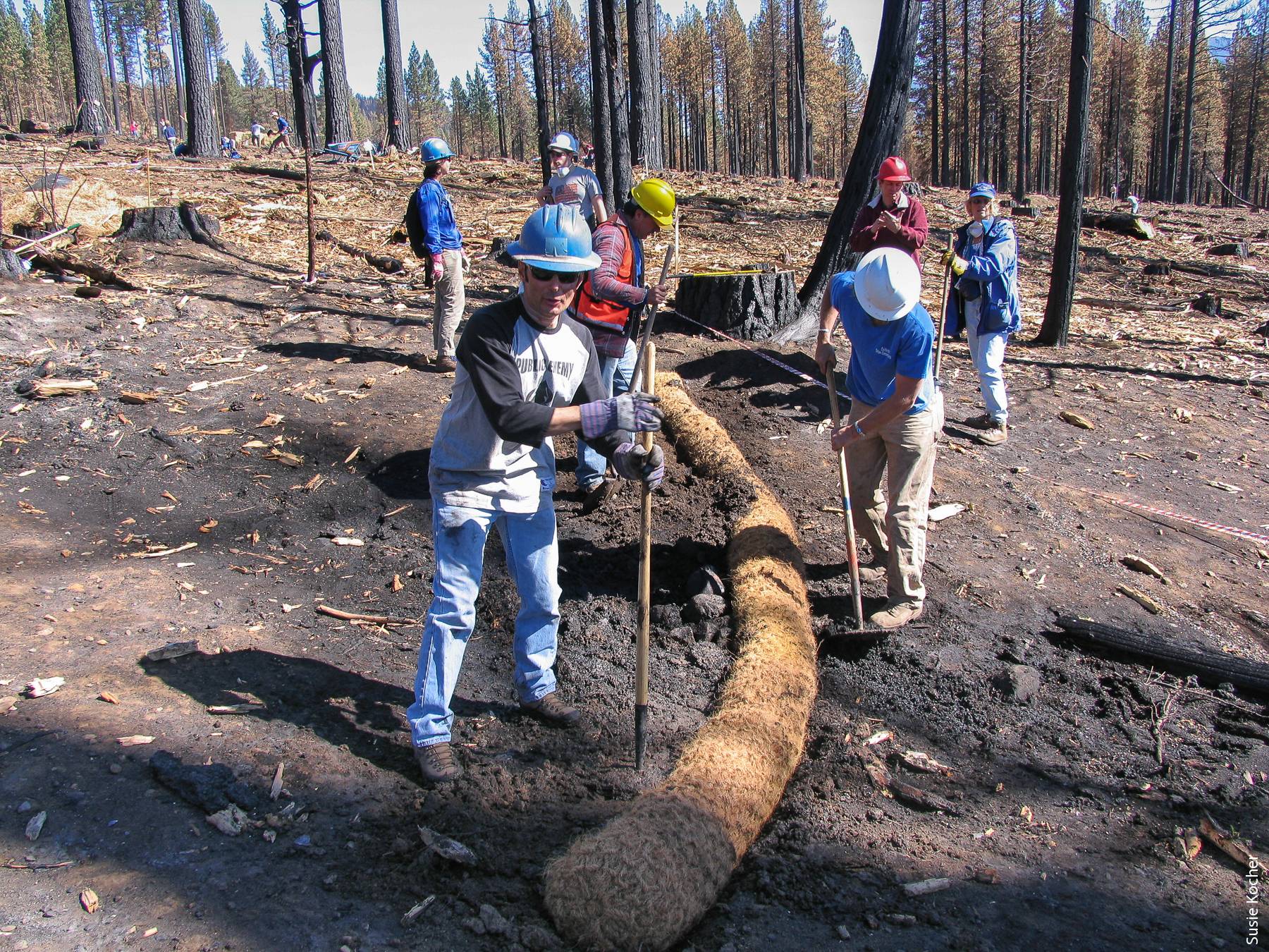
The River Fire
As part of the Mendocino Complex fire, the River Fire burned through HREC on the evening of July 27 and into July 28. Approximately 3,000 acres of our center burned in this fire. Due to the concentrated efforts of Center staff and Cal Fire crews, all of our employees, residents, sheep, livestock dogs, offices and residences were saved. Below please find the burn map of our property. All of the black area to the north was burned and the dark red patches were areas of vegetation that remained unburned. The fire intensity varied greatly as did oak survival. You will see two smaller burned areas in the southern part of the property that were prescribed burns performed in June of this year.

Research Opportunities
While this was a blow to current research, pastures, and water infrastructure, we also see this as a wonderful opportunity. Due to extensive historical data sets and ongoing research projects, coupled with a variety of grazed and ungrazed pastures, and prescribed burn plots for comparison with wildfire, there is enormous potential for pre- and post-fire studies in the fields of:
- Watersheds and hydrology; fire science; plant science; soil science; entomology and parasitology; wildlife and wildlife ecology; rangeland management; grazing practices as fire suppression…..
To support this research, HREC offers:
- A well maintained network of roads that accesses almost all parts of the property, vehicles to use.
- A fully equipped shop staffed by employees skilled in fabrication and repair of research equipment
o Electrical, wood working, welding and metal fabrication, mechanical
- Skilled staff trained in field work techniques, with long histories of successful research support
- Fiber optic internet with Wi-Fi access throughout headquarters, strong cell service in most areas
- A vault of raw data, photos, and final papers from research conducted at HREC.
- Warehouses for storing equipment, a variety of accommodations from dorms to private houses
- Wet and dry lab space (undergoing renovation during fall 2018, available spring 2019)
- Lysimeter with available watering system, electrical connections, and fiber optic access point
- A research flock of sheep consisting of just under 500 breeding ewes, with all needed facilities and RFID tracking
- Fenced pastures and biological reserve areas for different treatment plots and controls
- A fully equipped conference facility with A/V equipment and fiber optic connections
Next Steps
- Zoom meeting on September 7th, 10am. More in depth information, Q&A.
- Field day on October 19th, 10am-5pm. Presentations, brainstorming, Q&A, site tours, available accommodations
- To register for either event follow this link: http://ucanr.edu/survey/survey.cfm?surveynumber=25451
Contact: HREC Interim Director John Bailey, jtbailey@ucanr.edu, (707) 744-1424 x 112
- Author: Sabrina L. Drill
The Natural Resources Conservation Service has a series of helpful fact sheets about post-fire erosion control methods. To choose the right methods, you'll need to examine your unique situation and goals. These include whether your concerns are more immediate or if you have the opportunity to consider medium to long-range vegetation recovery, the degree of your slopes, how intense the burn was near you (is there still standing charred vegetation that might re-sprout?) and what the underlying geology and soil types are. You may need a site visit from an erosion control specialist, but these fact sheets can help you weigh your options NRCS Post-fire resources
Ventura County residents should also be following the County's post-fire website - http://venturacountyrecovers.org/ - of special note, Calrecycle just announced they will be able to assist homeowners with debris removal - http://venturacountyrecovers.org/information-meetings-set-calrecycle-debris-removal-services-deadline-right-entry-forms/