- Author: Lynn Wunderlich
As we move into winter after four years of drought, all eyes are on what weather we can expect and how it may impact Sierra foothill growers next spring. Sources for foothill weather information include the CIMIS (California Irrigation Management Information System) stations, which provide detailed weather information including temperature, precipitation, reference ET, soil temperatures and wind speeds; and the PMI (Powdery mildew index) stations, which provide limited data such as canopy temperatures-used to calculate the grape powdery mildew index- and precipitation.
Here in the foothills we have 3 active CIMIS stations: Camino #13, Diamond Springs #228 (both in El Dorado County) and Plymouth #227 (Amador County). Typically, the Camino station receives the most precipitation, and the precipitation decreases as you move south. CIMIS data can be directly accessed via the CIMIS website (login set up is free but required), or you can access CIMIS from my "How to Access Weather Data" webpage here.
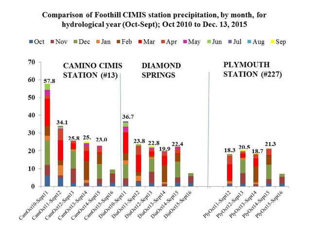
I've just downloaded the precipitation data for the hydrological year to date. The "hydrological year" begins Oct. 1 and runs to Sept. 30; it includes the winter rainy season that a perennial crop would expect to see. Here is the precipitation data by month to date, as compared to the previous 4 years:
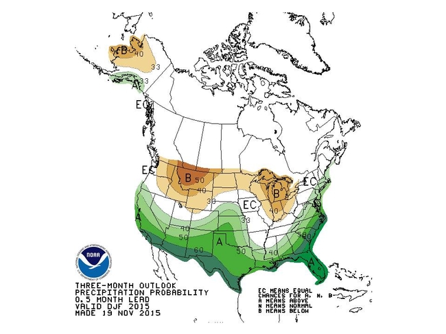
Our National Weather Service and NOAA (the National Oceanic and Atmospheric Administration) publishes a climate prediction page on their website. Their 3 month prediction for precipitation shows "a" or "above average" for Southern California, continuing, though not as strongly, for the foothills:
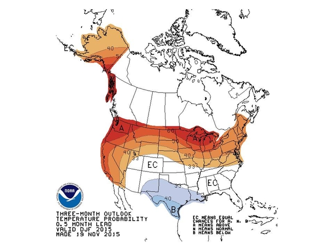
This is great news! However, if we look closer at the forecast, NOAA's three month outlook for temperatures also shows an "A" or above normal forecast:


