Calag Archive
Calag Archive

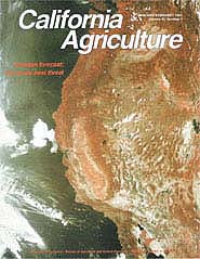
Invasion forecast: the exotic pest threat
Cover:
Registered by a satellite sensor 35,000 kilometers above Earth, the red tones of the infrared image on the cover indicate reflectance by green, photosynthesizing plants. Such satellite images can be used to generate maps of vegetative cover, using a Normalized Difference Vegetation Index (NDVI). NDVI images help track and predict the spread of exotic pests.
Photo and computer image courtesy of NASA AMes Research Center.
January-February 1992
Volume 46, Number 1
Volume 46, Number 1


