University of California
Dev Test!

Calag Archive

Calag Archive

California Agriculture, Vol. 54, No.3

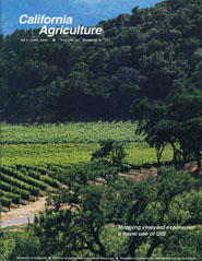
Mapping vineyard expansion: a novel use of GIS
Cover:  With economic boom times, statewide wine grape acreage has increased 53% since 1990. Scientists have examined growth in Sonoma County (see pp 4-20). - Photo by Jack kelly Clark
May-June 2000
Volume 54, Number 3

Peer-reviewed research and review articles

Mapping vineyard expansion provides information on agriculture and the environment
by Adina M. Merenlender
| Full text HTML  | PDF  
Using GIs, UC researchers provided more accurate estimates of vineyard acreage in Sonoma County.
Vineyards are expanding rapidly in California's coastal counties due to a booming wine market. This change in land use has led to public debate over natural habitat removal, overproduction of wine grapes, loss of agricultural diversity, and changing scenery. Using a geographic information system (GIS) to map and analyze vineyard expansion in Sonoma County, approximately 11,600 acres of new vineyards were identified from 1990 through 1997. The total acreage was calculated to be at least 48,000 acres in 1997, 20% more than reported by county agricultural officials. Compared to vineyards established before 1990, a higher percentage of vineyards planted between 1990 and 1997 were located on hillsides that supported oak woodlands. Oak woodlands support a majority of the region's biodiversity, provide ecosystem goods and services, and have aesthetic value. This research was designed to document the effects of recent vineyard expansion on Sonoma County's hardwood rangelands and to provide tools for informed discussion and decision-making by land-use planners, farmers, residents and environmentalists.
Modeling vineyard expansion, potential habitat fragmentation
by Emily Heaton, Adina M. Merenlender
| Full text HTML  | PDF  
Scientists used statistical modeling and GIS to identify areas in Sonoma County that may be suitable for vineyard development in the future.
We used a statistical modeling technique called logistic regression analysis, and a geographic information system (GIS), to map areas of possible future vineyard expansion in Sonoma County, based on data about vineyard development from 1990 through 1997. The goal of this research was to develop a model that would improve our understanding of vineyard expansion patterns at a landscape scale (for instance, including an entire county). The approach involved identifying landscape characteristics that were associated with vineyard development and mapping the areas with similar characteristics that were undeveloped in 1997. We used the results to map where habitat removal and fragmentation could result from vineyard expansion. This method, although still under development, is designed for county- or regional-scale analysis to assist land-use planners, natural resource protection agencies and land conservation programs in protecting valuable environmental resources while sustaining a vital agricultural economy.
How the GIS was used to map and quantify policy impacts
by Colin Brooks, Adina M. Merenlender
Full text HTML  | PDF  
Publicly funded weather database benefits users statewide
by Doug Parker, Daniel R. Cohen-Vogel, Daniel E. Osgood, David Zilberman
| Full text HTML  | PDF  
California's ClMlS database provides about $64.7 million in benefits and saves 107,300 acre-feet of water per year, at a cost of $850,000.
The California Irrigation Management Information System (CIMIS), developed and operated by the California Department of Water Resources, was assessed using a UC Cooperative Extension survey and the CIMIS user database. We found that the benefits of the program far outweigh the state cost of about $850,000 per year. Statewide, 363,816 agricultural acres are under CIMIS, with annual estimated benefits of $64.7 million. Fresno and Kern counties receive the largest net benefits, while Santa Barbara and Ventura counties have the highest benefits per acre. According to our calculation, statewide agricultural water applications are reduced by 107,300 acre-feet annually. Initially designed for irrigation management, CIMIS weather information stations benefit a host of other agricultural and nonagricultural activities such as pest control and water use by parks and golf courses. Using general economic principles, we also assessed alternative scenarios for future management of CIMIS, such as charging fees or continuing its operation as a public-sector resource.
Avocado and citrus orchards along the coast may use less water
by Mark E. Grismer, Richard L. Snyder, Ben A. Faber
| Full text HTML  | PDF  
Water use of two commercial orchards located near Ventura was less than the published crop coefficients for citrus and avocado orchards.
Most citrus and avocado water-use studies have been conducted in inland orchards; however, orchards located in coastal areas are subject to cooler temperatures and foggier atmospheric conditions. To develop coastal area crop coefficients (Kc values) for irrigation management, we measured orchard consumptive water use (ETc) from two different commercial orchards located near Ventura. In addition to coastal climate variability, the ETc measurements were complicated by the wide variability in field soil, slope and elevation. On average, we measured Kc values of 0.46 for young lemons, 0.52 for mature lemons and 0.64 for mature avocados. These values were slightly less than those published, perhaps as a result of greater fog conditions in the orchards as compared to those occurring at the nearest reference ET stations.
Broccoli residues can control Verticillium wilt of cauliflower
by Steven T. Koike, Krishna V. Subbarao
| Full text HTML  | PDF  
Verticillium wilt, a damaging disease of cauliflower, was successfully managed by incorporating broccoli residues into infested soil.
Verticillium wilt, a damaging disease of cauliflower, was successfully managed in a multiple-year field study by incorporating broccoli residues into infested soil. In a study conducted from 1993 to 1995 in the Salinas Valley, cauliflower disease incidence and severity were consistently and significantly reduced in the broccoli residue plots when compared with no broccoli. The commercial standard plots fumigated with methyl bromide + chloropicrin had the lowest disease incidence and severity. In both years of our tarping study, Verticillium wilt severity was lowest in the metham sodium treatment. The cauliflower-Verticillium host-pathogen system therefore can act as a model for controlling soil-borne diseases without the use of synthetic chemicals.
Commercial handling influences quality and ripening of Bartlett pears
by I. Tayfun Agar, Elizabeth J. Mitcham
| Full text HTML  | PDF  
Fruit softening and change in skin color occurred faster in pears that were commercially harvested, then dumped onto the packing line.
Pear fruit injury occurs during harvest and additional injuries occur during postharvest handling in packinghouses. With increased commercial handling, Bartlett pears exhibited higher rates of ethyiene production and respiration, which are associated with ripening. Fruit softening and change in skin color from green to yellow occurred faster in pears that were harvested by a commercial crew and then dumped onto the packing line, as compared to pears that were harvested by a commercial crew, without packing-line handling. Immersion dumps used with flotation salts may be less damaging to pears as compared to non-immersion dumps.
Monitoring soil moisture helps refine irrigation management
by Blaine R. Hanson, Steve Orloff, Douglas Peters
| Full text HTML  | PDF  
Soil moisture sensors can help determine the interval between irrigation, depth of wetting, depth of extraction by roots and adequacy of wetting.
Soil moisture sensors can be used to determine the appropriate interval between irrigation, depth of wetting, depth of extraction by roots and adequacy of wetting. We tested the performance of soil moisture sensors in different crops. Sensors that read on a continuous basis, such as the Enviroscan device, can provide valuable information that may not be readily evident from periodic measurements. The Watermark blocks responded well throughout the wetting and drying cycles, indicating that they function more consistently over a wider range of soil moisture contents compared with tensiometers and gypsum blocks.
Soil type affects accuracy of dielectric moisture sensors
by Blaine R. Hanson, Douglas Peters
| Full text HTML  | PDF  
The TRASE and ThetaProbe devices gave reasonably accurate soil moisture measurements over a range of soil textures.
Several types of dielectric soil moisture sensors were evaluated at various locations in California. The TRASE and ThetaProbe devices were reasonably accurate over a range of soil textures. In silt loam and silty clay soil types, the Enviroscan readings were inaccurate. The Aquaterr meter, which provides a qualitative measurement of soil moisture content, responded to changes in soil moisture content for several different soils, but little response occurred in one sandy soil.
Effectiveness of tensiometers and electrical resistance sensors varies with soil conditions
by Blaine Hanson, Douglas Peters, Steve Orloff
| Full text HTML  | PDF  
Watermark block readings were more reliable than tensiometers and responded over a larger range of soil moisture cqntents.
Tensiometers, gypsum blocks, Watermark blocks and an electromagnetic conductivity meter were evaluated for their response to changes in soil moisture content. Tensiometers and Watermark blocks had similar responses, but the blocks operated better than tensiometers in drier soil. Gypsum blocks did not respond until some threshold moisture content was reached. The electromagnetic conductivity meter responded to changes in moisture content in fine-textured soil, but it did not respond in sandy soil.
Harvest mechanization helps agriculture remain competitive
by James F. Thompson, Steven C. Blank
| Full text HTML  | PDF  
Mechanical harvesting has reduced labor costs in rice and processing tomatoes and enabled growers to increase production.
California farmers have remained competitive in the global marketplace by using technology to reduce their costs and to expand production. Case studies of rice and processing tomatoes show that harvest mechanization has reduced labor use by 92% to 97% and has also reduced labor costs, down from half to two-thirds of total costs to less than 20%. Mechanization is at least partly responsible for the steady increase in production of these two crops. Although mechanization has reduced the number of labor hours for harvesting, overall employment for rice and processing tomatoes has risen due to increased production, and so have harvester operator wages. Further advances in tomato harvest technology will continue to reduce labor needs, while the rice industry will experience moderate changes.
Webmaster Email: bjnoel@ucanr.edu

Thank you for visiting us at California Agriculture. We have created this printable page for you to easily view our website offline. You can visit this page again by pointing your Internet Browser to-

http://ucanr.edu/sites/dev_test/archive/index.cfm?issue=54_3

California Agriculture, Vol. 54, No.3

Mapping vineyard expansion: a novel use of GIS
Cover:  With economic boom times, statewide wine grape acreage has increased 53% since 1990. Scientists have examined growth in Sonoma County (see pp 4-20). - Photo by Jack kelly Clark
May-June 2000
Volume 54, Number 3

Peer-reviewed research and review articles

Mapping vineyard expansion provides information on agriculture and the environment
by Adina M. Merenlender
| Full text HTML  | PDF  
Using GIs, UC researchers provided more accurate estimates of vineyard acreage in Sonoma County.
Vineyards are expanding rapidly in California's coastal counties due to a booming wine market. This change in land use has led to public debate over natural habitat removal, overproduction of wine grapes, loss of agricultural diversity, and changing scenery. Using a geographic information system (GIS) to map and analyze vineyard expansion in Sonoma County, approximately 11,600 acres of new vineyards were identified from 1990 through 1997. The total acreage was calculated to be at least 48,000 acres in 1997, 20% more than reported by county agricultural officials. Compared to vineyards established before 1990, a higher percentage of vineyards planted between 1990 and 1997 were located on hillsides that supported oak woodlands. Oak woodlands support a majority of the region's biodiversity, provide ecosystem goods and services, and have aesthetic value. This research was designed to document the effects of recent vineyard expansion on Sonoma County's hardwood rangelands and to provide tools for informed discussion and decision-making by land-use planners, farmers, residents and environmentalists.
Modeling vineyard expansion, potential habitat fragmentation
by Emily Heaton, Adina M. Merenlender
| Full text HTML  | PDF  
Scientists used statistical modeling and GIS to identify areas in Sonoma County that may be suitable for vineyard development in the future.
We used a statistical modeling technique called logistic regression analysis, and a geographic information system (GIS), to map areas of possible future vineyard expansion in Sonoma County, based on data about vineyard development from 1990 through 1997. The goal of this research was to develop a model that would improve our understanding of vineyard expansion patterns at a landscape scale (for instance, including an entire county). The approach involved identifying landscape characteristics that were associated with vineyard development and mapping the areas with similar characteristics that were undeveloped in 1997. We used the results to map where habitat removal and fragmentation could result from vineyard expansion. This method, although still under development, is designed for county- or regional-scale analysis to assist land-use planners, natural resource protection agencies and land conservation programs in protecting valuable environmental resources while sustaining a vital agricultural economy.
How the GIS was used to map and quantify policy impacts
by Colin Brooks, Adina M. Merenlender
Full text HTML  | PDF  
Publicly funded weather database benefits users statewide
by Doug Parker, Daniel R. Cohen-Vogel, Daniel E. Osgood, David Zilberman
| Full text HTML  | PDF  
California's ClMlS database provides about $64.7 million in benefits and saves 107,300 acre-feet of water per year, at a cost of $850,000.
The California Irrigation Management Information System (CIMIS), developed and operated by the California Department of Water Resources, was assessed using a UC Cooperative Extension survey and the CIMIS user database. We found that the benefits of the program far outweigh the state cost of about $850,000 per year. Statewide, 363,816 agricultural acres are under CIMIS, with annual estimated benefits of $64.7 million. Fresno and Kern counties receive the largest net benefits, while Santa Barbara and Ventura counties have the highest benefits per acre. According to our calculation, statewide agricultural water applications are reduced by 107,300 acre-feet annually. Initially designed for irrigation management, CIMIS weather information stations benefit a host of other agricultural and nonagricultural activities such as pest control and water use by parks and golf courses. Using general economic principles, we also assessed alternative scenarios for future management of CIMIS, such as charging fees or continuing its operation as a public-sector resource.
Avocado and citrus orchards along the coast may use less water
by Mark E. Grismer, Richard L. Snyder, Ben A. Faber
| Full text HTML  | PDF  
Water use of two commercial orchards located near Ventura was less than the published crop coefficients for citrus and avocado orchards.
Most citrus and avocado water-use studies have been conducted in inland orchards; however, orchards located in coastal areas are subject to cooler temperatures and foggier atmospheric conditions. To develop coastal area crop coefficients (Kc values) for irrigation management, we measured orchard consumptive water use (ETc) from two different commercial orchards located near Ventura. In addition to coastal climate variability, the ETc measurements were complicated by the wide variability in field soil, slope and elevation. On average, we measured Kc values of 0.46 for young lemons, 0.52 for mature lemons and 0.64 for mature avocados. These values were slightly less than those published, perhaps as a result of greater fog conditions in the orchards as compared to those occurring at the nearest reference ET stations.
Broccoli residues can control Verticillium wilt of cauliflower
by Steven T. Koike, Krishna V. Subbarao
| Full text HTML  | PDF  
Verticillium wilt, a damaging disease of cauliflower, was successfully managed by incorporating broccoli residues into infested soil.
Verticillium wilt, a damaging disease of cauliflower, was successfully managed in a multiple-year field study by incorporating broccoli residues into infested soil. In a study conducted from 1993 to 1995 in the Salinas Valley, cauliflower disease incidence and severity were consistently and significantly reduced in the broccoli residue plots when compared with no broccoli. The commercial standard plots fumigated with methyl bromide + chloropicrin had the lowest disease incidence and severity. In both years of our tarping study, Verticillium wilt severity was lowest in the metham sodium treatment. The cauliflower-Verticillium host-pathogen system therefore can act as a model for controlling soil-borne diseases without the use of synthetic chemicals.
Commercial handling influences quality and ripening of Bartlett pears
by I. Tayfun Agar, Elizabeth J. Mitcham
| Full text HTML  | PDF  
Fruit softening and change in skin color occurred faster in pears that were commercially harvested, then dumped onto the packing line.
Pear fruit injury occurs during harvest and additional injuries occur during postharvest handling in packinghouses. With increased commercial handling, Bartlett pears exhibited higher rates of ethyiene production and respiration, which are associated with ripening. Fruit softening and change in skin color from green to yellow occurred faster in pears that were harvested by a commercial crew and then dumped onto the packing line, as compared to pears that were harvested by a commercial crew, without packing-line handling. Immersion dumps used with flotation salts may be less damaging to pears as compared to non-immersion dumps.
Monitoring soil moisture helps refine irrigation management
by Blaine R. Hanson, Steve Orloff, Douglas Peters
| Full text HTML  | PDF  
Soil moisture sensors can help determine the interval between irrigation, depth of wetting, depth of extraction by roots and adequacy of wetting.
Soil moisture sensors can be used to determine the appropriate interval between irrigation, depth of wetting, depth of extraction by roots and adequacy of wetting. We tested the performance of soil moisture sensors in different crops. Sensors that read on a continuous basis, such as the Enviroscan device, can provide valuable information that may not be readily evident from periodic measurements. The Watermark blocks responded well throughout the wetting and drying cycles, indicating that they function more consistently over a wider range of soil moisture contents compared with tensiometers and gypsum blocks.
Soil type affects accuracy of dielectric moisture sensors
by Blaine R. Hanson, Douglas Peters
| Full text HTML  | PDF  
The TRASE and ThetaProbe devices gave reasonably accurate soil moisture measurements over a range of soil textures.
Several types of dielectric soil moisture sensors were evaluated at various locations in California. The TRASE and ThetaProbe devices were reasonably accurate over a range of soil textures. In silt loam and silty clay soil types, the Enviroscan readings were inaccurate. The Aquaterr meter, which provides a qualitative measurement of soil moisture content, responded to changes in soil moisture content for several different soils, but little response occurred in one sandy soil.
Effectiveness of tensiometers and electrical resistance sensors varies with soil conditions
by Blaine Hanson, Douglas Peters, Steve Orloff
| Full text HTML  | PDF  
Watermark block readings were more reliable than tensiometers and responded over a larger range of soil moisture cqntents.
Tensiometers, gypsum blocks, Watermark blocks and an electromagnetic conductivity meter were evaluated for their response to changes in soil moisture content. Tensiometers and Watermark blocks had similar responses, but the blocks operated better than tensiometers in drier soil. Gypsum blocks did not respond until some threshold moisture content was reached. The electromagnetic conductivity meter responded to changes in moisture content in fine-textured soil, but it did not respond in sandy soil.
Harvest mechanization helps agriculture remain competitive
by James F. Thompson, Steven C. Blank
| Full text HTML  | PDF  
Mechanical harvesting has reduced labor costs in rice and processing tomatoes and enabled growers to increase production.
California farmers have remained competitive in the global marketplace by using technology to reduce their costs and to expand production. Case studies of rice and processing tomatoes show that harvest mechanization has reduced labor use by 92% to 97% and has also reduced labor costs, down from half to two-thirds of total costs to less than 20%. Mechanization is at least partly responsible for the steady increase in production of these two crops. Although mechanization has reduced the number of labor hours for harvesting, overall employment for rice and processing tomatoes has risen due to increased production, and so have harvester operator wages. Further advances in tomato harvest technology will continue to reduce labor needs, while the rice industry will experience moderate changes.

University of California, 1301 S. 46th St., Bldg. 478 Richmond, CA
Email: calag@ucanr.edu | Phone: (510) 665-2163 | Fax: (510) 665-3427
Please visit us again at http://californiaagriculture.ucanr.edu/