Calag Archive
Calag Archive

A warmer California:
Assessing the impacts of climate change
Cover:
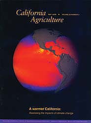
A new sensor orbiting the Earth aboard NASA's Terra satellite is collecting the most detailed measurements ever made of the sea's surface temperature.
The Moderate-resolution Imaging Spectro-radiometer (MODIS) is measuring sea surface temperature at twice the accuracy of previous satellites. Taken Jan. 1-8, 2001, this image shows cold water upwelling near the coast of Peru, and joining the South Equatorial Current, which flows westward across the Pacific Ocean.
Thermal expnasion of seawater and widespread loss of land ice due to global warming have very lilely contributed to the documented rise on sea level (1 to 2 millimeters annually) during the 20th century.
Image by Jesse Allen, based on data provided by the MODIS OCEAN Team and the university of Miami Rosenstiel School of Marine and Atmospheric Science Remote Sensing Group.
May-June 2002
Volume 56, Number 3
Volume 56, Number 3


