Posts Tagged: watershed
Headwaters
I have the privilege of engaging California's communities with the aspiration of safeguarding the sustenance and well-being that its oak-woodland watersheds and the people that are a part of them provide. This millennia-long integrated relationship of humans and land has parallel histories in other Mediterranean parts of the world. The following blog is the first of occasional installments about working Mediterranean landscapes in California and around the globe. Combined they will explore the concepts of watershed functions, working landscapes and Mediterranean climate, vegetation and management. Join me in experiencing these settings, growing our appreciation for the integrated nature of these landscapes and people, and gaining understanding and tools for our tenure as stewards. - David Lewis, director, UC Cooperative Extension, Marin County
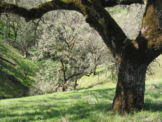
I am standing where stream flow begins, in a nameless tributary of the Russian River to the east of Hopland, Calif. This particular spot and location has been a grazing livestock ranch, primarily sheep, going back more than 100 years (learn more). This is one of thousands of spots in a watershed where water comes to the surface, joins in a channel and starts its path downstream. Many of us have stood at a confluence of two rivers or an estuary where a watershed's outfall meets an ocean. These locations are the stream's or river's end, their terminus. Where I am standing, is the headwaters of a stream system, where water is initially released and visible as a thin, shallow bouncing band.
Watersheds collect, store, and transport water. The transport function is performed by streams and rivers. These are dynamic, pervious channel networks each with a beginning and an end. At any part of the network, the channel is that lowest point in the landscape, stretching from one stream bank to the other, and generally widening in the downstream direction, until the stream mouth empties into another water body.
At the other end of a network is the channel head, where the channel begins. This is where I am standing. Channel heads are found in small, intimate folds in the landscape. These depressions are referred to by many names — draws, bowls, hollows — the place in hills where the slopes become shallow and coalesce.
Like an amphitheater, the surrounding hillslopes rise around me. Reaching out at shoulder height, I can almost touch these slopes. The mixed oak woodland and interspersed grasslands are in attendance across these slopes. Ghost pines, live oaks, black oaks and madrones, among other trees, make their stand interspersed with annual and perennial grasses blanketing the ground. This mosaic of vegetation is hosted and sustained by the complex mix of marine sediments that have been pushed up, forming these hills, and erosion carving the stream channel. Below the surface are soils one to three feet deep that have developed from the underlying geology.
It's March 3, 2019, and on the cusp of spring. Between the light breezes, the stream water sings its way downstream. I think back to the intense storms that moved across this part of California the week before and the resulting floods in the lower portion of the Russian River. Those and earlier winter storms soaked into the soil until the soil reached its capacity to hold water. Once the soils were primed, water was released to the channel network. That water is still being released now, days later, and will be for several more months into May or even June. Rainfall for this area and most of California has been substantial, matching amounts not seen since 1983, and definitively ending the nearly five-year drought. This contrast in extremes is the norm for California, meaning the next drought or next flood is only a year away.
Downstream the Russian River is perennial, flowing year-round. But here at the channel head, flow is intermittent on an annual cycle. Rains begin in the fall, with headwater surface flows starting in late fall or early winter, once soils are saturated. This wetting up process reverses in the spring, until the channel head is dry.
At some point this year flow in the headwaters will stop. Saturated soils releasing water laterally below the ground surface, will gradually release less and less water to the channel. Trees and grasses will demand more and more water as they leaf out and grow. As soils pores empty of free water, the remaining moisture is held more tightly to soil particles and plant root surfaces through a physical tension. Eventually the channel head will run dry.
While you may not have the opportunity to visit a channel head and experience the place where stream flow starts and stops each year, you are often closer to one than you think. Driving a rural road or hiking in a favorite park or open space will invariably find you crossing one of these unnamed headwater streams. As you do, give a look upstream, from where the water going past you has come. Up the channel into the bowl is one of the channel heads and headwaters for the watershed you are in.
I don't know when I will get to this channel head again. However, this place where surface flow is initiated will be close in my mind, particularly, as I visit the confluences and estuary of the Russian River, during the wet and dry periods and high and low rainfall years to come.
To learn more about these specific watersheds and research conducted in them this article is suggested. If interested in learning how stream flow is generated in California oak woodland watersheds you may want to read this article.
International and California water conferences shine new light on lingering drought
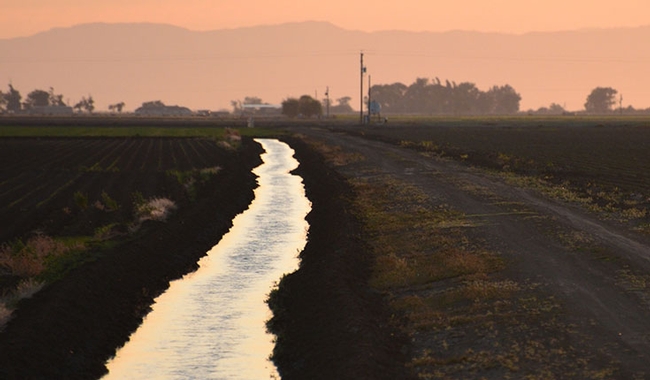
The total cost to the state, according to a new report released Tuesday by the Center for Watershed Sciences (CWS) at the University of California, Davis, is now $2.74 billion and 21,000 jobs.
Some see this as the new normal and new evidence ties it to climate change.
But despite the profound impact on the California agricultural economy, the state is actually doing well. And it's becoming the world's test kitchen for best practices in adapting agriculture to changing water supplies.
A legacy of progressive environmental regulations
“Despite the drought, we have a remarkably robust agricultural system,” says Jay Lund, director of CWS. “If you go back millennia and look at droughts, with a 30 percent loss of water you'd have a 30 percent loss of food production and you'd have 30 percent of the people starving.”
That hasn't happened today, he says, because California agriculture is more diversified than ever and its economy is connected to a world food market that advances despite the drought.
The many tools that UC Agriculture and Natural Resources (UC ANR) and others are deploying to help Californians better adapt today are also being translated into immediate lessons for the developing world.
Stockholm comes to Davis
Starting Sunday, representatives from more than 200 organizations will meet in Stockholm, Sweden, for the World Water Week mega conference. Under the theme Water for Development, they will refine the United Nations' broad Sustainable Development Goals to address the one billion people who would still be without safe drinking water and basic sanitation.
Many partners of UC ANR and the UC Davis World Food Center will be leading some of the numerous discussions, including: CGIAR, the World Bank, the Bill & Melinda Gates Foundation and the UN Food and Agriculture Organization.

Presentations on the Case of California will open two days of panel discussions, ranging from how climate change will impact the cost of water in different regions of the world to how groundwater aquifers can be recharged and how new policies can bolster water markets.
The goal is to seize the momentum now building for an international effort towards #WaterSecurity. By drawing development investors, leading scientists, committed policy makers and global industry partners into one room within the world's number one ag school, the event will set a course of action in sustainably securing water for food and for people across the planet.
College students create wildlife habitats in a Wild Campus program
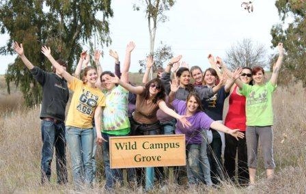
Working with campus experts (such as faculty and staff in the Department of Wildlife, Fish and Conservation Biology) and local environmental and conservation organizations, the volunteer students are improving the habitats for local wildlife and engaging the public in hands-on activities.
This is an extraordinary program that gives the students real-world environmental management skills, along with leadership opportunities and communications experience. Professor John Eadie, Department of Wildlife, Fish and Conservation Biology at UC Davis, said of the Wild Campus program, “Hands-on activity is a huge part of the educational experience.”
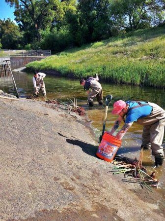
A past project — Build a Wild Home Day — involved working with the UC Davis Arboretum on a successful public outreach program to build bird and bat boxes for installation on campus. (Great photos of this program are on the group’s Facebook page.)
The Wild Campus organization has a large cadre of eager and dedicated students who are improvising and making the most of limited resources. However, they are in need of donated field equipment (used equipment is fine) and financial contributions.
Visit the Wild Campus website and Facebook page for a feel-good look at what these ambitious students are doing to improve the environment, along with ways you can help them succeed.
Scientists examine California's vulnerability to climate change
The UC Davis research appears in a report, "Our Changing Climate," released today by the California Natural Resources Agency and the California Energy Commission. The report is the third assessment from the California Climate Change Center since 2006.
UC Davis scientists authored nine of the 35 studies contained in the report. The UC Davis work addresses climate change impacts on native fishes, agriculture, urban planning, water management and other issues:
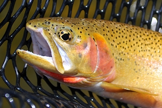
* Peter Moyle, a wildlife, fish and conservation biology professor in the UC Davis Center for Watershed Sciences, studied the predicted effects of climate change on native fishes. His team found that most native fishes will suffer population declines, and some will likely go extinct. Fishes requiring cold water are particularly vulnerable.
Meanwhile, non-native fishes are expected to increase, although they will also experience habitat loss during severe droughts.
"California's unique native fishes are already in steep decline, and climate change is making the situation worse," Moyle said. "This is likely to increase the complexity of managing California's water supply. Preventing predictable extinctions is possible but will require planning now for increased water temperatures and more variable flows."
* James Thorne, a researcher in the Department of Environmental Science and Policy, helped create a model that simulates how rainfall interacts with the landscape. Thorne's research group looked at hydrologic data from the past and present to help predict what may happen in the future. That model was used for other studies in the report, such as those regarding fire and agriculture, allowing cross comparisons among the researchers' work.
Thorne also looked at six different policy options for urban growth, including smart-growth, infill and "business as usual" approaches.
"If we want the most lands preserved for a variety of different purposes -- agricultural and biodiversity protection, reduced fire threats -- the infill policy was best," Thorne said.
* Studies by Louise Jackson, UC Cooperative Extension specialist and professor in the Department of Land, Air and Water Resources at UC Davis, complemented Thorne's growth policy conclusion. Her group's case study focused on greenhouse gas emission mitigation and adaptation to climate change in Yolo County. They found that "channeling much or all future urban development into existing urban areas" will help preserve agricultural land and open space, reduce Yolo County's greenhouse gas emissions and enhance agricultural sustainability. Their research also found that farmers concerned about climate change were more likely to voluntarily adopt practices that would conserve water and reduce greenhouse gas emissions.
Jackson's group also developed an agricultural vulnerability index for California that identified four areas as especially vulnerable to the effects of climate change: the Sacramento-San Joaquin Delta; Salinas Valley; the corridor between Merced and Fresno; and the Imperial Valley.
* Jay Lund, director of the UC Davis Center for Watershed Sciences, examined climate change adaptations for managing water in the San Francisco Bay Area. His group's research suggests that Bay Area urban water demands can be largely met even under severe forms of climate change, but at a cost. The cost includes buying water from agricultural users, using more expensive alternatives such as water recycling and desalination, and some increased water scarcity. A shared connection of public water systems, or interties, recently completed for emergency response, greatly aids adaptation, the study reports.
* Joshua Viers, associate director of the Center for Watershed Sciences, co-authored a study analyzing "water year" classifications.
These indices determine whether a year is considered wet, dry or in-between, as well as how much water is allocated and who gets it.
"Unfortunately, the method to distinguish different water year types is indexed to historical climatic conditions and is intended to represent an equal chance for any given year," said Viers. "Our science suggests that future climatic conditions are not likely to represent this history, and thus water management agencies may need to reconsider these arbitrary indexing thresholds going forward to achieve a more equitable situation."
Viers also co-authored a study about climate change's impact on hydropower production in the Sierra Nevada. It found that an 11 F increase in air temperature would reduce hydropower in the area by about 10 percent, and that most reductions would occur in the northern Sierra Nevada. The central Sierra Nevada would adapt better to changes in runoff, while hydropower generation in the southern watershed would decrease.
Other institutions, including UC Berkeley, UC Santa Cruz, Stanford, the Scripps Institution of Oceanography, and Lawrence Berkeley National Laboratory researched climate change impacts on electricity consumption, sea level, wildfires and coastal flooding.
This assessment will provide a foundation for the state's 2012 Climate Adaptation Strategy, with completion expected in December 2012. Comprised of scientific studies from several academic institutions, the assessment is directed by the Governor's Office and intended to help state and local communities protect public health, grow the state's economy, ensure energy reliability and safeguard the environment.
UCCE specialist George retires after 34 years of improving rangelands
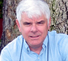
“Mel has been a mentor and leader within the range science community his entire career,” said Ken Tate, UC Cooperative Extension specialist, who holds the Russell L. Rustici Endowed Chair in Rangeland Watershed Sciences. “Mel’s ability to see emerging issues on rangelands, and to position UC ahead of these issues, has allowed us to keep our research and extension at the forefront of rangeland management.”
When George arrived at UC Davis in 1978, he was responsible mainly for forage trials, helping ranchers keep their land productive. But George could see issues with grazing and water quality on the horizon and worked to head them off at the pass.
In the early 1990s, he spearheaded the UC Cooperative Extension Rangeland Watershed Program, which uses education and applied research to help ranchers and regulators mitigate the risk of pathogens in water runoff from rangeland. Some 80 percent of California’s water passes through or is stored on rangeland and the UC Cooperative Extension Rangeland Watershed Program has helped develop management practices that keep that water clean.
“The Rangeland Management Program has been a tremendous help in protecting open space, habitat for plants and wildlife and healthy watersheds that California rangelands provide,” says Tracy Schohr, director of the California Rangeland Conservation Coalition, a band of 100 diverse environmental, ranching and policymaking groups committed to protecting the state’s diminishing rangeland. “They educate land managers and provide the objective, accurate information we need.”
George’s research and extension has improved millions of acres of rangeland in the United States, Africa, Europe, China and beyond. In 1991, for example, George worked with Chinese researchers to develop a research site in the Tibetan Plateau of Szechwan Province, helping develop a winter feeding program for their yak herds that doubled the survival of yak calves. In 1994, George helped Albania develop grazing practices to protect new forest plantations to replace those destroyed during the transition from Communist to democratic rule.
The list goes on and on.
“Mel has a knack for taking a complicated process and making it navigable for ranchers and other land managers,” says Tate who, like George, has been based in the UC Davis Department of Plant Sciences. “He has greatly advanced both the art and science of rangeland management.”
George got into range management in a round-about way, a journey that passed through farming and animal science and was nearly cut short by a plane crash.
Farming is in George’s blood going back 15 generations, a fact he learned not too long ago when he became a genealogy buff. He was raised in the Butte County town of Gridley and was the first in his family to attend college, receiving his bachelor’s degree in animal science from California State University, Chico. During his senior year at Chico, a professor interested him in range management, which led him to Texas Tech where he received his master’s in range management in August 1969.
The Vietnam War was in progress and in October 1969, George was drafted into the U.S. Army. In November 1970, he boarded a plane bound for active duty that crashed during takeoff, killing 40 people aboard. George was severely burned.
“But I lived, and was released with a medical profile that prevented me from going to a war zone,” George says.
He was stationed at Fort Ord until the summer of 1971 when he and his wife, Gail, moved to Logan, Utah, where George earned his Ph.D. in range ecology at Utah State University. He worked nearly three years on the faculty at California Polytechnic State University, San Luis Obispo, before coming to UC Davis in 1978.
George has earned countless awards over the years, including the Outstanding Alumnus at Utah State University in 2000, the prestigious James H. Meyer Distinguished Achievement Award at UC Davis in 2007 and the College of Agriculture Distinguished Alumnus Award from Chico State University in 2008.
George will stay busy in retirement, still working on a slew of rangeland research projects under way in the UC Davis Department of Plant Sciences.
“It’s such a fascinating field because rangeland is the most complex agricultural system there is,” George says. “You have to be willing to think outside the box to manage so many moving parts, and I like that. There are so many issues on the horizon like carbon storage and protecting biodiversity.”
And even in retirement, George will do all he can to keep our rangelands healthy and sustainable for generations to come.
