- Author: Dan Macon
")
One of the most obvious signs of systemic stress, at least to me, are the water levels in our foothill reservoirs. After the first three years of this drought, we went into last winter with depressingly low water levels in most of our man made lakes. These reservoirs are critical for storing water for irrigation, human consumption, and downstream wildlife habitat. In normal years, they allow us to capture snow runoff and save it for use during the dry summer months. The winter of 2014-2015, however, brought virtually no snow to the Sierra Nevada – and consequently no spring runoff. I thought our reservoirs were low last summer; this summer is even worse. Last weekend, I drove across the Parrotts Ferry bridge over New Melones Reservoir (on the Stanislaus River between Calaveras and Tuolumne Counties). I was shocked to see that the water level had dropped below the old Parrotts Ferry bridge – I'd ridden across it as a kid, but didn't think I'd ever see it again once the New Melones Dam was built. Perhaps even more shocking – I could see the Stanislaus River flowing under the bridge.
")
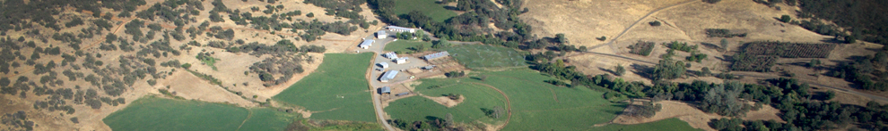
Closer to home, the oak trees in Auburn and at the Sierra Foothill Research and Extension Center are starting to turn color as if autumn were already here. When deciduous trees experience extremely dry conditions, they'll often shed their leaves early as a survival mechanism. The blue oaks and black oaks at SFREC are dropping leaves earlier this year than most of us can remember. Some of the trees are in full color; they make the hillsides seem like we're already in October. In addition to turning color and dropping leaves, we've seen more trees dropping entire branches (and some are even falling down entirely).
")
According to the National Weather Service, one of the strongest El Niños ever measured seems to be shaping up in the Pacific Ocean. Many in the media are reporting this phenomenon as if it's a sure bet – our drought is all but over! Unfortunately, the impacts of El Niño aren't so certain – Northern California is just about as likely to experience dry conditions as wet weather in an El Niño year. I'll believe we're having a wet winter when I'm still wearing my mud boots next April! In the meantime, I'll keep an eye out for additional signs of stress.


Dan, you are an accomplished "free lance" writer, and an article such as this would suffice for inclusion in any major airlines on-board magazine. Why? Because its story, backed up by photos (photo credits?)that are actually relevant to that story.
Especially now, this would be of interest to almost anyone.
I would be interested in knowing which springs have ceased flow. They are all named or numbered, and I have a Station map that Dustin Flavell (bid Dustin "Hello" for me, please) helped me put together.
Over the years, I have promoted the reality that one of the most outstanding attributes of the SFREC is in its number and spatial diversity of natural springs, as their behavior would be of un-questioned value in documenting future climate changes worth taking note of.
(I mentioned that to UCD Chancellor P. B. Ketehi once, just after a talk she had given, and just got a (brief) blank stare in return; I guess there actually are a few folks who don't know what a Field Station is!)
There is quite recent, and rapidly growing, interest in documenting the structure and diversity of underground aquifers in the San Joaquin Valley. The investigative technology that develops could also be adapted to characterize sub-surface water "pools" and flows at SFREC.
THAT would be fascinating.
Charlie