- Author: Lynn M. Sosnoskie
The United States Geological Survey (https://www.usgs.gov/) defines drought as a 'period of drier than normal conditions that results in water-related problems.' Short-term effects of drought include: declines in surface water flows, which can impact water supplies for agricultural, urban, and environmental uses. Long term effects of drought can include aquifer overdrafts and land subsidence. California has experienced drought events in the past (most recently: 1976-1977, 1986-1992, 2007-2009, and 2011-2017) and is expected to experience many more in the future. While a changing climate and variable weather patterns are contributing to the California's water issues, a lack of new water projects, a complex water distribution network, and a complicated system of water rights also factor into the equation, magnifying the concerns of many parties.
Below are some useful web page links for both monitoring and responding to drought conditions.
The California Department of Water Resources (DWR) was established in 1956 and 'is responsible for managing and protecting California's water resources. DWR works with other agencies to benefit the State's people and to protect, restore, and enhance the natural and human environments.' The DWR manages a significant portion of the state's water supply including the State Water Project. The department's website provides information about the California Water Plan, flood management, dam safety, and groundwater protection, as well as other topics. The California Irrigation Management Information System (CIMIS) is a program unit of the Water Use and Efficiency Branch that manages over 145 weather stations throughout the state that collect publicly available data about soil and air temperature, relative humidity, precipitation, and evapotranspiration. The California Data Exchange Center, which is also housed at the DWR site, maintains an extensive collection of hydrologic data including: current river conditions, snow reports, and reservoir storage.
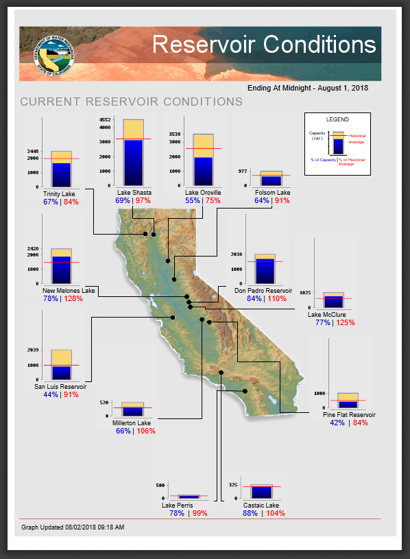
Current California reservoir conditions as of August 1, 2018, according to data collected and maintained by the California Data Exchange Center.
Drought.gov houses the United States Drought Monitor, a map that shows the current location and intensity of drought across the country. The site also provides drought forecasts for several months in advance. The data is updated each Tuesday and released on Thursday. Additional links provide information about the seasonal wildfire outlook and agricultural impacts and reports.
https://www.drought.gov/drought/
http://droughtmonitor.unl.edu/
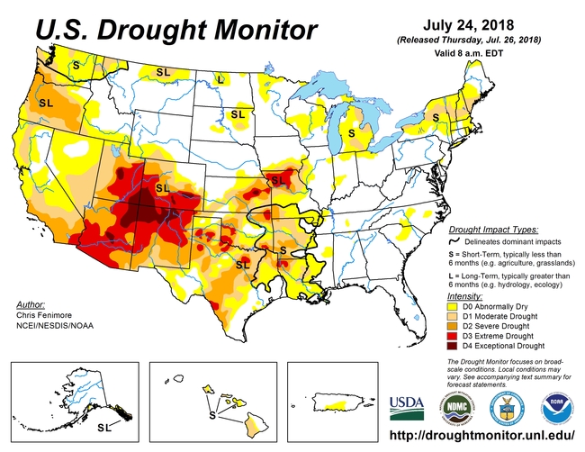
Drought conditions in the United States as of August 1, 2018. The U.S. Drought Monitor is jointly produced by the National Drought Mitigation Center at the University of Lincoln-Nebraska, the United States Department of Agriculture, and the National Oceanic and Atmospheric Administration. Map Courtesy of NDMC-UNL
The National Weather Service Climate Prediction Center provides operational predictions of climate variability over time scales ranging from a week in advance to an entire season (as is technically feasible).
http://www.cpc.ncep.noaa.gov/products/predictions/90day/
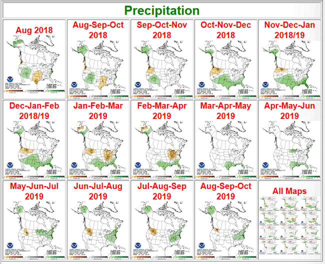
Precipitation forecasts from NOAA. Predictions range from a few weeks to a year in the future.
The State of California as well as the California Department of Food and Agriculture have web pages that provide California-specific drought resources (such as links to the state water project) as well as portals to both state and federal assistance programs.


