Maps for Cooperative Extension
Settling into a new county can be challenging. One has to figure out where things are, how to get from A to B, and where the greatest needs and opportunities are.
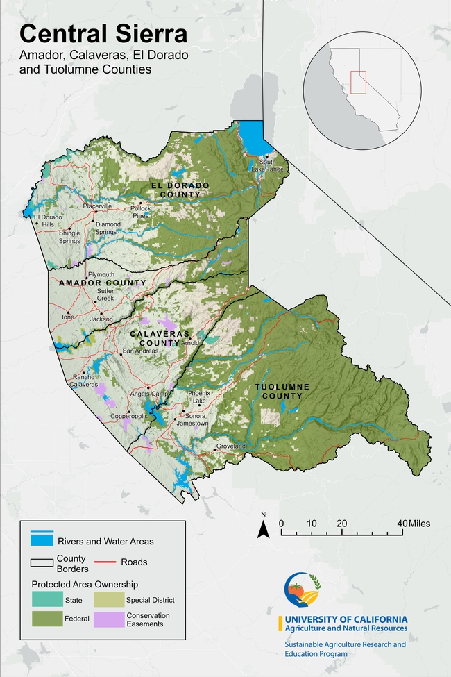
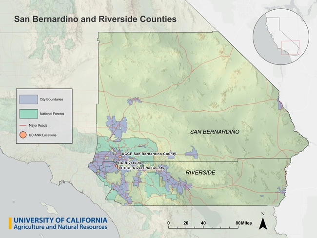
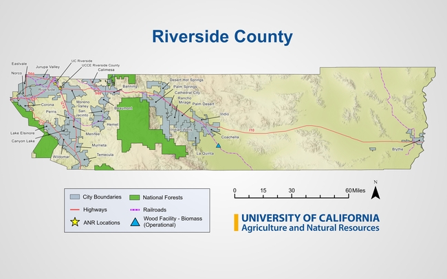
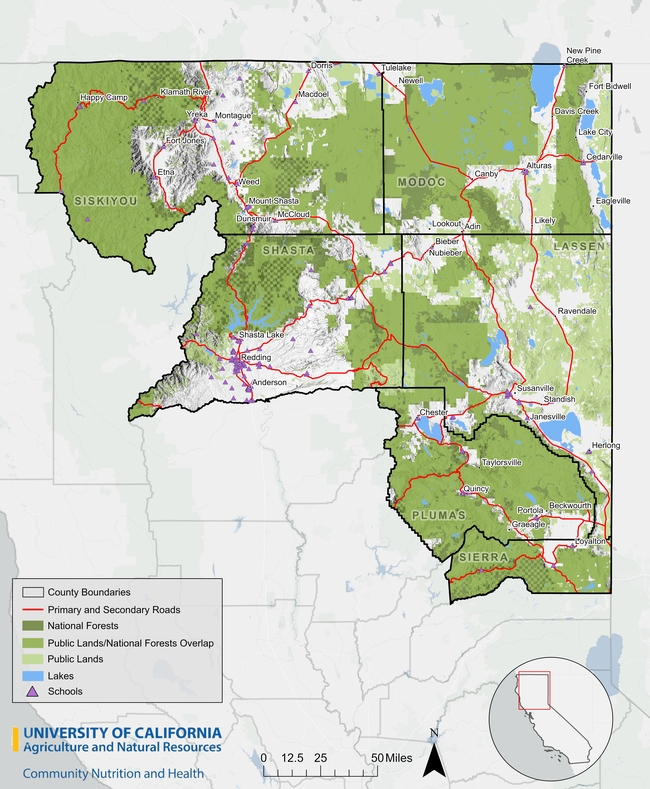
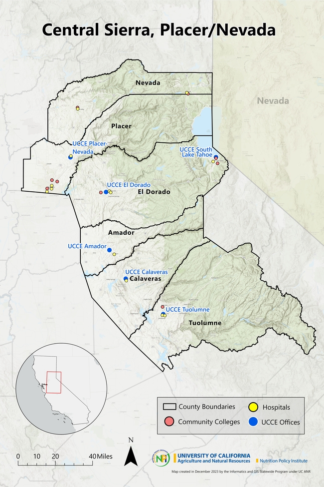
To help new Cooperative Extension Advisors navigate these waters, IGIS in the past year has booted up a new service called Maps for CE. The goal of Maps for CE, available to CE Advisors and other academics less than two years into their position, is to help our new colleagues get a handle on their coverage area (which often straddles multiple counties), thus building a strong foundation for their research and extension program. We do this by co-designing a custom wall map, web map, or both! To make the map useful for the researcher, reference layers are tailored to the researcher's specific program area and clientele. Some examples of maps produced from the new program below can be seen below (click on a map to see a larger version).
How it Works
To get started, the Advisor is sent a Google Form link where they select their county(s), background layers, additional points of interest, basemap, administrative boundaries and branding elements. The idea is to pick layers that are relevant to the programmatic focus - think of it like building a sandwich at a deli counter! A forestry Advisor may want to see national forest boundaries or land cover in the background, while a food systems advisor may want to include food distribution infrastructure on the map.
The menu of available layers is constantly evolving, but the current selection is shown below. If a desired layer is missing (e.g., a certain land-use layer), the order form includes an open ended question to describe the layer so we can try to find it.
Some Advisors get very excited when they see the layer menu, and request what we call a “kitchen sink” map. Maps with too many layers rarely turn out well, so we provide some guidelines about good cartography and follow-up when reviewing the drafts.
Background Layers
- Major roads
- Secondary roads
- City points/boundaries
- Unincorporated areas
Additional Points of Interest
- UCCE Offices
- Schools
- Hospitals
- Airports
- Railroads
- Other UC ANR Locations
Basemap Layers
- Hillshade topography
- Landfire vegetation
- Satellite imagery
- Any other basemap from ESRI's gallery
- No background image
Administrative Boundaries
- Census blocks
- Census tracts
- National forests
- Parcel boundaries (up to a minimum size)
- Protected areas
- School districts
- Zip code areas
- Air Space
Finally, the order form asks the user to provide a title for the map, indicate whether or not they want it printed and/or a companion web map, and select an output size. We can design either, but printing is up to the Advisor.
Design and Review
Once the information is submitted, an IGIS map-maker will go to work and assemble a rough draft of the map in ArcGIS Pro. Once the draft is complete, we will reach back out to the Advisor to schedule a time to chat about any changes needed and final touches they'd like to see. From that point we will continue to make iterations until it is exactly what they're looking for.
Researchers requesting paper maps will get a high quality PDF that they can take to their local print center for printing (we unfortunately don't have the capacity to print maps, but can help you identify a place to print locally). Clients also receive a copy of the ArcGIS Pro project so they can continue working on it on their own.
Even the Best Maps are Never Finished
Just like good research and extension programs, maps must evolve to keep up with changing needs. A newer version of a layer may come out, or the program may evolve to embrace a new clientele group. In any case, change is always expected.
Fortunately, GIS is well equipped to make updates, and we provide all kinds of support to ANR academics to continue their mapping journey. These include ArcGIS licenses for all ANR employees, workshops, Tech Notes, and Office Hours. We make maps with handover in mind, whether we are working on an ArcGIS Pro project or web map, so that the researcher can run with it and make variations for different needs and purposes.
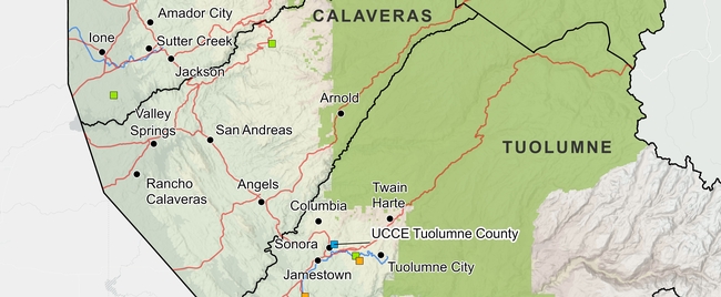
Here are a few more examples of advisor maps we have produced in the past:
How do I get started?
Currently, this service is available at no cost to UC ANR CE Advisors and other academics who have been in their positions for less than two years. If you fit this bill and are interested, feel free to reach out to Ben Satzman or Andy Lyons for more info.
