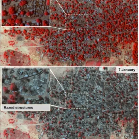
Amnesty's before and after satellite images were taken on 2 January and 7 January. Healthy vegetation is shown in red on the graphics.From the BBC: Satellite images of Nigerian towns attacked by Boko Haram show widespread destruction and suggest a high death toll, Amnesty International says.
The IGIS team is constantly alert to new technologies that might be beneficial to UC ANR and the public that we serve. One particularly exciting technology that has been gathering much attention recently is that of emerging unmanned aircraft systems (UAS).
Here are some evocative words about mapping from an unlikely source: in her astounding and engrossing book Wolf Hall, Hilary Mantel has Thomas Cromwell say: But the trouble is, maps are always last year's.
The Arthur Temple College of Forestry and Agriculture, in conjunction with Stephen F. Austin State University, will soon launch a new scholarly journal titled Journal of Geospatial Applications in Natural Resources.
From our Faith Kearns at the UC Water Institute: https://twitter.com/ucanrwater/status/543501860527550464 As great as this bath has been, we still are way behind normal.