- Author: Pamela Kan-Rice
May 15, 2014
CONTACTS: Pam Kan-Rice, (510) 206-3476, pam.kanrice@ucanr.edu and Jeannette Warnert, (559) 240-9850, jewarnert@ucanr.edu
University of California ANR wildfire experts
Carl Bell
UC Cooperative Extension regional advisor for invasive plants
Bell conducts wildfire recovery and invasive weeds research in San Diego, Orange, Los Angeles, Ventura, Riverside and San Bernardino counties.
(760) 815-2777
cebell@ucanr.edu
Mike De Lasaux
UC Cooperative Extension natural resources advisor for Plumas and Sierra counties.
Areas of expertise – wildfire fuel reduction on small forest parcels, forestry and watershed management.
(530) 283-6125
Sabrina Drill
UC Cooperative Extension natural resources advisor for Los Angeles and Ventura counties.
Drill holds workshops to teach homeowners that the arrangement and proper maintenance of plants around homes in the wildland-urban interface can help reduce the risk of wildfire. Also, that choosing the right plants can protect the health of neighboring habitat by limiting the introduction of invasive plants.
(626) 586-1975
Keith Gilless
UC Berkeley professor of forest economics in the College of Natural Resources.
Area of expertise -- Wildland fire protection planning; forest economics and management; evaluation of prescribed burning.
Gilless has studied large urban-wildland fires, including the Oakland-Berkeley and Santa Barbara fires, to evaluate the probability of a house within the fire perimeter surviving as a function of the house's structural characteristics, its surrounding vegetation, and the defensive actions taken to protect it.
(510) 642-7171
Jan Gonzales
University of California Cooperative Extension project coordinator for the Wildfire Zone
The Wildfire Zone (www.wildfirezone.org) is a wildfire education and outreach program in San Diego County. Gonzales has been involved with wildfire prevention, safety and recovery education since 2005. She is an executive board member of the San Diego County Fire Safe Council and member of county and regional area safety task forces on wildfire and forest health issues.
(858) 822-7718
Susan Kocher
UC Cooperative Extension natural resources advisor for Amador, Calaveras, Tuolumne and El Dorado counties.
After the Angora Fire near Lake Tahoe, Kocher evaluated the effectiveness of defensible space. She helped the California Tahoe Conservancy forester set up a rapid parcel assessment to identify high priority treatment sites on their parcels. Kocher worked with the California Department of Forestry structure damage assessment team to see how their formal evaluation methodology functions and collaborated with Ed Smith of University of Nevada Cooperative Extension to film examples of defensible space for the “Living with Fire in the Tahoe Basin” Web site, http://www.livingwithfire.info/tahoe/
(530) 542-2571
Max Moritz
UC Cooperative Extension wildfire specialist in the Department of Environmental Science, Policy and Management at UC Berkeley. He is located in Santa Barbara County.
Areas of expertise -- Wildland fire, fire modeling, fire effects, shrubland ecosystems and spatial patterns of fire disturbance. By looking closely at fire history and monitoring plant moisture levels in the Santa Monica Mountains, Moritz and his colleagues developed a way to predict when an area becomes vulnerable to large-scale fires.
(805) 893-2125
Glenn Nader
UC Cooperative Extension natural resources advisor for Sutter and Yuba counties.
Areas of expertise -- Landscaping for fire safety
(530) 822-7515
Kimberly Rodrigues
UC Cooperative Extension natural resources advisor
Rodrigues' research focused on how to make public participation in resource management more meaningful and relevant to reduce conflicts. She participated in the Sierra Nevada Adaptive Management Project, a 10-year project that has the potential to transform not only how we view forest fires, but how scientists, government agencies and public stakeholders interact in the pursuit of common goals.
(530) 750-1283
Tom Scott
UC Berkeley Cooperative Extension area natural resources wildlife specialist for Southern California.
Areas of expertise -- conservation of wildlife, wildlife management at the urban-wildland interface, and response of wildlife to fire. After a catastrophic 1993 fire season, Scott was instrumental in developing subsequent meetings and a book on fire ecology, management and policy. Scott authored Brushfires in California: Ecology and resource management in 1995, with Jon Keeley.
(951) 827-5115
John Shelly
UC Cooperative Extension forest products and biomass utilization advisor
Areas of expertise -- Forest products, wood manufacturing methods, biomass utilization, physical properties of wood.
(510) 665-3491
Scott Stephens
Associate professor of fire science and co-director Center for Fire Research and Outreach at UC Berkeley
Areas of expertise -– Wildland fire science, fire ecology, fire behavior, wildfire.
(510) 642-7304
Bill Stewart
UC Cooperative Extension forestry specialist in the Department of Environmental Science, Policy and Management at UC Berkeley and co-director Center for Fire Research and Outreach
Areas of expertise -– Economics of fire prevention and fire suppression programs, economic assessment of property damages and environmental damages from fires.
(510) 643-3130
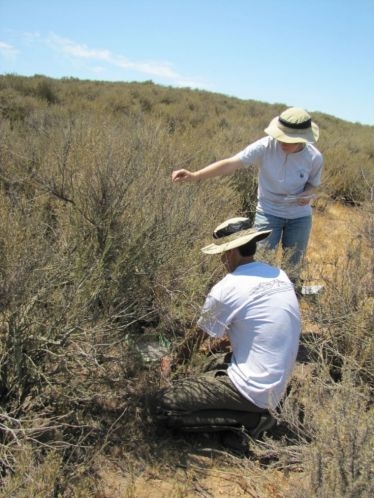
The researchers measured atmospheric nitrogen deposition levels at ten sites throughout the Santa Monica Mountains and found significantly higher pollution levels in the eastern end, closer to Los Angeles.
Generally attributed to vehicle emissions in the Santa Monica Mountains, nitrogen deposition is the air pollution from industry, agriculture and transportation that settles out of the atmosphere and onto the earth’s surface.
The study is helping the scientists better understand how high nitrogen levels affect native vegetation and what that might mean for fire risk in such a fire-prone region.
“Invasive annual grasses from the Mediterranean have a greater growth response to nitrogen than most native species, and are crowding out native plants,” says Edith Allen, a professor of plant ecology and Cooperative Extension specialist at UC Riverside, and the principal investigator for the study. “Grasses also produce fine, flashy fuels that cause more frequent and larger fires, promoting vegetation-type conversion from native shrubland to exotic annual grassland.”
The preliminary results are from the first year of a three-year study undertaken by Allen, Irina Irvine, a restoration ecologist for Santa Monica Mountains National Recreation Area, and Andrzej Bytnerowicz and Mark Fenn of the U.S. Forest Service.
At the two sites with the best air quality, the researchers added various levels of nitrogen fertilizer into experimental plots of coastal sage scrub to simulate pollution levels found throughout the mountains. They found that the higher levels of nitrogen led to a decline in native shrub seedlings and an increase in nonnative grasses.
Other studies in Australia and California have demonstrated a link between nonnative grasses, also known as “flashy fuels,” and larger and more frequent wildfires.
“The recent fire of May 2013 burned our research plots, but provides an opportunity to learn how invasive grasses compete with native seedlings establishing post fire under nitrogen deposition,” Allen said. “The data will enable us to determine critical loads of nitrogen deposition to help set clean air regulations to protect native ecosystems.”
Coastal sage scrub once covered much of coastal California and is now an endangered habitat type, primarily due to development.
Funded by the National Park Service’s Air Resources Division, the $100,000 study will help the scientists better determine the “critical load” when vegetation shifts, causing alterations to the structure and functionality of ecosystems.
For more information, please visit: http://ucrtoday.ucr.edu/20098
- Author: Robert Sanders, (510) 643-6998, rsanders@berkeley.edu
In a press announcement accompanying the release of the studies, Secretary of Natural Resources John Laird noted that “significant increases in wildfires, floods, severe storms, drought and heat waves are clear evidence that climate change is happening now. California is stepping up to lead the way in preparing for — and adapting to — this change. These reports use cutting-edge science to provide an analytical roadmap, pointing the way for taking concrete steps to protect our natural resources and all Californians.”
Laird and others appeared yesterday at a press conference in Sacramento, where Robert B. Weisenmiller, chair of the California Energy Commission, called the reports “historic” and praised the scientists who contributed.
“We scientists know that climate change is and will be significantly affecting the state’s energy supply and demand system,” he said. “The research in these assessments furthers our understanding of the impacts …. The challenges are enormous, but certainly this state has the capability to rise to those challenges, and with these types of studies we are going to be prepared. We will use these in the energy commission planning … to maintain a reliable grid, but also use this as a way of planning our research.”
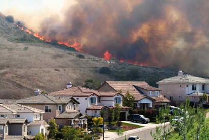
Laird and Weisenmiller were joined at the press conference by Chief Ken Pimlott, director of the California Department of Forestry and Fire Protection (Cal Fire), who painted a grim picture of the state’s fire future. Of the 20 worst fires in California history, 11 have occurred since 2002, he said. The fire season in some areas has increased by an average of two months, and a few areas in Southern California now have a year-round fire season.
“Studies like those being released today are key in helping us move forward to prepare California” to deal with these large and damaging fires, said Pimlott.
State’s fire season longer, fires more intense
UC Berkeley fire expert Max Moritz, who contributed a paper about increased vulnerability to wildland fires in the state, has been warning of increasing fire danger for years.
“Our results reveal that California should prepare — regardless of the future we may face climatically — for quite different fire activity levels in the future,” said Moritz, UC Cooperative Extension specialist in the Department of Environmental Science, Policy and Management at UC Berkeley. “Though our models continue to improve, we still don’t know which future climate scenario will actually emerge. The challenge is to learn to ‘coexist’ with this natural hazard and move toward fire-resilient ecosystems and fire-resistant urban development.”
Speaking for the more than 120 scientists in 26 teams who contributed to the studies, Susanne Moser, a Social Science Research Fellow at Stanford University’s Woods Institute for the Environment, said that the report “spells out our new understanding of what climate change might mean to California. We are trying to inform the public, we are trying to inform the decision makers, with valuable information that they can use in … planning.”
The reports represent the third assessment commissioned by the California Climate Change Center since 2006, following up on discussions and topics presented at the Governor’s Conference on Extreme Climate Risks and California’s Future held last December in San Francisco. The new studies will provide a foundation for the 2012 Climate Adaptation Strategy, which is expected to be completed in December 2012.
David Ackerly, who co-authored three of the papers released yesterday, provided a new vegetation map that will allow planners to see how the Bay Area will likely change in the future.
“The big result that comes out of the models — and we have to remember that they are models — is a very wide expansion of chaparral and the loss of the cooler oak woodlands. And as climate change becomes more extreme, the Bay Area looks more and more like Santa Barbara or areas farther south, and the vegetation begins to look like Southern California, which is mostly scrublands,” said Ackerly, a professor of integrative biology. “That could take a hundred years or more, but the short-term result is that the dead trees become a fire danger and alien weeds invade.”
The short-term impacts are the most uncertain, he said, though UC Berkeley scientists hope to fill in these gaps through a broad research effort, the Berkeley Initiative in Global Change Biology.
“We hope to answer the question, ‘How fast can these changes really occur?’” he said.
Ackerly said that through his reports, which synthesized previous and ongoing research, he particularly wanted to link the expected decline of biodiversity throughout the state with a more visible impact on the ecosystem services people take for granted. The predicted march of desert northward into the San Joaquin Valley will make some areas unsuitable for agriculture, for example, while warmer winters may mean that plums and peaches will not get the winter chill they need to produce fruit.
“This is not merely nature for nature’s sake; nature and the services we expect from nature are all connected,” he said.
Gov. Jerry Brown is listening to these reports, according to Ken Alex, Brown’s senior policy advisor and director of the Office of Planning and Research, who also spoke at the press conference.
“Here in California, we do make policy decisions based on the science,” he said. “Gov. Brown actually reads the science, and he takes it very seriously, and I know that at a very deeply personal level, he wants to do something about climate change and wants to see California take the leadership role.”
The 26 teams submitting reports were led by researchers from around the state, including 15 from UC Berkeley, 19 from other UC campuses and two from Lawrence Berkeley National Laboratory. For highlights from the reports, link to the CEC’s press release (PDF). To download the full reports, link to CEC’s website.
“The incredible breadth of studies, as well as the depth of their analyses, reveals just how much the University of California has to offer in preparing us all to adapt to a changing climate,” Moritz added. “Hopefully, it also demonstrates how important it is to grow this scientific capacity within our public university system.”
- Author: Sarah Yang | Media Relations scyang@berkeley.edu, (510) 643-7741
By the end of the century, almost all of North America and most of Europe is projected to see a jump in the frequency of wildfires, primarily because of increasing temperature trends. At the same time, fire activity could actually decrease around equatorial regions, particularly among the tropical rainforests, because of increased rainfall.
The study, to be published Tuesday, June 12, in Ecosphere, an open-access, peer-reviewed journal of the Ecological Society of America, used 16 different climate change models to generate what the researchers said is one of the most comprehensive projections to date of how climate change might affect global fire patterns.
"In the long run, we found what most fear — increasing fire activity across large parts of the planet," said study lead author Max Moritz, fire specialist in UC Cooperative Extension. "But the speed and extent to which some of these changes may happen is surprising."
"These abrupt changes in fire patterns not only affect people's livelihoods," Moritz added, "but they add stress to native plants and animals that are already struggling to adapt to habitat loss."
The projections emphasize how important it is for experts in conservation and urban development to include fire in long-term planning and risk analysis, added Moritz, who is based at UC Berkeley’s College of Natural Resources.
UC Berkeley researchers worked with an atmospheric scientist from Texas Tech University to combine over a decade of satellite-based fire records with historical climate observations and model simulations of future change. The authors documented gradients between fire-prone and fire-free areas of Earth, and quantified the environmental factors responsible for these patterns. They then used these relationships to simulate how future climate change would drive future fire activity through the coming century as projected by a range of global climate models.
"Most of the previous wildfire projection studies focused on specific regions of the world, or relied upon only a handful of climate models," said study co-author Katharine Hayhoe, associate professor and director of the Climate Science Center at Texas Tech University. "Our study is unique in that we build a forecast for fire based upon consistent projections across 16 different climate models combined with satellite data, which gives a global perspective on recent fire patterns and their relationship to climate."
The fire models in this study are based on climate averages that include mean annual precipitation and mean temperature of the warmest month. These variables tend to control long-term biomass productivity and how flammable that fuel can get during the fire season, the researchers said.
Variables that reflect more ephemeral fluctuations in climate, such as annual rainfall shifts due to El Niño cycles, were not included because they vary over shorter periods of time, and future climate projections are only considered representative for averages over time periods of 20-30 years or longer, the authors said.
The study found that the greatest disagreements among models occur for the next few decades, with uncertainty across more than half the planet about whether fire activity will increase or decrease. However, some areas of the world, such as the western United States, show a high level of agreement in climate models both near-term and long-term, resulting in a stronger conclusion that those regions should brace themselves for more fire.
"When many different models paint the same picture, that gives us confidence that the results of our study reflect a robust fire frequency projection for that region," said Hayhoe. "What is clear is that the choices we are making as a society right now and in the next few decades will determine what Earth’s climate will look like over this century and beyond."
Study co-author David Ganz, who was director of forest carbon science at The Nature Conservancy at the time of the study, noted the significance of the findings for populations that rely upon fire-sensitive ecosystems.
"In Southeast Asia alone, there are millions of people that depend on forested ecosystems for their livelihoods," he said. "Knowing how climate and fire interact are important factors that one needs to consider when managing landscapes to maintain these ecosystem goods and services."
The researchers noted that the models they developed focused on fire frequencies, and that linking these to other models of fire intensity and vegetation change are important next steps.
"Our ability to model fire activity is improving," said Moritz, "but a more basic challenge is learning to coexist with fire itself."
The Natural Sciences and Engineering Research Council of Canada, the U.S. Forest Service, the National Science Foundation and The Nature Conservancy helped support this study.
RELATED INFORMATION
- Climate change to spur rapid shifts in fire hotspots, projects new analysis (2009 UC Berkeley press release)
- Author: Sarah Yang | Media Relations scyang@berkeley.edu, (510) 643-7741
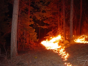
The paper, published in the June issue of the peer-reviewed journal BioScience, and led by researchers at the University of California, Berkeley, synthesizes 20 years of research throughout the country on the ecological impact of reducing forest wildfire risk through controlled burns and tree thinning. It comes as California braces for a potentially bad fire season, particularly in the southern Sierra where precipitation was half its normal level.
"We need to act, because climate change is making fire season longer, temperatures are going up, and that means more fire in many regions, particularly ones with a Mediterranean environment," said study lead author Scott Stephens, UC Berkeley associate professor of fire science.
The study authors, which included scientists from the U.S. Forest Service and six research universities in the United States and Australia, relied upon data from the U.S. Fire and Fire Surrogates Study, in addition to a wide range of other studies. Together, the studies represented a broad spectrum of ecological markers, detailing the effects of fuel-reduction treatments on wildlife, vegetation, bark beetles, soil properties and carbon sequestration.
"Some question if these fuel-reduction treatments are causing substantial harm, and this paper says no," said Stephens. "The few effects we did see were usually transient. Based upon what we've found, forest managers can increase the scale and pace of necessary fuels treatments without worrying about unintended ecological consequences."
A few of the researchers’ specific ecological findings include:
- For the first five years after treatment, some birds and small mammals that prefer shady, dense habitat moved out of treated areas, while others that prefer more open environments thrived. The study authors said these changes were minor and acceptable.
- When mechanical tree thinning was followed by prescribed fire, there was an increase in the overall diversity of vegetation. However, this also included non-native plant species. The researchers recommend continued monitoring of this effect.
- Only 2 percent or less of the forest floor saw an increase in mineral soil exposure, which could lead to small-scale erosion. Other soil variables, such as the level of compaction, soil nitrogen and pH levels, were temporary, returning to pre-treatment levels after a year or two.
- Increases in bark beetles, a pest that preys on fire-damaged trees, was short-lived and concentrated in the smaller diameter trees. Researchers noted that thinning out a too-dense forest stand improves tree vigor and ultimately increases its resilience to pests, in addition to fire.
The results of this paper may help inform an analysis of one of the larger prescribed fires in the history of the U.S. Forest Service. Called the Boulder Burn, the proposed treatment covers 6,000-9,000 acres in the Southern Sierra Nevada's Sequoia National Forest and is tentatively set to begin by late fall.
"This paper is more comprehensive and definitive than any other article I've seen," said Malcolm North, research scientist with the U.S. Forest Service and an associate professor in forest ecology at UC Davis. "In one place, it summarizes the state of the science in fuel-reduction treatments, and to my mind, it shuts the door on those who say that any type of fuels treatment is detrimental to the forest. If done properly where surface fuels are reduced, treatments work. It's time to get on with it."
Nearly a century of fire suppression and the preferential logging of large-diameter trees, which are better able to withstand forest fires, have left forests vulnerable to more destructive, albeit less frequent, wildfires, the researchers said. In addition, the lack of fire has hindered nutrient cycling in forests and the proliferation of certain plant species, such as the sequoia, that rely upon fire to promote seed dispersal.
This realization led to the gradual re-emergence during the past 20 years of fuel-reduction as a forest management tool. The goal is simple: Thin or remove overly dense stands of trees, ground vegetation and downed woody debris in a carefully controlled way before they become fuel for a raging wildfire. When low- or moderate-intensity controlled burns are not an option, fire-prone trees are mechanically removed or shredded on site.
Such techniques are an attempt to emulate the frequent fires common in California for thousands of years. Before 1800, Stephens said, an estimated 1.1 million acres of forest burned annually in California, including wildfires ignited by lightning and other natural sources, and blazes set intentionally by Native Americans as a way to manage or alter landscapes. Most were blazes of low-to-moderate intensity that more than 80 percent of the trees could survive, unlike the catastrophic wildfires of modern times.
"Today, the combination of wildfires and fuel-reducing treatments only touch 6-8 percent of the land that used to burn annually before 1800, and fuel-reducing treatments alone only affect 1 percent," said Stephens. "That's a pittance. At that level, treatments are just triage rather than fire prevention."
To approach levels that have a chance of reducing wildfire risk in the long term, he said, the amount of land to be treated in a year would need to increase to 2-4 percent — still low compared to historical levels.
Stephens noted that two-thirds of the fuel-reduction treatments in the western United States rely upon mechanical thinning, which would be much more costly than prescribed burns to scale up. In the southeast region, the use of prescribed fire dominates.
In the West, particularly in California, the biggest challenge to expanding controlled burns is the potential reduction in air quality during treatment, said Stephens.
"We have a choice," he said, "of dealing with lower levels of smoke from prescribed fires that may only be needed every 15 years or so, and which can be timed for optimum wind conditions, or acute levels of smoke from catastrophic fires that can last for months when they hit."
The U.S. Department of Agriculture-U.S. Department of the Interior Joint Fire Science Program helped support this research.


