- Author: Michael Hsu
UC ANR Fire Network compiles expert advice on preparedness, evacuation tasks
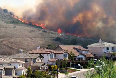
The explosive growth of the Park Fire in Northern California was fueled by recent, intense heat waves and extremely dry vegetation – conditions seen at many locations across the state.
Given the potential for wildfire and smoke impacts during what is expected to be a protracted “fire season,” California residents should think ahead and complete emergency preparations: https://ucanr.edu/sites/fire/Preparedness/.
“If you are concerned that you or someone you know could be affected by fire or smoke, now is the time to take simple steps to prepare,” said Yana Valachovic, University of California Cooperative Extension forest advisor for Humboldt and Del Norte counties.
Valachovic and other members of the UC Agriculture and Natural Resources Fire Network are urging community members to tackle small but significant tasks to minimize potential fire damage. Many of these tasks can be finished in a weekend, such as:
- Clean debris from your roof and gutters.
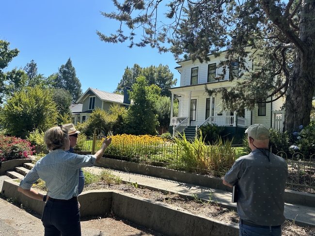
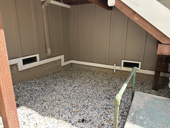
- Inspect the area around your home and nearby structures and remove all combustibles (dead grass, plants, woody mulch, stored wood, etc.) in the first 5 feet, including under decks and stairs.
- Inspect the foundation, under-eave, and gable-end vents for holes and damage; add a layer of finer metal-mesh screens (1/8” mesh) to the vents to prevent ember penetration.
- Inspect the garage door bottom seal to make sure embers can't blow under the door.
- Replace the first 5 feet of wooden fences that attach to buildings with a noncombustible panel or gate.
A recently published report, “Retrofitting a Home for Wildfire Resistance,” also can help residents prioritize the measures that are most cost-effective and fit their budget.
Six things to do, six hours before evacuation
As evacuation warnings are issued for local communities, there are six important things to do in advance of an actual evacuation order, according to Valachovic:
- Close windows, pet doors and skylights.
- Move inside patio cushions, brooms and door mats; tie open wooden gates that attach to the house or deck to prevent a fire from traveling from the fence to the house.
- Relocate the barbecue propane tank away from home.
- Stage buckets of water and garden hoses in visible locations.
- Dress for evacuation: cotton clothes, sturdy shoes, hat and face protection and leather gloves.
- Put your “go bag” in your vehicle.
The UC ANR Fire Network website also includes downloadable checklists – in English and Spanish – for your go bag (https://ucanr.edu/sites/fire/Safety/Evacuation/Preparing_a_Go-Bag/) and for a host of important pre-evacuation tasks for your household, property, pets and livestock (https://ucanr.edu/sites/fire/Safety/Evacuation/).
“We want communities to be wildfire-prepared – not scared,” Valachovic emphasized.
Smoke exposure a significant public health concern
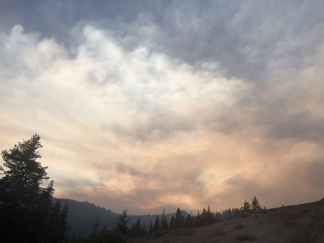
Hazardous smoke can blanket wide swaths of California – and much of the Western U.S. – during ongoing wildfire events. A primer on harmful health effects, a list of tips for reducing smoke exposure, and other resources and links can be found on the UC ANR Fire Network site: https://ucanr.edu/sites/fire/Safety/Air_Quality_and_Smoke/.
“If there's smoke in the forecast for the next few days, I would keep an eye on my local air quality at fire.airnow.gov,” said Katie Low, statewide coordinator for UC ANR's Fire Network. “And if the AQI – Air Quality Index – is high, I would limit my outdoor activity, wear an N95 mask if I do go outside, and run my air purifier.”
For instructions on making a DIY air cleaner, creating a “clean air space” in your home and fitting an N95 mask properly, visit the California Air Resources Board's “Smoke Ready California” page: https://ww2.arb.ca.gov/smokereadyca.
Another useful tool is the crowd-sourced #FireMappers fire activity map – powered by the National Alliance for Public Safety GIS Foundation, GISCorps, and CEDR Digital Corps – accessible through the UC ANR Fire Network site: https://ucanr.edu/sites/fire/Safety/Current/.
- Author: Pamela Kan-Rice
September is National Preparedness Month, designated to encourage disaster and emergency readiness. To help Californians prepare for extreme heat, earthquakes, public safety power shutoffs and wildfire, University of California Cooperative Extension has created a disaster preparedness website organized for quick access to critical information.
The website https://ucanr.edu/Disaster contains fact sheets with tips for getting prepared.
“Unfortunately, with a warming climate, we are facing more and more extreme climate-related events such as heat waves, wildfires, power shutoffs and storms. All Californians need to step up their preparedness efforts to be ready to meet this more uncertain future,” said Susan Kocher, UC Cooperative Extension forestry advisor, who co-authored the disaster preparedness resources for the website.
Extreme heat
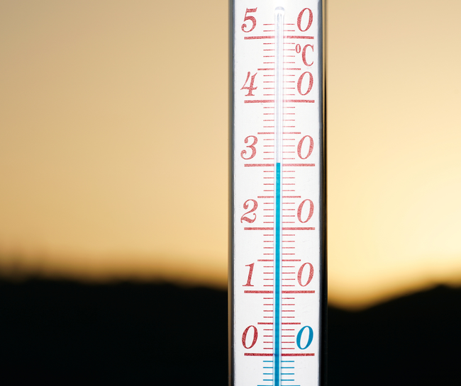
The fact sheet for extreme heat events offers suggestions for avoiding heat exposure, such as identifying nearby cooling centers and covering windows to keep heat out. It also suggests things to do during hot weather such as staying hydrated, taking cool showers and keeping pets indoors. It describes symptoms of heat-related illnesses, which can have serious health effects.
Public Safety Power Shutoff
During extreme weather events, electrical power in high fire-threat areas may be shut off to prevent sparking. This precaution is known as a Public Safety Power Shutoff. A PSPS is most likely to occur from May to November, when conditions are the hottest and driest.
UC Cooperative Extension recommends signing up to receive PSPS alerts from your energy company. Experts also advise making a plan for medications that need to be refrigerated or medical devices that require power. To prevent foodborne illness, they offer suggestions for ensuring food safety during and after a power outage.
Wildfire and smoke
Wildfire smoke can harm your health. During wildfires, UC Cooperative Extension recommends wearing an N95 outdoors to reduce smoke exposure and taking steps to prevent smoke from entering buildings. To reduce wildfire risk, the website describes methods of removing flammable vegetation around homes.
Earthquakes
UC Cooperative Extension offers safety tips for before, during and after an earthquake. Identifying the safest place in your home during an earthquake in advance is helpful. For example, doorways are not the safest place to be in modern homes. Experts recommend crawling under a sturdy desk or table, while avoiding areas next to windows, beneath ceiling fixtures or near large items that may fall during an earthquake.
The website also offers resources on drought, food safety after a fire, and wildfire preparedness and recovery.
In 2020 and 2021, Cooperative Extension researchers from around the country held listening sessions with community members who had experienced extreme weather events and other types of disasters to learn what had worked well, what had not, and how communities could be strengthened.
In response, these disaster resources were developed by Kocher, UC Davis undergraduate student Caydee Schweitzer, Tracy Schohr, UC Cooperative Extension livestock and natural resource advisor, and Vikram Koundinya, UC Cooperative Extension evaluation specialist. The group plans to add fact sheets on more disaster topics in the future.
This project was funded by a USDA National Institute of Food and Agriculture Renewable Resources Extension Act grant.
MEDIA CONTACT: Susan Kocher, UC Cooperative Extension forestry advisor, sdkocher@ucanr.edu
- Author: Ann Brody Guy
But a new international research review led by the University of California, Berkeley, says the debate over fuel-reduction techniques is only a small part of a much larger fire problem that will make society increasingly vulnerable to catastrophic losses unless it changes its fundamental approach from fighting fire to coexisting with fire as a natural process.
The paper, “Learning to Coexist with Wildfire,” to be published in the Nov. 6 issue of the journal Nature, examines research findings from three continents and from both the natural and social sciences. The authors conclude that government-sponsored firefighting and land-use policies actually encourage development on inherently hazardous landscapes, amplifying human losses over time.
“We don't try to ‘fight' earthquakes – we anticipate them in the way we plan communities, build buildings and prepare for emergencies. We don't think that way about fire, but our review indicates that we should,” said lead author Max Moritz, Cooperative Extension specialist in fire at UC Berkeley's College of Natural Resources. “Human losses will only be mitigated when land-use planning takes fire hazards into account in the same manner as other natural hazards, like floods, hurricanes and earthquakes.”
The analysis looked at different kinds of natural fires, what drives them in various ecosystems, the ways public response to fire can differ, and the critical interface zones between built communities and natural landscapes. The authors found infinite variations on how these factors can come together.
“It quickly became clear that generic one-size-fits-all solutions to wildfire problems do not exist,” Moritz said. “Fuel reduction may be a useful strategy for specific places, like California's dry conifer forests, but when we zoomed out and looked at fire-prone regions throughout the Western United States, Australia and the Mediterranean Basin, we realized that over vast parts of the world, a much more nuanced strategy of planning for coexistence with fire is needed.”
Planning for co-existence
If humans choose to live in fire-prone regions, fire must be managed on par with other naturally occurring hazards, the authors argue, and research must seek to understand what factors and outcomes we can and cannot affect.
One common tool is applicable to the vast array of ecological and social science interactions at the critical wildfire/urban interface: more effective land-use planning, along with the regulations that guide it.
- Adopting new land-use regulations and zoning guidelines that restrict development in the most fire-prone areas;
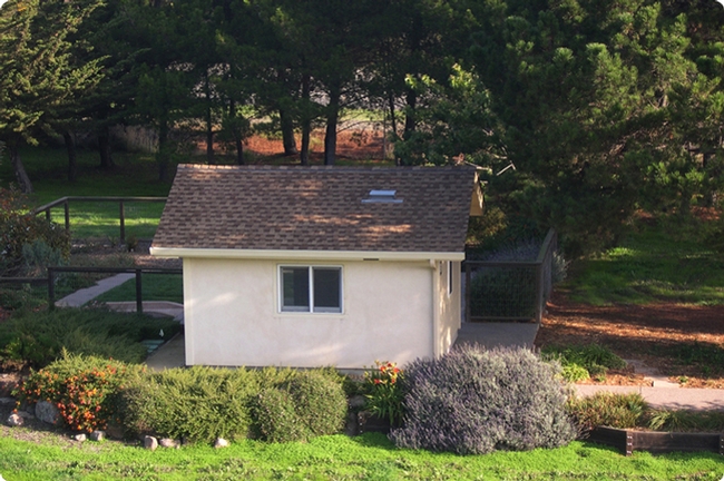
- Updating building codes, such as requiring fire-resistant construction to match local hazard levels and encouraging retrofits to existing ignition-prone homes;
- Implementing locally appropriate vegetation management strategies around structures and neighborhoods;
- Evaluating evacuation planning and warning systems, including understanding situations in which mandatory evacuations are or are not effective;
- Developing household and community plans for how to survive stay-and-defend situations; and
- Developing better maps of fire hazards, ecosystem services and climate change effects to assess trade-offs between development and hazard.
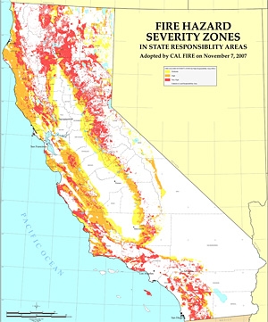
As an example of positive steps, the report cites new fire danger mapping efforts, including an existing fire hazard severity zone map that guides building codes in California. Produced by the state's Department of Forestry and Fire Protection, the current map does not explicitly incorporate locally varying wind patterns, which influence the worst fire-related losses of homes and lives, but future iterations will include these data.
Fire ecology and climate
The authors underscore that wildfires are a natural part of many ecosystems and can have a positive long-term influence on the landscape, despite people labeling them as “disasters.” They can stimulate vegetation regeneration, promote a diversity of vegetation types, provide habitat for many species and sustain other ecosystem services, such as nutrient cycling.
Around the world, the numbers, sizes, and intensities of fires vary greatly. In some ecosystems, big, severe wildfires are natural events and more climate-driven – by drought or high winds – so fuel reduction is not a very effective tool in these locations. By contrast, many ecosystems that would naturally experience frequent lower-severity fires may respond to vegetation management aimed at both reducing fire hazard to humans and restoring crucial ecosystem processes. But, the authors agree, where fuel reduction is an appropriate goal, it would ideally be achieved by letting wildfires do their job.
A changing climate will complicate management strategies.
“How should future fire patterns compare to this historical variability? That's the big question,” Moritz said.
Describing wildfire as “one of the most basic and ongoing natural processes on Earth,” the authors call for a paradigm shift in the way society interacts with it, changing to an approach that achieves long-term, sustainable coexistence that benefits the planet's ecosystems on the landscape scale, while minimizing catastrophic losses on the human scale.
“A different view of wildfire is urgently needed,” said Moritz. “We must accept wildfire as a crucial and inevitable natural process on many landscapes. There is no alternative. The path we are on will lead to a deepening of our fire-related problems worldwide, which will only become worse as the climate changes.”
RELATED INFORMATION
- Author: Pamela Kan-Rice
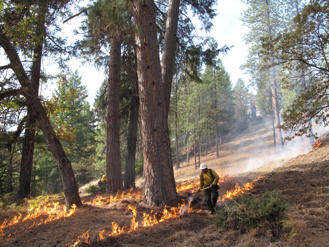
After a year of planning, a two-week controlled-burn training event will be held from Oct. 13 to 26. During the event, 30 fire professionals from California, Oregon, Washington, Nevada, Utah and Maine will be working and training with local hosts across northern California, with sites around Orick, Hayfork and Redding.
Last year, a similar event brought 40 firefighters from across the country to help the National Park Service and private landowners complete controlled burns as part of restoration and wildfire hazard reduction projects. Controlled burns are an important tool for creating fire safe communities, restoring resilient forests, and nurturing native plants and wildlife.
This summer, a wildfire that threatened the town of Weaverville was stopped when it hit an area burned eight months prior in a controlled burn. Previously burned areas were also critical to fire suppression efforts on the 2013 Rim Fire in the Sierra. These types of trainings are becoming increasingly important as drought and climate change increase the risk of severe fire, and land managers require new skills and experience to restore beneficial fire to the landscape while protecting communities and ecosystems from more destructive wildfires.
The Northern California Prescribed Fire Council and The Nature Conservancy are the main organizers of this year's event, which is designed to make the forests more fire resilient while at the same time helping fire professionals build new skills and partnerships. The same training model is being used across the country, with events held this year in Nebraska, Virginia, New Mexico, and in the mid-Klamath region of Humboldt County.
Participants in the fire training will include fire practitioners from local fire departments, government agencies, universities, non-governmental organizations, and local landowners. The training will be hosted by Redwood National Park, Whiskeytown National Recreation Area, and the Watershed Research and Training Center. In addition to working on the controlled burns, participants will learn about local fire ecology, laws and regulations, and how collaboration contributes to greater conservation.
These controlled burns will only be implemented if weather conditions meet the parameters for a safe, effective operation. Thanks to the recent rains, we are expecting conditions to line up nicely.
For more information, contact Yana Valachovic, UC Cooperative Extension Forest Advisor at (707) 445-7351 or yvala@ucanr.edu.
- Author: Robert Sanders, (510) 643-6998, rsanders@berkeley.edu
In a press announcement accompanying the release of the studies, Secretary of Natural Resources John Laird noted that “significant increases in wildfires, floods, severe storms, drought and heat waves are clear evidence that climate change is happening now. California is stepping up to lead the way in preparing for — and adapting to — this change. These reports use cutting-edge science to provide an analytical roadmap, pointing the way for taking concrete steps to protect our natural resources and all Californians.”
Laird and others appeared yesterday at a press conference in Sacramento, where Robert B. Weisenmiller, chair of the California Energy Commission, called the reports “historic” and praised the scientists who contributed.
“We scientists know that climate change is and will be significantly affecting the state’s energy supply and demand system,” he said. “The research in these assessments furthers our understanding of the impacts …. The challenges are enormous, but certainly this state has the capability to rise to those challenges, and with these types of studies we are going to be prepared. We will use these in the energy commission planning … to maintain a reliable grid, but also use this as a way of planning our research.”
Laird and Weisenmiller were joined at the press conference by Chief Ken Pimlott, director of the California Department of Forestry and Fire Protection (Cal Fire), who painted a grim picture of the state’s fire future. Of the 20 worst fires in California history, 11 have occurred since 2002, he said. The fire season in some areas has increased by an average of two months, and a few areas in Southern California now have a year-round fire season.
“Studies like those being released today are key in helping us move forward to prepare California” to deal with these large and damaging fires, said Pimlott.
State’s fire season longer, fires more intense
UC Berkeley fire expert Max Moritz, who contributed a paper about increased vulnerability to wildland fires in the state, has been warning of increasing fire danger for years.
“Our results reveal that California should prepare — regardless of the future we may face climatically — for quite different fire activity levels in the future,” said Moritz, UC Cooperative Extension specialist in the Department of Environmental Science, Policy and Management at UC Berkeley. “Though our models continue to improve, we still don’t know which future climate scenario will actually emerge. The challenge is to learn to ‘coexist’ with this natural hazard and move toward fire-resilient ecosystems and fire-resistant urban development.”
Speaking for the more than 120 scientists in 26 teams who contributed to the studies, Susanne Moser, a Social Science Research Fellow at Stanford University’s Woods Institute for the Environment, said that the report “spells out our new understanding of what climate change might mean to California. We are trying to inform the public, we are trying to inform the decision makers, with valuable information that they can use in … planning.”
The reports represent the third assessment commissioned by the California Climate Change Center since 2006, following up on discussions and topics presented at the Governor’s Conference on Extreme Climate Risks and California’s Future held last December in San Francisco. The new studies will provide a foundation for the 2012 Climate Adaptation Strategy, which is expected to be completed in December 2012.
David Ackerly, who co-authored three of the papers released yesterday, provided a new vegetation map that will allow planners to see how the Bay Area will likely change in the future.
“The big result that comes out of the models — and we have to remember that they are models — is a very wide expansion of chaparral and the loss of the cooler oak woodlands. And as climate change becomes more extreme, the Bay Area looks more and more like Santa Barbara or areas farther south, and the vegetation begins to look like Southern California, which is mostly scrublands,” said Ackerly, a professor of integrative biology. “That could take a hundred years or more, but the short-term result is that the dead trees become a fire danger and alien weeds invade.”
The short-term impacts are the most uncertain, he said, though UC Berkeley scientists hope to fill in these gaps through a broad research effort, the Berkeley Initiative in Global Change Biology.
“We hope to answer the question, ‘How fast can these changes really occur?’” he said.
Ackerly said that through his reports, which synthesized previous and ongoing research, he particularly wanted to link the expected decline of biodiversity throughout the state with a more visible impact on the ecosystem services people take for granted. The predicted march of desert northward into the San Joaquin Valley will make some areas unsuitable for agriculture, for example, while warmer winters may mean that plums and peaches will not get the winter chill they need to produce fruit.
“This is not merely nature for nature’s sake; nature and the services we expect from nature are all connected,” he said.
Gov. Jerry Brown is listening to these reports, according to Ken Alex, Brown’s senior policy advisor and director of the Office of Planning and Research, who also spoke at the press conference.
“Here in California, we do make policy decisions based on the science,” he said. “Gov. Brown actually reads the science, and he takes it very seriously, and I know that at a very deeply personal level, he wants to do something about climate change and wants to see California take the leadership role.”
The 26 teams submitting reports were led by researchers from around the state, including 15 from UC Berkeley, 19 from other UC campuses and two from Lawrence Berkeley National Laboratory. For highlights from the reports, link to the CEC’s press release (PDF). To download the full reports, link to CEC’s website.
“The incredible breadth of studies, as well as the depth of their analyses, reveals just how much the University of California has to offer in preparing us all to adapt to a changing climate,” Moritz added. “Hopefully, it also demonstrates how important it is to grow this scientific capacity within our public university system.”

