Posts Tagged: Stephanie Larson
Wildfire Fuel Mapper helps landowners manage vegetation, reduce fire risk
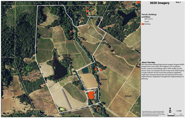
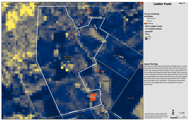
On the four-year anniversary of the devastating Tubbs and Nuns fires in Sonoma County, the University of California Cooperative Extension (UCCE) and Pepperwood Preserve are launching the Wildfire Fuel Mapper, a comprehensive toolkit to assist landowners in managing vegetation that may fuel wildfires.
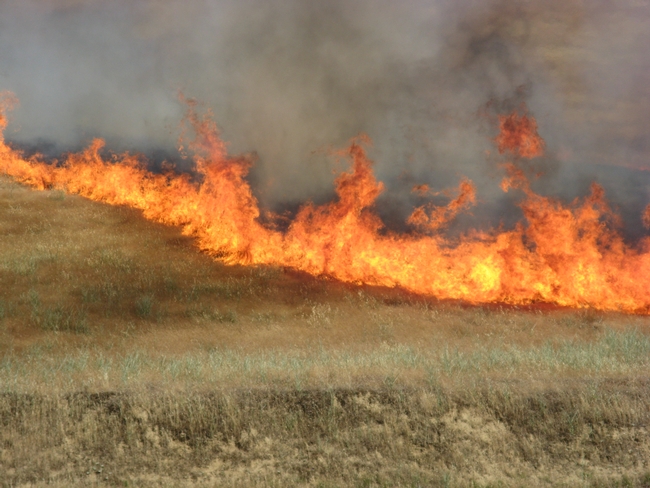
The October 2017 fires, which destroyed nearly 7,000 buildings and left 25 people dead, underscored the importance of wildfire mitigation, community safety and long-term resilience. To prepare for wildfire, the Wildfire Fuel Mapper toolkit connects Sonoma County landowners with resources, professionals, specialists and funding opportunities to subsidize fuel reduction projects.
The only mapping tool available at a parcel scale for the county, the Wildfire Fuel Mapper contains detailed maps of vegetation types and landscape elements that help users assess fire hazards and tailor a plan to manage those fuels.
The tool can be accessed directly by residents and used to map parcels greater than three acres. Wildfire professionals and vegetation management specialists also can use the Wildfire Fuel Mapper to better support their clients.
“When we're working in Sonoma County, we start every project by using the Wildfire Fuel Mapper tool,” said Joel Holland, president of Wildfire Services. “This invaluable tool provides a vital starting point from which to engage and educate property owners.”
To access a custom map report, available for download at either a parcel or watershed scale, visit www.wildfirefuelmapper.org.
“The Wildfire Fuel Mapper is designed for Sonoma County, but other counties could create a similar set of resources to help their residents prepare for wildfire,” said Stephanie Larson, director of UC Cooperative Extension in Sonoma County.
The Wildfire Fuel Mapper is part of a coordinated effort in Sonoma County to better provide the public with accessible maps and prioritization tools to reduce wildfire risk. UCCE is currently collaborating with Sonoma Water to develop a decision support framework – an integrated set of tools, including the Wildfire Fuel Mapper, that will expand to operate at the landscape scale, enabling landowners to make strategic investments in fuel load reduction, vegetation management and climate resilience.
“This project helps address the critical regional approach we need to assist landowners, watersheds, and agencies to design and implement better vegetation management,” North Coast Sen. Mike McGuire said. “Our county will be more fire safe thanks to UC Cooperative Extension's efforts.”
This project is a collaboration between University of California Cooperative Extension (UCCE), Pepperwood and Tukman Geospatial, with support from PG&E, the Thornton Foundation and CAL FIRE.
Match.Graze launches to reduce wildfire fuel, feed livestock
Matchmaking grazing animals with grass and rangelands
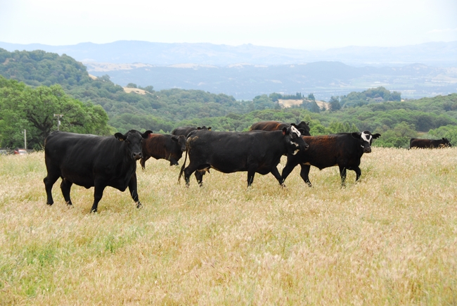
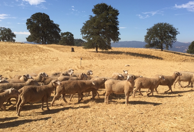
Professional grazing of overgrown rangelands, pastures and parcels is proven to reduce the spread of dangerous and costly wildfires.
Do you have land but no livestock and feel concerned about fire fuels on your property? Or are you a livestock owner that can provide a grazing service and/or need land and forage for your animals? Match.Graze can help.
Match.Graze is a free online platform connecting landowners statewide who want grazing animals to livestock owners with animals that can provide vegetation management services, created by UC Cooperative Extension.
From small semi-rural communities to large open spaces, grazing can provide an affordable solution to the inevitable accumulation of fire fuels. Grazing can be more cost-effective for reducing fuels on landscapes that are too steep, rocky or remote for mowing or chemical treatment, or in the wildland-urban interface where burning is not an option.
“I've noticed on several fires, including extreme fires, the fence lines where the fire just stopped. And the one variable, the one difference, was grazing,” said Marshall Turbeville, CAL FIRE battalion chief.
Cattle, sheep, goats and other grazing animals all have different roles to play in grazing for fire fuel reduction. If you want to use livestock to help reduce fire risk in your area, visit MatchGraze.com.
“Every property is different and requires thoughtful consideration of how it should best be grazed,” said Stephanie Larson, director of UCCE in Sonoma County, UCCE livestock and range management advisor and co-creator of the livestock-land matchmaking service. “UC Cooperative Extension is here to serve, put Match.Graze to work and let's prevent catastrophic fire while helping landowners and agriculture.”
To find a local grazing partner, visit MatchGraze.com, set up a free account, create a pin on the map and make a match.
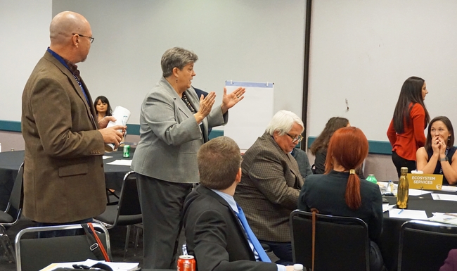
To protect California ecosystem services, they must be valued
The ecosystem services of landscapes in California are essential to the state's future, but many people take them for granted.
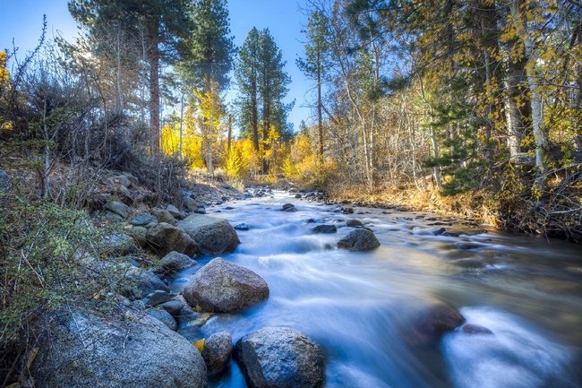
In addition to direct economic outputs, working landscapes – farms, rangelands, forests and fisheries, to name a few – sequester carbon, capture water, support wildlife, offer picturesque views and make space for hiking, skiing, boating and other recreational activities.
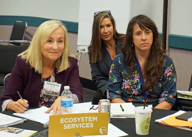
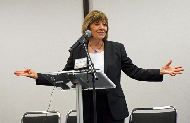
“We need to put a value to ecosystem services, from an economic standpoint, that incentivizes people who own and manage these landscapes so they can continue to manage them for everyone's benefit,” said Stephanie Larson, UC Cooperative Extension rangeland advisor in Sonoma County.
When ecosystem services have been monetized, proper compensation can be calculated, ensuring benefits like clean water, fresh air and a livable climate are protected for future generations.
In November, UC Agriculture and Natural Resources released a report at the California Economic Summit in Fresno on the value of California's working landscapes. The report determined the state's working landscapes generate $333 billion in annual sales and 1.5 million jobs. That number does not include ecosystem services.
“The value of ecosystem services is probably higher than the $333 billion direct economic contribution of working landscapes outlined in the report,” said Glenda Humiston, University of California vice president for agriculture and natural resources. Humiston is chair of the economic summit's working landscape task force. “The problem is, when we don't have that quantified, it's hard to make investments to make sure those ecosystem services are maintained.”
Humiston said that, in time, systems can be developed for the public to support the ecosystem services they enjoy.
“You might have a small surcharge on binoculars,” she said. “That money could be used to protect bird habitat so birders can go somewhere to see birds. Water districts might assess a surcharge on your water bill to pay for the forested watersheds where they are getting your water. There are many different mechanisms to do this. We're trying to figure out what would be the best mechanism.”
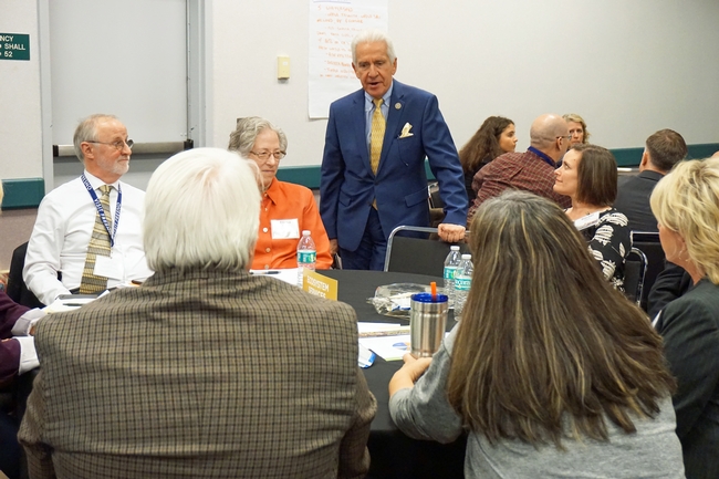
During the summit, a team of researchers, policymakers and industry professionals launched a new phase of work to calculate with scientific accuracy the value of ecosystem services. Larson is a member of the leadership team, along with executive director of the Central Valley Partnership Dan O'Connell and Sequoia Riverlands Trust director of pubic planning and policy Adam Livingston.
The team is working with partners to secure funding and technical support to integrate data sets already available from the Council of Governments' Rural-Urban Connections Strategy into an open source, statewide system for mapping ecosystem services.
Once the tool is established, the team will be ready to pilot test it in four areas of California that provide ecosystem services.
“I love this concept,” said Kenny Spain, economic development specialist with the Headwaters Fund in Humboldt County and a member of the task force. “It's a valuable tool.”
Learn more:
View a 4-minute video of UC ANR vice president Glenda Humiston announcing the release of the report, California's Working Landscape: A Key Contributor to the State's Economic Vitality, at the 2019 California Economic Summit.
View California Governor Gavin Newsom's keynote address at the 2019 California Economic Summit:
Livestock owners asked to weigh in on fire impact
Fire Impact and Risk Evaluation (FIRE) survey.
“We will aim to quantify the impact of wildfires in different livestock production systems,” said Beatriz Martínez López, director of the Center for Animal Disease Modeling and Surveillance in the UC Davis School of Veterinary Medicine. “The idea is also to create a risk map showing areas more likely to experience wildfires with high economic impact in California.
“This economic and risk assessment, to the best of our knowledge, has not been done and we hope to identify potential actions that ranchers can take to reduce or mitigate their losses if their property is hit by wildfire.”
Martínez López, who is also an associate professor in the Department of Medicine & Epidemiology at UC Davis, is teaming up with UC Cooperative Extension livestock and natural resources advisors and wildfire specialists around the state to conduct the study.
“Right now, we have no good estimate of the real cost of wildfire to livestock producers in California,” said Rebecca Ozeran, UC Cooperative Extension livestock and natural resources advisor for Fresno and Madera counties. “Existing UCCE forage loss worksheets cannot account for the many other ways that wildfire affects livestock farms and ranches. As such, we need producers' input to help us calculate the range of immediate and long-term costs of wildfire.”
Stephanie Larson, UC Cooperative Extension livestock and range management advisor for Sonoma and Marin counties, agreed, saying, “The more producers who participate, the more accurate and useful our results will be.”
“We hope the survey results will be used by producers across the state to prepare for wildfire,” said Matthew Shapero, UC Cooperative Extension livestock and natural resources advisor for Ventura and Santa Barbara counties, “And by federal and private agencies to better allocate funds for postfire programs available to livestock producers.”
The survey is online at http://bit.ly/FIREsurvey. It takes 15 to 30 minutes, depending on the number of properties the participant has that have been affected by wildfire.
“Survey answers are completely confidential and the results will be released only as summaries in which no individual's answers can be identified,” said Martínez López. “This survey will provide critical information to create the foundation for future fire economic assessments and management decisions.”
Videos show hikers how to avoid Black Friday stampedes on park trails
While Americans traditionally beat a path to the malls the day after Thanksgiving, many opt out of shopping on Black Friday to enjoy the outdoors. In regional parks and other open spaces, hikers may encounter crowds of a different sort – cattle grazing with their calves. A 1,200-pound cow blocking the path can be daunting.
With a little patience and understanding, people who hike, bike and horseback ride can coexist peacefully with the cattle, according to Sheila Barry, UC Cooperative Extension livestock and natural resources advisor in Santa Clara County.
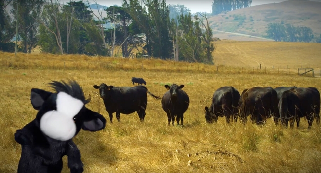
For happier trails, UC Agriculture and Natural Resources has produced a series of videos that show hikers how they can amicably share open space with their beefy neighbors. In a two-minute video, a black cow puppet with a furry white face describes how to politely coax cows to moo-ove aside without spurring a Black Friday stampede.
“We wanted to produce videos that are entertaining as well as informative,” Barry said.
The cow pun-filled video also describes the ecosystem services cattle provide by consuming nearly their body weight in plants. By grazing, cows manage the vegetation, reducing wildfire fuel, increasing water capture and promoting the diversity of native grasses and wildflowers.
In “Sharing open spaces with livestock,” the UC Agriculture and Natural Resources livestock experts give four simple tips for safely sharing open space with cows on the trail:
- Keep moo-ving and speak in a normal tone. Sudden movements and loud noises may surprise cows.
- Approach cows from the side or front. They find it udderly unnerving to have someone sneak up from behind, the bovine blind spot.
- Steer clear of getting between a protective mother and her calf.
- If you need to move a cow, step slowly into its flight zone. Invading the animal's “personal space” will motivate it to mosey aside.
A second video, “Sharing open spaces with livestock when you have a dog,” gives advice for dog owners to keep their best friends safe around cows.
In a third video, “A year in the life of a cow,” the UC Cooperative Extension spokespuppet describes a typical year for a beef cow.
“The videos are a fun way to educate the public about grazing on rangelands,” said Stephanie Larson, UC Cooperative Extension livestock and rangeland advisor in Sonoma County.
The videos are based on the UC ANR publication “Understanding Working Rangelands,” authored by Barry and Larson, at http://ucanr.edu/shareopenspace.
Watch all three videos on UC ANR's YouTube channel:
Sharing open spaces with livestock https://youtu.be/Qd8LEGLDhaM
Sharing open spaces with livestock when you have a dog https://youtu.be/zzdGnfFwmcA
A year in the life of a cow https://youtu.be/znJbWknVXVg


