Posts Tagged: land management
Officials release new weevil to battle yellow starthistle
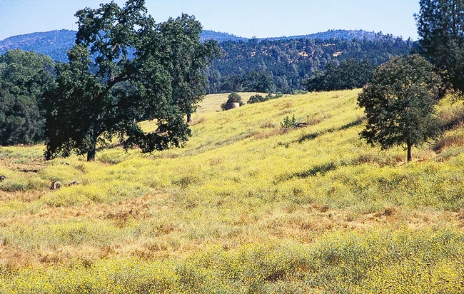
In April 2021, scientists released weevils from the Mediterranean region of Europe at the Bureau of Land Management Magnolia Ranch day-use area in El Dorado County to join the battle against yellow starthistle. Yellow starthistle rosette weevil is a newly approved natural enemy of yellow starthistle, which was introduced in California more than 150 years ago and, with no natural enemies in its new location, became one of the state's most harmful weeds, infesting nearly 15 million acres.
In California, yellow starthistle can grow to shoulder height, forming massive, thorny patches that block hiking trails, crowd out native plants and present a wildfire danger. The plant is toxic to horses and its flowers are encircled by inch-long sharp spines that can pierce the eyes of grazing animals.
UC Cooperative Extension has worked for decades with landowners to manage yellow starthistle-invested land.
“Over the years, we have developed effective control strategies for yellow starthistle – including well-timed mowing, grazing, hand pulling, burning, cultivation and herbicide application,” said Scott Oneto, UC Cooperative Extension natural resources advisor in El Dorado County. “But these treatments are rarely implemented on a scale large enough to combat our enormous starthistle infestations.”
Efforts to introduce natural enemies from yellow starthistle's home range began in the 1960s. Several species were released to attack starthistle flower heads. These insects lay eggs, hatch and feed on developing seeds, reducing seed production.
“Although the flower head insects sometimes attack high proportions of flowers, yellow starthistle is a very prolific seed producer with an individual plant producing as much as 100,000 seeds,” Oneto said. “Even if the insects reduce seed production by 50%, that still leaves a lot of seeds.”
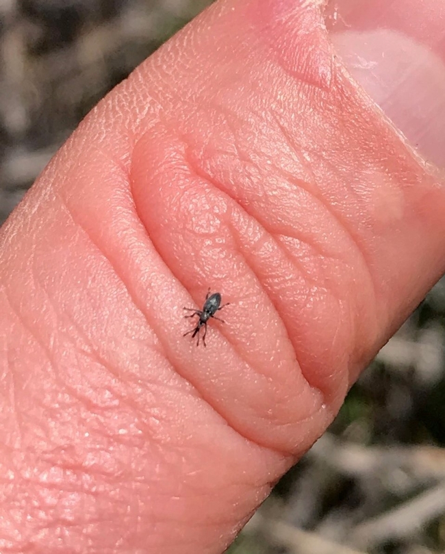
The newly introduced yellow starthistle rosette weevil, first collected in Turkey as a prospective biocontrol agent in 1984, attacks the plant at the base. Since 2001, United States Department of Agriculture research entomologist Lincoln Smith has studied the insect at the USDA Agricultural Research Service laboratory in Albany.
“Larvae of the weevil develop and feed inside the root crown during spring, adults emerge in June, and then they spend the rest of the year hiding,” Smith said. “There is only one generation per year, so populations will grow slowly, which will gradually reduce yellow starthistle populations.”
The weevil presents no risk to other plants in California except bachelor's buttons, which is an introduced plant from Europe, but not considered a noxious weed. Successful biological control with the weevil is expected to reduce yellow starthistle, but not completely eliminate the weed.
This was the second release of the beneficial insect in North America. The first release occurred in Solano County in April 2020.
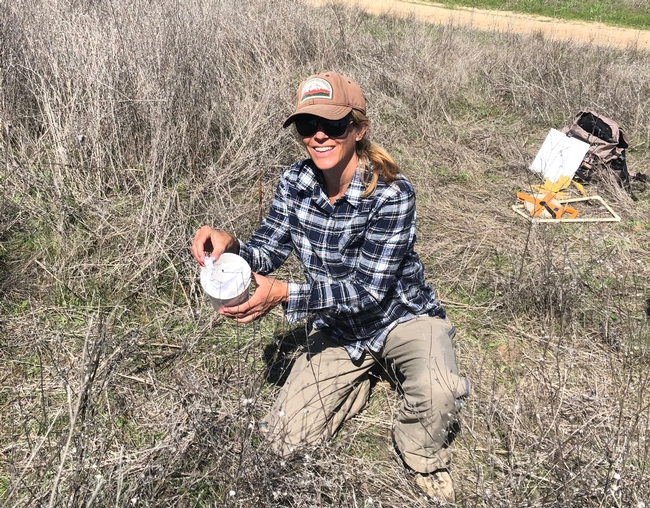
Bureau of Land Management and University of California Cooperative Extension researchers will be monitoring the Magnolia Ranch site intensively over the next several years to determine the rate of rosette weevil reproduction and efficacy at feeding on yellow starthistle.
For more information, see A New Warrior Released in the Battle to Control Yellow Starthistle by Scott Oneto on the UC Weed Science blog.
New project to build climate resilience through improved land management
A $4.6 million grant to UC Merced and UC Irvine will help UC Agriculture and Natural Resources researchers develop new tools and methods for California land owners to better manage the state's forests, shrub lands and grasslands.
California's Strategic Growth Council agreed to fund the Innovation Center for Advancing Ecosystem Climate Solutions, a three-year program co-led by UC Merced Professor Roger Bales and UC Irvine Professor Michael Goulden. The money comes through California Climate Investments, a statewide initiative that puts billions of cap-and-trade dollars to work
The goals include reducing wildfire risk, improving long-term carbon sequestration and bolstering resilience in the face of climate change, with an emphasis on California's rural regions and low-income communities.
“Our part of the project is to work with stakeholders and identify areas where we can focus management practices to promote healthy forests, minimize wildfires, improve water security and increase carbon sequestration,” said Toby O'Geen, UC Cooperative Extension soil resource specialist at UC Davis.
“Right now, many of California's forests, shrub lands and grasslands are carbon sources, and we need to change them into carbon sinks,” said Bales, director of the Sierra Nevada Research Institute and distinguished professor of engineering. “Our research will address information bottlenecks to guide decision making, build local capacity for science-based land management and develop methods for translating benefits of land restoration into financing for land restoration.”
California's recent drought, tree die-offs, wildfires and rising temperatures all point to the necessity of improved forest stewardship, Goulden said.
“Officials in the state government and agencies recognize this need, but uncertainty over how to proceed has sometimes slowed progress,” he said.
Most of the work will be conducted by scientists at Merced and Irvine, but collaborators from UC Berkeley, UC Davis, Stanford University, San Diego State University and the University of California Division of Agricultural and Natural Resources, as well as state agencies, will play important roles.
“This research will enable UC Cooperative Extension advisors to provide better advice to land managers to reduce the severity of wildfires,” said Glenda Humiston, UC vice president for agriculture and natural resources. “Severe wildfires are not only releasing greenhouse gases, but polluting the air of many communities, aggravating the health of people in less-affluent, inland areas such as Tulare, Yuba and Mariposa counties.”
At UC Merced, an interdisciplinary group of researchers from two departments — Civil & Environmental Engineering and Management of Complex Systems — will collaborate with UC Cooperative Extension and engage with local stakeholders. The group will study and identify the most-effective land-management practices, in terms of water conservation, forest health, fire resistance and carbon capture.
“We will develop the spatial data and analysis tools to plan landscape restoration, develop local capacity for better managing the state's wildlands in a warming climate, and enumerate the greenhouse gas and other benefits from investments in land management,” Bales said.
Goulden, professor of Earth systems science, said UC Irvine researchers will use a big-data approach to analyze observations collected by satellites since the 1980s to measure the efficacy of thousands of past and ongoing forest treatments, while UC Merced takes a different approach.
“We will work with groups in rural communities to systematically evaluate how well, or poorly, our products can support decision making,” Bales said, “and then develop both implementation pathways and policy recommendations to better and more-quickly implement landscape-restoration and carbon-capture projects across the state.”
Because there are critical gaps in the understanding of carbon cycles, uptake by forests and negative feedback from climate change, this project initiative has been established to develop new knowledge through measurements and modeling. Researchers will synthesize the resulting data to produce actionable information for stakeholders.
Bales and Goulden agreed the Innovation Center will target low-risk, high-yield opportunities to reduce California's greenhouse-gas contributions.
Just a small improvement in management efficiency will have meaningful benefits — on the order of several million metric tons of CO2 per year, Goulden said.
The program will also benefit low-income communities in the state by reducing wildfire risk, which disproportionately impacts poorer areas in California; by maintaining water quantity through better vegetation management; by fostering tourism in disadvantaged locales; and by preparing students in these areas for careers in sustainability and climate resilience.
UC ANR research center is site of archaeological learning
What kind of behavior is appropriate around such important discoveries? Can we touch these markings without degrading them further? Can we show them to the public? How do our tribal partners feel about such finds? How do they affect land management decisions?
The questions led to a partnership with the local Tribal Historic Preservation Officer (THPO) Shawn Padi of the Hopland Band of Pomo Indians and a public event at Hopland, “Archaeology for All." The Oct. 10 event featured UC Berkeley archaeologist Donna Gillette and THPO's Padi and Hillary Renick.
As one of the nine UC Agriculture and Natural Resources Research and Extension Centers (RECs) across California, Hopland REC offers opportunities for research projects across a variety of disciplines, particularly those requiring rangeland, oak woodland and chaparral environments. While respecting that need, the center managers are also committed to being exemplary stewards of the land, setting examples and raising awareness as methods are changed and improved.
Gillette began research at HREC in 2006, when it became evident that some of the ancient petroglyph style markings on the 5,358-acre site were thought to date back two millennia. Many of these markings take the form of circles carved into large rocks and are described as “pecked, curvilinear, nucleated” markings (PCNs). Gillette's work indicated that these markings were in fact between 5,000 to 8,000 years old, pre-dating Pomo culture (as we know it).
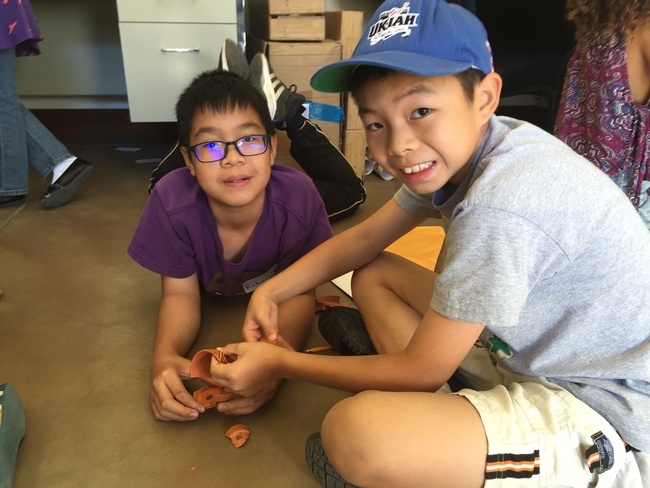
Over 100 members of the public attended the Oct. 10 event to discuss local history and cultural markings that might be found on the landscape. They learned why it is important to leave any discoveries of artifacts or markings just as found and report them to a local THPO. Children got the chance to become archaeologists themselves and saw directly how difficult it can be to piece together history when pieces of the story might have been removed or broken.
The challenge of balancing current demands on natural resources and culturally important sites can be complex. However, learning from the history of people in the area is a vital step in understanding sustainable use and behavior for the future. The Hopland Research and Extension Center has benefited greatly from relationships such as those with local THPOs. Their knowledge is integral to future land management decisions.
Author: Hannah Bird
This Earth Day, UC pushes for healthier California forest lands
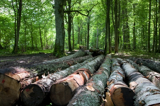
California forests aren’t natural anymore. Over time, human impacts such as logging and fire suppression have left forests more prone to diseases, insects and wildfires. UC Cooperative Extension received a competitive grant from Cal Fire to launch a forest management training program for private landowners to help protect California’s forests.
There are approximately 33 million acres of forest in California. Forty percent of those acres are owned by families, Native American tribes, or private companies and 27 percent are owned by individuals. According to a report by the National Woodland Owner Survey, 99 percent of family-owned forests are in parcels of 500 acres or less. Less than 1 percent of them had written management plans when surveyed.
Management plans are important — they lead to healthier forests. And healthier forests benefit everyone in California. They protect against devastating wildfires, make for healthier rural communities, better wildlife habitat, improve water quality, and increase carbon sequestration, among other benefits.
The UCCE Forest Stewardship Training Series makes it easy for landowners to create a forest management plan. By creating a written plan, landowners are forced to sit down and think about their goals and objectives, and essentially create a business plan. It’s also an important document when communicating with other professionals, such as bankers, accountants, granting agencies, etc. A management plan lays out the background of the forest, the landowner’s objectives, and the steps the landowner has taken or is taking to achieve those objectives.
Landowners are encouraged to start the process through an online e-learning site. Through the webinar, landowners learn how to set goals and objectives for their forest land and become familiar with their forest land by learning to understand tree management, wildlife, and water quality, recognize insects and diseases, and understand safety and roads. Once the landowner has set their goals and gone through the basic understanding training, they are connected with a professional forester to continue the land management plan process.
Upon completing the online training, landowners are invited to an all-day workshop for a more in-depth understanding of forest land management. Workshops will take place in Ukiah on May 18, Redding on May 29, Berkeley on June 15, and Auburn on June 22. Visit www.ucanr.edu/forest_learning for more information, or contact Rick Standiford, UC Cooperative Extension Forest Management Specialist, at standifo@berkeley.edu.

