Posts Tagged: Max Moritz
Wildfires may spur animal biodiversity
Naturally fire-prone ecosystems tend to have more species of birds and mammals, new study reveals
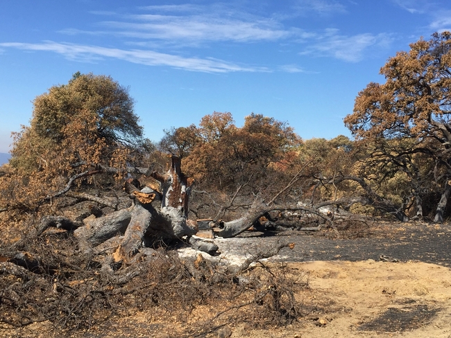
Wildfires. Many see them as purely destructive forces, disasters that blaze through a landscape, charring everything in their paths. But a study published in the journal Ecology Letters reminds us that wildfires are also generative forces, spurring biodiversity in their wakes.
“There's a fair amount of biodiversity research on fire and plants,” said Max Moritz, a UC Cooperative Extension wildfire specialist who is based at UC Santa Barbara's Bren School of Environmental Science & Management and the study's lead author. Research has shown that in ecosystems where fire is a natural and regular occurrence, there can be more species of plants — a greater “species richness” — due to a variety of factors, including fire-related adaptations. But, he said, there hasn't been nearly as much research in the way of animal biodiversity and fire.
“If you look at how fire operates across the planet, fire actually eats plant productivity,” Moritz said. Productivity, which is a measure of how quickly biomass is generated within a given ecosystem, is also a driver of species richness at broad spatial scales. “When fires occur, they can take a bite out of that bottom line,” he added.
If fire regularly consumes some of the base of an ecosystem's food chain, how does that ripple up to affect the biodiversity at higher levels?
That was the question Moritz investigated during a project supported by UC Santa Barbara's National Center for Ecological Analysis & Synthesis; he later recruited collaborators Enric Batllori from Universitat de Barcelona and Benjamin M. Bolker from McMaster University in Canada. For several years they combed through global datasets on various factors such as plant biomass, fire observations and species richness patterns.
While it might be natural to assume that plant biomass regularly consumed by fire would in turn lead to lower animal biodiversity, they found that for birds and mammals, fire is associated with increased diversity. In fact, they say, the effect of fire on biodiversity in the case of birds rivals that of the ecosystem's productivity. And in the case of mammals, fire's influence was even stronger than that of productivity.
“It's counterintuitive,” Moritz said. In the short term, fire's consumption of plant material (also known as “net primary productivity”) could result in less food for the animals that consume plants and make it more difficult to survive and reproduce. But in the longer term, he said, there may be evolutionary effects that unleash adaptations and formations of new species.
The researchers also looked at the effect of fire on amphibian species, however, the connection between fire and biodiversity in their case was difficult to make, possibly because amphibians live in wetter environments where fires may not be a regular occurrence.
So what accounts for the net positive effects of fire on mammal and bird diversity? The study is a correlative one, Moritz said, so more granular examinations have to be made to find out for sure. But it's likely that fire selects for species that can adapt to and quickly recover from a burn, and fire often creates environmentally complex habitats that meet different species' requirements.
“We know that fire creates a lot of heterogeneity and opens up all these niches,” Moritz said, and this resource availability might create favorable environments for some organisms to flourish alongside or over others. For example, animals that have strategies to survive fires or reproduce faster might do better in a fire-prone environment, as could those that make use of different habitats that emerge in the wake of a blaze.
Despite the connection between fire and species richness, the authors are careful to point out it does not mean fire is good for all ecosystems. In places where fire is not a natural occurrence, its presence “is more of a modern threat than an important process to maintain,” they said. And for places where fire is a natural part of the ecosystem, climate change-driven and intentional deforestation fires “may be quite different from natural fire regimes.”
Nevertheless, they say, these findings indicate that fire plays an underappreciated role in the generation of animal species richness and biodiversity conservation. Furthermore, the study adds nuance to the Latitudinal Biodiversity Gradient, a global pattern of terrestrial biodiversity in which the world's most biodiverse areas are located nearest to the equator, with levels of biodiversity generally decreasing toward the poles.
“This is a pattern that people have known for decades and have argued quite a bit about in terms of what drives it,” Moritz said. “And it turns out, it's hard to figure out. And it looks like fire plays a far more important role than we've ever really understood.”
Study: Regional approach to wildfire more comprehensive, equitable
Pilot program in Santa Barbara County shows promise for bolstering resilience
After a rash of wildfires across Southern California in 2003, many counties, cities and neighborhoods adopted Community Wildfire Protection Plans to improve their preparedness and fire response. But Rob Hazard, fire marshal for Santa Barbara County, has noticed that CWPPs and resources are unevenly distributed across areas at high risk of wildfire.
“Communities that are more affluent, more white, they are the ones that end up getting the grants, they're the ones that end up getting the projects to mitigate risks,” Hazard said, “whereas more disadvantaged communities…often don't have the organization to make that happen, or maybe it's not the most pressing issue of the moment.”
Mapping those underserved communities – and ensuring they have a more equitable share of attention – are some of the goals of a new, more comprehensive approach to wildfire, currently being piloted in Santa Barbara County. This “Regional Wildfire Mitigation Program” aims to fill in many of the gaps left by CWPPs, which tend to have a more narrow focus on fuel reductions for a specific locality.
“They certainly have their role and benefits, but CWPPs are pretty limited in scope,” said Max Moritz, University of California Cooperative Extension's statewide wildfire specialist. “They're really focused on modeling and prioritizing fuel breaks, and they leave all of these other aspects of our fire problem – our vulnerabilities, our potential losses – unaddressed.”
Moritz is the lead author of a recently published research article that describes the Regional Wildfire Mitigation Program's three key areas (or “domains”) for wildfire mitigation work: the built environment (pinpointing and addressing needs in buildings/infrastructure), landscape (creating buffers through land use policies and management choices), and community (educating the public on home hardening and other issues).
“It's this holistic approach that combines all of these elements, and each one of those elements speak to each other – they can't be independent,” said Hazard, a study co-author.
Seeking a better way
After the Thomas Fire devastated the region in 2017-18 and triggered deadly mudslides in Montecito, Moritz – an adjunct professor at UC Santa Barbara's Bren School of Environmental Science & Management – sought more encompassing risk mapping and mitigation solutions that could complement CWPP efforts.
He got together with Hazard, who began his career as a “hotshot crew” firefighter with the U.S. Forest Service and has been with Santa Barbara County Fire Department for nearly 25 years.
“Both of us believe: Yes, it is home hardening – but it's also defensible space, but it's also some fuel treatments, but it's also some prescribed fire, but it's also some agricultural belt (to create a buffer),” said Hazard. “We looked at it objectively, and in every community in Santa Barbara County there's something that either works – or doesn't.”
By the end of the pilot program along the south coast of Santa Barbara County, the team hopes to have refined a “decision support system” that other communities across the state – and perhaps around the globe – could use. The framework would incorporate their localized risk assessment data and conditions to help generate lists of prioritized projects across the three “domains” of wildfire mitigation.
The ability to adapt to new data and continual changes in ecosystems, communities and climate is another advantage of the RWMP. Unlike a “plan” that tends to be a one-off with a defined start and end date, this wildfire mitigation “program” is designed to pivot and evolve as conditions change. The goal is to motivate and guide implementation of risk mitigation activities in each domain.
“The program is a living program, so it's not going to be some PDF that sits on a server somewhere,” Hazard said.
One of the early lessons from the RWMP pilot has been that – aside from funding – a crucial factor in maintaining the momentum of a wildfire mitigation program is the presence of a dedicated group of community members.
“In each community, we'll need a group that is ready to take this on and spearhead it and run with it,” Moritz said. “In many communities, that will probably be the Fire Safe Council.”
Building ‘Firewise' communities
Local Fire Safe Councils are “grassroots, community-led organizations that mobilize residents to protect their homes, communities and environments from catastrophic wildfire,” according to the California Fire Safe Council.
And while Moritz, Hazard and other experts serve on the volunteer Board of Directors for Santa Barbara County Fire Safe Council, they soon realized that they needed to hire staff to perform the “community domain” work of educating and reaching out to residents.
A $5 million grant from the National Fish and Wildlife Foundation for the RWMP project helped build the capacity of the council, which hired its first staff member, Anne-Marie Parkinson, last fall.
“A lot of people underestimate how important it is to have community activists or leaders who take on the role and responsibility of organizing people, being the point of contact, rallying people to do activities or work days,” said Parkinson, a graduate of UCSB's Bren School and a co-author of the RWMP study.
Parkinson has been working to get communities recognized by Firewise USA, a program of the National Fire Protection Association to organize residents in bolstering wildfire preparedness and reducing risk.
Although she has been encouraged by the awareness and activism among the community members she has met, Parkinson also hears from residents about the need for more resilient power and communications networks – concerns that could be better addressed by consolidating those requests with a regional approach.
“As we work with more and more communities, you can start to map which communities want better telecommunications, and which communities would benefit from a fuel break around them, and then we could write a grant that benefits five communities, instead of one small grant for one community,” Parkinson said.
Moving forward
There are many communities in fire-prone environments that are in need of help, and climate change makes their situation increasingly urgent, Moritz said, and a new and comprehensive framework – the RWMP – now exists for assessing and mitigating multiple risks.
“Every community has its own unique fire hazards and its own unique spatial layout of neighborhoods and vulnerabilities inherent to those neighborhoods,” he said. “But despite the uniqueness of each community and each region, I'm hoping this will provide a somewhat systematic way to approach making progress and mitigating a whole suite of risks.”
Other authors of the article are Kelly Johnston, Molly Mowery and Katie Oran of the Community Wildfire Planning Center; Marc Mayes of Spatial Informatics Group-Natural Assets Lab and UC Santa Barbara Earth Research Institute; Graham Wesolowski of Spatial Informatics Group-Natural Assets Lab; and David Schmidt of Spatial Informatics Group. The article is published in Frontiers in Forests and Global Change at https://www.frontiersin.org/articles/10.3389/ffgc.2022.848254/full.
People interested in learning more about the RWMP approach are encouraged to contact Graham Wesolowski at gwesolowski@sig-nal.org or Max Moritz at mmoritz@bren.ucsb.edu.
Ag Pass program aims to improve wildfire preparedness on rangeland
When the Detwiler Fire broke out near his family's ranch in 2017, Tony Toso was home to take defensive action to protect his family and animals. The Mariposa County rancher feels fortunate that he was on site.
“We were on the front end of the fire damage and it started on a Sunday,” recalled Toso. “Had I not been home that day, it would have been very difficult for me to access my property and help keep our livestock safe. Within a matter of hours of the fire starting, the CHP had our county road closed and would not let anyone in.”
Emergency personnel close roads around wildfires for the safety of people and to prevent them from impeding fire suppression efforts. When fire threatens large ranching operations, ranchers need to move their livestock out of harm's way and make sure they have feed and water. While volunteer groups can assist in rescuing dogs, cats, and a few sheep or horses, they don't have a rancher's knowledge, expertise and experience that are essential for managing hundreds of cattle at large-scale ranching operations.
To help rural communities prepare for wildfire, it would be helpful for farmers and ranchers to have a plan in place to coordinate with first responders, according to Max Moritz, UC Cooperative Extension wildfire specialist. Ag Pass is a program developed in Ventura County to identify farmers and ranchers to firefighters, law enforcement and other emergency personnel so they can allow them onto their property to rescue animals and identify access roads and water sources.
“Because fires are increasingly impacting people and are not going away anytime soon, we need to figure out approaches to sustainably live on fire-prone landscapes. In a broader sense, the Ag Pass is another way that we can adapt to, and coexist with, wildfire,” Moritz said.
Matthew Shapero, UC Cooperative Extension livestock and range advisor, and Moritz have written a publication to guide people who would like to create an Ag Pass Program for wildfire preparedness in their own locale.
“Our neighbors had cattle just north of us and they tried to get in and could not,” said Toso. “An Ag Pass in that situation, would have been a huge benefit had I not been at home and then wanted to access my property.”
In Ventura County, agricultural workers can apply for identification cards from the Central Ventura County Fire Safe Council, which verifies farm information through the county's pesticide applicator permit database. Ag Pass members provide detailed maps of their farms that show access roads – including many that don't show up on other maps.
Shapero, who works in Ventura and Santa Barbara counties, has been working with ranchers and county agencies to create an Ag Pass program in Santa Barbara County.
“The last few fire seasons have made a program like the Ag Pass more urgent than ever, especially as awareness of wildfire's impacts to agriculture has grown,” Shapero said. “We hope that this publication provides localities with a workable blueprint that will expedite the adoption of this or similar programs.”
Shapero has been working with Anthony Stornetta of Santa Barbara County Fire and representatives of other agencies to develop a training for Ag Pass participants in Santa Barbara County.
“After being at the Carr, Sonoma, Creek and Camp fires for months at a time, I started developing the program from the fire side and presented it to California Cattlemen's Association a couple years ago,” Stornetta. “This was a great collaborative effort. After meeting with our fire safe council, we are looking at the program being fully adopted very soon.”
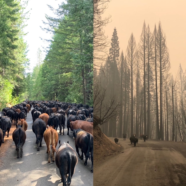
In September, the Bear Fire raged through the Plumas National Forest where 400 of Dave Daley's cattle roamed to graze. The fifth-generation rancher wrote in moving detail of his grueling search for surviving cows in the rugged terrain during the wildfire and posted it to the California Cattlemen's Association website.
“I was unable to get access initially,” Daley said. “After working with our sheriff, I was able to get access through his office. But it required a deputy to take his time every day for 10 days to meet me at the roadblocks and escort me for several miles into our cattle range. I am very thankful for their willingness to do so. However, it was probably not the best use of their time when they were dealing with so many crises simultaneously and the fire was still raging. If there had been an Ag Pass system, that would have simplified the process, freed up law enforcement and given me a chance to save more cattle.”
Toso, the Mariposa County rancher and president of the California Cattlemen's Association, thinks a program as described in the UC Cooperative Extension publication benefits both ranchers and first responders.
“We can not only help protect ranching families, but we can use the opportunity to build working relationships and create trust between landowners and emergency personnel, as well as provide valuable information to those first responders from knowing the lay of the land,” he said. “Helping other counties and our member ranchers get a program on the books with their respective counties will be a priority for our organization.”
“Given each community's unique agency and personnel structure, it is our belief that the Ag Pass is best administered at the local or county level, however we are working with the state to see if policy measures can be developed that would simplify and support the Ag Pass concept,” Shapero said.
The training developed for Santa Barbara County includes an overview of hazards and safety issues, entrapment avoidance, incident organization, fire behavior, working with law and fire liaisons, access to incident, carding and certification. Stornetta anticipates the Santa Barbara County training will be held in spring 2021 and hopes it can be used in other counties as well. Ranchers who are interested in the Ag Pass training should contact Stornetta or Shapero.
“Preparing for Disaster: Establishing an Ag Pass Program in Your Community,” can be downloaded for free at https://anrcatalog.ucanr.edu/pdf/8685.pdf.
(First published Dec. 21, 2020)
Reducing wildfire risk includes building communities to coexist with fire
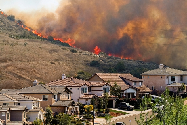
The Camp Fire that destroyed the town of Paradise and other wildfires that have devastated communities in recent years have convinced wildfire experts that Californians need to take more than one approach to coexist with fire.
To better protect new houses against wildfire, California has building codes, but where residential communities are built on the landscape and how they are designed are also very important to limit wildfire-related losses, according to University of California Cooperative Extension specialists Max Moritz and Van Butsic.
“Defensible space and vegetation management is important, but in the long term, where and how we build new developments will be equally important for keeping Californians safe,” said Butsic, who studies land use.
To develop their recommendations for reducing wildfire risk for future community development, Moritz, who specializes in wildfire, and Butsic reviewed fire studies and consulted firefighters and community planners.
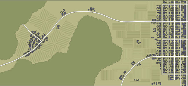
Their new publication, “Building to Coexist with Fire: Risk Reduction Measures for New Development,” is designed for city planners, fire districts and communities to incorporate community-scale risk reduction measures when building or rebuilding in fire-prone areas.
“There is currently little codified guidance for where and how to build our communities in California, aside from building codes for individual structures and a few requirements for road access and water supplies,” said Moritz, who is based at UC Santa Barbara.
Wildfire consultant and architect David Shew, who retired as a CAL FIRE chief after 31 years, said, “I can state without hesitation that the land use planning principles and design recommendations identified in this study are necessary steps to help increase wildfire resiliency to existing and future communities. Being a first-hand witness to the increasingly destructive nature of wildfires, I can attest to the value and necessity for these improvements to be integrated into our built environment. This should become a much-used reference for every planning and fire official who face wildfire impacts.”
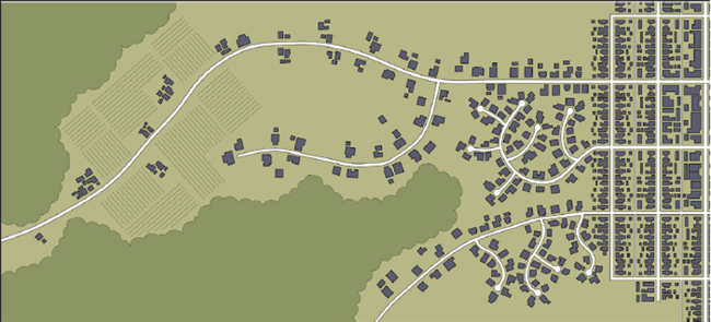
To reduce fire vulnerability of communities, Moritz and coauthor Butsic, who is based at UC Berkeley, recommend including fire professionals and biological resource experts early in the community planning process. They also recommend considering the placement of communities on the landscape, such as near bodies of water and agricultural land, and how they are laid out to minimize exposure to wildfire. Key considerations include defensibility, risk of ignition and ease of evacuating residents.
“This report provides both a robust justification for integrating resilience practices into land use planning and community design, and a toolbox for doing so,” Sarah G.Newkirk, director of disaster resilience with The Nature Conservancy in California. “The risk reduction measures described can be put to use immediately – ideally in combination with each other – both in ongoing wildfire recovery planning, and in local hazard mitigation planning. Furthermore, the report should be a wake-up call to FEMA to think broadly about how best to support wildfire mitigation in California.”
To more efficiently reduce fuel in new communities, Moritz and Butsic write, “The design, maintenance and use of defensible space for fire protection is easier when neighborhoods are developed more densely and are built to stringent fire-resistant building codes.”
In the 31-page publication, they present risk reduction measures for four design contexts:
- landscape setting – engage in strategic planning much earlier, use hazard maps and use major landscape features
- separation from wildfire source—use nonflammable amenities in design, employ safe setbacks on slopes and concentrate on inner side of roadways
- density management – cluster with other homes
- protective infrastructure – harden public facilities and refuges, locate power lines underground and augment water requirements.
They provide examples for each risk reduction measure, along with some discussion of challenges associated with each measure.
“Our hope is that this guidance will be helpful for agency personnel involved in evaluating and approving future development in California,” Moritz said. “Because there is a pressing need for additional housing in California, communities must be built with design principles that make them safer to inhabit and less vulnerable to inevitable wildfires.”
The publication “Building to Coexist with Fire: Risk Reduction Measures for New Development” can be downloaded for free at https://anrcatalog.ucanr.edu/Details.aspx?itemNo=8680.
Protecting homes from wildfire in a time of climate change
Many climate change projections point to impacts that will be felt 50 or 100 years from now. But there are indications the earth is already experiencing rising sea levels, intensifying storms, increasing wildfires and droughts, and warmer oceans and atmosphere, reported Mary Caperton Morton in Science News.
For information about wildfire in California, Morton spoke to Max Moritz, UC Cooperative Extension wildfire specialist in the Bren School of Environmental Science and Management at UC Santa Barbara.
“Warming temperatures are melting snow sooner and drying out vegetation so that we're already seeing longer fire seasons and more available fuel," Moritz said.
In 2017 and 2018, California wildfires killed 147 people, burned 3.5 million acres and destroyed over 34,000 structures in two of the worst fire seasons on record. Wildfires are expected to become more severe across the West.
Governor Newsom is responding to the threat by including in his proposed 2020-2021 state budget $86 million for CALFIRE to boost its firefighting response and $127 million for the Department of Emergency Services to address such disasters, reported the San Francisco Chronicle. The proposed budget will also fund the creation of a new 106-person wildfire safety division to oversee Pacific Gas & Electric Co. and other utilities.
CALFIRE recommends establishing defensible space around homes and building to code with fire-safe materials. For older homes, CALFIRE suggests low-cost retrofitting strategies, including sealing gaps with caulk, weather stripping or fine metal mesh screens; removing dead or dry vegetation from around the house and regularly cleaning leaves and other flammable material from gutters and under decks.
Moritz pointed out that the houses themselves are fuel for wildfire. Community-level fire safety approaches will be needed, he said.
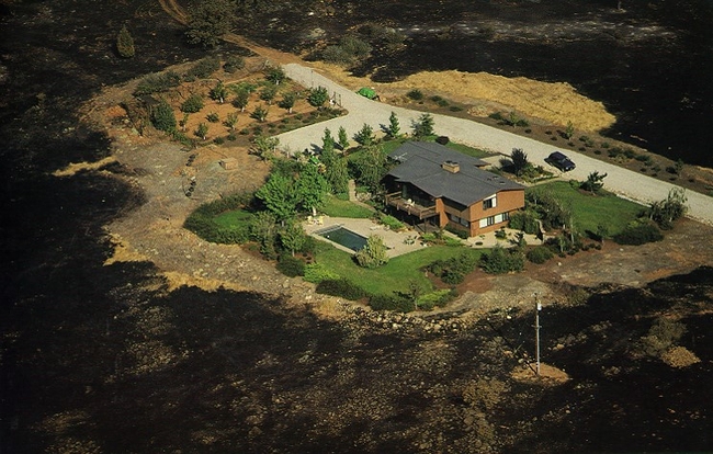
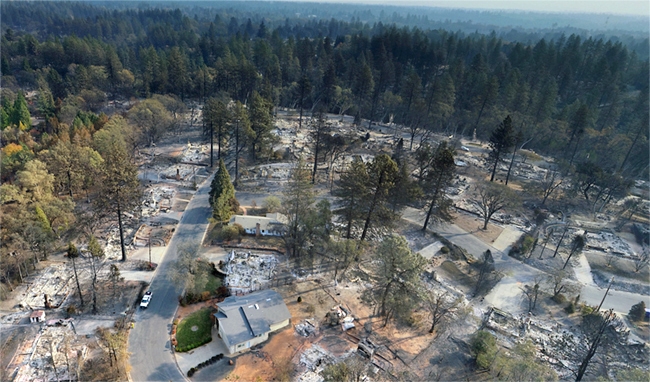
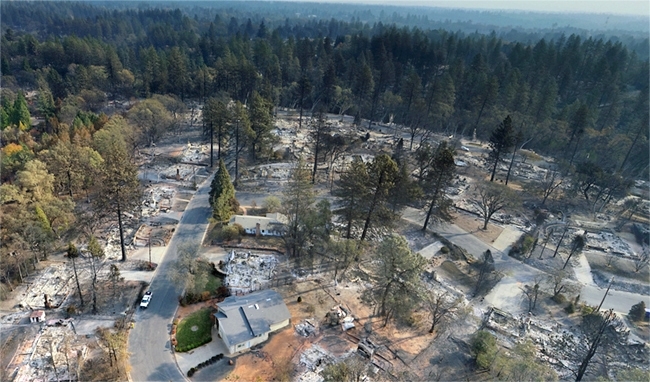
"You've probably seen aftermath photos where a fire has swept through a town and all the homes have burned, but there are still trees standing and green vegetation,” Moritz said. “That's what happens when the homes themselves are the fuel. It's not a land management problem where you should have cleared more shrubland. You can't thin the fuels because the homes were the fuel.”
In a report published in April by UC Agriculture and Natural Resources, Moritz and colleagues also recommend burying power lines, creating water storage facilities for fighting fires, hardening emergency facilities and creating community refuges where people can take shelter.
"A whole suite of risk-reduction measures can be applied at the community scale,” he said. “We need to pay attention to how we lay out communities, with buffer zones between houses and between the community and the surrounding landscape.”
“Building to Coexist with Fire: Risk Reduction Measures for New Development” can be downloaded free at https://anrcatalog.ucanr.edu/Details.aspx?itemNo=8680.

