Posts Tagged: crop
$1.7M granted for climate-smart planning led by UC ANR scientists

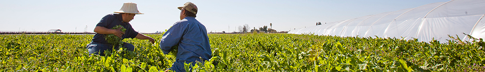
In California, natural and working lands make up 95 million acres of the state and play a vital role in building resilience to the impacts of climate change. University of California Agriculture and Natural Resources was awarded $1.7 million for the California Next Generation and Equitable Climate Action Plan, as part of the state's Natural and Working Lands Climate Smart Strategy and California's 30x30 Initiative, an effort to conserve 30% of the state's lands and coastal waters by 2030.
Natural and working lands include both unmanaged and managed areas actively used for agriculture, forestry or production purposes.
Chandra Richards, UC Cooperative Extension agricultural land acquisitions academic coordinator for Southern California, and Cristina Murillo-Barrick, UCCE's Black, Indigenous and People of Color community development advisor for the Bay Area, are leading the California Next Generation and Equitable Climate Action Plan project.
To build capacity and technical assistance for climate-smart action planning, Richards and Murillo-Barrick will use the Climate Smart Land Management Program funding, awarded through the California Department of Conservation, to focus on two of the most pressing climate action issues: equitable land access and land management diversification.
According to the 2022 U.S. Department of Agriculture census, demographic data indicates that California agricultural land ownership and production is concentrated within an aging and mostly White demographic. However, research suggests diverse management practices promote healthy landscapes. This has been shown to benefit the environment, human health and climate resilience in multiple ways.
For this reason, this project centers on “historically underrepresented communities,” a term that includes California Native American Tribes, communities of color, landless farmers, immigrant and non-English speaking communities and other agency-designated minority groups (racial, ethnic and non-male groups, socially disadvantaged farmers and ranchers, and California designated severely disadvantaged communities).
Focusing on Southern California, UC Cooperative Extension scientists will identify barriers to land access, management and opportunities to increase land manager diversity. They also will engage historically underrepresented communities in coalition building, capacity assessment and climate action planning.
Within the last few decades, Californians have faced increased ecosystem stressors and decreasing diversity of natural systems. This pattern continues to damage already-vulnerable communities (disproportionately historically underrepresented communities), while also worsening and intensifying climate impacts, including drought, wildfire, flooding and disease. Overcoming these kinds of systemic and structural challenges will require the next generation of land managers to reflect California equitably, while preparing them to take on climate resilience. The project will determine clear solutions and plans that enable long-term, strategic land use and protection.
To do this work, UCCE is collaborating with the Community Alliance with Family Farms (CAFF), California Association of Resource Conservation Districts (CARCD) and the California Bountiful Foundation, all of whom serve as subgrantees and will deepen connections with communities.
Organizations like CARCD have long served as “boots on the ground” personnel and have close relationships with landowners and land managers. “RCDs have been hearing the land equity need for a long time and are actively collaborating with different partners to tackle this pressing issue,” said Qi Zhou, program manager of Justice, Equity, Diversity and Inclusion at CARCD and member of the Strategic Growth Council Land Equity Task Force.
“California RCDs are excited about this project because it will allow major California agriculture and conservation partners to collaboratively develop plans and implement projects centering on equity land access and land management diversification,” Zhou added.
Project lead Richards said $270,000 of the grant will be reserved for new partnerships with organizations in Southern California that have experience with, and strong ties to, historically underserved communities.
UC ANR is collaborating with the California Department of Food and Agriculture as well as California Climate and Agriculture Network (CalCAN), and World Be Well, a Southern California nonprofit.
Tawny Mata, CDFA's director of the Office of Environmental Farming and Innovation, described technical assistance providers as being grounded in their local agricultural communities and recognized their importance to partners in the success of CDFA's incentive programs.
“When we do succeed in reaching historically underserved farmers and ranchers with our grant programs, it is often with the thoughtful support and planning of a technical assistance provider,” Mata said. “I look forward to this project helping us refine our own technical assistance funding programs and bringing technical assistance providers together to network and share best practices for improving land access and promoting climate-smart agriculture.”
“The successes of this project will elevate the voices of historically underrepresented communities, strengthening efforts in these communities to support climate action,” said Richards. Additionally, the project will increase sharing of regional reports, needs assessments and community plans surrounding climate-smart management practices. Finally, it will boost technical assistance for these groups specifically.
To learn more about the Climate Smart Land Management Program and this year's awardees, visit:
Researchers create app to help drones improve farm efficiency

When flown at the right times, drones can help farmers adapt to a changing climate
Researchers at the University of California, Davis, have developed a web application to help farmers and industry workers use drones and other uncrewed aerial vehicles, or UAVs, to generate the best possible data. By helping farmers use resources more efficiently, this advancement could help them adapt to a world with a changing climate that needs to feed billions.
Associate Professor Alireza Pourreza, director of the UC Davis Digital Agriculture Lab and postdoctoral researcher Hamid Jafarbiglu, who recently completed his doctorate in biological systems engineering under Pourreza, designed the When2Fly app to make drones more proficient and accurate. Specifically, the platform helps drone users avoid glare-like areas called hotspots that can ruin collected data.

Drone users select the date they plan to fly, the type of camera they are using and their location either by selecting a point on a map or by entering coordinates. The app then indicates the best times of that specific day to collect crop data from a drone.
Jafarbiglu and Pourreza, who is also a UC Cooperative Extension specialist of agricultural mechanization, said that using this app for drone imaging and data collection is crucial to improve farming efficiency and mitigate agriculture's carbon footprint. Receiving the best data — like what section of an orchard might need more nitrogen or less water, or what trees are being affected by disease — allows producers to allocate resources more efficiently and effectively.
"In conventional crop management, we manage the entire field uniformly assuming every single plant will produce a uniform amount of yield, and they require a uniform amount of input, which is not an accurate assumption," said Pourreza. "We need to have an insight into our crops' spatial variability to be able to identify and address issues timely and precisely, and drones are these amazing tools that are accessible to growers, but they need to know how to use them properly."
Dispelling the solar noon belief
In 2019, Jafarbiglu was working to extract data from aerial images of walnut and almond orchards and other specialty crops when he realized something was wrong with the data.
"No matter how accurately we calibrated all the data, we were still not getting good results," said Jafarbiglu. "I took this to Alireza, and I said, 'I feel there's something extra in the data that we are not aware of and that we're not compensating for.' I decided to check it all."
Jafarbiglu pored through the 100 terabytes of images collected over three years. He noticed that after the images had been calibrated, there were glaring bright white spots where they were supposed to look flat and uniform.
But it couldn't be a glare because the sun was behind the drone taking the image. So Jafarbiglu reviewed literature going back to the 1980s in search of other examples of this phenomenon. Not only did he find mentions of it, but also that researchers had coined a term for it: hotspot.

A hotspot happens when the sun and UAV are lined up in such a way that the drone is between the viewable area of the camera's lens system and the sun. The drone takes photos of the Earth, and the resulting images have a gradual increase in brightness toward a certain area. That bright point is the hotspot.
The hotspots are a problem, Jafarbiglu said, because when collecting UAV data in agriculture, where a high level of overlap is required, observed differences in the calibrated images need to come solely from plant differences.
For example, every plant may appear in 20 or more images, each from varying view angles. In some images, the plant might be close to the hotspot, while in others it may be situated further away, so the reflectance may vary based on the plant's distance from the hotspot and spatial location in the frame, not based on any of the plant's inherent properties. If all these images are combined into a mosaic and data are extracted, the reliability of the data would be compromised, rendering it useless.
Pourreza and Jafarbiglu found that the hotspots consistently occurred when drones were taking images at solar noon in mid-summer, which many believe is the best time to fly drones. It's an obvious assumption: the sun is at its highest point above the Earth, variations in illumination are minimal, if not steady and fewer shadows are visible in the images. However, sometimes that works against the drone because the sun's geometrical relationship to the Earth varies based on location and the time of year, increasing the chance of having a hotspot inside the image frame when the sun is higher in the sky.

"In high-latitude regions such as Canada, you don't have any problem; you can fly anytime. But then in low-latitude regions such as California, you will have a little bit of a problem because of the sun angle," Pourreza said. "Then as you get closer to the equator, the problem gets bigger and bigger. For example, the best time of flight in Northern California and Southern California will be different. Then you go to summer in Guatemala, and basically, from 10:30 a.m. to almost 2 p.m. you shouldn't fly, depending on the field-oriented control of the camera. It's exactly the opposite of the conventional belief, that everywhere we should fly at solar noon."
Grow technology, nourish the planet
Drones are not the only tools that can make use of this discovery, which was funded by the AI Institute for Next Generation Food Systems. Troy Magney, an assistant professor of plant sciences at UC Davis, mainly uses towers to scan fields and collect plant reflectance data from various viewing angles. He contacted Jafarbiglu after reading his research, published in February in the ISPRS Journal of Photogrammetry and Remote Sensing, because he was seeing a similar issue in the remote sensing of plants and noted that it's often ignored by end users.
"The work that Hamid and Ali have done will be beneficial to a wide range of researchers, both at the tower and the drone scale, and help them to interpret what they are actually seeing, whether it's a change in vegetation or a change in just the angular impact of the signal," he said.
For Pourreza, the When2Fly app represents a major step forward in deploying technology to solve challenges in agriculture, including the ultimate conundrum: feeding a growing population with limited resources.
"California is much more advanced than other states and other countries with technology, but still our agriculture in the Central Valley uses technologies from 30 to 40 years ago," said Pourreza. "My research is focused on sensing, but there are other areas like 5G connectivity and cloud computing to automate the data collection and analytics process and make it real-time. All this data can help growers make informed decisions that can lead to an efficient food production system. When2Fly is an important element of that."
This article was originally published on the UC Davis College of Engineering News page.
New tool calculates crop rotation costs, benefits for California rice growers

UC researchers studying how practice can help farmers manage drought, pests, other challenges
Due to severe water shortages, rice acres planted in California plummeted by 37% from 2021 to 2022, according to numbers released recently by the U.S. Department of Agriculture's National Agricultural Statistics Service. But now, thanks to University of California researchers, growers have a new tool they could potentially use to cope with droughts and other environmental and socioeconomic changes.
A crop rotation calculator provides farmers in the Sacramento Valley – where 97% of California rice is grown – with projections on the economic impacts of transitioning their fields from rice into four less water-intensive crops: dry beans, safflower, sunflower or tomato.
The tool represents an initial attempt to address the dearth of research on rice crop rotation in California, while giving growers much-needed, science-backed data on whether the practice would make financial sense for their farms.
“I believe more rice growers could benefit from the many advantages of crop rotation, and this new tool is an excellent first step by the UC to help growers look into making such a transition,” said George Tibbitts, a Colusa County rice farmer.
Funded in part by the USDA National Institute of Food and Agriculture, through the Western Integrated Pest Management Center, the calculator is a collaborative effort of UC Agriculture and Natural Resources, UC Integrated Pest Management and UC Davis to fill a major gap in rice research.
“I do think there are people who would have tried rotational crops in the past, but it's just so unknown, we didn't have anything we could give them and be like, ‘Hey, this is the recommended crop for your area,'” said Whitney Brim-DeForest, UC Cooperative Extension rice advisor. “This tool gives them some preliminary data they can use to make a more informed decision.”

Crop rotation a potential boon to growers, environment
UC Davis doctoral student Sara Rosenberg and Brim-DeForest, alongside other members of the UC rice research team, surveyed California rice growers in 2020 on their experiences with and perceptions of crop rotation. Although the practice is rare in the Sacramento Valley (only an estimated 10% of rice acreage is under rotation), some farmers reported benefits that could be crucial in a water-scarce future.
“From having conversations with growers who do rotate, one of the biggest benefits they describe is their flexibility in times of drought, where they can keep producing on their land when there isn't enough water to grow rice,” said Rosenberg, noting that crop rotation could be one option in a “toolbox” of strategies that growers also use to manage fertilizer price shocks, herbicide resistance and other challenges.

During the ongoing drought that caused about half of California's rice acreage to go fallow in 2022, Tibbitts said his water district was only able to allocate 10% of his usual allotment.
“With such a limited supply, it would have been tough to grow even one field of rice,” he said. “But it was enough water so that we could rent two of our fields to a tomato grower – tomatoes under drip irrigation use much less water than a flooded field of rice. We were also able to grow one field of sunflowers, which doesn't need any irrigation at all if you can plant the seeds into existing moisture in the early spring.”
While drought is one motivating factor to rotate crops, Tibbitts said that on principle he avoids planting all his acreage in rice and “not have all (his) eggs in one basket.”
“My primary motivation for rotating into and out of rice has been to help with weed and disease control,” he added. “Crop rotation is a primary tool of IPM (integrated pest management), and I feel it has helped me greatly over the years.”
According to Brim-DeForest, rotating cropping systems can allow for the use of different weed control tools, such as different herbicide modes of action, and different cultural controls such as tillage, reducing the chances of selecting for herbicide-resistant weeds – an increasingly pervasive issue in rice systems.
Rosenberg noted that, in some situations – and depending on the crops in rotation – the practice can also disrupt the life cycles of insects and diseases and potentially improve soil structure and increase nutrient cycling and uptake, which may lead to a reduction in inputs such as fertilizer.
More research on crop diversification needed in rice systems
The benefits of crop rotation for California rice growers are largely theoretical and anecdotal, however, so the UC rice team is looking to add evidence-based grounding through a variety of studies – from looking at long-term effects on soil health indicators to testing various cover crops (which may deliver some benefits of diversification, similar to those of rotation).

“In California, there is no quantitative data on crop rotation in rice,” said Brim-DeForest. “You'd think after a hundred and some odd years (of UC agricultural research), all the research would have been done, but, no – there's tons still to do.”
Through interviews with Sacramento Valley growers, researchers found that cost was frequently mentioned as a barrier to trying crop rotation, along with incompatible soil conditions and a lack of equipment, knowledge and experience.
To help clarify those economic uncertainties, the new calculator tool allows growers to enter baseline information specific to their circumstances – whether they rent or own their own land, whether they contract out the work to plant the rotational crop, and other factors. The calculator then generates potential costs and benefits of staying in rice versus rotating to dry beans, safflower, sunflower or tomato, during the first year and in an “average” year for those crops.
The upfront costs of rotation during “year one” can be daunting. Therefore, the tool only focuses on a short-term profitability perspective. Researchers are currently working on longer term modeling for crop rotation – incorporating the possibility of reduced herbicide use over time, and under different crop yield scenarios, for example – that could significantly change the growers' calculus.
“You could actually be profitable in the long term, whereas this first, short glimpse is showing you a negative,” said Rosenberg.
In addition, thanks to collaboration with the UC IPM team, the rice rotation calculator is an evolving tool that will be continually improved based on user feedback and additional data. Brim-DeForest also said that it could be adapted to other cropping systems – for example, alfalfa going into another rotational crop.
The rice calculator tool can be found at: https://rice-rotation-calculator.ipm.ucanr.edu/.
Other contributors to the project include Bruce Linquist, Luis Espino, Ellen Bruno, Kassim Al-Khatib and Michelle Leinfelder-Miles of UCCE; Cameron Pittelkow of UC Davis; as well as UC IPM team members Chinh Lam, Tunyalee Martin and Hanna Zorlu; and the California rice growers and industry members who participated in the research.
Avocado growers to get irrigation tools, strategies from UC ANR’s Montazar

CDFA grant supports research to optimize water use for iconic California crop
California growers, who account for more than 90% of avocado production in the U.S., will soon be getting some help in weathering the extreme fluctuations of climate change.
Ali Montazar, a University of California Cooperative Extension irrigation and water management advisor, recently received a grant to develop tools and strategies that optimize growers' irrigation practices across Southern California – the state's avocado belt. California avocados are valued at more than $411 million, according to the National Agricultural Statistics Service.
“This region faces uncertain water supplies, mandatory reductions of water use, and the rising cost of water – while efficient use of irrigation water is one of the highest conservation priorities,” Montazar said. “Water is the most critically important input to avocado production.”

At the California Avocado Commission's suggestion, Orange County was added to the study to better capture the range of climates and cropping systems across the region, Montazar said.
He hopes to develop “crop coefficients” that avocado growers can use to determine the optimal irrigation for their crop based on a host of factors: soil type and salinity, canopy features, row orientation, slopes, soil and water management practices, and more.
“Growers are unclear on how much water the crop actually needs under those conditions,” Montazar said.
He will incorporate data from the actual water use in the experimental orchards – including information from the newest soil moisture and canopy temperature sensors – to help ensure growers do not under- or overwater their crops. Overirrigating contributes to a devastating disease, avocado root rot, caused by the plant pathogen Phytophthora cinnamomi.
Another component of the grant supports outreach in disseminating these resources and best practices to the broader agricultural community.
“Developing and adopting these tools and information may have a significant impact on water quality and quantity issues and bolster the economic sustainability of avocado production not only in the well-established production region of Southern California, but also in Kern and Tulare counties where new avocado plantings are growing,” Montazar said.
Preliminary findings and recommendations are expected at the end of 2022.
Cover cropping season has begun: Free recorded webinars, demos available

Cover crops, typically planted in early fall, deliver a host of agricultural and conservation benefits. But many growers have gone away from planting them due to technical challenges and extra costs associated with the practice. In partnership with the Contra Costa County Resource Conservation District, two University of California Cooperative Extension advisors collaborated to support farmers' cover cropping efforts and reduce costs.
Kamyar Aram, UCCE specialty crops advisor for Contra Costa and Alameda counties, and Rob Bennaton, UCCE Bay Area urban agriculture and food systems advisor, developed online project content for a free educational series on cover cropping, which entails growing non-cash crops to add beneficial biomass to soils.

“Our site visit videos include a diversity of cropping systems, operation types and scales, and levels of experience with cover crops, so we really capture a variety of perspectives,” Aram said. “Now, with the videos online, I hope that they will serve as tools for other farm educators, as well as a resource for growers directly.”
When the COVID-19 pandemic scrapped plans for in-person workshops and visits, the series organizers pivoted to online webinars, starting in fall 2020, which drew more than 150 participants. The recorded videos – which cover basic methods, financial assistance, tips for orchards and vineyards and more – expanded the potential reach and impact of the series far beyond Contra Costa County.
“Each video, whether it's a webinar recording or a virtual site visit, emphasizes different aspects, and the titles are designed to help viewers find the resources they are most likely to benefit from,” said Aram. “There really is something for everyone.”

In particular, the organizers of the series recognized the importance of including technical and extension support to urban and semi-urban farmers in the East Bay and beyond.
“We wanted to make sure to include practical support from fellow farmers that was both accessible and relevant to our diverse small and urban farmers,” said Julio Contreras, UCCE community education specialist. “This meant covering topics like seeding with spreaders or by broadcasting – using small equipment and machinery or no-till systems – and even cover cropping in planter boxes.”
Aram and Bennaton also credited their Contra Costa Resource Conservation District partners: Ben Weise, agriculture conservation manager; Derek Emmons, agriculture conservation coordinator; and Chris Lim, executive director.
The project, funded by a Specialty Crops Block Grant from the California Department of Food and Agriculture, was also made possible by the generous contributions of time and expertise from presenters and hosts of farm-site visits, according to Aram.
“I hope that the videos will enjoy a long life online; they really contain a wealth of knowledge,” he said.
The series is available for view at http://ucanr.edu/CoverCropsCoCo.
