Posts Tagged: ArcGIS
ESRI User Conference 2004 in San Diego - Day 3: Embracing AI
The third day of the ESRI User Conference was an exhilarating deep dive into the world of Artificial Intelligence. The AI Summit, the first of its kind hosted by ESRI, focused on the integration of AI into the ESRI ArcGIS Suite of software and tools. The excitement in the air was palpable as attendees explored the transformative potential of AI in GIS.
AI Summit Highlights
The AI Summit highlighted the strategic incorporation of AI into two broad categories within the ArcGIS ecosystem: GeoAI and AI Assistants.
- GeoAI: This category encompasses advanced AI models and algorithms specifically designed forgeospatial analysis. Attendees learned about howGeoAI can enhance spatial data interpretation, improve predictive modeling, and support more accurate decision-making. The sessions showcased real-world applications, demonstrating howGeoAI is being used to tackle complex challenges. These tools included:
- Deep Learning Models and object detection and pixel classification
- Unstructured text searching and geocoding
- and many others
- AI Assistants: These tools are designed to augment the user experience within theArcGIS platform, making it more intuitive and efficient. AI Assistants leverage generative AI to provide intelligent recommendations, automate routine tasks, and enhance data visualization. The demonstrations highlighted how these assistants can streamlineworkflows, improve productivity, and empower users to extract deeper insights from their data. AI assistants are being included in:
- Help documentation, online and within ArcGIS Pro
- Webmapping - Smart mapping
- Survey 123 webform design
- ArcGIS AI Hub Assistant
- and the list goes on
Innovative Applications and Future Directions
Throughout the day, experts and innovators shared their experiences and insights on the cutting-edge applications of AI in GIS. From machine learning models that classify historic and current aerial photos to AI-driven tools that optimize road condition extraction from full motion video capture, the presentations underscored the vast potential of AI to revolutionize the field.
Exciting Outcomes
One significant outcome of the day was my decision to request access to ArcGIS Hub Premium and its AI Assistant. This powerful tool will enable the querying of geospatial data created and maintained by IGIS and UCANR using AI using a natural language model. This will open up major opportunities for those needing information about UCANR and data that is important to Californians, making it easier to access, analyze, and leverage critical geospatial information.
Looking Ahead
The integration of AI into the ArcGIS Suite represents a significant leap forward, promising to unlock new possibilities for geospatial analysis and decision-making. As the conference progresses, attendees are eager to see how these advancements will continue to evolve and shape the future of GIS.
Perspective on AI
In response to concerns that AI might replace GIS professionals, the panelists provided some important perspectives. They emphasized that GIS professionals may potentially lose their jobs if they don't embrace AI. Just like if a GIS Professional was still using AML or Avenue programming laguages instead of modern languages and tools, they would eventually be replaced by someone who was using new languages and tools. The was reinforced a comment by one panelist who added, "If you lose your job because of AI, it will be to someone who is using AI."
Stay tuned for more updates and insights from the 2024 ESRI User Conference! The journey into the future of GIS, powered by AI, has just begun.
Lawn-pocalypse! Surviving Drought
Ah, summer! The season of sunburns, pool parties, and… lawn droughts. If your once lush, green carpet now looks like a crunchy brown doormat, you're not alone. Let's dive into why your yard is staging a dramatic death scene and what you can do to...

Bermuda grass and weeds overtaking drought stressed turf grass.
ESRI User Conference 2023 – Day 2: AGOL Map Viewer
The thing that I possibly like the most about the ESRI Users Conference is that you not only get to see all of the recent updates that the company has recently developed but also glimpses of what is coming soon. In particular, I am excited about the advancements that they have made in respect to web mapping applications.
Are you an ArcGIS Online user, and have been wondering when to transition from the Traditional Web Map Viewer to the new Web Map Viewer? To answer that question, for myself, I think the time is now. At this point, per ESRI, there are now only four remaining functionalities that remain to be added to the new Map Viewer to give it all of the functionality that the Traditional Map Viewer had, which will be discontinued in late 2025, including the abilities to:
- Calculate fields (this would be nice to have)
- Add additional relationships to related records (something I have never needed to do previously)
- Vector tile style editing (not something I have ever needed to do, but which I could see being useful for some people)
- Saving/duplicating layers (there is a relatively simple work around for this, but it would be nice to have it built into the Map Viewer)
That said, there are far more than four added functionalities that the new Map Viewer has that the old version lacks, including:
- Easier browsing of data
- Feature editing enhancements
- Analysis enhancements, both for vectors and rasters
- Shortcuts
- Improved visibility, filtering, and effects (on the fly)
- Toggleable layers
- Charts (donut and pie)
- Label enhancements (including improved bookmarks and placements)
- Blending (in a group layer); including blending layers with basemaps and multiply effects
- Added display expressions
- Multidimensional imagery support, including an imagery slider
- The ability to upload feature symbols (svg)
- Sketch layers (as opposed to Classic's notes) with snapping, and also with the ability to upload custom symbols
- The ability to add and manually georeferenced media layers (jpg or png) using control points (on which media blending and effects can also be applied)
Besides all of these additions, the interface has been thoughtfully revamped with usability and efficiency in mind. Some of the above enhancements will now allow you to complete some work flows/functions several times faster than they could be done before. I must admit that I am very pleased!
Climate-Change Resources
University of California UC ANR Green Blog (Climate Change and Other Topics) https://ucanr.edu/blogs/Green/index.cfm?tagname=climate%20change (full index)
Examples:
- Save Trees First: Tips to Keep Them Alive Under Drought https://ucanr.edu/b/~CdD
- Landscaping with Fire Exposure in Mind: https://ucanr.edu/b/~G4D
- Cities in California Inland Areas Must Make Street Tree Changes to adapt to Future Climate https://ucanr.edu/b/~oF7
Drought, Climate Change and California Water Management Ted Grantham, UC Cooperative Extension specialist (23 minutes) https://youtu.be/dlimj75Wn9Q
Climate Variability and Change: Trends and Impacts on CA Agriculture Tapan Pathak, UC Cooperative Extension specialist (24 minutes) https://youtu.be/bIHI0yqqQJc
California Institute for Water Resources (links to blogs, talks, podcasts, water experts, etc.) https://ciwr.ucanr.edu/California_Drought_Expertise/
UC ANR Wildfire Resources (publications, videos, etc.) https://ucanr.edu/News/For_the_media/Press_kits/Wildfire/ (main website)
-UC ANR Fire Resources and Information https://ucanr.edu/sites/fire/ (main website)
-Preparing Home Landscaping https://ucanr.edu/sites/fire/Prepare/Landscaping/
UC ANR Free Publications https://anrcatalog.ucanr.edu/ (main website)
- Benefits of Plants to Humans and Urban Ecosystems: https://anrcatalog.ucanr.edu/pdf/8726.pdf
-Keeping Plants Alive Under Drought and Water Restrictions (English version) https://anrcatalog.ucanr.edu/pdf/8553.pdf
(Spanish version) https://anrcatalog.ucanr.edu/pdf/8628.pdf
- Use of Graywater in Urban Landscapes https://anrcatalog.ucanr.edu/pdf/8536.pdf
- Sustainable Landscaping in California https://anrcatalog.ucanr.edu/pdf/8504.pdf
Other (Non-UC) Climate Change Resources
Urban Forests and Climate Change. Urban forests play an important role in climate change mitigation and adaptation. Active stewardship of a community's forestry assets can strengthen local resilience to climate change while creating more sustainable and desirable places to live. https://www.fs.usda.gov/ccrc/topics/urban-forests
Examining the Viability of Planting Trees to Mitigate Climate Change (plausible at the forest level) https://climate.nasa.gov/news/2927/examining-the-viability-of-planting-trees-to-help-mitigate-climate-change/
Reports and other information resources coordinated under the auspices of the United Nations and produced through the collaboration of thousands of international scientists to provide a clear and up to date view of the current state of scientific knowledge relevant to climate change. United Nations Climate Action
Scientific reports, programs, action movements and events related to climate change. National Center for Atmospheric Research (National Science Foundation)
Find useful reports, program information and other documents resulting from federally funded research and development into the behavior of the atmosphere and related physical, biological and social systems. Search and find climate data from prehistory through to an hour ago in the world's largest climate data archive. (Formerly the "Climatic Data Center") National Centers for Environmental Information (NOAA)
Think tank providing information, analysis, policy and solution development for addressing climate change and energy issues (formerly known as the: "Pew Center on Global Climate Change"). Center for Climate & Energy Solutions (C2ES)
Mapping Resilience: A Blueprint for Thriving in the Face of Climate Disaster. The Climate Adaptation Knowledge Exchange (CAKE) was launched in July 2010 and is managed by EcoAdapt, a non-profit with a singular mission: to create a robust future in the face of climate change by bringing together diverse players to reshape planning and management in response to rapid climate change. https://www.cakex.org/documents/mapping-resilience-blueprint-thriving-face-climate-disaster
Cal-Adapt provides a way to explore peer-reviewed data that portrays how climate change might affect California at the state and local level. We make this data available through downloads, visualizations, and the Cal-Adapt API for your research, outreach, and adaptation planning needs. Cal-Adapt is a collaboration between state agency funding programs, university and private sector researchers https://cal-adapt.org/
Find reports, maps, data and other resources produced through a confederation of the research arms of 13 Federal departments and agencies that carry out research and develop and maintain capabilities that support the Nation's response to global change. Global Change (U.S. Global Change Research Program)
The Pacific Institute is a global water think tank that combines science-based thought leadership with active outreach to influence local, national, and international efforts to develop sustainable water policies. https://pacinst.org/our-approach/
Making equity real in climate adaptation and community resilience policies and programs: a guidebook. https://greenlining.org/publications/2019/making-equity-real-in-climate-adaption-and-community-resilience-policies-and-programs-a-guidebook/
Quarterly CA Climate Updates and CA Drought Monitor Maps (updated each Thursday) https://www.drought.gov/documents/quarterly-climate-impacts-and-outlook-western-region-june-2022
Drought focus of Water Resources IMPACT magazine special issue
UC ANR experts address emotional toll of drought
Preparing the American West for prolonged drought is the focus of a double issue of Water Resources IMPACT magazine. The California Water Commission staff are guest editors for this special open-access edition of the magazine, which is published by the American Water Resources Association.
Faith Kearns, academic coordinator of University of California Agriculture and Natural Resources' California Institute for Water Resources, is among the authors delving into how drought impacts people and the environment and how we can better prepare for the inevitable.
The first issue, published on Feb. 14, focuses on water scarcity issues confronting California and the ways these issues affect different sectors.
In “Trauma, Care, and Solidarity: Addressing the Emotional Toll of Chronic Drought,” Kearns highlights the effects of drought on mental health. She points to the spike in suicide hotline calls when wells ran dry in Southeast Asian communities in California's Central Valley.
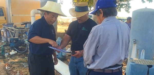
By listening to Southeast Asian farmers, Ruth Dahlquist-Willard and Michael Yang of UC Cooperative Extension were able to “lighten the load” for them by providing pragmatic support, Kearns writes.
“The scale of some of these highly emotional issues – drought, wildfires, climate change – can make them seem incredibly difficult, if not impossible, to deal with,” Kearns said. “At the same time, they are affecting everyone living in the western U.S. on a daily basis. I wanted to highlight and provide models based on work that people – whether they are researchers, clinical psychologists, or Cooperative Extension advisors – are doing right now to ease the way.”
The authors who contributed to the double issue are a diverse array of Tribal experts, academics, nongovernmental organization thought-leaders, water managers and water policy influencers, each of whom brings their own perspective on the topic of drought. Their expertise and perspectives in climate science, water policy and water management will help inform drought-related decision-making and support policies that better prepare the state to thrive during periods of prolonged water scarcity.
In addition to Kearns, the first issue includes articles contributed by:
- Samantha Stevenson, University of California, Santa Barbara
- Jay Lund, University of California, Davis
- Ron Goode, North Fork Mono Tribe
- Andy Fecko, Placer County Water Agency
- Jeff Mount, Public Policy Institute of California, and Ted Grantham, University of California, Berkeley/UC Cooperative Extension
- Nat Seavy and Karyn Stockdale, National Audubon Society
- Kjia Rivers, Community Water Center
- Cannon Michael, Bowles Farming
- Michelle Reimers, Turlock Irrigation District
The January/February edition of Water Resources IMPACT magazine can be accessed, free of charge, on the American Water Resources Association website at https://www.awra.org under “Publications.”
The second issue, to be published in March, will focus on drought response, considering the options for adaptation. This two-part series complements the Commission's work on strategies to protect communities and fish and wildlife in the event of a long-term drought.


