Posts Tagged: Kassim Al-Khatib
Diagnosing herbicide problems takes detective work

Field day offers examples, tips for solving the mystery
A grower applies an herbicide to his tomato plants, or thinks a neighbor's treatment is drifting over her almond trees. A short time later, the leaves start to bleach or shrivel. Was it the herbicide? Or maybe water stress? Soil nutrients? Perhaps an insect?
Figuring out the causes of crop problems takes detective work, and like solving any mystery, it starts with knowing the signs, gathering evidence and asking questions.
The Diagnosing Herbicide Symptoms field day at UC Davis was an opportunity to see, up close, the shriveled cotton, scorched corn and dying sunflowers that can result when herbicides are applied incorrectly. Using the right herbicide – in the right proportion, at the right time and in the right field – can make the difference between a thriving crop and a financial loss.

A top take-away to avoid problems: “Don't do stuff at night!” laughed Becky Wheeler-Dykes, a UC Cooperative Extension farm advisor attending the June 26 event to better serve growers in Glenn, Tehama and Colusa counties. “The packages look the same. People grab the wrong jug.” And then, disaster.
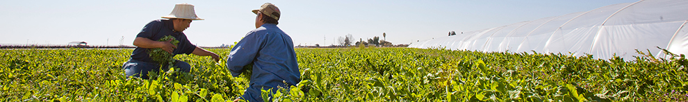
Instructors were Brad Hanson, professor of Cooperative Extension; and Kassim Al-Khatib, the Melvin D. Androus endowed professor for weed science; both in the Department of Plant Sciences. They were joined by John Roncoroni, a Cooperative Extension emeritus farm advisor rooted in the department's weed science program. Attendees were a mixture of people from agriculture, industry, government officials, university researchers and Cooperative Extension advisors. The event was hosted by the Weed Research and Information Center, based in the Department of Plant Sciences.

Out in a field west of campus, visitors could see the progression of damage, from control plots with green and healthy crops to plants that looked sadder as herbicide concentrations increased. Visitors could see the patterns of damage for common foliar chemicals such as glyphosate, paraquat, and 2,4-D, as well as soil-applied herbicides from several chemical classes.
“There's a lot of detective work,” said Stephen Chang, a master's student in Hanson's lab aiming for a career in Cooperative Extension. “For example, the company that makes the herbicide says there shouldn't be a problem, but the grower says, there is a problem. This course helps with developing the skills to figure out what happened.”
It might not be the herbicide at all
Detective work and problem-solving frame the approach, Hanson explained. The cause of crop damage can be simple or complex. Like a good mystery, what appears to be a clue can turn out to be a red herring. Professionals need to draw on their inner Sherlock Holmes to observe and document symptoms, look for patterns in the plants and in the field, ask questions, gather information about the larger environment and collect samples.
An herbicidal Agatha Christie would then suggest: What if it's not herbicide damage at all? Participants learned to consider the possibility of insects, pathogens and viruses, as well as problems with water, nutrients, soil condition and even root damage from cultivation practices.
Hanson recalled puzzling over symptoms he found in an orchard. The culprit? “A leaking natural gas line,” he said.
More resources for herbicide issues
Participants also heard from Molly Mathews, deputy agriculture commissioner from Yolo County, on how a field investigation is conducted. Lawyer Robert Davies, of Donahue Davies LLP in Folsom, outlined the basics of what happens when there are lawsuits related to crop damage from herbicide drift.

The Diagnosing Herbicide Symptoms field day is part of a larger program of education and outreach offered through the Weed RIC, said director Julia Stover-Blackburn. It was the first time the event has been offered since the COVID-19 pandemic, she added.
- For more information about field days and resources, visit the Weed RIC webpage.
- For a thorough discussion of herbicide symptoms, visit this page overseen by Al-Khatib and sponsored by University of California Agriculture and Natural Resources.
- This online course follows an earlier version of the Diagnosing Herbicide Symptoms field program.
This story was originally published on the UC Davis Department of Plant Sciences website.
Google Weed View? Professor trains computer to spot invasive weed

Algorithm for AI enables low-cost tracking of invasive plant
To manage johnsongrass, a noxious weed that crowds out cotton and sickens horses, farmers have tried herbicides, burning and hand-pulling. Now, researchers at University of California, Davis, have developed a more high-tech weapon against the invasive weed: artificial intelligence and machine learning.
Using photos from Google's Street View database, UC Davis researchers have tracked down over 2,000 cases of johnsongrass in the Western United States for a fraction of the cost and time that it would take to do drive-by or other in-person surveys. They call their tool Google Weed View.
The advancement could help land managers easily and quickly survey for other problem plants.
“Once the model is trained, you can just go and run it on millions of images from Google Street View,” said Mohsen Mesgaran, an assistant professor in the Department of Plant Sciences at UC Davis. “We have huge flexibility, and its capability can be scaled up very quickly.”
The technique can easily be extended to other plant species. All that is needed is to label the new item in Street View photos and train the algorithm to identify that object in the images.
By providing location information, Google Weed View also offers an opportunity to examine how climate affects the growth and spread of weeds and invasive plants at very large scales.
“I think it can be both useful for management and for people with interests in more basic questions in ecology,” Mesgaran said.

A colleague's query
Mesgaran began looking at using Google's photo database of roadways, streets and highways after Kassim Al-Khatib, a professor of Cooperative Extension in the same department, asked if he could survey Western states for johnsongrass.
Al-Khatib studies where johnsongrass grows, ways to manage it and how this perennial has evolved to be so prevalent and resilient. He's also working with scientists at the University of Georgia to decode the genome of johnsongrass, which is one of the top 10 most invasive weeds worldwide.
Johnsongrass can crowd out native plants, harbor pathogens and affect agriculture. It grows up to 7 feet tall with flowers that are green, violet, dark red or purplish brown depending on maturity, according to a UC Statewide Integrated Pest Management Program briefing page.
“Johnsongrass is a major weed not just in California but worldwide,” Al-Khatib said. “It's very difficult to control. It's a problem on vineyards. It's a problem for cultivated crops. It's a problem on orchards.”
Google Weed View allows for rapid, convenient scanning. It is continuously updated via everyday users with compatible cameras and images collected by Google. “Instead of a day of in-person driving, we can use AI to determine if johnsongrass is in a county or not,” Al-Khatib said.

Setting the parameters
To find the weeds, Mesgaran went to Google Street View, which hosts billions of panoramic photos. It didn't take long to find johnsongrass.
“The pictures are really good quality,” he said. “You can see plants and flowers.”
Street View's photos offer a 360-degree view, so in his request Mesgaran set parameters, based on street direction (bearing), to only see the side view. He also specified latitude and longitude, and other factors. To train the deep, or machine learning model, he chose Texas, where johnsongrass is prevalent.
A student sorted through over 20,000 images from that request to find pictures with johnsongrass and drew rectangular shapes around the weeds. They located 1,000 images.
The labeled photos were fed into a computer to train a deep learning algorithm capable of identifying johnsongrass in Google's images. The model was run again to capture potentially more images containing johnsongrass. These additional images were then labeled and used to further refine the model. With each iteration, the algorithm learned and became more accurate.
“This deep learning model was trained by these images,” Mesgaran said. “Once we had a semi-working model, we ran it against about 300,000 images.”
For Al-Khatib's request, researchers focused on 84,000 miles of main roads in California, Nevada, Oregon and Washington states. The team discovered 2,000 locations with johnsongrass.
Google Weed View cost less than $2,000 to purchase the images and teach the model. A traditional car survey to cover the same area would cost an estimated $40,000 in gas, hotel, food and other costs.
“In a matter of months, we came up with 2,000 records and I can do it for the whole U.S.,” Mesgaran said.
Next up? The entire United States.
This story was originally published on the UC Davis College of Agricultural and Environmental Sciences news site.
Climate-Change Resources
University of California UC ANR Green Blog (Climate Change and Other Topics) https://ucanr.edu/blogs/Green/index.cfm?tagname=climate%20change (full index)
Examples:
- Save Trees First: Tips to Keep Them Alive Under Drought https://ucanr.edu/b/~CdD
- Landscaping with Fire Exposure in Mind: https://ucanr.edu/b/~G4D
- Cities in California Inland Areas Must Make Street Tree Changes to adapt to Future Climate https://ucanr.edu/b/~oF7

Drought, Climate Change and California Water Management Ted Grantham, UC Cooperative Extension specialist (23 minutes) https://youtu.be/dlimj75Wn9Q
Climate Variability and Change: Trends and Impacts on CA Agriculture Tapan Pathak, UC Cooperative Extension specialist (24 minutes) https://youtu.be/bIHI0yqqQJc
California Institute for Water Resources (links to blogs, talks, podcasts, water experts, etc.) https://ciwr.ucanr.edu/California_Drought_Expertise/
UC ANR Wildfire Resources (publications, videos, etc.) https://ucanr.edu/News/For_the_media/Press_kits/Wildfire/ (main website)
-UC ANR Fire Resources and Information https://ucanr.edu/sites/fire/ (main website)
-Preparing Home Landscaping https://ucanr.edu/sites/fire/Prepare/Landscaping/
UC ANR Free Publications https://anrcatalog.ucanr.edu/ (main website)
- Benefits of Plants to Humans and Urban Ecosystems: https://anrcatalog.ucanr.edu/pdf/8726.pdf
-Keeping Plants Alive Under Drought and Water Restrictions (English version) https://anrcatalog.ucanr.edu/pdf/8553.pdf
(Spanish version) https://anrcatalog.ucanr.edu/pdf/8628.pdf
- Use of Graywater in Urban Landscapes https://anrcatalog.ucanr.edu/pdf/8536.pdf
- Sustainable Landscaping in California https://anrcatalog.ucanr.edu/pdf/8504.pdf
Other (Non-UC) Climate Change Resources
Urban Forests and Climate Change. Urban forests play an important role in climate change mitigation and adaptation. Active stewardship of a community's forestry assets can strengthen local resilience to climate change while creating more sustainable and desirable places to live. https://www.fs.usda.gov/ccrc/topics/urban-forests
Examining the Viability of Planting Trees to Mitigate Climate Change (plausible at the forest level) https://climate.nasa.gov/news/2927/examining-the-viability-of-planting-trees-to-help-mitigate-climate-change/
Reports and other information resources coordinated under the auspices of the United Nations and produced through the collaboration of thousands of international scientists to provide a clear and up to date view of the current state of scientific knowledge relevant to climate change. United Nations Climate Action
Scientific reports, programs, action movements and events related to climate change. National Center for Atmospheric Research (National Science Foundation)
Find useful reports, program information and other documents resulting from federally funded research and development into the behavior of the atmosphere and related physical, biological and social systems. Search and find climate data from prehistory through to an hour ago in the world's largest climate data archive. (Formerly the "Climatic Data Center") National Centers for Environmental Information (NOAA)
Think tank providing information, analysis, policy and solution development for addressing climate change and energy issues (formerly known as the: "Pew Center on Global Climate Change"). Center for Climate & Energy Solutions (C2ES)
Mapping Resilience: A Blueprint for Thriving in the Face of Climate Disaster. The Climate Adaptation Knowledge Exchange (CAKE) was launched in July 2010 and is managed by EcoAdapt, a non-profit with a singular mission: to create a robust future in the face of climate change by bringing together diverse players to reshape planning and management in response to rapid climate change. https://www.cakex.org/documents/mapping-resilience-blueprint-thriving-face-climate-disaster
Cal-Adapt provides a way to explore peer-reviewed data that portrays how climate change might affect California at the state and local level. We make this data available through downloads, visualizations, and the Cal-Adapt API for your research, outreach, and adaptation planning needs. Cal-Adapt is a collaboration between state agency funding programs, university and private sector researchers https://cal-adapt.org/
Find reports, maps, data and other resources produced through a confederation of the research arms of 13 Federal departments and agencies that carry out research and develop and maintain capabilities that support the Nation's response to global change. Global Change (U.S. Global Change Research Program)
The Pacific Institute is a global water think tank that combines science-based thought leadership with active outreach to influence local, national, and international efforts to develop sustainable water policies. https://pacinst.org/our-approach/
Making equity real in climate adaptation and community resilience policies and programs: a guidebook. https://greenlining.org/publications/2019/making-equity-real-in-climate-adaption-and-community-resilience-policies-and-programs-a-guidebook/
Quarterly CA Climate Updates and CA Drought Monitor Maps (updated each Thursday) https://www.drought.gov/documents/quarterly-climate-impacts-and-outlook-western-region-june-2022
Drought focus of Water Resources IMPACT magazine special issue

UC ANR experts address emotional toll of drought
Preparing the American West for prolonged drought is the focus of a double issue of Water Resources IMPACT magazine. The California Water Commission staff are guest editors for this special open-access edition of the magazine, which is published by the American Water Resources Association.
Faith Kearns, academic coordinator of University of California Agriculture and Natural Resources' California Institute for Water Resources, is among the authors delving into how drought impacts people and the environment and how we can better prepare for the inevitable.
The first issue, published on Feb. 14, focuses on water scarcity issues confronting California and the ways these issues affect different sectors.
In “Trauma, Care, and Solidarity: Addressing the Emotional Toll of Chronic Drought,” Kearns highlights the effects of drought on mental health. She points to the spike in suicide hotline calls when wells ran dry in Southeast Asian communities in California's Central Valley.
By listening to Southeast Asian farmers, Ruth Dahlquist-Willard and Michael Yang of UC Cooperative Extension were able to “lighten the load” for them by providing pragmatic support, Kearns writes.
“The scale of some of these highly emotional issues – drought, wildfires, climate change – can make them seem incredibly difficult, if not impossible, to deal with,” Kearns said. “At the same time, they are affecting everyone living in the western U.S. on a daily basis. I wanted to highlight and provide models based on work that people – whether they are researchers, clinical psychologists, or Cooperative Extension advisors – are doing right now to ease the way.”
The authors who contributed to the double issue are a diverse array of Tribal experts, academics, nongovernmental organization thought-leaders, water managers and water policy influencers, each of whom brings their own perspective on the topic of drought. Their expertise and perspectives in climate science, water policy and water management will help inform drought-related decision-making and support policies that better prepare the state to thrive during periods of prolonged water scarcity.

In addition to Kearns, the first issue includes articles contributed by:
- Samantha Stevenson, University of California, Santa Barbara
- Jay Lund, University of California, Davis
- Ron Goode, North Fork Mono Tribe
- Andy Fecko, Placer County Water Agency
- Jeff Mount, Public Policy Institute of California, and Ted Grantham, University of California, Berkeley/UC Cooperative Extension
- Nat Seavy and Karyn Stockdale, National Audubon Society
- Kjia Rivers, Community Water Center
- Cannon Michael, Bowles Farming
- Michelle Reimers, Turlock Irrigation District
The January/February edition of Water Resources IMPACT magazine can be accessed, free of charge, on the American Water Resources Association website at https://www.awra.org under “Publications.”
The second issue, to be published in March, will focus on drought response, considering the options for adaptation. This two-part series complements the Commission's work on strategies to protect communities and fish and wildlife in the event of a long-term drought.
Your water-efficient landscape doesn’t have to be barren

UC climate-ready landscape trials identify low-water yet attractive plants
Good news: roses can be a part of your water-efficient landscape. Lorence Oki, UC Cooperative Extension environmental horticulture specialist in the UC Davis Department of Plant Sciences, identified rose cultivars that remain aesthetically pleasing with little water.
Oki is the principal investigator of the Climate-Ready Landscape Plants project, which may be the largest irrigation trial in the western U.S., and the UC Plant Landscape Irrigation Trials (UCLPIT), the California component of that project. These projects evaluate landscape plants under varying irrigation levels to determine their optimal performance in regions requiring supplemental summer water.
“There are some assumptions that pretty plants use a lot of water, like roses,” Oki said. “Everyone thinks they need a lot of water, but we've found some that don't, and they still look great. A water-efficient landscape doesn't need to look like a Central Valley oak-grassland in the summer. It can look really attractive.”
In 2021, Oki's team at UC Davis identified Lomandra confertifolia ssp. pallida "Pom Pom" Shorty and Rosa "Sprogreatpink" Brick House® Pink as two of the best low-water plants in the trial.

“The useful tip or information that is shared at the end of each trial is the selection and designation of plants as Blue Ribbon winners. These are the plants that looked good with an overall rating of 4 or higher throughout and were on the low (20%) water treatment,” said Natalie Levy, associate specialist for water resources, who manages the project at the UC ANR South Coast Research and Extension Center.
How plants earn a blue ribbon
Each trial year, the selection of new plants is based on research recommendations and donated submissions from the nursery industry. The landscape plants are trialed in full sun or 50% shade cover.
Irrigation treatments are based on the rate of evaporation and plant transpiration (evapotranspiration) measured through a local California Irrigation Management Information System (CIMIS) weather station that provides a reference evapotranspiration (ETo) rate.
Three levels of irrigation are provided to the plants equal to 20%, 50%, and 80% of ETo. The volume of water applied is the same at each irrigation based on soil characteristics, but the interval between applications varies with weather and the treatment. Using this method, irrigations for the 20% treatment are less frequent than the 80% treatment.
“The 20% treatment during the 2022 trial was irrigated an average of once per month while the 80% treatment was irrigated weekly,” explained Levy.
During the deficit irrigation trial, monthly height and width measurements are taken to determine the plant growth index. Monthly qualitative aesthetic ratings on a scale of 1 to 5 are determined for foliage appearance, flowering abundance, pest tolerance, disease resistance, vigor and overall appearance.
A second round of flowering abundance and overall appearance measurements are also taken to capture more of the blooming period. For example, UCLPIT identified in the 2020 trial at South Coast REC that the "Apricot Drift" rose had a mean overall appearance score of 3.5 out of 5, deeming it “acceptable to very nice” and a low water use plant within the Water Use Classification of Landscape Species or WUCOLS guide.
Project expands options for landscape planting

“(WUCOLS) only has 3,500 plants in it. There are guesses that there are close to 10,000 cultivars in urban landscapes in California, if not more,” said Oki. “WUCOLS also didn't have numerical ratings. Instead, you'll see verbal ratings like ‘low water use' or ‘high water use.'”
The UCLPIT project has not only developed numerical recommendations for irrigation, but it has also added new landscape plants that are compliant with California's Model Water Efficient Landscape Ordinance. In fact, UCLPIT's data is one of the few sources that can be used to supplement WUCOLS.
Geographic diversity of trial sites adds to knowledge base
In addition to UC Davis and South Coast REC in Irvine, the trials have expanded beyond California as the Climate-Ready Landscape Plants project and is in progress at Oregon State University, University of Washington, University of Arizona and Utah State University thanks to a USDA/CDFA grant awarded in 2020.
Lloyd Nackley, associate professor of nursery production and greenhouse management at Oregon State University, is the principal investigator of the trial in the Portland metro area, which is entering its third year.
“People know that there are drought tolerant plants, but there are many. We're trying to highlight lesser known or newer varieties. And even though the trial is three years, most gardeners would hope that their garden lasts longer than that,” said Nackley.
One of the observations that Nackley recalls is of the Hibiscus Purple Pillar plant. Unlike the trial at South Coast, the Purple Pillar did not perform well in Oregon in the spring.
“It wasn't until August that we saw the plant bloom and begin to look like what we saw from South Coast in April,” Nackley said.

Ursula Schuch, horticulture professor and principal investigator of the trial taking place at the University of Arizona, was also surprised at the range of performance among different plant types and the effects of irrigation, heat and temperature.
“This research will reassure green industry professionals that they can stretch their water budget to successfully cultivate more plants, watering them according to their needs instead of irrigating every plant according to the highest water-using plants,” said Schuch.
Although research is only conducted in the West, the hope is that there will be trials in other regions of U.S.
Doing so would yield comprehensive information about the plants and their performance in different climates. As extreme weather events persist in the U.S., disease pressure and risks do too. Trials throughout the country would provide location-specific data regarding disease susceptibility.
To learn more about the UCLPIT research project, visit https://ucanr.edu/sites/UCLPIT/
