Posts Tagged: Monterey
Lawn-pocalypse! Surviving Drought
Ah, summer! The season of sunburns, pool parties, and… lawn droughts. If your once lush, green carpet now looks like a crunchy brown doormat, you're not alone. Let's dive into why your yard is staging a dramatic death scene and what you can do to...

Bermuda grass and weeds overtaking drought stressed turf grass.
Fueling community knowledge: A conversation with UC ANR Fire Advisor Barb Satink Wolfson
In the wake of California's increasing wildfire concerns, UC ANR has made a concerted push to expand their fire network by hiring more academic advisors like...
Analysis of Sediments Deposited by 2023 Floods in the Salinas Valley
Richard Smith, Joji Muramoto, Tim Hartz and Michael Cahn
UCCE Emeritus Farm Advisor, Extension Specialist, Emeritus, Extension Specialist and Irrigation and Water Resources Farm Advisor.
The winter of 2023 had the highest rainfall years in the last 25 years. The high rainfall resulted in flooding onto farmland along the main branch of the Salinas River in both January and March. The flood waters disrupted planting schedules as well as inundated established plantings resulting in a disruption to the beginning of the vegetable production season.
The river also deposited a layer of sediments in flooded fields (Photo 1). The sediments came from several sources: river sediments from as far away as San Luis Obispo County; sediments from side channels; and soil sediments scoured from upstream farms. Several growers and industry personnel have asked what is the composition of these sediments? In April after the flooding had subsided, we collected samples at river crossings from San Lucas to Salinas. The layer of sediment left by the flood waters tended to curled up as it dried out and were easy to collect. Any field soil was brushed from the bottom of the sediments and they were sent to the UC Davis Analytical Laboratory for analysis.
Tables 1 and 2 have analysis of the sediments collected. The data in the table is arranged with sites from south to north; the two side channels, Arroyo Seco and Monroe Canyon are listed separately. Monroe Canyon is the drainage that comes from the west side of Hwy 101 just south of the intersection of Hwy 101 and Central Avenue north of King City; it cuts through a large section of the Monterey shale formation that contains elevated levels of cadmium.
The San Lucas, Arroyo Seco and Monroe Canyon samples are coarser indicating that they were transported by rapid water movement, while the rest of the samples are dominated by silts and clays, indicating that they were transported by slower moving water. In general, there is a good correlation between the clay content of the sediments and nutrient and organic matter content. Higher nutrients in the silt and clay sediments include total nitrogen, calcium, magnesium, sulfate, zinc and iron. The sediments are generally fertile which may indicate that they are at least partially composed of soil eroded from farmed fields farther upstream. Sediments that are low in phosphorus likely originated from non-farmed or vineyard areas.
The elevated cadmium levels measured in sediments from the Arroyo Seco and Monroe Canyon indicate that these side channels carried sediments from the Monterey shale formation which has naturally high levels of cadmium into the Salinas River. Presumably these sediments originating in the Monterey shale formation are transported to areas further downstream by flood waters.
Photo 1. Sediments deposited in a field along the Salinas River
Table 1. Analysis of river sediment samples from locations from San Lucas to Salinas and two side channel locations.
Table 2. Analysis of river sediment samples from locations from San Lucas to Salinas and two side channel locations.
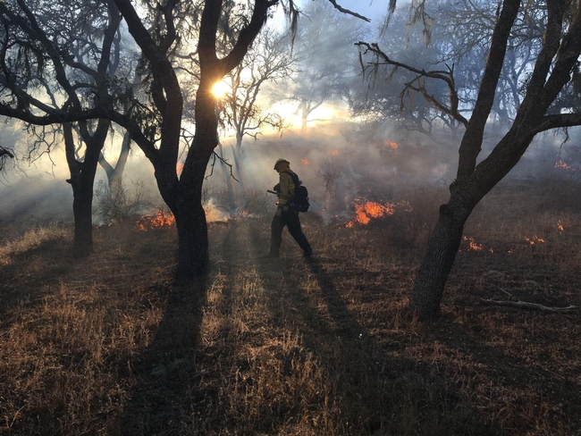
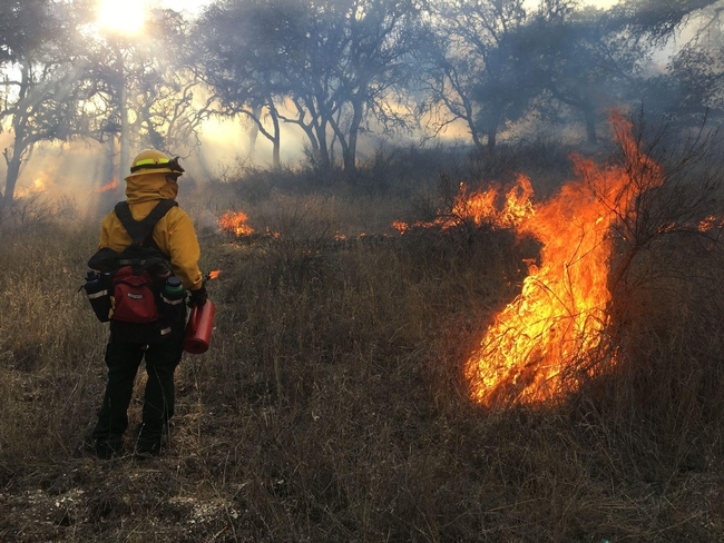
Public invited to observe prescribed fire training June 4-9
The Monterey Bay area will host part of the first California Central Coast Prescribed Fire Training Exchange, or Cal-TREX.
Fire practitioners from across the state, greater North America and international locations (Spain, Honduras, Costa Rica, Ecuador) are gathering for a Prescribed Fire Training Exchange on June 3-10.
The training is hosted by the Central Coast Prescribed Burn Association, which empowers the public to build a culture of “good fire” and helps private landowners conduct prescribed burns in Monterey, San Benito and Santa Cruz counties.
Prescribed burns will be open for the public to observe on various days throughout the training, most likely June 4-9, depending on the weather. Please see the CCPBA webpage for updates on upcoming burns: http://calpba.org/centralcoastpba.
Prescribed Fire Training Exchanges (TREX) first came to Northern California in 2013, and have made a dynamic, positive cultural shift concerning prescribed fire, within both regional fire services and the general public. These “good fire” TREX events have drawn significant attention, especially in the context of more severe wildfire seasons.
After months of cross-organizational cooperative planning, participants in the weeklong training will be burning a mix of grassland, oak woodland and shrub vegetation types, and make a lasting, positive change concerning “good fire” on the Central Coast.
The TREX will provide experiential training opportunities to advance regional prescribed fire capacity, while also enhancing research to better understand the ecological response of wild plant and animal species following fire.
At this TREX event, participants will learn how to safely conduct prescribed burns in various vegetation types across three counties. Along with multiple prescribed burns, the weeklong program will include lectures and seminars on local fire ecology of plant and animal species, tribal burning practices and burn planning led by multiple burn bosses and other experts.
Burn locations may include the Nyland property (owned by Trust for Public Land and San Benito Agricultural Land Trust) near San Juan Bautista, the Santa Lucia Conservancy near Carmel Valley and the Kechun Village (owned by the Nason family) in Arroyo Seco.
Be advised, while the CCTREX works closely with the Monterey Bay Air Resources District (MBARD) to assure good smoke dispersal, smoke may be seen and present in these areas during and after a burn. Please see the CCPBA webpage for updates on upcoming burns: http://calpba.org/centralcoastpba.
BurnBot, a new technology featuring a mobile burn chamber, remote-controlled mastication and fire drone systems, will be used for the prescribed burn on June 4. To observe the Nyland burn on June 4, register at https://bit.ly/CCPBApublicRxfire. Details including time and directions will be emailed to registered participants.
Participants and partners include members of the Amah Mutsun Tribal Band and the Esselen Tribe of Monterey County, University of California Agriculture and Natural Resources, Resource Conservation District of Monterey County, CAL FIRE, local land trusts, scientists, ranchers, students, researchers, land managers and others. The CCPBA is funded by two CAL FIRE wildfire prevention grants.
For more information, contact Jamie Tuitele-Lewis, fire fuel mitigation program and forest health coordinator, at jtlewis@rcdmonterey.org or Barb Satink Wolfson, UC Cooperative Extension area fire advisor, at bsatinkwolfson@ucanr.edu.
Climate-Change Resources
University of California UC ANR Green Blog (Climate Change and Other Topics) https://ucanr.edu/blogs/Green/index.cfm?tagname=climate%20change (full index)
Examples:
- Save Trees First: Tips to Keep Them Alive Under Drought https://ucanr.edu/b/~CdD
- Landscaping with Fire Exposure in Mind: https://ucanr.edu/b/~G4D
- Cities in California Inland Areas Must Make Street Tree Changes to adapt to Future Climate https://ucanr.edu/b/~oF7
Drought, Climate Change and California Water Management Ted Grantham, UC Cooperative Extension specialist (23 minutes) https://youtu.be/dlimj75Wn9Q
Climate Variability and Change: Trends and Impacts on CA Agriculture Tapan Pathak, UC Cooperative Extension specialist (24 minutes) https://youtu.be/bIHI0yqqQJc
California Institute for Water Resources (links to blogs, talks, podcasts, water experts, etc.) https://ciwr.ucanr.edu/California_Drought_Expertise/
UC ANR Wildfire Resources (publications, videos, etc.) https://ucanr.edu/News/For_the_media/Press_kits/Wildfire/ (main website)
-UC ANR Fire Resources and Information https://ucanr.edu/sites/fire/ (main website)
-Preparing Home Landscaping https://ucanr.edu/sites/fire/Prepare/Landscaping/
UC ANR Free Publications https://anrcatalog.ucanr.edu/ (main website)
- Benefits of Plants to Humans and Urban Ecosystems: https://anrcatalog.ucanr.edu/pdf/8726.pdf
-Keeping Plants Alive Under Drought and Water Restrictions (English version) https://anrcatalog.ucanr.edu/pdf/8553.pdf
(Spanish version) https://anrcatalog.ucanr.edu/pdf/8628.pdf
- Use of Graywater in Urban Landscapes https://anrcatalog.ucanr.edu/pdf/8536.pdf
- Sustainable Landscaping in California https://anrcatalog.ucanr.edu/pdf/8504.pdf
Other (Non-UC) Climate Change Resources
Urban Forests and Climate Change. Urban forests play an important role in climate change mitigation and adaptation. Active stewardship of a community's forestry assets can strengthen local resilience to climate change while creating more sustainable and desirable places to live. https://www.fs.usda.gov/ccrc/topics/urban-forests
Examining the Viability of Planting Trees to Mitigate Climate Change (plausible at the forest level) https://climate.nasa.gov/news/2927/examining-the-viability-of-planting-trees-to-help-mitigate-climate-change/
Reports and other information resources coordinated under the auspices of the United Nations and produced through the collaboration of thousands of international scientists to provide a clear and up to date view of the current state of scientific knowledge relevant to climate change. United Nations Climate Action
Scientific reports, programs, action movements and events related to climate change. National Center for Atmospheric Research (National Science Foundation)
Find useful reports, program information and other documents resulting from federally funded research and development into the behavior of the atmosphere and related physical, biological and social systems. Search and find climate data from prehistory through to an hour ago in the world's largest climate data archive. (Formerly the "Climatic Data Center") National Centers for Environmental Information (NOAA)
Think tank providing information, analysis, policy and solution development for addressing climate change and energy issues (formerly known as the: "Pew Center on Global Climate Change"). Center for Climate & Energy Solutions (C2ES)
Mapping Resilience: A Blueprint for Thriving in the Face of Climate Disaster. The Climate Adaptation Knowledge Exchange (CAKE) was launched in July 2010 and is managed by EcoAdapt, a non-profit with a singular mission: to create a robust future in the face of climate change by bringing together diverse players to reshape planning and management in response to rapid climate change. https://www.cakex.org/documents/mapping-resilience-blueprint-thriving-face-climate-disaster
Cal-Adapt provides a way to explore peer-reviewed data that portrays how climate change might affect California at the state and local level. We make this data available through downloads, visualizations, and the Cal-Adapt API for your research, outreach, and adaptation planning needs. Cal-Adapt is a collaboration between state agency funding programs, university and private sector researchers https://cal-adapt.org/
Find reports, maps, data and other resources produced through a confederation of the research arms of 13 Federal departments and agencies that carry out research and develop and maintain capabilities that support the Nation's response to global change. Global Change (U.S. Global Change Research Program)
The Pacific Institute is a global water think tank that combines science-based thought leadership with active outreach to influence local, national, and international efforts to develop sustainable water policies. https://pacinst.org/our-approach/
Making equity real in climate adaptation and community resilience policies and programs: a guidebook. https://greenlining.org/publications/2019/making-equity-real-in-climate-adaption-and-community-resilience-policies-and-programs-a-guidebook/
Quarterly CA Climate Updates and CA Drought Monitor Maps (updated each Thursday) https://www.drought.gov/documents/quarterly-climate-impacts-and-outlook-western-region-june-2022


