Posts Tagged: UAS
Ag from Above x Ag for All (AFA2)
IGIS is proud to announce its collaboration with 4H on a new and exciting, three-year, USDA-funded grant, Ag from Above x Ag for All (AFA2), aimed at sparking interest in food and agriculture among teenagers by using cutting-edge drone and mapping technologies. By blending hands-on activities with real-world applications, AFA2 empowers young people to explore the science behind agriculture in fun and meaningful ways. AFA2 is not just about teaching technology—it's about using that technology to make a real difference in communities and ensuring that the next generation of agricultural scientists and leaders is diverse, skilled, and ready to take on the challenges of the future.
Period: 3-years from August 1, 2024 to July 31, 2027.
Tasks: Develop, test, and evaluate two curricula, SkyMappers: Agricultural Drones and GIS Mastery, Dronovation: Cultivating Change with Teens, and prepare an educator professional development guide.
Who It's For: This project targets teenagers aged 13 to 18, with special attention to including girls and Latino youth—groups often underrepresented in STEM fields.
Why It Matters: The future of farming and food production will increasingly rely on technology. By engaging young people with drones and GIS, AFA2 aims to build their scientific literacy and interest in agriculture, while also preparing them for future careers in these vital fields. Additionally, by focusing on food justice and culturally relevant learning, we aim to empower all young people to see themselves as future leaders in science and agriculture.
Our Partners: University of California's Cooperative Extension, 4-H Youth Development Program, Informatics and GIS Program, the UC Santa Cruz CITRIS Initiative for Drone Education and Research, and the UC Davis AI Institute for Next Generation Food Systems.
- PI: Steven Worker, 4-H Youth Development Advisor (Sonoma)
- Co-PI: Nathaniel Caeton, 4-H Youth Development Advisor (Shasta)
- Co-PI: Matthew Rodriguez, 4-H Youth Development Advisor (Placer)
- Co-PI: Andy Lyons, IGIS Program Coordinator (UC Berkeley)
- Co-PI: Sean Hogan, IGIS Academic Coordinator (Davis)
- Collaborator: Flavie Audoin, Rangeland Management Extension Specialist (Univ. of Arizona)
- Collaborator: Lucy Diekmann, Urban Agriculture/Food System Advisor (Santa Clara)
- Collaborator: Becca Fenwick, Director, CITRIS Initiative for Drone Education and Research (UCSC)
Lawn-pocalypse! Surviving Drought
Ah, summer! The season of sunburns, pool parties, and… lawn droughts. If your once lush, green carpet now looks like a crunchy brown doormat, you're not alone. Let's dive into why your yard is staging a dramatic death scene and what you can do to...

Bermuda grass and weeds overtaking drought stressed turf grass.
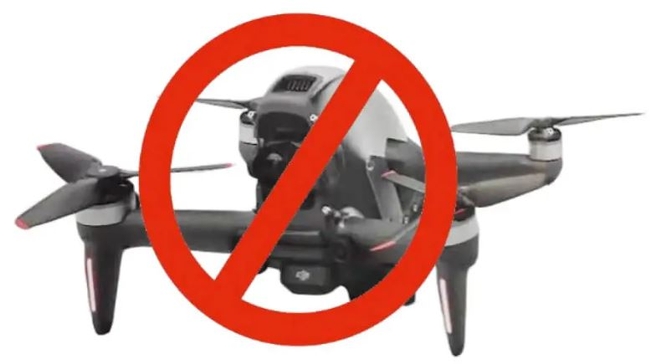
New Drone Restrictions Coming - The National Defense Authorization Act of 2024
There is some potentially big news for drone users within the university systems that came out last week. Congress passed the National Defense Authorization Act of 2024 on Thursday December 14th, which includes provisions restricting the use of Chinese drones in connection with almost all federal grant funding. This bill will very likely be signed by the President later in the year, and while there could still be some adjustments, as the bill pertains to drones, any forthcoming changes are very unlikely at this point.
Specifically, Title 18, Subtitle B, Sections 1821-1833 will prohibit all Federal Agencies from purchasing any drone made in China, and will sunset all operations of Chinese drones in two (2) years. This will apply to all federal grants (Section 1825). Beginning two years after the enactment of this Act, except as provided in subsection (b) pertaining to the one exception of the National Oceanic and Atmospheric Administration (NOAA), no Federal funds awarded through a contract, grant, or cooperative agreement, or otherwise made available may be used to procure a covered unmanned aircraft system that is manufactured or assembled in China; or in connection with the operation of such a drone or unmanned aircraft system.
This legislation also requires the development of new federal wide policy on the purchase of drones (including grants/contracts). Likely this will be some version of the BlueSUAS list (vetted by DoD for security) that will be the new standard. We will have to wait and see how this unfolds.
For now, assuming the current NDAA compliance requirements, we only have the following platform recommendations for multispectral/photogrammetry operations using federal funds. However, hopefully new authorized technology will be forthcoming soon.
- eBee X (~$13k) fixed-wing, Cat 3 OOP, but requires laptop in field
- Wingtra Gen II (~$36k), VTOL with forward flight
- Freefly Astro (~$32k mapping package), multi-rotor, 1.5kg payload capacity
- Aurelia X6 Pro V2 (~$22k NDAA compliant package, no payload), 6kg payload capacity
For more information, please consider signing up for office hours with the UC ANR IGIS Statewide Program:
https://igis.ucanr.edu/Office_Hours/
or refer to resources through UC Unmanned Aircraft System Safety site:
https://www.ucop.edu/safety-and-loss-prevention/environmental/program-resources/unmanned-aircraft-systems-safety.html
California Rural Central Valley Cellular Broadband Speed Tests
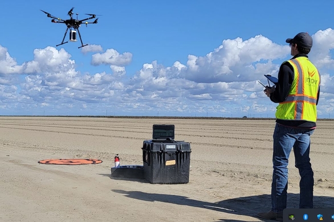
In the past year IGIS has had the pleasure to work with Juniper Unmanned inc. to undertake a proof of concept project interested in mapping cellular broadband speeds at four agricultural sites in the rural Central Valley of California, using a drone equipped to spatially record cellular network speeds for ATT, Verizon and T-Mobile cell phone carriers. Information of this type may be useful for future smart-farming efforts, including allocations of resources and the potential placement of cellular antennas on farms in the future.
For more information, please see the following StoryMap, which reports the project's findings: https://storymaps.arcgis.com/stories/d1f34c829c104c9d9bb0ed4536f39e03
Climate-Change Resources
University of California UC ANR Green Blog (Climate Change and Other Topics) https://ucanr.edu/blogs/Green/index.cfm?tagname=climate%20change (full index)
Examples:
- Save Trees First: Tips to Keep Them Alive Under Drought https://ucanr.edu/b/~CdD
- Landscaping with Fire Exposure in Mind: https://ucanr.edu/b/~G4D
- Cities in California Inland Areas Must Make Street Tree Changes to adapt to Future Climate https://ucanr.edu/b/~oF7
Drought, Climate Change and California Water Management Ted Grantham, UC Cooperative Extension specialist (23 minutes) https://youtu.be/dlimj75Wn9Q
Climate Variability and Change: Trends and Impacts on CA Agriculture Tapan Pathak, UC Cooperative Extension specialist (24 minutes) https://youtu.be/bIHI0yqqQJc
California Institute for Water Resources (links to blogs, talks, podcasts, water experts, etc.) https://ciwr.ucanr.edu/California_Drought_Expertise/
UC ANR Wildfire Resources (publications, videos, etc.) https://ucanr.edu/News/For_the_media/Press_kits/Wildfire/ (main website)
-UC ANR Fire Resources and Information https://ucanr.edu/sites/fire/ (main website)
-Preparing Home Landscaping https://ucanr.edu/sites/fire/Prepare/Landscaping/
UC ANR Free Publications https://anrcatalog.ucanr.edu/ (main website)
- Benefits of Plants to Humans and Urban Ecosystems: https://anrcatalog.ucanr.edu/pdf/8726.pdf
-Keeping Plants Alive Under Drought and Water Restrictions (English version) https://anrcatalog.ucanr.edu/pdf/8553.pdf
(Spanish version) https://anrcatalog.ucanr.edu/pdf/8628.pdf
- Use of Graywater in Urban Landscapes https://anrcatalog.ucanr.edu/pdf/8536.pdf
- Sustainable Landscaping in California https://anrcatalog.ucanr.edu/pdf/8504.pdf
Other (Non-UC) Climate Change Resources
Urban Forests and Climate Change. Urban forests play an important role in climate change mitigation and adaptation. Active stewardship of a community's forestry assets can strengthen local resilience to climate change while creating more sustainable and desirable places to live. https://www.fs.usda.gov/ccrc/topics/urban-forests
Examining the Viability of Planting Trees to Mitigate Climate Change (plausible at the forest level) https://climate.nasa.gov/news/2927/examining-the-viability-of-planting-trees-to-help-mitigate-climate-change/
Reports and other information resources coordinated under the auspices of the United Nations and produced through the collaboration of thousands of international scientists to provide a clear and up to date view of the current state of scientific knowledge relevant to climate change. United Nations Climate Action
Scientific reports, programs, action movements and events related to climate change. National Center for Atmospheric Research (National Science Foundation)
Find useful reports, program information and other documents resulting from federally funded research and development into the behavior of the atmosphere and related physical, biological and social systems. Search and find climate data from prehistory through to an hour ago in the world's largest climate data archive. (Formerly the "Climatic Data Center") National Centers for Environmental Information (NOAA)
Think tank providing information, analysis, policy and solution development for addressing climate change and energy issues (formerly known as the: "Pew Center on Global Climate Change"). Center for Climate & Energy Solutions (C2ES)
Mapping Resilience: A Blueprint for Thriving in the Face of Climate Disaster. The Climate Adaptation Knowledge Exchange (CAKE) was launched in July 2010 and is managed by EcoAdapt, a non-profit with a singular mission: to create a robust future in the face of climate change by bringing together diverse players to reshape planning and management in response to rapid climate change. https://www.cakex.org/documents/mapping-resilience-blueprint-thriving-face-climate-disaster
Cal-Adapt provides a way to explore peer-reviewed data that portrays how climate change might affect California at the state and local level. We make this data available through downloads, visualizations, and the Cal-Adapt API for your research, outreach, and adaptation planning needs. Cal-Adapt is a collaboration between state agency funding programs, university and private sector researchers https://cal-adapt.org/
Find reports, maps, data and other resources produced through a confederation of the research arms of 13 Federal departments and agencies that carry out research and develop and maintain capabilities that support the Nation's response to global change. Global Change (U.S. Global Change Research Program)
The Pacific Institute is a global water think tank that combines science-based thought leadership with active outreach to influence local, national, and international efforts to develop sustainable water policies. https://pacinst.org/our-approach/
Making equity real in climate adaptation and community resilience policies and programs: a guidebook. https://greenlining.org/publications/2019/making-equity-real-in-climate-adaption-and-community-resilience-policies-and-programs-a-guidebook/
Quarterly CA Climate Updates and CA Drought Monitor Maps (updated each Thursday) https://www.drought.gov/documents/quarterly-climate-impacts-and-outlook-western-region-june-2022


