Posts Tagged: drone
Ag from Above x Ag for All (AFA2)
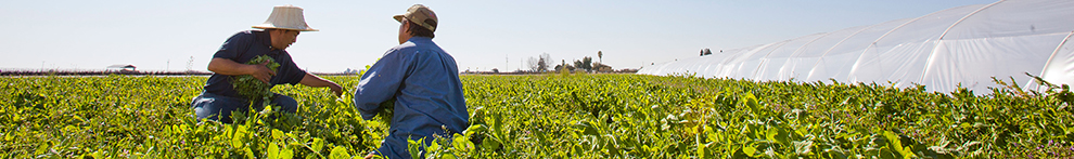
IGIS is proud to announce its collaboration with 4H on a new and exciting, three-year, USDA-funded grant, Ag from Above x Ag for All (AFA2), aimed at sparking interest in food and agriculture among teenagers by using cutting-edge drone and mapping technologies. By blending hands-on activities with real-world applications, AFA2 empowers young people to explore the science behind agriculture in fun and meaningful ways. AFA2 is not just about teaching technology—it's about using that technology to make a real difference in communities and ensuring that the next generation of agricultural scientists and leaders is diverse, skilled, and ready to take on the challenges of the future.
Period: 3-years from August 1, 2024 to July 31, 2027.
Tasks: Develop, test, and evaluate two curricula, SkyMappers: Agricultural Drones and GIS Mastery, Dronovation: Cultivating Change with Teens, and prepare an educator professional development guide.
Who It's For: This project targets teenagers aged 13 to 18, with special attention to including girls and Latino youth—groups often underrepresented in STEM fields.
Why It Matters: The future of farming and food production will increasingly rely on technology. By engaging young people with drones and GIS, AFA2 aims to build their scientific literacy and interest in agriculture, while also preparing them for future careers in these vital fields. Additionally, by focusing on food justice and culturally relevant learning, we aim to empower all young people to see themselves as future leaders in science and agriculture.
Our Partners: University of California's Cooperative Extension, 4-H Youth Development Program, Informatics and GIS Program, the UC Santa Cruz CITRIS Initiative for Drone Education and Research, and the UC Davis AI Institute for Next Generation Food Systems.
- PI: Steven Worker, 4-H Youth Development Advisor (Sonoma)
- Co-PI: Nathaniel Caeton, 4-H Youth Development Advisor (Shasta)
- Co-PI: Matthew Rodriguez, 4-H Youth Development Advisor (Placer)
- Co-PI: Andy Lyons, IGIS Program Coordinator (UC Berkeley)
- Co-PI: Sean Hogan, IGIS Academic Coordinator (Davis)
- Collaborator: Flavie Audoin, Rangeland Management Extension Specialist (Univ. of Arizona)
- Collaborator: Lucy Diekmann, Urban Agriculture/Food System Advisor (Santa Clara)
- Collaborator: Becca Fenwick, Director, CITRIS Initiative for Drone Education and Research (UCSC)

Lawn-pocalypse! Surviving Drought
Ah, summer! The season of sunburns, pool parties, and… lawn droughts. If your once lush, green carpet now looks like a crunchy brown doormat, you're not alone. Let's dive into why your yard is staging a dramatic death scene and what you can do to...

Bermuda grass and weeds overtaking drought stressed turf grass.
Predators by drone: Biological control research
Two of the worst pests plaguing lettuce growers in the Salinas Valley area are aphids, specifically lettuce-currant aphids (Nasovonia ribisnigri), and western flower thrips (Frankliniella occidentalis). Lettuce-currant aphid is an invasive pest that sets up shop in the heart of the lettuce plant and will render the crop unsellable when it reaches high enough numbers. Thrips can both cause cosmetic damage to lettuce crops and are also responsible for the spread of Salinas impatiens necrotic spot virus (INSV), the fatal lettuce disease that has driven large losses since the 2020 growing season.
While effective tools exist to control both aphids and thrips, they are almost exclusively chemical. Chemical sprays are increasingly under pressure due to changes in the regulatory framework in California as well as the development of pest resistance and discoveries of key chemistries in area watersheds1,2. The UC Davis FiVE lab biological control research program addresses a growing interest in developing alternative tools for managing both pests that do not rely on chemical applications. Biological control provides an opportunity for the management of thrips and aphids that do not rely on chemical tools.
Biological control is defined as the use of natural enemies to control a target pest. Three general categories of biological control could possibly be used as management practices for lettuce pests in the Salinas Valley area:
• Conservation biological control refers to the establishment and maintenance of resources and conditions favorable
")
• Inundative biological control involves the release of a beneficial insect species in large numbers with the expectation that the beneficials that are released will only provide control for a short amount of time before eventually dying out. Such releases would need to be repeated at regular intervals for the duration of the growing cycle for a crop.
• Augmentative biological control refers to the use of releases of smaller numbers of beneficials to areas where a smaller population of the species already exists, but not in numbers great enough to provide adequate control of the targeted pest species. The goal of augmentative releases is to bolster already-existent populations of beneficial species so they achieve great enough numbers to provide control of the pest or pests of interest.
Conservation biological control in the Salinas Valley
Syrphid flies
Aphid pests of lettuce have been effectively managed in some lettuce production systems through the planting of sweet alyssum adjacent to and interspersed within crop fields3. Sweet alyssum is a favorite of the Syrphid fly (Diptera: Syrphidae), the primary biological control agent used to control aphid pests in lettuce. Syrphids, also called hoverflies or flower flies, are a family of black and yellow pigmented flies which resemble bees and stinging wasps. The coloration is a protective camouflage; Syrphid flies are harmless to humans. Syrphid adults are frequently seen visiting flowers for their nectar and pollen, which the insect consumes both as an energy source and to support their reproduction.
In exchange the female Syrphid flies will lay eggs in lettuce plants with lettuce aphid infestations, the primary food source for their young. Once the eggs hatch, the syrphid maggots, which are predatory on slow, soft-bodied insects, will feed on the aphids and suppress their population. Syrphid larvae are known to be voracious; some California species have been shown to consume upwards of 100 aphids per day4!
Syrphids are the intended beneficiaries of most conservation biological control in central coast lettuce fields, but other beneficial species take advantage of these resources as well.
Other predatory species love sweet alyssum
Many other biological control agents are supported by insectary plantings5. Ladybird beetles often inhabit lettuce fields and may provide some control of lettuce aphid infestations. Common lacewings (family Chrysopidae) are also found in lettuce fields and insectary plantings. Lacewings, which are only predatory in their immature or larval life stage, can provide biological control services against lettuce aphids and western flower thrips. Minute pirate bug (Orius sp.) and aphid midges (Aphidoletes aphidimyza) have also been observed in and collected from insectary plantings in lettuce fields, but it is not known the extent to which they can suppress populations of lettuce aphid or Western flower thrips.
UC Davis Fi-VE Bug IPM Lab biological control research programs
Including insectary plantings to attract naturally occurring predators has historically been the only efficient way to get beneficial species into crop fields. Newly developed technology using drones as a dispersal tool may provide another option for growers interested in using biological control as part of their pest management programs for aphids and thrips. This technology drastically reduces the time and labor required to conduct large releases of laboratory-reared beneficial insects, making the approach more feasible for growers.
As part of a research program funded by the California Department of Pesticide Regulation (CA DPR) and in collaboration with Daniel Hasegawa at USDA-ARS and with Parabug, we are studying the release of biological control agents using drones for the management of aphid and thrips pests of lettuce crops. Our three experimental programs are as follows:

Experiments run by former Monterey County IPM Advisor Alejandro Del Pozo-Valdivia found that a single inundative release of green lacewing eggs (Chrysoperla rufilabris) in lettuce fields reduced aphid pressure six weeks after release6. Our experiment builds on Alejandro's work, examining whether repeated releases of green lacewing eggs throughout the lettuce growing cycle reduce aphid numbers. Additionally, the experiment includes two treatments aimed at suppressing western flower thrips: inundative releases of a species of predatory mite (Amblyseius cucumeris), and a combined release of both predatory mites and green lacewing eggs.
Augmentative releases to bolster non-syrphid predatory species in insectary strips and intercropped alyssum

Other native predators of aphids and thrips are present in the insectary plantings growers use to attract syrphids, but their numbers are too low to provide suppression of thrips and aphids in adjacent crops. These species are reared by commercial insectaries, but using them in an inundative release could prove too costly for growers. Experiments in this program examine the use of smaller releases of these predatory species early in the growing cycle over insectary plantings. The goal is to determine whether the presence of floral resources allows the predators to stick around and build up enough in population to control aphids and thrips in the crop field. Experiments will be conducted with aphid midge (Aphidoletes aphidimyza), an aphid predator, and minute pirate bug (Orius insidiosus), a predator of western flower thrips.
Augmentative releases to manage thrips in non-crop areas

Western flower thrips plague not just vegetable crop fields but also the vegetation surrounding crop areas. In this experiment, we will examine whether releases of cucumeris mites and minute pirate bugs over field edges planted with ice plant will establish these predators in the vegetation and provide long-term suppression of western flower thrips.
Citations
- Deng, X. Study 321: Surface water monitoring for pesticides in agricultural areas in the Central Coast and southern California (2022)
- Gao, Y., Lei, Z. & Reitz, S. R. Western flower thrips resistance to insecticides: detection, mechanisms and management strategies. Pest Manag. Sci. 68, 1111–1121 (2012).
- Brennan, E. B. Agronomic aspects of strip intercropping lettuce with alyssum for biological control of aphids. Biol. Control 65, 302–311 (2013).
- Hopper, J. V., Nelson, E. H., Daane, K. M. & Mills, N. J. Growth, development and consumption by four syrphid species associated with the lettuce aphid, Nasonovia ribisnigri, in California. Biol. Control 58, 271–276 (2011).
- Bugg, R. L., Colfer, R. G., Chaney, W. E., Smith, H. A. & Cannon, J. Flower Flies (Syrphidae) and Other Biological Control Agents for Aphids in Vegetable Crops. (University of California, Agriculture and Natural Resources, 2008). doi:10.3733/ucanr.8285.
- Del Pozo-Valdivia, A. I., Morgan, E. & Bennett, C. In-Field Evaluation of Drone-Released Lacewings for Aphid Control in California Organic Lettuce. J. Econ. Entomol. 114, 1882–1888 (2021).
New Drone Restrictions Coming - The National Defense Authorization Act of 2024

Specifically, Title 18, Subtitle B, Sections 1821-1833 will prohibit all Federal Agencies from purchasing any drone made in China, and will sunset all operations of Chinese drones in two (2) years. This will apply to all federal grants (Section 1825). Beginning two years after the enactment of this Act, except as provided in subsection (b) pertaining to the one exception of the National Oceanic and Atmospheric Administration (NOAA), no Federal funds awarded through a contract, grant, or cooperative agreement, or otherwise made available may be used to procure a covered unmanned aircraft system that is manufactured or assembled in China; or in connection with the operation of such a drone or unmanned aircraft system.
This legislation also requires the development of new federal wide policy on the purchase of drones (including grants/contracts). Likely this will be some version of the BlueSUAS list (vetted by DoD for security) that will be the new standard. We will have to wait and see how this unfolds.
For now, assuming the current NDAA compliance requirements, we only have the following platform recommendations for multispectral/photogrammetry operations using federal funds. However, hopefully new authorized technology will be forthcoming soon.
- eBee X (~$13k) fixed-wing, Cat 3 OOP, but requires laptop in field
- Wingtra Gen II (~$36k), VTOL with forward flight
- Freefly Astro (~$32k mapping package), multi-rotor, 1.5kg payload capacity
- Aurelia X6 Pro V2 (~$22k NDAA compliant package, no payload), 6kg payload capacity
For more information, please consider signing up for office hours with the UC ANR IGIS Statewide Program:
https://igis.ucanr.edu/Office_Hours/
or refer to resources through UC Unmanned Aircraft System Safety site:
https://www.ucop.edu/safety-and-loss-prevention/environmental/program-resources/unmanned-aircraft-systems-safety.html

Researchers create app to help drones improve farm efficiency

When flown at the right times, drones can help farmers adapt to a changing climate
Researchers at the University of California, Davis, have developed a web application to help farmers and industry workers use drones and other uncrewed aerial vehicles, or UAVs, to generate the best possible data. By helping farmers use resources more efficiently, this advancement could help them adapt to a world with a changing climate that needs to feed billions.
Associate Professor Alireza Pourreza, director of the UC Davis Digital Agriculture Lab and postdoctoral researcher Hamid Jafarbiglu, who recently completed his doctorate in biological systems engineering under Pourreza, designed the When2Fly app to make drones more proficient and accurate. Specifically, the platform helps drone users avoid glare-like areas called hotspots that can ruin collected data.

Drone users select the date they plan to fly, the type of camera they are using and their location either by selecting a point on a map or by entering coordinates. The app then indicates the best times of that specific day to collect crop data from a drone.
Jafarbiglu and Pourreza, who is also a UC Cooperative Extension specialist of agricultural mechanization, said that using this app for drone imaging and data collection is crucial to improve farming efficiency and mitigate agriculture's carbon footprint. Receiving the best data — like what section of an orchard might need more nitrogen or less water, or what trees are being affected by disease — allows producers to allocate resources more efficiently and effectively.
"In conventional crop management, we manage the entire field uniformly assuming every single plant will produce a uniform amount of yield, and they require a uniform amount of input, which is not an accurate assumption," said Pourreza. "We need to have an insight into our crops' spatial variability to be able to identify and address issues timely and precisely, and drones are these amazing tools that are accessible to growers, but they need to know how to use them properly."
Dispelling the solar noon belief
In 2019, Jafarbiglu was working to extract data from aerial images of walnut and almond orchards and other specialty crops when he realized something was wrong with the data.
"No matter how accurately we calibrated all the data, we were still not getting good results," said Jafarbiglu. "I took this to Alireza, and I said, 'I feel there's something extra in the data that we are not aware of and that we're not compensating for.' I decided to check it all."
Jafarbiglu pored through the 100 terabytes of images collected over three years. He noticed that after the images had been calibrated, there were glaring bright white spots where they were supposed to look flat and uniform.
But it couldn't be a glare because the sun was behind the drone taking the image. So Jafarbiglu reviewed literature going back to the 1980s in search of other examples of this phenomenon. Not only did he find mentions of it, but also that researchers had coined a term for it: hotspot.

A hotspot happens when the sun and UAV are lined up in such a way that the drone is between the viewable area of the camera's lens system and the sun. The drone takes photos of the Earth, and the resulting images have a gradual increase in brightness toward a certain area. That bright point is the hotspot.
The hotspots are a problem, Jafarbiglu said, because when collecting UAV data in agriculture, where a high level of overlap is required, observed differences in the calibrated images need to come solely from plant differences.
For example, every plant may appear in 20 or more images, each from varying view angles. In some images, the plant might be close to the hotspot, while in others it may be situated further away, so the reflectance may vary based on the plant's distance from the hotspot and spatial location in the frame, not based on any of the plant's inherent properties. If all these images are combined into a mosaic and data are extracted, the reliability of the data would be compromised, rendering it useless.
Pourreza and Jafarbiglu found that the hotspots consistently occurred when drones were taking images at solar noon in mid-summer, which many believe is the best time to fly drones. It's an obvious assumption: the sun is at its highest point above the Earth, variations in illumination are minimal, if not steady and fewer shadows are visible in the images. However, sometimes that works against the drone because the sun's geometrical relationship to the Earth varies based on location and the time of year, increasing the chance of having a hotspot inside the image frame when the sun is higher in the sky.

"In high-latitude regions such as Canada, you don't have any problem; you can fly anytime. But then in low-latitude regions such as California, you will have a little bit of a problem because of the sun angle," Pourreza said. "Then as you get closer to the equator, the problem gets bigger and bigger. For example, the best time of flight in Northern California and Southern California will be different. Then you go to summer in Guatemala, and basically, from 10:30 a.m. to almost 2 p.m. you shouldn't fly, depending on the field-oriented control of the camera. It's exactly the opposite of the conventional belief, that everywhere we should fly at solar noon."
Grow technology, nourish the planet
Drones are not the only tools that can make use of this discovery, which was funded by the AI Institute for Next Generation Food Systems. Troy Magney, an assistant professor of plant sciences at UC Davis, mainly uses towers to scan fields and collect plant reflectance data from various viewing angles. He contacted Jafarbiglu after reading his research, published in February in the ISPRS Journal of Photogrammetry and Remote Sensing, because he was seeing a similar issue in the remote sensing of plants and noted that it's often ignored by end users.
"The work that Hamid and Ali have done will be beneficial to a wide range of researchers, both at the tower and the drone scale, and help them to interpret what they are actually seeing, whether it's a change in vegetation or a change in just the angular impact of the signal," he said.
For Pourreza, the When2Fly app represents a major step forward in deploying technology to solve challenges in agriculture, including the ultimate conundrum: feeding a growing population with limited resources.
"California is much more advanced than other states and other countries with technology, but still our agriculture in the Central Valley uses technologies from 30 to 40 years ago," said Pourreza. "My research is focused on sensing, but there are other areas like 5G connectivity and cloud computing to automate the data collection and analytics process and make it real-time. All this data can help growers make informed decisions that can lead to an efficient food production system. When2Fly is an important element of that."
This article was originally published on the UC Davis College of Engineering News page.
