
Table of Contents
- Greetings from UC ANR
- What is soil?
- Viewing forest health through a soil lens: forest site productivity and site index
- Vegetation management and soil effects research
- Fire effects on soils
- Urban and WUI Post-fire Soil Remediation - Q&A with Natalie Levy, UC ANR Soil Health & Organic Materials Management Advisor, Los Angeles, Orange and San Diego Counties
- After the fire: home garden soil management
- Getting up close and personal with your soils
- Research and restoration project highlight: efforts to learn from forest soils along an ecological staircase
- Should I worry about soil contamination?
Greetings from UC ANR
Charles E. Kellogg was the Chief of the USDA’s Bureau of Chemistry and Soils from 1934 to 1971. He kept detailed records of his professional and personal activities, including his national and international travels to gather information on soils around the world, and his interest in compiling a history of the US Soil Survey. He authored several books and hundreds of published articles all about soil. In the 1938 USDA Yearbook of Agriculture he wrote,
“Essentially, all life depends upon the soil ... There can be no life without soil and no soil without life; they have evolved together.”
In 1956 he published The Soils That Support Us in which he states,
“Each soil has had its own history. Like a river, a mountain, a forest, or any natural thing, its present condition is due to the influences of many things and events of the past.”
Though a drop in the bucket of soil information, this Forest Stewardship Education newsletter provides some foundational information on soil - how it's made, how it relates to forestland and forest management, and what we should consider when soil is negatively impacted. As Charles E. Kellogg reminds us, all soil is unique with its own history - another 'it depends' response if I've ever heard one!
To learn more about Charles E. Kellogg and his work, visit the USDA National Agricultural Library at: https://www.nal.usda.gov/exhibits/speccoll/collections/show/33
Cheers,
Jannike Allen, Forest Stewardship Community Education Specialist
Kim Ingram, Forest Stewardship Education Coordinator
What is soil?
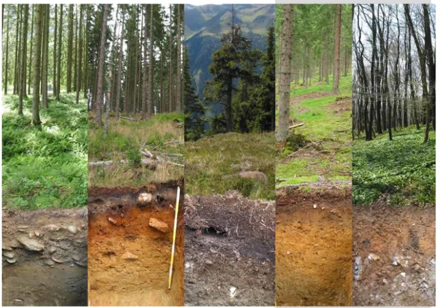
Your forest soil is the foundation upon which trees grow and where they obtain nutrients and water. The soil's chemical and physical properties determine what plant types can or cannot grow there, how fast they might grow and how much biomass they may produce. In California, generally, soil make up is not the limiting factor for tree growth, water availability during the growing season is. But that doesn't mean that landowners should ignore soil health.
Soil is made through the weathering and decomposition of a parent material (granite, volcanic material or sedimentary rock). Its chemical and physical properties include texture, structure, organic matter, nutrients and acidity (pH).
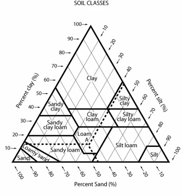
Sand, silt and clay are the three particle size classes that make up the fine earth fraction (soil particles that are less than 2 mm). These particles combine in different amounts and determine soil texture. There are 12 soil texture designations through USDA NRCS and are shown in the "Textural Triangle" above. Soil texture determines how well the soil retains water and nutrients, as well as how much it may or may not compact under pressure. Soil structure refers to the shape of the soil commonly known as aggregates. The presence of aggregates contributes to air and water flow through a soil. Soil reaction (pH) influences the availability of essential and toxic elements. Soil bulk density is the mass of solid particles in a given volume of soil and is used to determine the compactness of soil. Soil strength is the capacity of soil to carry loads applied to the ground without failing. Soil organic matter refers to plant and animal components, in various stages of decomposition. Soil horizons refer to the horizontal layers starting at the top with humus on down through the topsoil, subsoil and ending in the parent material. Soils also contain macro and micro-nutrients and micro-organisms at varying levels.
Find out which soils are on the landscape:
Viewing forest health through a soil lens: forest site productivity and site index
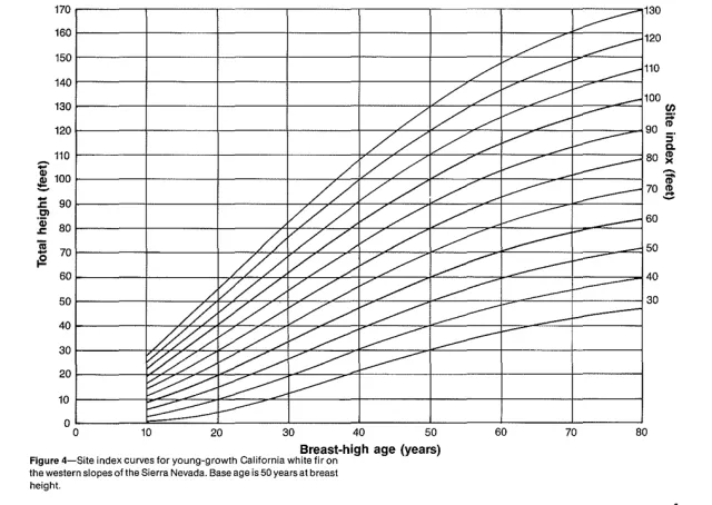
Rather than surveying and testing the soil itself, foresters often look at your trees on site to assess how productive (the ability to grow trees) the site is. Soils where trees grow quickly are said to have a high site quality. Another way to think about high site quality is that the trees that grow there become taller in less time than on sites with low site quality.
The relationship between a tree's height and age is called its site index. Site index is a classification of site productivity for timber production, expressed as dominant tree height at a reference age (50 or 100 years). For example, site index 80(50) is a site that can grow trees 80 feet in height in 50 years. Site index curves are used to assess sites based on the stand age and the average height of dominant trees (higher numbers are considered more productive).
How different soil types are impacted by forest management activities
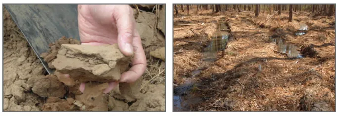
Depending on the management activity you engage in, it can have different effects on the forest soil in the short-term or long-term. Issues such as compaction, erosion, soil biota changes, and a reduction in nutrient supplies can be mitigated by taking appropriate measures beforehand.
According to Meagan Hynes, NRCS Soil Conservationist, Best Management Practices (BMPs) include:
Minimize the potential for compaction by:
- Avoiding operating equipment on wet soil;
- Operating when the ground is dry or frozen;
- After rain, allowing the soil to drain before resuming operations;
- Minimizing the disturbance of litter and surface mineral soils, especially on slopes; and
- Limiting compacted and deeply rutted areas to less than 10% of the managed area.
Reduce compaction by using:
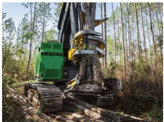
- The smallest equipment possible with fewer passes, lighter loads and longer reach;
- Low-pressure tire tracks or tracked equipment;
- Leaving 50-70% groundcover; and
- Operating large equipment only if the water table is at least 18" below the surface.
Reduce erosion potential through:
- The use of proper road design
To learn more and connect with soil professionals, find a USDA NRCS field office, Certified Professional Soil Scientists (CPSS) – Soil Science Society of America, or reach out to Resource Conservation Districts, Cal Fire, the US Forest Service, or Registered Professional Foresters. Also check out these USFS videos about "Why foresters and soil Scientists Should Be Best Friends".
Vegetation management and soil effects research
In 2007, research was conducted at UC Berkeley's Blodgett Forest Research Station to consider the effects on soil from various fuel treatments including prescribed fire, mechanical treatment thinning and thin+burn (commercial harvest followed by mastication), and mechanical treatment followed by prescribed fire. Pre- and post-treatment soil samples were gathered within the treated units. A control unit (no treatment) was also identified. Authors Moghaddas and Stephens (Mechanized fuel treatment efects on soil compaction in Sierra Nevada mixed-conifer stands, 2007) found that there was no significant effect on soil bulk density from the mechanical fuels treatment. Soil strength was consistently greater in skid trails as opposed to non-skid trail areas and concentrated in the upper soil levels. Overall, mastication activities did not significantly increase soil bulk density or strength in non-skid trail areas.
In 2014, Busse et al. published PSW-GTR-241, Fuel Reduction Practices and Their Effects on Soil Quality. Looking at soil heating from the use of prescribed fire, they note:
- All soil heating under certain circumstances can alter soil properties and functions, and the amount of soil heating varies greatly depending on the fuel composition;
- Soil itself is not a good conductor of heat, meaning peak temperatures and the duration time of heat decline with soil depth. An exception to this is smoldering fires in thick duff layers or large-diameter wood;
- Soil moisture is an important factor in controlling heat transfer in soil. Though heat travels faster in moist soils compared to dry soils, its movement is restricted by the energy-quenching effect of water; and
- Compaction increases the thermal contact between soil particles, reducing the air-filled pore space, resulting in an increase in soil thermal conductivity.
Busse et al. include the following take-home points:
- Low- to moderate-severity burning (as in prescribed burns) results in very little damage from soil heating;
- Severe burning and harvesting based compaction are high risk factors for soil damage IF applied across a large percentage of the land;
- Burning of slash piles containing a mix of fuel sizes generally does not produce excessive soil temperatures or changes in soil function;
- Identify high-risk soil conditions and use BMPs and caution when mechanical harvesting;
- Findings from most single-entry studies indicate few soil concerns when BMPs are used. However, more results from multiple-entry activities are needed; and
- Landowners should remember that effects of vegetation management on soils are site-specific and that soil ecosystems are variable and dynamic.
There are best management practices (BMP) to follow when using heavy equipment for managing vegetation and timber harvesting. By taking into consideration soil type, the slope of the unit being worked on, the number and kinds of equipment used, and weather-related conditions, BMPs can mitigate negative effects on soil, which in turn can protect the productivity of the site.
Parajuli et al. from Clemson Cooperative Extension developed a paper (Logging Operations and Soil Compaction, 2022) that outlines some of these BMPs including:
- Increasing the number and width of heavy equipment wheels or tracks, using lighter equipment, and reducing load size which can reduce negative effects on soil compaction;
- Having properly placed skid trails and landings can confine soil compaction to more limited areas; and
- Avoid harvesting on wet soil, install water bars and soil stabilization methods as needed.
Other long-term monitoring projects provide new insights into soil compaction and how the soil ecosystem responds. The Rocky Mountain Research Station (RMRS), in collaboration with the Kootenai National Forest in Montana, conducted a long-term monitoring project to determine soil recovery after timber harvesting and follow-up activities (The Organic Truth: What 22 years of monitoring reveals about forest soil resiliency on the Kootenai National Forest, RMRS (2019)).
Researchers took a new look at the accepted assumption that compacted soils take a long time to recover, if ever. Project Scientist Page-Dumroese acknowledged that "soil properties and recovery from compaction are different across the landscape, (but that) productive sites are usually resilient to harvesting, and sites without a lot of organic matter are not."
Key findings from this research include:
- Soil texture and organic matter content greatly influence how soils recover from a disturbance. High organic matter is positively correlated with resilience;
- Over 80 percent of the harvest units showed soil recovery following a timber harvest years later. Only 9 percent did not recover, while some units had 100 percent recovery;
- Root growth, freeze-thaw cycles, and soil fauna contribute to soil recovery from compaction; and
- Using harvest equipment and methods that reduce forest floor compaction decreases soil disturbance that affects tree growth.
Fire effects on soils

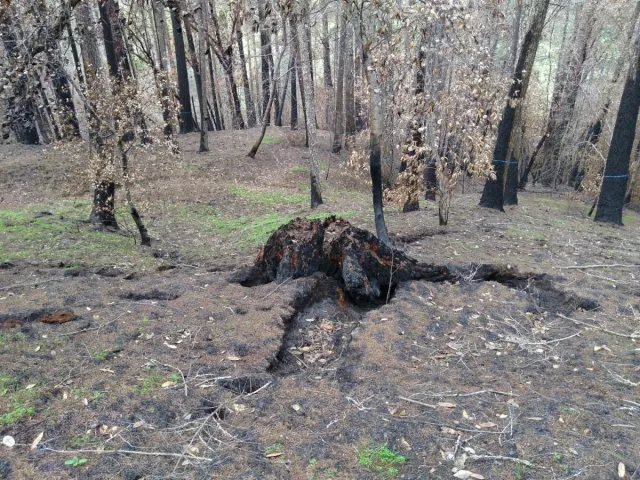
Fire can have biological, thermal and physical impacts on soil (especially topsoil), changing soil moisture, temperature, water repellency, texture, structure, pH, and more. Soil is expected to rapidly recover when heated below 100°C. Above that threshold, root and seed mortality and then bacteria and fungi death begin occurring. At progressively higher temperatures, inorganic nitrogen and phosphorus are released, soil carbon and nitrogen are lost, and at very hot temperatures, minerals can even be transformed. Post-fire impacts included reduced biological activity, increased erosion, and rapid leaching of nutrients from soil to streams. Fire can also contribute ash, pyrogenic carbon or biochar, and woody debris and leaf litter to soil. Gaudinski et al.’s 2026 review “Understanding how fire impacts soil carbon and nutrient cycling: Toward standardized reporting of fire metrics for the integrated plant-soil system” seeks to help the soil science community link fire metrics to soil properties. The frequency of fire at a given site can influence how impactful each fire is on nutrient cycling in the soil. Fire intensity (energy released during fire) or fire severity (how much fire alters vegetation on the site) are useful metrics to characterize fire to understand its impact on soil. Soil burn severity (SBS) helps assess fire’s effect on soil and involves measuring ash depth and color, organic matter loss, root impacts, changes in soil structure, and water repellency. Gaudinski et al. encourage people to consider the plant-soil system together, since fire impacts soil properties and biota, and also impacts plants, which in turn affects what nutrient inputs the soil receives.
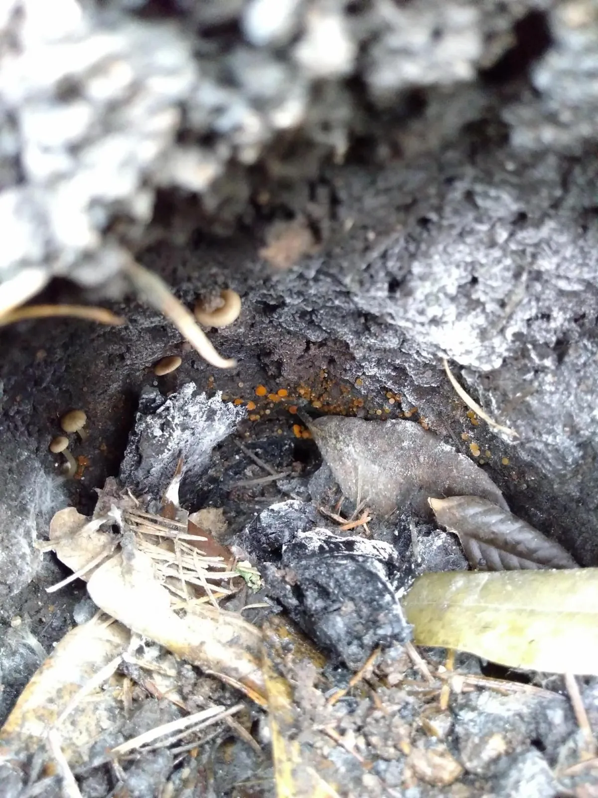
Though there are challenges in assessing fire effects at any level, it is notably difficult to observe the effects fire has on below ground organisms. The Rocky Mountain Research Station (RMRS), in collaboration with Colorado State University, has been using DNA sequencing tools to study the effects of fire at various intensities on below ground microbial communities (How wildfires reshape the soil microbiome and impact soil health and forest regeneration, RMRS (2024)). DNA extracted from burned and unburned sites are analyzed to measure presence or absence, and the number of microbes present. According to RMRS, bacteria, fungi and viruses all play a role in the health of forest soil by cycling nutrients, stabilizing soil organic matter, and forming essential symbioses with plants which are important in promoting the regeneration of trees and shrubs.
Findings from their research in lodgepole pine communities include:
- Key soil microbes and overall diversity decline proportional to increasing fire severity;
- High-severity wildfire can result in long-term (years to decades) decreases in soil microbial biomass and diversity;
- "Fire-loving' bacteria increase after fire and become the dominant species which can help degrade and stabilize organic soil material within the fire footprint; and
- Loss of the soil ectomycorrhizal fungi that form symbioses with conifer trees after wildfire and bark beetle outbreaks may inhibit post-disturbance, natural, forest regeneration.
For more information about how soil burn severity is assessed post-fire, check out the "Assessing soil burn severity" factsheet.
Urban and WUI Post-fire Soil Remediation - Q&A with Natalie Levy, UC ANR Soil Health & Organic Materials Management Advisor, Los Angeles, Orange and San Diego Counties
Q: Tell us a little about the Altadena Soil Recovery Pilot you conducted after the Eaton Fire. What led you to explore this aspect of wildfire?
A: Following the Eaton Fire, I became interested in understanding how wildfire affects residential soils and what nature-based solutions could help protect exposed soil during the recovery process. One immediate community concern was erosion. When bare soil is exposed to wind and rainfall, soil particles can move off-site through dust or runoff, potentially carrying contaminants with them.
Through the Altadena Soil Recovery Pilot, I partnered with residents, L.A. County Public Works, and Agromin, a regional organic recycler, to explore the use of recycled organic materials, specifically coarse-screened composted mulch, as a protective surface cover on fire-affected residential properties. This choice of material is practical because coarse mulch acts as a protective blanket over the soil. It intercepts rainfall, reduces the direct impact of raindrops on the soil surface, and helps slow and disperse water moving across the property. This can reduce soil detachment and surface runoff, helping keep exposed soil in place. With the assistance of a local UC ANR Master Gardener who lost their home in the fire, fourteen residents agreed to participate in the pilot to see how this strategy works on a broader neighborhood scale. Through this collaboration, approximately 645 cubic yards of material were applied across more than 128,000 square feet of property
Ultimately, the project brought together two related goals: protecting exposed soil during post-fire recovery and finding beneficial uses for recycled organic materials. California's Senate Bill (SB) 1383 is increasing the diversion of organic materials from landfills and creating greater demand for beneficial uses of compost and composted mulch. The pilot provided an opportunity to explore how these materials could address an immediate community need by providing protective cover for exposed soil and helping to limit soil movement ahead of the rainy season.
Q: What advice would you give residents in terms of soil health and post-fire remediation?
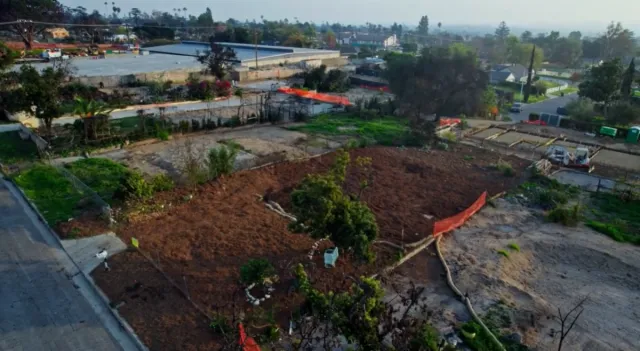
A: I would encourage residents to think about soil as part of the rebuilding process rather than treating it as an afterthought. Soil testing can be an important starting point following a fire because it can help residents understand the condition of their soil and inform decisions about what comes next. Depending on the results, residents can then determine whether additional intervention or remediation may be appropriate.
However, making those long-term decisions takes time, and properties may remain exposed to the elements. For bare or disturbed soils, establishing erosion and runoff control is an important step before the arrival of seasonal rains. Maintaining a protective cover helps keep soil in place and creates a physical barrier over the exposed ground. This was one of the key reasons we explored coarse composted mulch in the Altadena pilot. It provides immediate surface protection while residents test their property, evaluate their options, and develop plans for rebuilding.
The benefits of this approach can evolve over time as residents go through their rebuilding process. As the coarse mulch gradually decomposes at the surface, it contributes organic matter that supports vital soil functions like aggregation, water retention, and infiltration, all while continuing to act as a shield against wind and rain.
Later, as residents transition into the rebuilding phase and landscape restoration, fine compost can be incorporated directly into the soil. Adding fine compost introduces organic matter beneath the surface, which increases water-holding capacity by improving soil structure and creating pore space to retain moisture. It also provides a source of carbon and organic compounds that support microbial activity and nutrient cycling, creating ideal conditions for establishing new vegetation.
These two materials offer distinct, complementary pathways for soil health recovery. Coarse mulch provides immediate surface protection and a slow release of organic matter, while incorporated fine compost places organic matter directly into the root zone to enhance biological activity.
Q: What are the trade-offs for covering versus not covering affected soil?
A: The primary consideration when leaving fire-affected soil bare is its continued exposure to wind and rainfall, which can increase the potential for erosion and soil movement. Applying a protective cover can help protect exposed soil from the elements and provide a physical barrier over the soil surface.
During the pilot, we observed that the composted mulch generally remained in place following winter rainfall and continued to provide visible surface cover. There are also logistical considerations when deciding where and how to apply a cover at the residential scale:
- Construction and timing: A mulch cover can protect soil while a property is being rebuilt, but residents should consider future site changes. If construction or grading is expected soon, residents may want to place cover on areas that are not being actively disturbed and can remain covered until final property renovations or landscaping is completed.
- Material and Application: Material characteristics and application depth can influence how long the surface cover lasts. In the pilot, we applied coarse-screened composted mulch at approximately a 2-inch depth. For residents considering this approach, a 2-inch application can offer a practical balance, remaining in place longer than a thinner 1-inch layer while requiring less material and labor to spread than a 3-inch depth.
Ultimately, covering exposed soil requires some planning around the property's rebuilding timeline, but it can provide an important layer of protection while residents test their soil, evaluate their options, and determine what comes next.
Q: Where can residents go for information and testing?
A: I encourage residents to start with trusted university, government, and local agency resources when looking for information about post-fire soils, testing, and remediation. It is also important to understand what a soil test can tell you and to use a qualified laboratory with appropriate analytical methods.
For residents affected by the 2025 Los Angeles-area wildfires, the UC Master Gardener Program of Los Angeles County has compiled a Fire Recovery Resources for Your Landscape and Garden guide that brings together UC ANR resources and additional information related to soil and landscape recovery. UC Master Gardeners have also compiled a list of soil-testing laboratories that residents can consult when looking for a laboratory.
For residents in the Los Angeles area who are specifically concerned about lead, the USC Clean Program offers free soil testing for eligible residents through its soil-testing program.
The California Department of Toxic Substances Control (DTSC) also provides wildfire emergency guidance and guidance on collecting post-fire soil samples, including recommendations for collecting samples that can provide useful information about a property.
Another resource is the Soil Remediation Guide, developed by the Consortium, which includes USC Public Exchange, the LMU Center for the Study of Los Angeles, CAP.LA, Department of Angels, Altadena Recovery and Rebuild Corporation, LA Fire HEALTH Study, and the Centre for Applied Ecological Remediation.
My recommendation is to start with current university and government resources before making major changes to a property. There is no one-size-fits-all approach to post-fire soil recovery. Soil testing and a clear understanding of site conditions can help residents make informed decisions about the next steps for their property.
Q: Are there any other lessons from the pilot project you would like to share?
A: One of the key lessons from the pilot was the importance of timing, specifically establishing the protective cover on exposed soil before the arrival of seasonal rains. The project also gave us an opportunity to see how composted mulch could be delivered, applied, and maintained on residential properties under actual field conditions.
The pilot showed that access to material is only one part of the equation. Transportation, delivery, spreading, labor, and application costs all need to be considered when developing a community-scale response. Working collectively with residents, L.A. County Public Works, Agromin, and spreading contractors made it possible to move a large volume of recycled organic material into the community. That collaboration demonstrated how existing organic waste infrastructure can potentially be connected to an immediate disaster recovery need.
Another important lesson is that post-fire recovery is a process rather than a single intervention. A property may move from protecting exposed soil, to testing and evaluating conditions, to rebuilding, and eventually to landscape restoration. The role of recycled organic materials can change along that continuum. Coarse composted mulch can provide surface protection while gradually contributing organic matter, while fine compost can later be incorporated into soil as part of landscape restoration.
Overall, the pilot provided valuable field experience in using recycled organic materials to protect fire-affected residential soils at the neighborhood scale. It demonstrated the feasibility of coordinating material procurement, delivery, and application across multiple properties under California's SB 1383 framework, and it provided lessons that can help inform future post-fire recovery efforts.
After the fire: home garden soil management
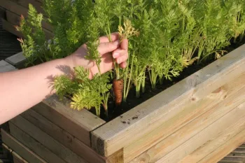
Being able to replant trees, shrubs and vegetable gardens after a fire helps with both physical and psychological recovery. However, soil can be negatively impacted by fire in a number of ways. Additionally, more urban or built environment's soils carry an increased risk for contamination.
The UC Fire Network has developed a guide for homeowners (After the Fire: Home Garden Soil Management, UC Fire Network (2025) to help assess, test and remediate their home garden soils in order to reduce the likelihood of exposure to potentially harmful contaminants so homeowners can reclaim their green thumbs.
The 3-step process outlined by the Fire Network includes:
- Understanding your site history - past land use can leave behind contaminants such as lead paint or hazardous chemicals.
- Testing your soil - The U.S. Environmental Protection Agency (U.S. EPA) recommends that for urban areas, “at a minimum, the soil test should include pH, percent organic matter, nutrients, micronutrients, and metals, including lead.” Laboratory soil testing is recommended, especially if the soil is currently being used or is going to be used for urban agriculture. DIY soil testing kits are NOT recommended as they cannot test for many contaminants found post-fire.
- Remediating your soil - Next steps depend on the results of your soil test. If levels of contamination are found to be below acceptable levels, then immediate remediation is not needed. If test result show levels of contamination higher than acceptable levels, homeowners can: a) dilute existing soil with new, quality soil, maintain a neutral pH, and amend with organic matter; b) Use raised beds with a permeable bottom barrier or other containers, or; c) Remove the contaminated soil - disposal should follow local regulations.
Getting up close and personal with your soils
Whether you have forested land or a mix of ecosystems (e.g. forests and rangelands), site specific soil characteristics may be a topic you've considered. Perhaps you've looked at a Web Soil Survey map to get some clues about the soil on your land, but what are some other ways to get to know your soil? There are a variety of hands on ways to get acquainted with the soil on your land. This month a group including ranchers, technical service providers, and scientists gathered on a ranch in Marin County to learn about soil characteristics and health in a rangeland context.
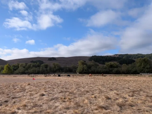
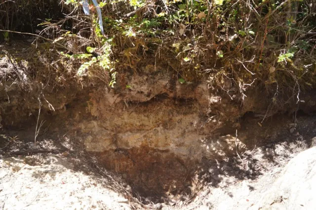
During the workshop we looked at soil pits (photos below) and discussed visible clues about the site, and the diversity of soils across rangelands. Landscape signs that there may be high diversity in soils include: high slopes, diverse vegetation assemblages, and being near a waterbody. Digging soil pits can help us identify variations that are present, from shallow soils upslope to soils that hold a lot of water in riparian areas.
Besides looking at soil pits, another step for getting to know your soils can include assessing soil texture by feel. By wetting a soil sample in your hand and assessing it according to a soil texture flow chart (linked below), you can determine an approximate measure of particle size.
According to the Natural Resources Conservation Service, "Soil health is the continued capacity of soil to function as a vital living ecosystem that sustains plants, animals, and humans." Soil health in rangelands (and forests) must be viewed differently than in croplands because these soils are unimproved, fairly undisturbed, and are not irrigated. However, that doesn't mean they aren't able to function well, and knowing more about their characteristics can be a step towards appreciating soil diversity!
The following article explores the Pygmy Forest, a place where nutrient poor soils are the foundation for a special plant community.
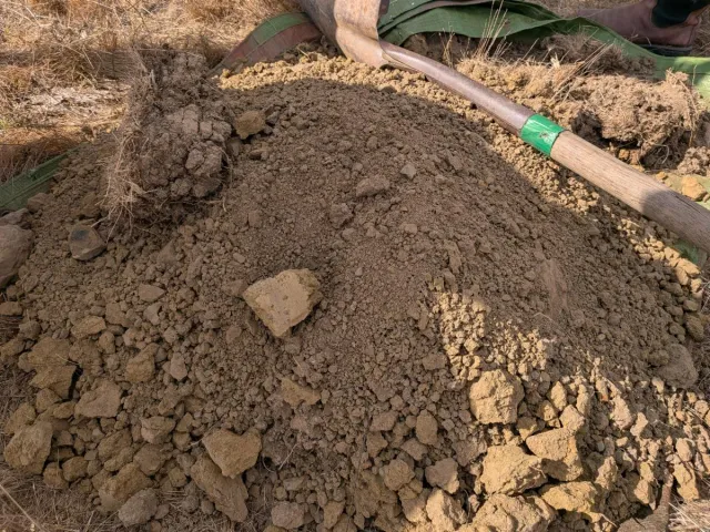
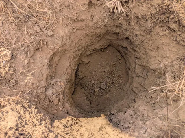
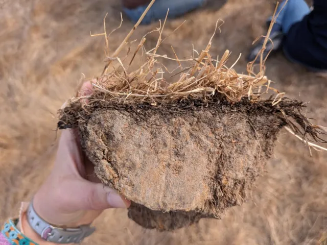
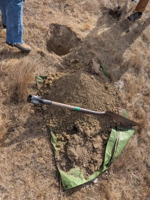
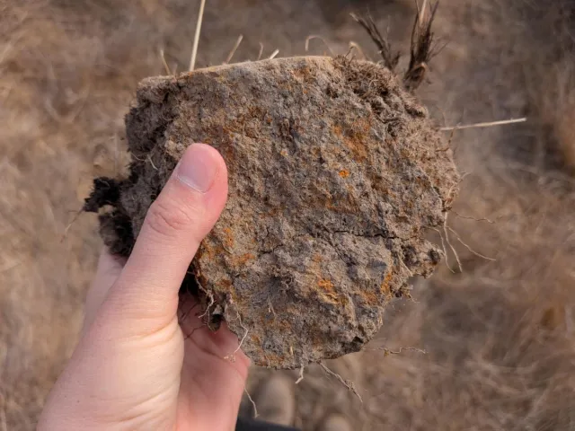
Digging up soil to create a soil pit is a way to look at layers, colors and soil structure, which can reveal information such as whether water tends to pool or infiltrate. Photos by Jannike Allen.
Research and restoration project highlight: efforts to learn from forest soils along an ecological staircase
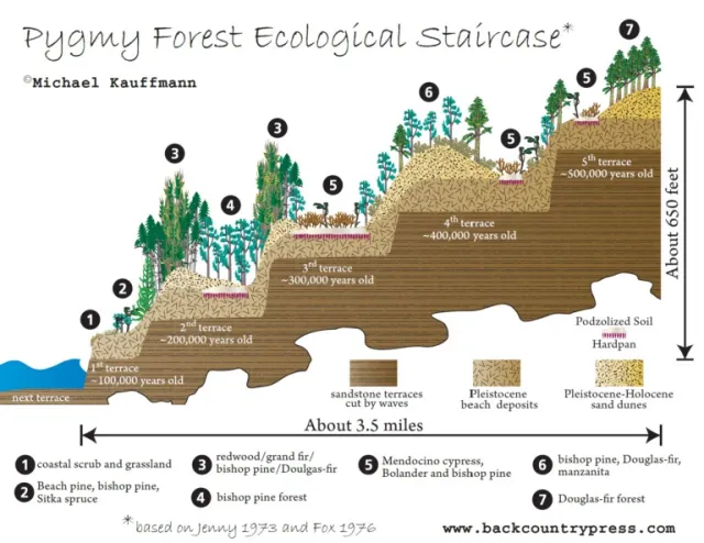
In Mendocino County's Jackson Demonstration State Forest (JDSF), managed by CAL FIRE, and Jug Handle State Natural Reserve, the "ecological staircase" provides an exciting and unique place for scientists to study vegetation, soils, and connections between the two, such as the distribution of forest nutrients above and belowground or the biogeochemical properties of the soils supporting the ecosystems. JDSF is providing support to make this research possible, while also working to restore pygmy forest with prescribed fire in the process.
The ecological staircase is a set of naturally occurring terraces that were cut by waves 10s to 100s of thousands of years ago and then gradually lifted up by tectonic forces. The terraces make up a chronosequence: a series of landforms that differ in age. The terrace furthest from the ocean formed longest ago, making its forest and soils the oldest, and the terrace closest to the ocean is the youngest. The ecological staircase is an ideal place to study how the age of a landscape can impact the nutrients present because they feature a sequence of soils of varying ages located close together that are experiencing the same climate conditions.
In sections of the ecological staircase known as "Pygmy Forest” or more formally as the Mendocino Cypress Woodland Alliance, Spodosol and Ultisol soils form through weathering processes. These soils tend to be acidic, nutrient poor, and infertile. Rare in California, these nutrient poor soils often appear white at or near the soil surface due to a prevalence of bleached coarse-grained minerals that remain after other soil materials and nutrients are leached away. Throughout the chronosequence, cemented hardpans often form deep in the soil as iron, silicon, and other elements are dissolved and redeposited by soil water and groundwater. The result is a harsh, poorly drained environment where tolerant plants survive yet exhibit stunted growth. In June, UC ANR staff and community members had the opportunity to tour part of the Pygmy Forest where the group heard from land managers and researchers about their work to understand how nutrients, characteristics, and pathogens in the soil impact forest health.
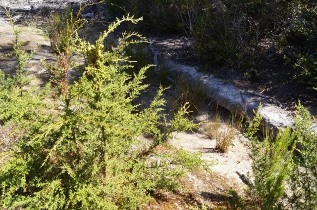
JDSF staff shared that they are working towards applying prescribed fire in the pygmy/ bishop pine forest, in collaboration with researchers to document fire effects. The project idea is focused on restoration, and could include 3.5 miles of road abandonment (1.2 miles in pygmy forest), removal of 12 stream-crossing culverts, and re-routing of user-built trails away from wet and other sensitive areas. Prior to these restoration actions, the existing road and trail infrastructure would be used in a research experiment. Treatments may include prescribed fire alone, mastication, and mastication & prescribed fire together. Including mastication as a fuels treatment would help researchers test how this treatment may impact pygmy forest and develop best management practices for future management of this plant community. Currently, there is a lack of peer-reviewed science to address the potential impacts of these treatments on pygmy forest ecosystem function given many changes to the system over the past century (e.g. housing development, fire suppression, invasive plants, pathogens, etc.). The site has had fire excluded from it and as a result, foresters are seeing forest health issues including pathogens and senescence of species that need fire to regenerate. Characteristic species here include Bolander’s pine, Mendocino cypress, and Bishop pine, which have fire adaptations including serotinous cones that open when they experience fire. Historical fire return intervals for a redwood stand adjacent to this pygmy forest ranged from 6 to 34 years during the period from 1750 to 1850 (Brown and Baxter 2003), but this specific area is now in a fire deficit, not having any recorded fire since 1913. Mike Jones, UCCE Forestry Advisor, discussed that desired fire effects in the Pygmy Forest may look like stand replacing fire, giving the fire adapted species a chance to regenerate.
Niklas Blanadet, a PhD student from Yale, is studying nutrients stored in wood. These stores impact the health of the tree, and serve as an important nutrient stock feeding the broader ecosystem, including the soil as the wood decomposes. The ecological staircase is a perfect place for the team to compare the significance of wood and soil nutrients in forests of different ages, highlighting decreases in soil nutrient availability as forests age. In an ecosystem without a lot of nutrients overall, such as the Pygmy Forest, the percentage of nutrients stored in wood becomes more important. For example, Calcium is a nutrient used in plant cell walls, and Calcium stocks can be much higher in wood than in soil, like in the Congo basin where wood holds 80% of the wood and soil Calcium stocks (Bauters et al. 2022). Nutrients from trees can be available when leaves drop, and also when the tree dies and decomposes. If the nutrients become available through gradual wood decay, nearby plants may have a better chance to uptake the nutrients compared to if the decay happened quickly and nutrients were leached away in water. The team estimates how much wood is present in the forest using LiDAR, a remote sensing technology that maps the surface of the landscape by sending and receiving laser pulses. They also gather wood nutrient data by measuring and coring trees within inventory plots on the ground to inform forest-wide estimates. The plot data is paired with soil measurements to compile a fuller picture of the ecosystem. Dr. Rebecca Lybrand, UC Davis Associate Professor and Dr. Eric Slessarev, UC Berkeley Assistant Professor, are researchers on the team who are focused on understanding the soils of the ecological staircase. A PhD student in Dr. Slessarev’s lab, Henry Betts, is employing different approaches, such as beryllium-10 analysis and luminescence dating, to determine when the terraces formed. Dr. Lybrand’s work uses a field-lab analysis technique to better understand soil formation including the role of fungi in mineral weathering processes.
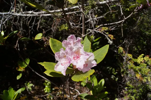
Yale undergrad Benny Seidman is investigating mycorrhizae, which connect plants and fungi, allowing plants to share extra sugars they produce during photosynthesis. In turn, the fungi help the plants scavenge or mine nutrients out of the soils, which can be key in the pygmy forest where nutrients are so sparse or hard to obtain to begin with. Benny focuses on three shrub species: evergreen huckleberry, pacific rhododendron, and Labrador tea, which form lignotubers underground, and can use them to resprout after fire. They are also all members of the Ericaceae family, which has a specific mycorrhizae associated with it. This mycorrhizae can survive without the host plant, so when a fire occurs and topkills the plants, the fungi becomes saprotrophic, breaking down wood to survive. Benny is sampling fine root structures from shrub roots in order to look at how much fungus is present on the roots before and after fire. This may provide information about whether this fungi's ability to stay alive in the soil may help the plants return post fire, since their fungal symbiont is still present.
If you would like to learn more about the Pygmy Forest, consider visiting Jug Handle State Natural Reserve and hiking the ecological staircase trail.
Should I worry about soil contamination?
If mining has occurred on your land you may wonder whether you should be concerned about potential soil contamination.
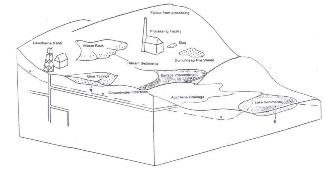
Due to California’s legacy of gold mining, it is not uncommon to find abandoned mining waste, such as tailings, drainage water, and chemicals used to process ore, on forested land. When natural processes, including weather and hydrology, interact with waste materials, contaminants can be released which may impact water quality and human and environmental health. Figure 2 from the Department of Toxic Substance Control’s Abandoned Mine Lands Site Discovery Process document shows that when water moves through waste rock, tailings, or dump/heap piles, contamination of soil or sediment in streams or lakes may occur. According to the 1999 Abandoned Mine Lands Preliminary Assessment Handbook, chemicals of concern in soil can include beryllium, arsenic and mercury. If you suspect there may be contaminated soil onsite, seek guidance before disturbing the soil, especially before doing activities that may lead to ingesting small amounts of soil such as by inhaling dust. If you have a specific reason to be concerned, approach the site with caution and wear personal protective equipment, and consider speaking with authorities. You may also consider having your soil tested, but keep in mind that labs need direction on specifically what toxic substance they need to test for, and these tests are expensive.
Find the printable version of this newsletter below. Note that the pdf is for print purposes ONLY.
