Posts Tagged: farming
NRCS in the City
- Author: Annie Edwards, Urban Conservationist
- Author: Catherine de la Peña, Soil Conservationis
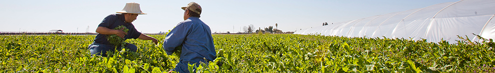
Are you an urban grower looking to improve the sustainability of your farm? If so, the USDA Natural Resources Conservation Service (NRCS) may be able to help you achieve your conservation goals. NRCS is a federal agency focused on implementing on-farm conservation across agricultural operations. NRCS provides America's farmers and ranchers with financial and technical assistance to voluntarily put conservation on the ground, helping both the environment and agricultural land. While NRCS is a federal agency, our office in California tailors our financial assistance to meet the unique natural resource concerns we see across the state.
As NRCS evolves to address the changing needs of our farmers and ranchers, the agency has taken strides to better serve urban producers. As of today, 17 Urban Service Centers have opened in major metropolitan centers across the US, with an additional 10 offices being planned. In California, we have two new Urban Service Centers.
- Oakland Urban Service Center Contacts:
- Compton Urban Service Center Contacts:
NRCS has a variety of programs to assist producers, including our flagship programs, the Environmental Quality Incentives Program (EQIP) and the Conservation Stewardship Program (CSP). These programs provide financial assistance to producers for implementing and maintaining conservation practices including high tunnels, hedgerows, structures for wildlife, and irrigation systems. To learn if your operation would be a good fit, refer to Is EQIP Right for Me? and Is CSP Right for Me?.
NRCS is also connected to the USDA Office of Urban Agriculture and Innovation Production (UAIP), which offers the UAIP Grant and Composting and Food Waste Reduction (CFWR) Cooperative Agreements.

In-ground beds with drip irrigation at Florence Fang Community Farm, San Francisco.
NRCS can provide financial assistance for microirrigation.
How to apply. We recommend that once you have a basic idea of what your conservation goals are, you reach out to your closest Urban Service Center and set up an appointment. At this meeting, you can connect face-to-face with your county's NRCS and USDA Farm Services Agency (FSA) staff. Before you come in, review USDA's getting started guide and take a moment to look over NRCS definitions of historically underserved farmers and ranchers (HUFR). Many NRCS programs— including EQIP and CSP offer higher rates for self-identified HUFR. A specific guide for HUFR can be found here.
If you are interested in applying to any of our programs, you'll need to work with FSA to establish a farm and tract number. Along with registering for NRCS programs, there are added benefits of receiving a farm number, including alerts about new programs, inclusion in the agricultural census, and becoming eligible to elect FSA county committee members. To create a farm and tract number, you will need the following:
- A completed New Customer Data Worksheet, submitted to your local NRCS office. Find the form, as well as instructions on how to apply, here.
- A deed/lease certifying that you have control of the land.
To apply for NRCS programs, you will need to submit a CPA-1200 application to your local NRCS office, which accepts applications year-round. After we receive your application, we will work with FSA to ensure that you are eligible for our programs.
NRCS is committed to helping people help the land— that means all people, including urban and small-scale growers. We look forward to working with you and providing the best service possible to you on your journey.
Lawn-pocalypse! Surviving Drought
Ah, summer! The season of sunburns, pool parties, and… lawn droughts. If your once lush, green carpet now looks like a crunchy brown doormat, you're not alone. Let's dive into why your yard is staging a dramatic death scene and what you can do to...

Bermuda grass and weeds overtaking drought stressed turf grass.
Practical Training of Nitrogen Planning and Management in Organic Production of Annual Crops
Habrá traducción al Español!
Where: This is an online virtual event
Monday November 27, 1-3 pm Session 1 Understanding nitrogen and soil organic matter
Monday, December 4, 1-3 pm Session 2 Compost, fertilizers and cover crops
Monday December 11 , 1-3 pm Session 3 Water, synchronizing demand and supply
Monday December 18, 1-3 pm Open house, Grower panel
Note: Limited to 80 participants -- Must enroll in all 3 classes (Session 1-3)
Cost $25 No one will be turned away due to lack of funds. Please email Rob Straser with questions (rkstraser@ucanr.edu).
Earn 6 hours of CDFA-INMTP continuing education credits (formerly CURES CE Credits)
Earn 6 hours CCA credits
About this workshop
In this 3-part series, participants will learn how to estimate nitrogen release from diverse organic sources and translate that knowledge to nitrogen fertilization plans and regulatory reporting requirements. In session 2 and 4, participants will be able to work on and receive feedback on their own nitrogen budgets. Over the first 3 sessions, we will cover the most common sources of nitrogen and complete a nitrogen budget.
Who should enroll?
Growers, CCAs, PCAs and other agricultural professionals who are interested in learning about nitrogen management in organic production are encouraged to enroll.
November 27, 2023, 1-3 pm Part 1: Understanding nitrogen: the nutrient, the role of microbes and the relevance of soil organic matter
Presenters: Daniel Geisseler, Radomir Schmidt and Margaret Lloyd
We will begin with an overview of the sources, transformations and fates of sources of organic nitrogen in soil. Foundational to this, we'll cover the role and dynamics of microbes in nitrogen management, and how that impacts management decisions. Lastly, we'll discuss using nitrogen budgets to understand the sources and proportions of available nitrogen to meet crop demand.
December 4, 2023 1-3 pm Part 2: Estimating nitrogen release from organic amendments and contributions from cover crops
Presenters: Patricia Lazicki and Margaret Lloyd
This session will focus on estimating nitrogen release from compost, organic fertilizers and cover crops. In addition, participants will be invited to apply the training to their own operations and receive feedback on the budget calculations during this session.
December 11, 2023 1-3 pm Part 3: Putting it all together: Completing a nitrogen budget, synchronizing nitrogen release with nitrogen demand, and using soil tests
Presenters: Daniel Geisseler, Joji Muramoto, Michael Cahn and Margaret Lloyd
In this session, we will address specific aspects of organic soil fertility management in vegetables. Discussions will include nitrogen in irrigation water, managing water for nitrogen optimization, crop nitrogen demand and strategies to supply demand, as well as using and interpreting soil testing. Specific references will be made to strategies for complying with forthcoming regulations. We will conclude with a discussion on new frontiers in plant's nitrogen acquisition science.
December 18, 2023, 1-3 pm part 4: Open house (Grower Panel)
In this session we will have 1-2 growers share their experience managing nitrogen on their farms. Then, we will open it up to questions, share experiences and discuss the nitrogen budget file. Attendees will be encouraged to bring their own data to receive feedback.
About the Presenters
 |
Daniel Geisseler is an associate Cooperative Extension Specialist in the Department of Land, Air and Water Resources at UC Davis. Daniel's research and outreach focuses on nutrient turnover and plant nutrition in agricultural systems. He is interested in the effects that different management practices have on nutrient use in California crops and how nutrient use efficiency can be improved, particularly with nitrogen. |
 |
Patricia Lazicki is the Vegetable Crops Advisor for Yolo, Solano, and Sacramento Counties, working mainly in tomatoes. Her research interests include soil health, and nutrient management and fertility in organic annual cropping systems. |
|
Margaret Lloyd is the Organic Agriculture and Small Farms Advisor for Yolo, Solano and Sacramento Counties. She runs an active research and outreach program focused on nutrient management and pest management for organic vegetable farms. |
|
 |
Joji Muramoto (joji@ucsc.edu) is an assistant Cooperative Extension organic production specialist at UC Santa Cruz. His research and extension focus on nitrogen and soilborne disease management in organic cropping systems across the state. |
|
Radomir Schmidt is a program manager at the Working Lands Innovation Center at the UC Davis Institute of the Environment. As a soil microbiologist, Radomir conducts research on the effects of specific farming practices (organic amendment application, enhanced rock weathering, cover cropping, no-till systems) on carbon sequestration and greenhouse gas fluxes in soils, and on the the roles of microbial communities in soil health improvement and maintenance. |
|
|
Michael Cahn (mdcahn@ucanr.edu) is an irrigation and water resources Farm Advisor for UC Cooperative Extension in Monterey County. His research and extension program focuses on irrigation efficiency, nutrient use of crops, and protecting water quality. He led the development of CropManage, an online decision support tool for irrigation and nutrient management. |
Researchers create app to help drones improve farm efficiency

When flown at the right times, drones can help farmers adapt to a changing climate
Researchers at the University of California, Davis, have developed a web application to help farmers and industry workers use drones and other uncrewed aerial vehicles, or UAVs, to generate the best possible data. By helping farmers use resources more efficiently, this advancement could help them adapt to a world with a changing climate that needs to feed billions.
Associate Professor Alireza Pourreza, director of the UC Davis Digital Agriculture Lab and postdoctoral researcher Hamid Jafarbiglu, who recently completed his doctorate in biological systems engineering under Pourreza, designed the When2Fly app to make drones more proficient and accurate. Specifically, the platform helps drone users avoid glare-like areas called hotspots that can ruin collected data.

Drone users select the date they plan to fly, the type of camera they are using and their location either by selecting a point on a map or by entering coordinates. The app then indicates the best times of that specific day to collect crop data from a drone.
Jafarbiglu and Pourreza, who is also a UC Cooperative Extension specialist of agricultural mechanization, said that using this app for drone imaging and data collection is crucial to improve farming efficiency and mitigate agriculture's carbon footprint. Receiving the best data — like what section of an orchard might need more nitrogen or less water, or what trees are being affected by disease — allows producers to allocate resources more efficiently and effectively.
"In conventional crop management, we manage the entire field uniformly assuming every single plant will produce a uniform amount of yield, and they require a uniform amount of input, which is not an accurate assumption," said Pourreza. "We need to have an insight into our crops' spatial variability to be able to identify and address issues timely and precisely, and drones are these amazing tools that are accessible to growers, but they need to know how to use them properly."
Dispelling the solar noon belief
In 2019, Jafarbiglu was working to extract data from aerial images of walnut and almond orchards and other specialty crops when he realized something was wrong with the data.
"No matter how accurately we calibrated all the data, we were still not getting good results," said Jafarbiglu. "I took this to Alireza, and I said, 'I feel there's something extra in the data that we are not aware of and that we're not compensating for.' I decided to check it all."
Jafarbiglu pored through the 100 terabytes of images collected over three years. He noticed that after the images had been calibrated, there were glaring bright white spots where they were supposed to look flat and uniform.
But it couldn't be a glare because the sun was behind the drone taking the image. So Jafarbiglu reviewed literature going back to the 1980s in search of other examples of this phenomenon. Not only did he find mentions of it, but also that researchers had coined a term for it: hotspot.

A hotspot happens when the sun and UAV are lined up in such a way that the drone is between the viewable area of the camera's lens system and the sun. The drone takes photos of the Earth, and the resulting images have a gradual increase in brightness toward a certain area. That bright point is the hotspot.
The hotspots are a problem, Jafarbiglu said, because when collecting UAV data in agriculture, where a high level of overlap is required, observed differences in the calibrated images need to come solely from plant differences.
For example, every plant may appear in 20 or more images, each from varying view angles. In some images, the plant might be close to the hotspot, while in others it may be situated further away, so the reflectance may vary based on the plant's distance from the hotspot and spatial location in the frame, not based on any of the plant's inherent properties. If all these images are combined into a mosaic and data are extracted, the reliability of the data would be compromised, rendering it useless.
Pourreza and Jafarbiglu found that the hotspots consistently occurred when drones were taking images at solar noon in mid-summer, which many believe is the best time to fly drones. It's an obvious assumption: the sun is at its highest point above the Earth, variations in illumination are minimal, if not steady and fewer shadows are visible in the images. However, sometimes that works against the drone because the sun's geometrical relationship to the Earth varies based on location and the time of year, increasing the chance of having a hotspot inside the image frame when the sun is higher in the sky.

"In high-latitude regions such as Canada, you don't have any problem; you can fly anytime. But then in low-latitude regions such as California, you will have a little bit of a problem because of the sun angle," Pourreza said. "Then as you get closer to the equator, the problem gets bigger and bigger. For example, the best time of flight in Northern California and Southern California will be different. Then you go to summer in Guatemala, and basically, from 10:30 a.m. to almost 2 p.m. you shouldn't fly, depending on the field-oriented control of the camera. It's exactly the opposite of the conventional belief, that everywhere we should fly at solar noon."
Grow technology, nourish the planet
Drones are not the only tools that can make use of this discovery, which was funded by the AI Institute for Next Generation Food Systems. Troy Magney, an assistant professor of plant sciences at UC Davis, mainly uses towers to scan fields and collect plant reflectance data from various viewing angles. He contacted Jafarbiglu after reading his research, published in February in the ISPRS Journal of Photogrammetry and Remote Sensing, because he was seeing a similar issue in the remote sensing of plants and noted that it's often ignored by end users.
"The work that Hamid and Ali have done will be beneficial to a wide range of researchers, both at the tower and the drone scale, and help them to interpret what they are actually seeing, whether it's a change in vegetation or a change in just the angular impact of the signal," he said.
For Pourreza, the When2Fly app represents a major step forward in deploying technology to solve challenges in agriculture, including the ultimate conundrum: feeding a growing population with limited resources.
"California is much more advanced than other states and other countries with technology, but still our agriculture in the Central Valley uses technologies from 30 to 40 years ago," said Pourreza. "My research is focused on sensing, but there are other areas like 5G connectivity and cloud computing to automate the data collection and analytics process and make it real-time. All this data can help growers make informed decisions that can lead to an efficient food production system. When2Fly is an important element of that."
This article was originally published on the UC Davis College of Engineering News page.
Climate-Change Resources
University of California UC ANR Green Blog (Climate Change and Other Topics) https://ucanr.edu/blogs/Green/index.cfm?tagname=climate%20change (full index)
Examples:
- Save Trees First: Tips to Keep Them Alive Under Drought https://ucanr.edu/b/~CdD
- Landscaping with Fire Exposure in Mind: https://ucanr.edu/b/~G4D
- Cities in California Inland Areas Must Make Street Tree Changes to adapt to Future Climate https://ucanr.edu/b/~oF7

Drought, Climate Change and California Water Management Ted Grantham, UC Cooperative Extension specialist (23 minutes) https://youtu.be/dlimj75Wn9Q
Climate Variability and Change: Trends and Impacts on CA Agriculture Tapan Pathak, UC Cooperative Extension specialist (24 minutes) https://youtu.be/bIHI0yqqQJc
California Institute for Water Resources (links to blogs, talks, podcasts, water experts, etc.) https://ciwr.ucanr.edu/California_Drought_Expertise/
UC ANR Wildfire Resources (publications, videos, etc.) https://ucanr.edu/News/For_the_media/Press_kits/Wildfire/ (main website)
-UC ANR Fire Resources and Information https://ucanr.edu/sites/fire/ (main website)
-Preparing Home Landscaping https://ucanr.edu/sites/fire/Prepare/Landscaping/
UC ANR Free Publications https://anrcatalog.ucanr.edu/ (main website)
- Benefits of Plants to Humans and Urban Ecosystems: https://anrcatalog.ucanr.edu/pdf/8726.pdf
-Keeping Plants Alive Under Drought and Water Restrictions (English version) https://anrcatalog.ucanr.edu/pdf/8553.pdf
(Spanish version) https://anrcatalog.ucanr.edu/pdf/8628.pdf
- Use of Graywater in Urban Landscapes https://anrcatalog.ucanr.edu/pdf/8536.pdf
- Sustainable Landscaping in California https://anrcatalog.ucanr.edu/pdf/8504.pdf
Other (Non-UC) Climate Change Resources
Urban Forests and Climate Change. Urban forests play an important role in climate change mitigation and adaptation. Active stewardship of a community's forestry assets can strengthen local resilience to climate change while creating more sustainable and desirable places to live. https://www.fs.usda.gov/ccrc/topics/urban-forests
Examining the Viability of Planting Trees to Mitigate Climate Change (plausible at the forest level) https://climate.nasa.gov/news/2927/examining-the-viability-of-planting-trees-to-help-mitigate-climate-change/
Reports and other information resources coordinated under the auspices of the United Nations and produced through the collaboration of thousands of international scientists to provide a clear and up to date view of the current state of scientific knowledge relevant to climate change. United Nations Climate Action
Scientific reports, programs, action movements and events related to climate change. National Center for Atmospheric Research (National Science Foundation)
Find useful reports, program information and other documents resulting from federally funded research and development into the behavior of the atmosphere and related physical, biological and social systems. Search and find climate data from prehistory through to an hour ago in the world's largest climate data archive. (Formerly the "Climatic Data Center") National Centers for Environmental Information (NOAA)
Think tank providing information, analysis, policy and solution development for addressing climate change and energy issues (formerly known as the: "Pew Center on Global Climate Change"). Center for Climate & Energy Solutions (C2ES)
Mapping Resilience: A Blueprint for Thriving in the Face of Climate Disaster. The Climate Adaptation Knowledge Exchange (CAKE) was launched in July 2010 and is managed by EcoAdapt, a non-profit with a singular mission: to create a robust future in the face of climate change by bringing together diverse players to reshape planning and management in response to rapid climate change. https://www.cakex.org/documents/mapping-resilience-blueprint-thriving-face-climate-disaster
Cal-Adapt provides a way to explore peer-reviewed data that portrays how climate change might affect California at the state and local level. We make this data available through downloads, visualizations, and the Cal-Adapt API for your research, outreach, and adaptation planning needs. Cal-Adapt is a collaboration between state agency funding programs, university and private sector researchers https://cal-adapt.org/
Find reports, maps, data and other resources produced through a confederation of the research arms of 13 Federal departments and agencies that carry out research and develop and maintain capabilities that support the Nation's response to global change. Global Change (U.S. Global Change Research Program)
The Pacific Institute is a global water think tank that combines science-based thought leadership with active outreach to influence local, national, and international efforts to develop sustainable water policies. https://pacinst.org/our-approach/
Making equity real in climate adaptation and community resilience policies and programs: a guidebook. https://greenlining.org/publications/2019/making-equity-real-in-climate-adaption-and-community-resilience-policies-and-programs-a-guidebook/
Quarterly CA Climate Updates and CA Drought Monitor Maps (updated each Thursday) https://www.drought.gov/documents/quarterly-climate-impacts-and-outlook-western-region-june-2022
