Posts Tagged: resilience
Lawn-pocalypse! Surviving Drought
Ah, summer! The season of sunburns, pool parties, and… lawn droughts. If your once lush, green carpet now looks like a crunchy brown doormat, you're not alone. Let's dive into why your yard is staging a dramatic death scene and what you can do to...

Bermuda grass and weeds overtaking drought stressed turf grass.
Connecting California’s forest landowners with California Tree School
While trees and forests are often emblematic of constancy in a fast-paced world, our state's forests are actually changing before our eyes. Since 2020, the UC ANR Forest Stewardship Education (FSE) program has been helping California's forest landowners be proactive about the inevitable shifts their forestland will experience. The Forest Stewardship and Post-Fire Forest Resilience workshop programs use an online educational format, which guide landowners through the basics of creating forest management plans and managing post-fire landscapes, respectively. Now, the FSE team is piloting a new program to engage a wider audience of forest landowners and community members passionate about trees.
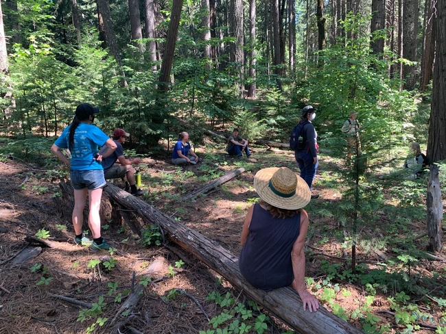
This spring, the Forest Stewardship and UC ANR Fire Network teams are holding the first California Tree School, where individuals attend multiple in-person classes on the forestry topics they are most curious about. “The existing online programs are very focused on forest management plans and post-fire activity, and [Tree School] lets us tackle other topics,” said UC ANR forest and natural resources advisor Susie Kocher.
A one-stop shop for continuing forestry education
California Tree School was inspired when Forest Stewardship Academic Coordinator Kim Ingram, Post-fire Academic Coordinator Katie Reidy and Kocher attended Oregon State University Extension's Tree School event in Clackamas County, Oregon. OSU Tree School is a day-long experience comprised of classes that cover the different dimensions of forestry: constructing a house from your own timber, carbon cap and trade, and buying portable sawmills are just a small sampling of the options for attendees. OSU Tree School students ranged from forest landowners to community college students, contributing to a space which would facilitate community connections as well as learning.
Kocher described the experience as a “a great one-day, one-stop shop to keep up-to-date on what we [forest landowners and professionals] should know.” Excited by the breadth of opportunities offered at OSU's Tree School, Ingram, Kocher and Reidy were inspired to bring the format to California.
“It's our time to discuss the whole ecosystem,” noted Reidy. “Tree School is bringing in the trustworthy, reliable group of experts who can provide more information on the questions pertaining to landowners' specific goals.”
California Tree School will be offered in two locations this spring, with CA Tree School- Hopland taking place on May 4, and CA Tree School- El Dorado on June 1. Similar to OSU's Tree School, attendees are expected to be a mix of forest landowners, natural resource professionals and interested community members.
Connecting statewide professionals; personalizing forestry education
Tree School offers attendees the opportunity to focus on subjects that pertain to their specific learning needs. This personalized approach is a new foray for the Forest Stewardship team, but is something that Ingram says workshop participants have been wanting for some time.
“Our participants never think they learn enough. They are always asking for more information, and this Tree School gives us the chance to expand on things we might not have had a chance to go over in the workshop series,” remarked Ingram. Additionally, Tree School instructors had creative freedom when it came to developing their classes, from the topic to the class format. This is evident when browsing through each session's class catalog. CA Tree School attendees choose four classes to attend, meaning they can build their first burn pile, understand the ins and outs of regional wildlife, paint outdoors and learn how to aid statewide reforestation efforts all in one day.
“I felt that Tree School created a sense of trust around complex topics,” noted Reidy about her experience last year in Oregon. For CA Tree School, the Forest Stewardship team aims to do the same. This meant recruiting from throughout the UC ANR network and other organizations, including CALFIRE and CARCD (California Association of Resource Conservation Districts), to bring trusted voices to the community.
“What's exciting about Tree School is that we are bringing natural resource professionals from all around to engage everyone at the same time, and all in one place,” noted Ingram.
The team is excited to see all the connections that will be made between community members and professionals during this pilot year, and “if this is successful and we can bring it back next year,” commented Kocher, “we are definitely interested in partnering with more people and expanding our outreach.”
Making CA Tree School an in-person experience was important to the team, as much of the education is hands-on. Additionally, Kocher sees enhanced potential for building personal connections: “In person, you have this opportunity for people to identify as part of a community,” noted Kocher, “So I'm excited for people to hang out with each other.”
Encouraging an informed community
“You can't separate the emotional from the physical, and there are a lot of topics in forestry like wildfire and economics that can be a bit of a downer,” said Ingram. “I'm excited to help create a positive learning environment, and one that encourages folks to turn to UC Cooperative Extension for these resources.”
“Our main goal here is to get science out there,” concurred Reidy. “The more exposure people have to science, the more confident they feel in themselves and their wants and needs.”
UC ANR Fire Network Hosts Wildfire Legislative Tour with Berkeley Forests
As California grapples with decades of severe wildfires, the newly established UC ANR Fire Network plays an integral role in providing and advancing science-based solutions and delivering useful tools throughout the state. Recently, the Fire Network...
UC Hopland Healthy Soils Project and The UC Berkeley Urban Bee Lab
The California Department of Food and Agriculture's Healthy Soil Program provides funding for on-farm initiatives aimed at implementing soil practices that reduce greenhouse gas emissions and enhance carbon storage. The UC Hopland Healthy Soils Project was created in collaboration with the Hopland Research and Extension Center (HREC) and undertaken by UC Berkeley's Dr. Gordon Frankie to assess the impact of various hedgerow plant species on pollinator diversity. Hedgerows typically consist of shrubs, trees, grasses, and flowering plants that offer various advantages to the surrounding farm ecosystem. These advantages include but are not limited to: weed control, windbreak, erosion control, improved air and water quality, biodiversity enhancement, and increased pollinator activity.
To measure the effect of the hedgerows on pollinator activity, Dr. Frankie and his team at the UC Berkeley Urban Bee Lab conduct bee surveys on both the treatment area (hedgerow) and the control area (weeds and grasses) four times a year during spring, summer, and fall. The ultimate objective of this project is to strike an ecological balance by selecting plant species that benefit a range of organisms such as bees, birds, butterflies, and others, while simultaneously mitigating greenhouse gas emissions and sequestering carbon in the farm soil.
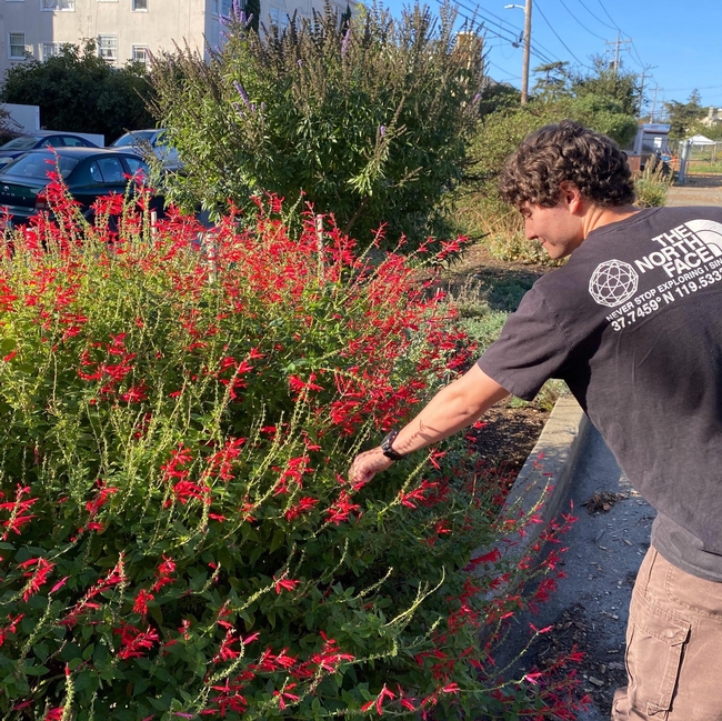
Assistant Researcher Jerid Vega with Pineapple Sage (Salvia elegans) at the Urban Bee Lab Garden in Berkeley, CA
Dr. Frankie, with the UC Berkeley Department of Environmental Science, Policy, and Management, is an urban entomologist with over 25 years of experience focusing on the behavioral ecology and community organization of solitary bee species in specific environments within California and Costa Rica. Over the past two decades, Dr. Frankie has conducted extensive studies on bee diversity, seasonality, and host plant preferences at various sites in northern California and seasonal dry forests in Costa Rica. His research also involves monitoring changes in annual bee frequencies and mortality factors that may impact bee populations. Recently, Dr. Frankie's work has shifted from pure wildland studies to comparative bee studies in both wildlands and urban residential gardens, driven by the discovery that urban areas can support diverse local bee species. This shift aligns with a broader concern of global pollinator decline and the need to find new ways to conserve and protect pollinators across different habitats.
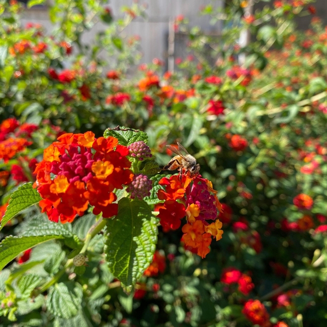
A pollinator visiting Lantana or Shrub Verbena (Lantana camara) at the Urban Bee Lab Garden in Berkeley, CA
Dr. Frankie and his assistant researcher Jerid Vega recently stopped by HREC to add herbaceous plants and flower seeds to their project's test hedgerow. Jerid graduated from Berkeley in the spring of 2023 with a B.S. in Molecular Biology from UC Berkeley's College of Natural Resources. Both Dr. Frankie and Jerid argue there is inherent value in recognizing what biodiversity is. “Supporting that biodiversity can be achieved through investments in smaller, more pollinator friendly gardens” says Vega.
Admittedly, Dr. Frankie acknowledges that picking plants for the hedgerow and observing their relationships with pollinator visitors is a very slow process. The time it takes for plant species to establish can be an obstacle to speedy species surveying. When asked how their research team selects and manages the plant species for a specific project, Dr. Frankie and Jerid credit nursery workers, master gardeners, and community members for their suggestions. Dr. Frankie's ideology on plant selection is collective, the product of conversation about pollinator activity from his team, colleagues, and master gardeners. “Those are the people who spend time with the plants, watching them far more than I do!” Dr. Frankie chimes.
Urban Bee Lab Garden in Berkeley, CA
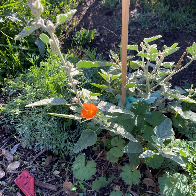
The Desert Mallow and native Redflower Buckwheat (pictured below) are just two of the many plant species that Dr. Frankie and his research team are in the process of observing. These native wildflowers not only produce striking, colorful blooms but also offer a wealth of nectar and pollen, making them a valuable food source for bees, butterflies, and other beneficial insects. Their extended blooming periods, typically from spring through late summer, ensure a consistent supply of sustenance for pollinators throughout the season. Additionally, both plants are well-adapted to arid and semi-arid regions, making them resilient and low-maintenance choices for gardeners. The Desert Mallow and Redflower Buckwheat exemplify the harmonious relationship between native plants and their pollinator counterparts that enhances biodiversity and contributes to a healthier ecosystem.
It's important to recognize that these pretty flowers attract all kinds of insects that aren't as suitable to some as the docile hummingbird. “It's not just bumble bees that these plants attract, it's wasps and flies that do their own part in benefiting ecosystem biodiversity,” adds Jerid Vega. The myth of insect pollinators being inherently eager to sting humans can be a significant obstacle in the way of convincing people to plant pollinator-friendly gardens. This fear of insects perpetuates reluctance to support both wildland and urban insect populations. In reality, these insects are not naturally aggressive toward people. “They're primarily focused on foraging for nectar/pollen to feed their colonies, and will only sting as a last resort if they feel threatened or cornered” concludes Jerid.
Educating people about the behavior and importance of bees and other pollinators is crucial. Dispelling the myth that bees are out to sting us can encourage more individuals to embrace pollinator-attracting plants, contributing to the conservation of these vital species. Understanding the true nature of bees and their role in pollination can lead to a more harmonious coexistence between humans and these remarkable insects.
When asked what potential small gardens with pollinator-preferred species have to attract a high diversity of bee species, Dr. Frankie provided some examples of encouraging results starting with his lab at the Oxford Tract. When the Bee Lab first moved to this site off campus, they started with bare soil. Since moving there full time in 2020, the garden has attracted over sixty species of native bees. The Bee Lab has also consulted on community gardens outside of the Bay Area in the past, including Emerson Community Garden in San Luis Obispo and a Diverse Home Garden in Ukiah. Emerson Community Garden surveyed 5 native bee species pre-planting and 42 species post-establishment. Diverse Home Garden in Ukiah surpassed that of Emerson, surveying 65 bee species in total over the course of 12 years.
The Bee Lab does their work with the help of community educators and a select group of volunteers primarily composed of undergraduate students interested in entomology, resource studies, or environmental conservation. Dr. Frankie's team sifts through volunteer applications annually, and are attracted to students they know will stay on board and have an interest in community outreach. Despite The Bee Lab being a small non-profit entity, they still respond to any invitations they can asking for lessons about pollinator vs. plant relationships.
Learn more about the UC Berkeley Bee Lab here.
This project was supported by funding through the CDFA's Healthy Soils Demonstration Program and 'California Climate Investments'. The HREC Hedgerow Demonstration Project is part of California Climate Investments, a statewide initiative that puts billions of Cap-and-Trade dollars to work reducing greenhouse gas emissions, strengthening the economy, and improving public health and the environment - particularly in disadvantaged communities.
Researchers create app to help drones improve farm efficiency
When flown at the right times, drones can help farmers adapt to a changing climate
Researchers at the University of California, Davis, have developed a web application to help farmers and industry workers use drones and other uncrewed aerial vehicles, or UAVs, to generate the best possible data. By helping farmers use resources more efficiently, this advancement could help them adapt to a world with a changing climate that needs to feed billions.
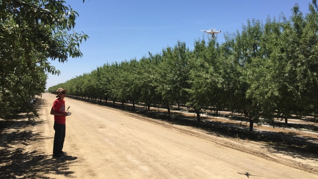
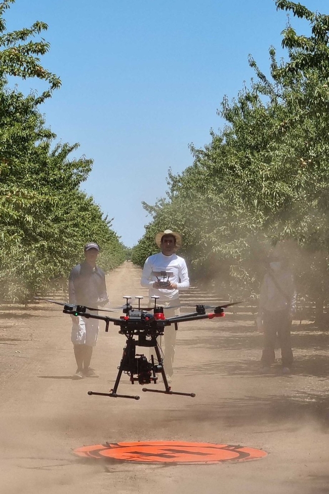
Associate Professor Alireza Pourreza, director of the UC Davis Digital Agriculture Lab and postdoctoral researcher Hamid Jafarbiglu, who recently completed his doctorate in biological systems engineering under Pourreza, designed the When2Fly app to make drones more proficient and accurate. Specifically, the platform helps drone users avoid glare-like areas called hotspots that can ruin collected data.
Drone users select the date they plan to fly, the type of camera they are using and their location either by selecting a point on a map or by entering coordinates. The app then indicates the best times of that specific day to collect crop data from a drone.
Jafarbiglu and Pourreza, who is also a UC Cooperative Extension specialist of agricultural mechanization, said that using this app for drone imaging and data collection is crucial to improve farming efficiency and mitigate agriculture's carbon footprint. Receiving the best data — like what section of an orchard might need more nitrogen or less water, or what trees are being affected by disease — allows producers to allocate resources more efficiently and effectively.
"In conventional crop management, we manage the entire field uniformly assuming every single plant will produce a uniform amount of yield, and they require a uniform amount of input, which is not an accurate assumption," said Pourreza. "We need to have an insight into our crops' spatial variability to be able to identify and address issues timely and precisely, and drones are these amazing tools that are accessible to growers, but they need to know how to use them properly."
Dispelling the solar noon belief
In 2019, Jafarbiglu was working to extract data from aerial images of walnut and almond orchards and other specialty crops when he realized something was wrong with the data.
"No matter how accurately we calibrated all the data, we were still not getting good results," said Jafarbiglu. "I took this to Alireza, and I said, 'I feel there's something extra in the data that we are not aware of and that we're not compensating for.' I decided to check it all."
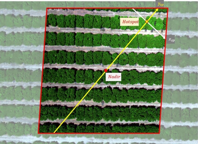
Jafarbiglu pored through the 100 terabytes of images collected over three years. He noticed that after the images had been calibrated, there were glaring bright white spots where they were supposed to look flat and uniform.
But it couldn't be a glare because the sun was behind the drone taking the image. So Jafarbiglu reviewed literature going back to the 1980s in search of other examples of this phenomenon. Not only did he find mentions of it, but also that researchers had coined a term for it: hotspot.
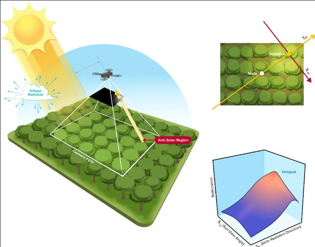
A hotspot happens when the sun and UAV are lined up in such a way that the drone is between the viewable area of the camera's lens system and the sun. The drone takes photos of the Earth, and the resulting images have a gradual increase in brightness toward a certain area. That bright point is the hotspot.
The hotspots are a problem, Jafarbiglu said, because when collecting UAV data in agriculture, where a high level of overlap is required, observed differences in the calibrated images need to come solely from plant differences.
For example, every plant may appear in 20 or more images, each from varying view angles. In some images, the plant might be close to the hotspot, while in others it may be situated further away, so the reflectance may vary based on the plant's distance from the hotspot and spatial location in the frame, not based on any of the plant's inherent properties. If all these images are combined into a mosaic and data are extracted, the reliability of the data would be compromised, rendering it useless.
Pourreza and Jafarbiglu found that the hotspots consistently occurred when drones were taking images at solar noon in mid-summer, which many believe is the best time to fly drones. It's an obvious assumption: the sun is at its highest point above the Earth, variations in illumination are minimal, if not steady and fewer shadows are visible in the images. However, sometimes that works against the drone because the sun's geometrical relationship to the Earth varies based on location and the time of year, increasing the chance of having a hotspot inside the image frame when the sun is higher in the sky.
"In high-latitude regions such as Canada, you don't have any problem; you can fly anytime. But then in low-latitude regions such as California, you will have a little bit of a problem because of the sun angle," Pourreza said. "Then as you get closer to the equator, the problem gets bigger and bigger. For example, the best time of flight in Northern California and Southern California will be different. Then you go to summer in Guatemala, and basically, from 10:30 a.m. to almost 2 p.m. you shouldn't fly, depending on the field-oriented control of the camera. It's exactly the opposite of the conventional belief, that everywhere we should fly at solar noon."
Grow technology, nourish the planet
Drones are not the only tools that can make use of this discovery, which was funded by the AI Institute for Next Generation Food Systems. Troy Magney, an assistant professor of plant sciences at UC Davis, mainly uses towers to scan fields and collect plant reflectance data from various viewing angles. He contacted Jafarbiglu after reading his research, published in February in the ISPRS Journal of Photogrammetry and Remote Sensing, because he was seeing a similar issue in the remote sensing of plants and noted that it's often ignored by end users.
"The work that Hamid and Ali have done will be beneficial to a wide range of researchers, both at the tower and the drone scale, and help them to interpret what they are actually seeing, whether it's a change in vegetation or a change in just the angular impact of the signal," he said.
For Pourreza, the When2Fly app represents a major step forward in deploying technology to solve challenges in agriculture, including the ultimate conundrum: feeding a growing population with limited resources.
"California is much more advanced than other states and other countries with technology, but still our agriculture in the Central Valley uses technologies from 30 to 40 years ago," said Pourreza. "My research is focused on sensing, but there are other areas like 5G connectivity and cloud computing to automate the data collection and analytics process and make it real-time. All this data can help growers make informed decisions that can lead to an efficient food production system. When2Fly is an important element of that."
This article was originally published on the UC Davis College of Engineering News page.

