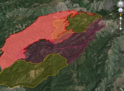
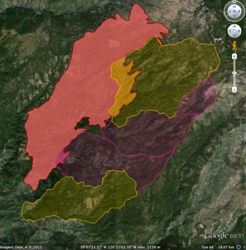
This website offers an initial description of post-fire vegetative conditions using the Rapid Assessment of Vegetation Condition after Wildfire (RAVG) process. RAVG analysis looks at fires that burn more than 1,000 acres of forested National Forest System (NFS) lands, beginning with fires that occurred in 2007. These fires result in direct losses of vegetative cover and many of the benefits associated with forested ecosystems.
NFS lands experience thousands of wildfires every year, most of which are relatively small. The largest fires typically account for 90% of the total acreage burned. RAVG analysis provides a first approximation of areas that due to severity of the fire may require reforestation treatments. These reforestation treatments would re-establish forest cover and restore associated ecosystem services. This initial approximation could be followed by a site-specific diagnosis and development of a silvicultural prescription identifying reforestation needs.
Summary:
- Post Fire Vegetation Mapping process that the Forest Service Uses http://www.fs.fed.us/postfirevegcondition/index.shtml
- Specific to the methodology of the RAVG program can be found at: http://www.fs.fed.us/postfirevegcondition/whatis.shtml
A nice press release about our new paper on the concepts behind a fire detection satellite with perhaps the coolest acronym yet: FUEGO — Fire Urgency Estimator in Geosynchronous Orbit. From Bob Sanders.

Current and planned wildfire detection systems are impressive but lack both sensitivity and rapid response times. A small telescope with modern detectors and significant computing capacity in geosynchronous orbit can detect small (12 m2) fires on the surface of the earth, cover most of the western United States (under conditions of moderately clear skies) every few minutes or so, and attain very good signal-to-noise ratio against Poisson fluctuations in a second. Hence, these favorable statistical significances have initiated a study of how such a satellite could operate and reject the large number of expected systematic false alarms from a number of sources. We suggest a number of algorithms that can help reduce false alarms, and show efficacy on a few. Early detection and response would be of true value in the United States and other nations, as wildland fires continue to severely stress resource managers, policy makers, and the public, particularly in the western US. Here, we propose the framework for a geosynchronous satellite with modern imaging detectors, software, and algorithms able to detect heat from early and small fires, and yield minute-scale detection times. Open Access Journal Link. Press Release. KPIX spot.


Forest visitors are asked to adhere to area and road closures. These closures are in place to protect visitors and fire fighters. The roads and areas that have been closed are unsafe due to fire-weakened, burned trees that pose a risk of falling, as well as frequently heavy smoke making visibility extremely poor. These areas and roads will be re-opened as soon as possible.
Some resources:
- Incident Report: http://www.inciweb.org/incident/3624/
- SimTable Report: http://apps.simtable.com/fireProgression/outputTemp/CA-TNF-HU11_%20american.html
- ESRI Online report: http://www.arcgis.com/explorer/?open=11487c248b3a407cb6fd446ce8ef73d8
We will keep you posted.
For more on the SNAMP project see: http://snamp.cnr.berkeley.edu/
This was originally posted on http://kellylab.berkeley.edu/.

The American Fire burning in heavy fuels on extreme slopes about 10 air miles northeast of the community of Foresthill, California, and eight air miles south of Interstate 80 has grown to 14,765 acres.
Some resources:
Incident Report: http://www.inciweb.org/incident/3624/
We will keep you posted.
For more on the SNAMP project see: http://snamp.cnr.berkeley.edu/
This was originally posted on http://kellylab.berkeley.edu/.


