- Author: Andrew J Lyons
- Contact: Sean D Hogan

June 24-28, 2024
CSU Monterey Bay
(plus virtual open)
DroneCamp is a premiere five-day training program that covers everything you need to know to use drones for mapping and data collection.
Curriculum at a Glance
- equipment
- safety & regulations
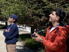
- flight planning
- manual & autonomous flight
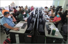
- photogrammetry
- hands-on data processing with Pix4D, OpenDroneMap & ArcGIS Pro
- data analysis & visualization
- research talks & use cases
- educator track - new for 2024!
Now in its eighth year, Drone Camp 2024 will once again provide a unique drone training opportunity designed for a wide range of skill levels and interests, from complete beginners with little to no experience in drone technology, to intermediate users who want to learn more advanced data processing and analysis.
DroneCamp started out as an IGIS workshop, but has evolved into a highly collaborative program with instructors coming from 8 campuses including UC ANR, UC Merced, UC Santa Cruz, CSU Monterey Bay, UC Davis, UC Berkeley, UC Santa Barbara, Lakeland College, and American River College.
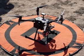
DroneCamp 2024 will be held in-person at CSU Monterey Bay June 24-28, 2024. Scholarships to cover the registration fee are available for all ANR academics and staff - but you must apply soon! More info available at DroneCampCA.org.
 |
 |
 |
 |

- Author: Sean D Hogan
In the past year IGIS has had the pleasure to work with Juniper Unmanned inc. to undertake a proof of concept project interested in mapping cellular broadband speeds at four agricultural sites in the rural Central Valley of California, using a drone equipped to spatially record cellular network speeds for ATT, Verizon and T-Mobile cell phone carriers. Information of this type may be useful for future smart-farming efforts, including allocations of resources and the potential placement of cellular antennas on farms in the future.
For more information, please see the following StoryMap, which reports the project's findings: https://storymaps.arcgis.com/stories/d1f34c829c104c9d9bb0ed4536f39e03


- Author: Sean Hogan
- Author: Brandon Stark
- Author: Maggi Kelly

non-recreational use of small unmanned aerial systems (sUAS - aka. drones) was added to the FAA's Code of Federal Regulations (CFR) in mid-2016, there have been a number of updates to the rules over the years, including an Academic Exemption for education and research purposes (which is only apply to institutions of higher education and not other state agencies or conservation groups). The most recent of these updates occurred in January 2021, when the regulations were further amended to allow for the operation of drones during the night and over people in limited circumstances. For some operators, these have been very welcome changes. However, maybe more widely relevant to our community of drone enthusiasts, in June 2021 the FAA announced the requirement of "The Recreational UAS Safety Test" (TRUST) for all recreational pilots; with the objective of ensuring that these pilots are likewise knowledgeable in the FAA's rules and regulations for drone operations.
Amidst these updates and changes to the regulations, a common question that IGIS receives is "what do I need to do to legally fly a drone?" To answer this question, the head of our UC System's Center of Excellence on Unmanned Aircraft System Safety (UASSafety), Dr. Brandon Stark, has provided the following simplified guidelines to help steer people in the right directions, for whether they need the TRUST and/or Part 107 certifications:
- Coursework -> TRUST
- Research in access-controlled field -> TRUST
- Research in public area with people -> Part 107
- Collection of data for another agency -> Part 107
- Promotional media -> Part 107
- Demonstration for students -> TRUST
- Demonstration for non-students -> Part 107
- Inspecting any structure for repairs -> Part 107
- Flying above the FAA's Facility Map Altitude -> Part 107
- Flying above 400 ft (AGL) -> Part 107
- Any operation that could profit the pilot in any way -> Part 107
- Strictly for fun (even if you have a Part 107 certification) -> TRUST
Note - The Academic Exception is not a loophole. Everyone now needs to have either completed a TRUST or Part 107 certification, and preferably both.
For the sake of drone operators everywhere, it is extremely important that we all abide by these rules and regulations; as it could take only one grievous mistake (even if the mistake is unwitting) to legally set back all of the progress that has been made for the allowance of sUAS operations, both within and outside of the UC System.
For more information on the TRUST and Part 107 certifications, please refer to the FAA's official site: https://faadronezone.faa.gov/
For all UC drone operations, please do not forget to file your flights in advance through the UC's UAS Safety App, https://ehs.ucop.edu/drones/. This is not only required by the UC System, but also provides the valuable benefit of insurance coverage for you and your drone in the event of an accident. Additionally, the recently created UC Drones knowledge portal is an incredible resource for a wide range of drone safety and regulation information: https://ucdrones.github.io/

- Author: Sean Hogan
- Author:
Ben Satzman
- Author: Maggi Kelly
July 2021 marks the fifth anniversary of Drone Camp, and thanks to an all-star lineup of presenters and instructors and a fantastic and diverse group of over 255 attendees from all over the world, it was a massive success this year. Initially launched in 2016 by the UC ANR, IGIS Statewide program, DroneCamp has now evolved into a multi-campus and industry collaboration, with a network of drone experts hailing from UC ANR, UC Santa Cruz, UC Berkeley, UC Merced, UC Davis, CSU Monterey Bay, and the Monterey Bay Drone Automation and Robotics Technology corporation. From 2016 to 2019, this event was held in-person at Davis, San Diego, and then in Monterey, CA.; however, in 2020 it was moved online due to COVID-19. The move indoors, to discuss a very outdoor-oriented topic, came with some challenges. We had to shelve our important (and fun) hands-on equipment and flight training, for example. Yet it had rewards. We were able to reach a more diverse and a greater number of participants, and widen the scope of content. Ultimately, 2020 was a great success, but in the process we recognized that it could be even better with additional help from our network of drone expert friends from around the state.
Like last year, we came together online for DroneCamp 2021 in July. Over 255 people joined from around the world to learn about theory, application, regulation, and data processing. We learned about the practical aspects of maintaining safety while flying, we took deep dives into various software workflows, and explored agricultural, forestry, and vegetation mapping examples. This year we hosted 5 Plenary sessions, and had some electrifying plenary talk sessions from cutting-edge scientists from around California: Crashing drones! Precision Agriculture! Citizen Science! Mapping aquatic environments!
Because the overall objective of DroneCamp remains to provide the most practical and comprehensive learning experience possible for attendees, we are working on an in-person, hands-on training day that is being scheduled for October, to be held in Monterey/Marina California. And, as the threat of COVID-19 subsides, additional in-person training sessions will be added around the state of California in the coming year.

DroneCamp Overview:
DroneCamp is designed for a wide range of skill levels and interests, for those who are interested in using drones for anything other than non-recreation use (calling for a part 107 remote pilot's license), from complete beginners with little to no experience in drone technology, to intermediate users who want to learn more advanced data processing and analysis. Between presentations on contemporary applications of drones in environmental and agricultural research, and hands-on data processing and analysis exercises, attendees have the opportunity to fully immerse themselves in the following topics:
-
Flight Skills: Safe Launch and Landings, Basic Operations, Traversing and Avoiding Obstacles, Night Flying
-
Safety and Regulations: Safety and Regulations Overview; How to be a Good Visual Observer; Operating in Controlled Airspace
-
Hardware: Sensors, Platforms and Field Accessories
-
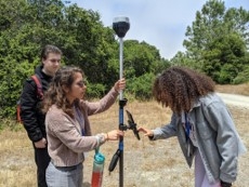
Data Collection: Mission Planning; High Precision Mapping
-
Data Processing: Stitching Drone Images with Pix4D, Agisoft Metashape, ArcGIS Pro, and OpenDroneMap; Analyzing Processed Drone Data in QGIS and ArcGIS Pro
-
Data Analysis and Management: Vegetation Analysis, Vegetation Analysis and Classification in ArcGIS Pro;Analysis of the Intertidal Zone; A case study of data management, from collection to storage and sharing of data outputs.
It was super fun and rewarding, and a great success for ANR and all the other collaborators. We built networks, increased collaboration, learned some very cool technical stuff, and got updated on current regulations, including the fact that you can now renew your 107 license easily here.
Some inspiring quotes from anonymous attendee reviews:
I was so appreciative of the extremely high caliber faculty/instructors that were recruited to give presentations, demos, and use of software. You all worked so well together to impart different pieces of expert knowledge. You all are brilliant and I'm inspired!!!
Loved it. We started off heavy which blew my mind but all the talks were so informative and fascinating. Really appreciate the diverse group of people you gathered together. Just wish it was in person! I would love to meet everyone.
Excellent presentation that allowed those of us with ArcMap experience to see the similarities and differences offered by ArcGis Pro. Again, a wonderful presentation (by a professional) that accounts for all the practical steps involved with data manipulation rolled into a final product.
Once I read through my notes, look at my screen captures and watch some of the presentations again, I will be able to structure my drone classes for my students. I'm developing a drone program from scratch for middle and high school students at a local charter school.
Consider signing up for the in-person training in October, and keep DroneCamp 2022 in your sights! Further information will be coming soon to the DroneCamp website, https://dronecampca.org/
- Author: Andy Lyons
- Contributor: Jacob Flanagan
- Contributor: Sean Hogan
- Contributor: Maggi Kelly
At the recent conference of the American Association of Geographers (AAG) in Washington DC, IGIS was recognized for its work in developing open source data management tools for drone data. The AAG is the largest association of geographers, GIS specialists, environmental scientists in the world, and its annual conference attracts over 8,500 people and over 6,900 presentations. IGIS researchers Andy Lyons, Jacob Flanagan, and Sean Hogan won second place in a poster competition sponsored by the AAG Remote Sensing Specialty Group and photogrammetry company Pix4D.

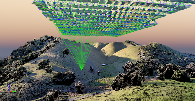
Data management involves protocols and file transfer utilities to help you organize data, assess quality, create backups, find and retrieve files, and reproduce workflows. Photogrammetry programs are brilliant at stitching photos into beautiful high resolution imagery, but they don't offer many tools for managing data before or after the processing. This is the gap IGIS is addressing.
IGIS has been working on data management tools for the past couple of years to help us manage the dozens of drone projects we conduct each year on behalf of UC researchers. In keeping with our public mission and research innovation focus, we use open source programming platforms such as Python and R and share our tools on GitHub so anyone can use them.
The poster presented at the AAG conference showcases 5 data management projects. The foundation of all our projects is a directory structure and file naming protocol that encompasses all the types of data in a drone project, including images, ground control points, GIS layers, documentation, intermediate files, and final outputs. Building upon this, the uavimg package for R creates offline HTML catalogs and maps of images, allow for quality control checks in the field and a master catalog to help an analyst find the right set of images for a project. The IGIS Drive Monitor, written in Python, is designed to run on a laptop in the field and automates the process even further by monitoring a USB drive and copying files into the right place automatically. The IGIS Pix4D Controller, also written in Python, runs on a server and automates the next step of the process, launching the Pix4D stitching software when a new set of images is detected, creating a new project, and initiating the stitching process. Finally, the IGIS Drone Data Management Logbook, still being developed, combines functionality of the previous utilities with additional visualization tools for quality control.
Our drone data management utilities are still under development, but they are available currently available for testing (see GitHub links in the poster). If you'd like to be a beta tester, please let us know!). Later this year, we plan on holding a webinar describing how to use these tools and invite feedback from users. Open source software is designed for collaboration, and our ultimate hope is to collaborate with other drone users and programmers facing similar needs. In the meantime, it's great to be recognized by leading experts in the field.
Open Source Tools for Drone Data Management poster, AAG 2019

