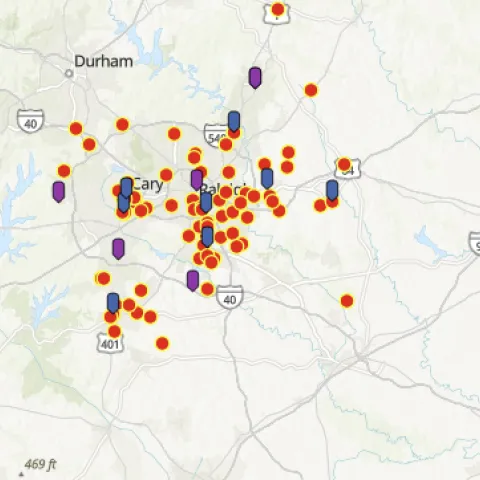
- Author: Andy Lyons
- Author: Sean Hogan
- Contributor: Shane Feirer
- Contributor: Maggi Kelly
- View More...
The IGIS Team is pleased to share our workshop schedule for Fall 2023. See the dates and descriptions below. If you're not available to attend one that really interests you keep an eye open for the recordings on our YouTube Channel.
Have an idea for a workshop? Or a quick question about mapping, drones, or data? Send us a note or sign-up for Office Hours.
Introduction to ArcGIS Online
Friday September 22, 2023 • 1:00 - 4:00pm • online • free
ArcGIS Online is the online component of the ESRI geospatial ecosystem, and the foundation for web mapping, story maps, and mobile data collection. This workshop will provide an overview of ArcGIS Online and teach participants how to create a web map. This workshop is a prerequisite for the Story Maps workshop, and recommended for ArcGIS Pro.
Requirements: No experience required. Participants must have an ArcGIS Online account set up prior to the workshop (free for all UCANR employees, temporary accounts available for others). Details and registration.
Intro to R Workshop Wednesdays
Part. 1. Wednesday September 27, 2023. 10:00a - 12:00p • online • free
Part. 2. Wednesday October 4, 2023. 10:00a - 12:00p • online • free
Part. 3. Wednesday October 11, 2023. 10:00a - 12:00p • online • free
Part. 4. Wednesday October 18, 2023. 10:00a - 12:00p • online • free
R is an enormously popular open-source platform for statistics, programming, and data science. The command line interface however is very different from Excel, and can take some getting used to. This introductory 4-part workshop series will start from the beginning. Through slides and hands-on exercises, participants will learn the fundamentals of working with data in R, including importing data, cleaning and manipulating tabular data for analysis, visualization, and simple statistical tests.
Requirements. No experience necessary. Participants with some experience are welcome to start with Part 2, but are expected to know the basics. To complete the hands-on exercises, participants need to sign-up for a Posit Cloud account (free). Details and Registration.
Introduction to ArcGIS Pro
Friday October 13, 2023 • 1:00 - 4:00pm • online • free
ArcGIS Pro is ESRI's powerhouse desktop application for all things GIS. It can do everything from basic cartography to advanced geospatial modeling. This introduction will get you started creating maps with local and online GIS data.
Requirements. ArcGIS licenses are free for all UC ANR employees, and temporary accounts available for others. Instructions will be provided on how to access the software. No experience needed, but the ArcGIS Online workshop (Sept 22) or equivalent experience is strongly encouraged. Details and registration.
Introduction to Jupyter Notebooks in ArcGIS Pro
November 17, 2023 • 1:00 - 4:00pm • online • free
Jupyter Notebooks are a user-friendly and interactive way to write Python code. ArcGIS Pro supports Jupyter notebooks natively, opening the door to a wide range of options for automation and extensibility. This workshop will get you started using Jupyter Notebooks in ArcGIS Pro to automate workflows, perform geoprocessing tasks, create data summaries, and import downscaled climate data from Cal-Adapt.
Requirements: Basic familiarity with ArcGIS Pro is expected. Licenses for ArcGIS Pro are free for all UC ANR employees, and temporary accounts available for others. Experience with Python is helpful but not required. Details and registration.
Introduction to ArcGIS Story Maps
Friday Dec. 15, 2023 • 1:00 - 4:00pm • online • free
Story Maps for ArcGIS is a powerful and popular platform for creating websites that convey compelling narratives through text, media, and maps. Story Maps are increasingly used for online extension, program reporting, and presentations. This workshop will get you started and give you the tools to create your own Story Maps.
Requirements: Participants must have an ArcGIS Online account set up prior to the workshop (free for all UCANR employees, temporary accounts available for others). The Intro to AGOL workshop, or equivalent background, is a prerequisite for this workshop. Details and registration.
/h2>/h2>/h2>/h2>/h2>
- Author: Andrew J Lyons

ESRI has developed a wide range of products and services that can be brought together to support a range of decision support contexts. Some of these are "no code" tools to develop web apps relatively easily. A good example of this is ArcGIS Dashboards, which allows you to bring together with relative ease a range of data sources with a modest number of transformations, layouts, and widgets. These are good options for relatively simple use-cases and if your data are already in the ArcGIS ecosystem.
However I actually get more excited about the building blocks of these systems, which to its credit ESRI also makes available. You can think of these as legos that can be combined in different configurations to support specific decision contexts. They include tools for data importing, pre-processing, analysis, and hosting, as well as delivery through a custom web interface. Below are a few highlights from my week at the ESRI conference, themed around the main components of a decision support system.
Data Pipelines. ArcGIS Data Pipelines is a fairly new tool (still in beta) for ArcGIS Online that allows you to create a data processing pipeline that imports vector or tabular data, apply some transformations, and (re)publish it as a Feature Service. A typical use case would be ingesting data from a non-ESRI platform (think open-source data portals commonly used by municipalities), clean it up, and republish it on AGOL (or Enterprise). Previously you would have to do this manually or write Python scripts for this kind of thing. Being able to import and clean up data through a flow-chart style interface is a pretty cool functionality, and particularly useful for decision support systems which often require bringing together disparate data sources under one umbrella. ArcGIS Data Pipelines exist 100% on AGOL, which is convenient but presents some limitations on what you can do. Right now all the import "jobs" have to be executed manually from the flow chart style editor, but it will support scheduling when it comes out of beta this fall. Pro Tip: although ESRI isn't charging an extra license fee to use Data Pipelines, credits are charged according to how much time you spend in the Editors, not the actual amount of data processed. So be sure to close the Editor when you're done with it!
Data Processing with Python. In terms of pre-processing and analyzing data, ESRI has a strong set of options including both "point-and-click" solutions and scripting tools. The scripting languages provide the most flexibility, and within these Python is far-and-away the most developed in the ESRI universe. ESRI has two primary packages for Python, including the venerable "arcpy" package and the recently rebranded "ArcGIS Map SDK for Python". The former is recommended if you're working locally (i.e., on your laptop), while that later is recommended if you're working in a cloud environment. Both have hundreds of functions for all kinds of data manipulations, as well as other functions for administering ArcGIS resources and interfacing with their various products. I'm a relatively newbie to working with spatial data in Python, so I attended a number of Python sessions that covered both the big picture as well as specific workflows. I look forward to working with these more and using them in projects.
Constructing Composite Indices. One of my favorite sessions this year was on constructing composite indices. Indices are commonly used in decision support systems to simplify decisions involving lots of different types of data - think about a system designed to allocate resources based on a multi-dimensional construct like "vulnerability", "conservation value", or "acquisition value". These are hard problems to wrap your head around, because they inherently involve multiple criteria which are often apples and oranges. In IGIS we bump into this need all the time. ArcGIS Pro now has a "Create Composite Index" data processing tool. But what I really appreciated about the workshop was the robust discussion of best practices, and how construction of a 'good' index is by no means a technical problem. Bias is introduced at every corner whether you like it or not, including how you normalize the individual layers, and how you combine layers into an single composite index. ESRI has some smart people thinking about this, and I would recommend everyone who creates or uses Composite Indices to read their recent whitepaper Creating Composite Indices Using ArcGIS: Best Practices.
Building Front Ends. Many people think about web-based decision support systems in terms of the 'front end', or web app. Although the magic of decision support is almost always grounded on the data or model, a well-designed web app is effectively the gatekeeper for sharing the value of research with users. ESRI has developed a number of "preset" web app tools, that combine a modest number of layouts and capabilities. These includes everything from simple Dashboards to the more flexible "Instant" and 'Experience Builder' web apps. These are all "no-code" solutions, which work well enough for many use-cases. Where more custom functionality is needed, ESRI continues to develop and document the underlying components. Of note this year is a reorganization of the JavaScript and Python libraries, which is not a game changer in itself but makes it a little easier to find what you need to construct a dataset or web app. If you like the look of ESRI's web apps, ESRI has also made many of the web app 'controls' (like a button or color selector) in their Calcite Design Framework available to web developers. But the most exciting announcement this year was that many of the underlying components of ESRI's 'out-of-the-box' web apps (like a map viewer or legend) will soon be released as open source web components. This will dramatically lower the bar for creating custom web apps scratch, and enable people like myself who don't have the time or patience to fine-tune web GIS JavaScript commands for a standard UI/UX.
All-in-all, attending the ESRI User Conference was an enriching experience. In addition to learning a lot of technical info, I met the ESRI developers who build these tools, other users like myself who are trying to figure out how to put the pieces together, and vendors who add value to ESRI's ecosystem. In IGIS, we like to say a 5 minute consultation can save you 5 hours of frustration. With the info and contacts I picked up at the User Conference, I feel like I made a big step forward that will save me a lot of time and effort applying these tools to upcoming projects.
- Author: Sean Hogan
The thing that I possibly like the most about the ESRI Users Conference is that you not only get to see all of the recent updates that the company has recently developed but also glimpses of what is coming soon. In particular, I am excited about the advancements that they have made in respect to web mapping applications.
Are you an ArcGIS Online user, and have been wondering when to transition from the Traditional Web Map Viewer to the new Web Map Viewer? To answer that question, for myself, I think the time is now. At this point, per ESRI, there are now only four remaining functionalities that remain to be added to the new Map Viewer to give it all of the functionality that the Traditional Map Viewer had, which will be discontinued in late 2025, including the abilities to:
- Calculate fields (this would be nice to have)
- Add additional relationships to related records (something I have never needed to do previously)
- Vector tile style editing (not something I have ever needed to do, but which I could see being useful for some people)
- Saving/duplicating layers (there is a relatively simple work around for this, but it would be nice to have it built into the Map Viewer)
That said, there are far more than four added functionalities that the new Map Viewer has that the old version lacks, including:
- Easier browsing of data
- Feature editing enhancements
- Analysis enhancements, both for vectors and rasters
- Shortcuts
- Improved visibility, filtering, and effects (on the fly)
- Toggleable layers
- Charts (donut and pie)
- Label enhancements (including improved bookmarks and placements)
- Blending (in a group layer); including blending layers with basemaps and multiply effects
- Added display expressions
- Multidimensional imagery support, including an imagery slider
- The ability to upload feature symbols (svg)
- Sketch layers (as opposed to Classic's notes) with snapping, and also with the ability to upload custom symbols
- The ability to add and manually georeferenced media layers (jpg or png) using control points (on which media blending and effects can also be applied)
Besides all of these additions, the interface has been thoughtfully revamped with usability and efficiency in mind. Some of the above enhancements will now allow you to complete some work flows/functions several times faster than they could be done before. I must admit that I am very pleased!
- Author: Shane T Feirer
The first day of the ESRI User Conference was a good day of new technologies and good stories of Conservation and GIS. There were approximately 18,000 attendees in San Diego for the Conference with an additional 10,000 attending virtually.
Jack Dangermond and ESRI highlighted their new offerings like ArcGIS Reality that allows users to generate a digital twin of at scale from buildings, cities, to entire countries. ESRI has also released new story map templates (the brief, e-magazine) and theme and text enhancements. They have built in new enhancements to the ArcGIS Dashboards, these enhancements include better mobile support and additional support of Arcade.
There have been considerable investment in enhancing Spatial Analysis and Data Science, these included:
- 60+ New Tools
- GeoAI Models (Deep Learning)
- Analysis in the Map Viewer
- Time Series Forecasting
- Predictive Modeling
- Multivariate Indexing
- Pie and Donut Charts
- Big Data Tools
I am looking forward to learning more about the enhancements in the coming days.
Beyond ArcGIS Online and its apps, ESRI highlighted its work on integrating the ArcGIS Mapping system into Office 365 applications. Users of Office 365 can now easy map data in spreadsheets, in teams, sharepoint these new tools. This could bring more mapping technology to UCANR Academics and Staff.
- Author: Andrew J Lyons
- Contributor: Tapan B Pathak
- Interested in hearing about the latest projected climate data just released from California's Fifth Climate Change Assessment?
- Have a burning question about how climate change will impact California's agricultural systems?
- Want to hear how researchers, industry leaders, and state agencies are thinking about decision support for climate adaptation?
If you answered yes to any of these questions, join us at the California Adaptation Forum on July 31, 2023 in Pomona (one of the workshops will also be on Zoom) for a pair of pre-conference workshops that will address these and other topics.
The California Adaptation Forum, being held in person for the first time in 5 years, is the premier conference in the state that brings together community leaders, state and local agencies representatives, researchers, and others to share and discuss how Californians are adapting to climate change today and preparing for the future. Pre-conference workshops will be held on Monday July 3, including:
Using Climate Data & Tools for Decision-Making with Cal-Adapt

July 31, 1:00 – 2:45 pm. In-person
Now more than 10 years old, Cal-Adapt is California's primary source for downscaled climate data. This workshop will review the data and tools available through Cal-Adapt.org, and describe the latest generation of downscaled climate data just released from the Fifth Climate Change Assessment. You'll also get to see the upcoming “Cal-Adapt: Analytics Engine” in action, talk to the researchers who built it, and play with the tools in interactive working sessions. Bring your questions, curiosity, and enthusiasm to dive into the data and explore how
climate projections can help you and your community prepare for climate change.
Speakers:
- Nancy Thomas (Geospatial Innovation Facility, UC Berkeley)
- Grace Di Cecco (Eagle Rock Analytics)
- Nancy Freitas (Lawrence Berkeley National Lab and UC Berkeley)
- Justine Bui (Spatial Informatics Group)

Advancing decision support for climate adaptation in agriculture and natural resources
July 31, 2023. 3:00 – 5:00 pm. In-person and on Zoom
Information on climate change is one of our best resources for adaptation planning. We have a pretty good idea how weather and climate can affect agricultural and natural systems, and we have pretty good data on climate trends. Connecting the two is the realm of decision support tools. In this workshop, we'll hear from researchers asking questions about the impacts of climate changes on tree crops, agricultural pests, urban trees, and water resources. In the second half of the workshop, participants will be invited to discuss their burning questions about climate adaptation, and talk with researchers who are trying to harness climate data to develop decision support tools for adaptation.
Speakers:
- Tapan Pathak (Professor of Extension, UC Merced)
- Andy Lyons (Program Coordinator, UC ANR)
- Bob Klein (California Pistachio Research Board)
- Janet Hartin (CE Advisor, UC ANR)
- Michael Wolff (Senior Environmental Scientist, CDFA)
- Romain Maendly (Climate Change Technical and Policy Advisor, DWR)
Zoom info: This workshop will be held in person and on Zoom. Zoom participants will be included in the entire workshop - presentations, Q&A with the presenters, and breakout discussions. Register here.


/h3>/h3>