- Author: Andy Lyons
- Author: Sean Hogan
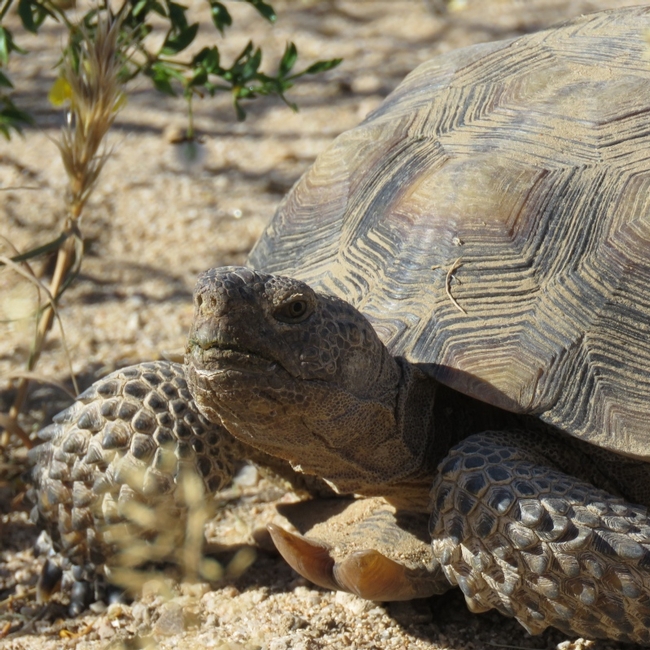
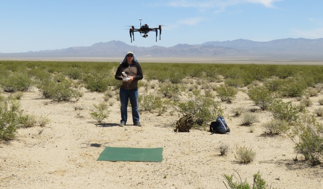
The drone data will be used to create fine resolution vegetation and elevation maps, as part of a desert tortoise research project led by Dr. Brian Todd in the Dept. of Wildlife, Fish, and Conservation Biology at UC Davis. The study seeks to better understand how the threatened desert tortoise navigates in its landscape, which will help biologists and land managers responsible for protecting the desert tortoise make management decisions, such as where to place road fences that don't cut off important resources for this long-lived species. Researchers on this project track the tortoises with GPS and temperature sensors, which they will now be able to overlay on the highly detailed maps of the desert generated from the drone imagery.
How does the desert look to a tortoise?
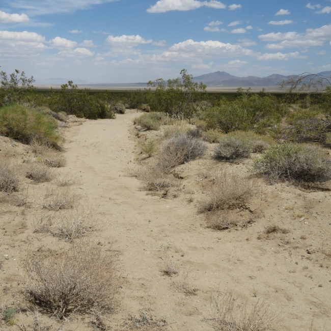
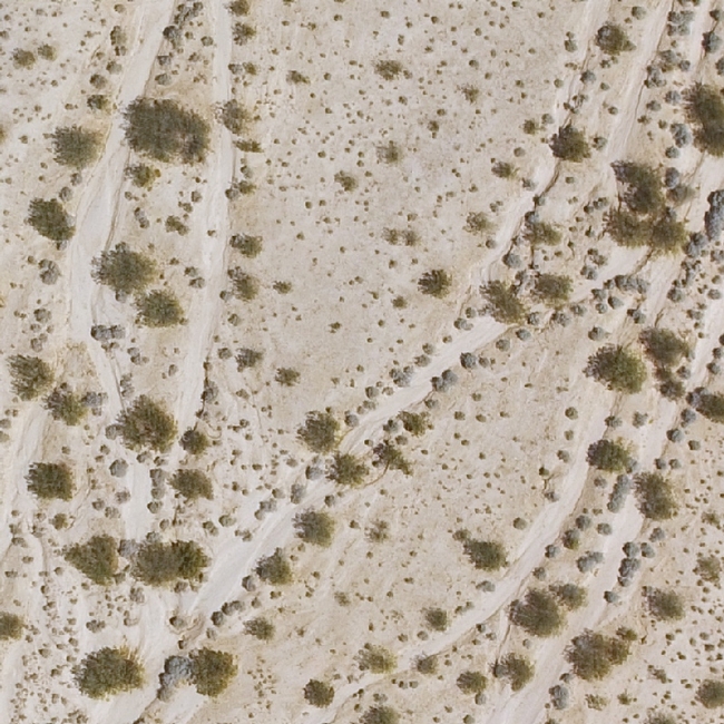
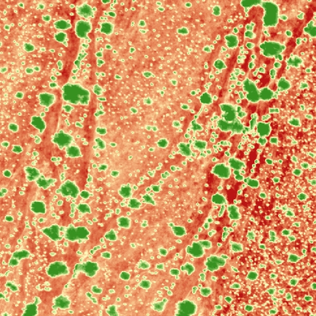
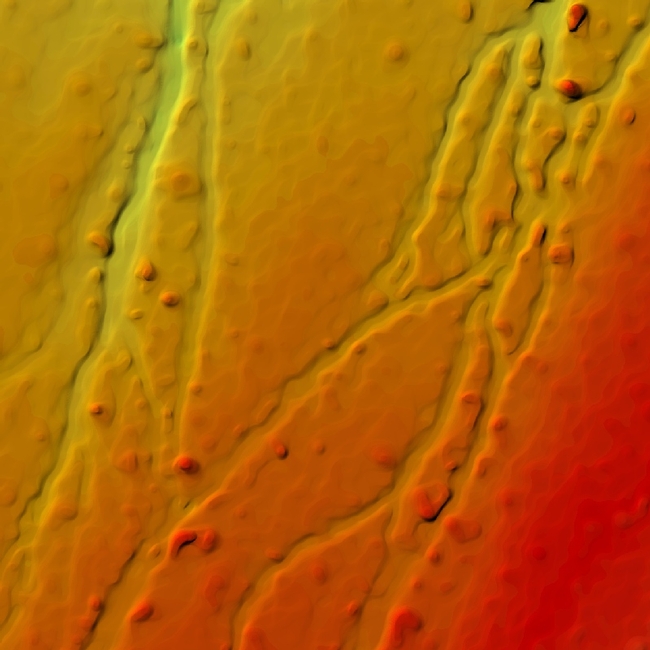
A Large Study Area
The study area is approximately 3600 acres, which is extremely large for a drone. We mapped the area in two trips in 2016 and 2017, with significant improvements to our mapping methods in between.
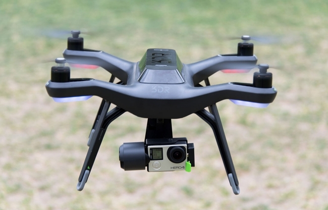
The Solo+GoPro combo worked well, but the flight time of the Solo, its mediocre GPS receiver, and the lack of an integrated GPS module in the GoPro were limiting factors that required more time for both flying and processing the data.
New Drone Platform for 2017
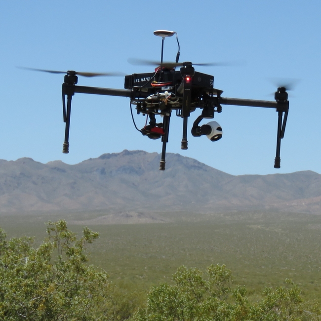
Lessons Learned
Some lessons learned for mapping large areas include:
- Mapping large areas with a quadcopter is viable with careful planning
- The Matrice 100 is large enough has enough power to fly 100 acre flights with two cameras on board with two batteries and calm winds
- Heat can dramatically reduce flight time because the air is thinner and equipment less efficient
- Checking your data in the field and having backup plans for weather and equipment glitches are essential
- Having two or more people on the flight crew helps tremendously
- Developing individual mission plans before going to the field reduces time between flights and hence illumination differences between adjacent areas
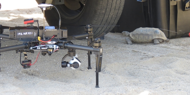
- The dessert tortoise is a charismatic creature with amazing adaptations, and a great curiosity about the research equipment we were setting up alongside the road:
Day 3: I opened the day with a lovely swim with Elizabeth Havice (in the largest pool in New England? Boston? The Sheraton?) and then embarked on a multi-mile walk around the fair city of Boston. The sun was out and the wind was up, showing the historical buildings and waterfront to great advantage. The 10-year old Institute of Contemporary Art was showing in a constrained space, but it did host an incredibly moving video installation from Steve McQueen (Director of 12 Years a Slave) called “Ashes” about the life and death of a young fisherman in Grenada.
My final AAG attendance involved two plenaries hosted by the Remote Sensing Specialty Group and the GIS Specialty Group, who in their wisdom, decided to host plenaries by two absolute legends in our field – Art Getis and John Jensen – at the same time. #battleofthetitans. #gisvsremotesensing. So, I tried to get what I could from both talks. I started with the Waldo Tobler Lecture given by Art Getis: The Big Data Trap: GIS and Spatial Analysis. Compelling title! His perspective as a spatial statistician on the big data phenomena is a useful one. He talks about how data are growing fast: Every minute – 98K tweets; 700K FB updates; 700K Google searches; 168+M emails sent; 1,820 TB of data created. Big data is growing in spatial work; new analytical tools are being developed, data sets are generated, and repositories are growing and becoming more numerous. But, there is a trap. And here is it. The trap of Big Data:
10 Erroneous assumptions to be wary of:
- More data are better
- Correlation = causation
- Gotta get on the bandwagon
- I have an impeccable source
- I have really good software
- I am good a creating clever illustrations
- I have taken requisite spatial data analysis courses
- It’s the scientific future
- Accessibly makes it ethical
- There is no need to sample
He then asked: what is the role of spatial scientists in the big data revolution? He says our role is to find relationships in a spatial setting; to develop technologies or methods; to create models and use simulation experiments; to develop hypotheses; to develop visualizations and to connect theory to process.
The summary from his talk is this: Start with a question; Differentiate excitement from usefulness; Appropriate scale is mandatory; and Remember more may or may not be better.
When Dr Getis finished I made a quick run down the hall to hear the end of the living legend John Jensen’s talk on drones. This man literally wrote the book on remote sensing, and he is the consummate teacher – always eager to teach and extend his excitement to a crowded room of learners. His talk was entitled Personal and Commercial Unmanned Aerial Systems (UAS) Remote Sensing and their Significance for Geographic Research. He presented a practicum about UAV hardware, software, cameras, applications, and regulations. His excitement about the subject was obvious, and at parts of his talk he did a call and response with the crowd. I came in as he was beginning his discussion on cameras, and he also discussed practical experience with flight planning, data capture, and highlighted the importance of obstacle avoidance and videography in the future. Interestingly, he has added movement to his “elements of image interpretation”. Neat. He says drones are going to be routinely part of everyday geographic field research.
What a great conference, and I feel honored to have been part of it.
- Author: Andy Lyons
- Contributor: Sean Hogan
- Contributor: Maggi Kelly
- Contributor: Robert Johnson
- View More...
A FAA remote pilot license is required to fly drones legally for any non-recreational purpose (which includes basically everything we use drones for in ANR and UC). The 'hard' part of obtaining your drone pilot certificate is passing a 60 question FAA Airman General Knowledge exam, which covers a broad range of topics related to the safe and legal operation of drones in the national airspace. Our efforts to get certified were propelled forward by an excellent FAA exam prep-class offered in early March by UC Merced Extension, and taught by Andreas Anderson, a long-term pilot and graduate of the UC Merced MESA lab.
Our programmatic goal in getting more certified drone pilots is to help serve the growing demand for drone services in the Division, including both flying missions and training. Flying safely and legally however is only the start. Using drones effectively as data collection platforms for research and extension takes a host of other skills and knowledge, including mission planning, flight operations, using the equipment, data management, and select principles of photogrammetry and remote sensing. This is why we encourage everyone in ANR interested in using UAVs for their research or extension programs to attend one of our Drone workshops, such as the upcoming workshops at Kearney REC (April 13-14), UC Berkeley (Apr 2 ), Quincy (June 7-8), or our three-day Dronecamp at the end of July (application deadline April 15, 2017). Need some inspiration how drones might be useful in your work? Check out the current issue of Cal Ag which features a number of applications of drone science for agriculture and natural resources.
IGIS is pleased to announce a three-day "Dronecamp" to be held July 25-27, 2017, in Davis. This bootcamp style workshop will provide "A to Z" training in using drones for research and resource management, including photogrammetry and remote sensing, safety and regulations, mission planning, flight operations (including 1/2 day of hands-on practice), data processing, analysis, and visualization. The workshop content will help participants prepare for the FAA Part 107 Remote Pilot exam. Participants will also hear about the latest technology and trends from researchers and industry representatives.
Dronecamp builds upon a series of workshops that have been developed by IGIS and Sean Hogan starting in 2016. Through these workshops and our experiences with drone research, we've learned that the ability to use mid-range drones as scientifically robust data collection platforms requires a proficiency in a diverse set of skills and knowledge that exceeds what can be covered in a traditional workshop. Dronecamp aims to cover all the bases, helping participants make a great leap forward in their own drone programs.
Dronecamp is open to all but will have a focus on applications in agriculture and natural resources. No experience is necessary. We expect interest to exceed the number of seats, so all interested participants must fill in an application before they can register. Applications are due on April 15, 2017. For further information, please visit http://igis.ucanr.edu/dronecamp/. Dronecamp Flier.
- Author: Andy Lyons
- Author: Sean Hogan
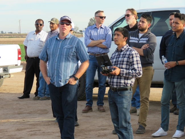
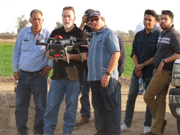
Earlier this month, IGIS held another two-day workshop on using drones for agriculture and land management. As with previous workshops, the material included drone technology, safety and regulations, principles of remote sensing, mission planning, flight operations, and data analysis. Although the winds were too strong on the first day to fly, we couldn't have asked for nicer weather the second day and everyone got to try to their hand at the flight controller.
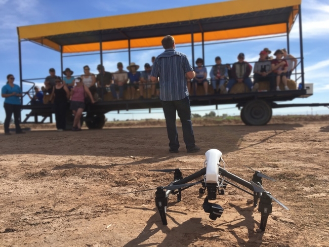
We were also quite fortunate that the timing coincided with DREC's Farm Smart program. Farm Smart is a winter educational outreach program at DREC which caters to 'snowbirds' who descend upon the Imperial Valley from all over the country each winter to enjoy the pleasant weather. For six weeks, Farm Smart organizes half-day visits to the center including presentations, cooking lessons and a tractor tour of the center. Sean Hogan gave presentations to three Farm Smart groups on their farm wagons, explaining the how modern drones work and are being used to monitor crop health and growth. The local paper, The Imperial Valley Press, covered the day and wrote a story that appeared the following day.
We were especially pleased to have a good contingent of workshop participants from Mexicali across the border. At a time when the headlines are filled with talk about walls, it was heartening to see the great potential for cross-border collaboration in ag technology. Many of the participants were from the Faculty of Engineering at La Universidad Autónoma de Baja California, where they are working on developing new sensors and navigation systems. Another group of participants came from the Imperial Irrigation District, whose many responsibilities includes monitoring hundreds of miles of irrigation canals.
From our perspective, the value of workshops goes well beyond the development of technical skills and knowledge. We love to hear about different applications of spatial technologies, and bring together diverse audiences with different areas of expertise and interests. These are the core ingredients of innovation and collaboration, which is the essence of Cooperative Extension. From this perspective, the DREC workshop was not only a great success in teaching a couple dozen people how to fly drones, but will continue to yield benefits that we can hardly anticipate.

