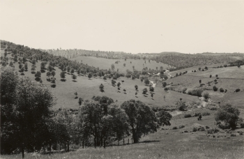
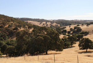
This one from Tim Hanson. The caption from the photos (286747. 286748, 286749, 286750) reads:
"Butte County. Panorama looking SW, S. SE and E from Neal Road. Note Juniperus californica in ravine. Woodland grass type of blue oak and digger pines with occasional Ceanothus cuneatus, Arctostaphylos manzanita and Rhus diversiloba."
There is still California juniper in the ravine, including far right of the new photo, which is uncommon in Butte County. The rare Monardella venosa grows in patches of dense clay soil in the flats of the canyon. The Wieslander picture was taken on 6/24/1933 and his picture was taken on 5/3/2011.
Joyce Gross is our most avid VTM photography buffs. Here are two new VTM reshoots for our viewing pleasure. Her original post here.
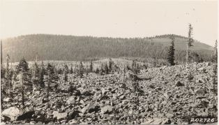
She says: This was the first VTM photo site I've found that required a hike to get there. Not only was the photo not taken from a road, but it was not taken from a trail. The hike from my car to the site was a little over a mile, but it felt like more. It was all uphill, and we didn't really know where we were going. The first 2/3 of the hike was along a narrow, rocky road (image below). The last third of the hike involved somewhat random wandering over rocks and around bushes towards a view we hoped to see but weren't sure exactly where it was. My Garmin GPS, and Gaia GPS on my iPad, were my friends on this hike, helping us get to the photo location and, especially, helping us get back. Thanks Joyce!

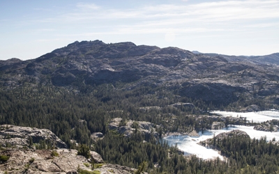
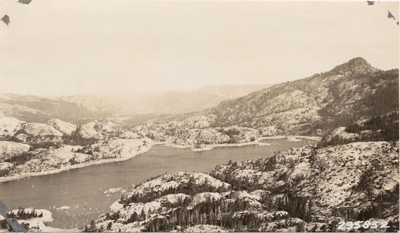
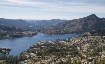
Take a look at this awesome VTM reshoot from the folks over at Geographic Resource Solutions (GRS), photographed during a recent mapping project of Lassen Volcanic National Park. Yet another great example and an incredible testament to lasting power of the VTM dataset. This particular photo was taken near the Chaos Crags Jumble in Lassen Volcanic National Park. Thanks to Ken Stumpf and GRS for sharing!

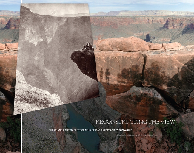
In a similar vein I recently stumbled upon another meshing of historical and contemporary photographs. The project features reshoots of the Grand Canyon and resulted in a 2012 book titled: Reconstructing the View: The Grand Canyon Photographs of Mark Klett and Byron Wolfe
Published by University of California Press. You can see a few of the photographer’s recent projects on their website. Historical photos are just the best!
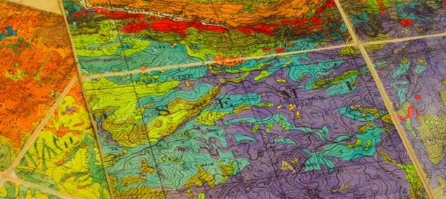
I spent this evening reading the oral history conducted in 1985 by Ann Lange of Albert Wieslander. It is called: California Forester: Mapper of Wildland Vegetation and Soils A. E. Wieslander, and it is a fascinating read. In addition to being a real spitfire and having very clear opinions on things (and people), he also tells this tale about the near loss in 1952 of the vegetation maps. Wieslander had made 23 of his vegetation maps available for publication through the University Press, for production and sale at a cost of $1 each. This was meant to supply funds for the rest of the maps to be published. But that didn't work out as planned.
"Not very many of the maps were sold, even though articles were written to give them publicity. I realized fairly soon that we wouldn't be able to publish any more unless we got additional money someplace.” He was "casually told one day that the University Press had written a letter to the station saying that the maps weren't selling very well, and it wanted to return the quadrangles to the station. They didn't want to handle it anymore.” A forest service employee "told the University Press the station didn't want the maps back and authorized it to dump them. I didn't know anything about this until after it was done. There was nothing I could do about it then. Imagine all these beautiful maps. They didn't even take out one as a sample.”
What!! That is so shortsighted… Anyway read on…
Wies (he refers to himself "Wies" in the interviews) then found out that the University Press couldn't understand the dumping of all those maps and alerted Paul Zinke, Forestry Professor here at Berkeley.
"So Zinke went down and got twenty copies of each of the quadrangles.”
“But, we still had all the original field maps, kept at the experiment station. Just before I retired, I talked with Herbert Mason about all the printed maps having been destroyed and about how it was important to preserve the originals. Researchers could use them. He suggested that the Botany Department set up in the Life Sciences Building a plant geography room. And the main feature of this plant geography room would be the vegetation mapping project. So I moved all the files of maps and sample plots over to the Life Sciences Building. Mason went through the material and found at least a third, maybe more, of the original maps were gone.” Apparently, different national forests had been writing to the station requesting certain maps. Since they didn't have any of the printed maps, originals were sent out, with no record kept of what was sent, or to whom.
This explains why the maps have been scattered across the state, and why it has taken so long to pull them (mostly) together again.
"Anyway, I'm glad that was done. It was a very nice publication, and it gave proper credit to the draftsman who did the beautiful job of drafting, and to the project, and to me. Then Critchfield also worked with James Griffen, of the university, and got out another publication on "The Distribution of Trees in California." It was based on the maps and other data we had." When Wies expressed "concern about these maps and Dr. Critchfield said, "I would like to get them deposited in the Bancroft Library." I don't know whether he did it or not, but that's what he told me.”
Thank goodness that they are back on campus in the Marian Koshland Library, and the whole collection (albeit without the herbarium specimens) will be re-united and available for use.
The latest from Joyce. This photo is "looking southwest from point on highway between Drytown and Amador. Cattle ranch headquarters surrounded by grassland without a brush problem. Amador Co." Taken by Albert Everett Wieslander himself, who incidentally graduated from CNR in 1914!


