- Author: Sean Hogan
- Author: Shane Feirer
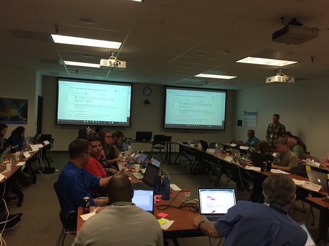
IGIS was pleased to attend an excellent “Forest and Shrubland LiDAR Derived Products Workshop” jointly held by the California Natural Resources Agency (CNRA) and California Department of Conservation (DOC), on March 17th.
CNRA has a budget for supporting the development of useful/high value data products that can support forest and shrubland planning and management decisions, including for emergency response. In the interest of seeking feedback from experts and potential users of such data products across the state of California, the goal of this workshop was to gather information for prioritizing LiDAR derived products for fire, vegetation, biodiversity, hydrology, climate change, and public safety decisions in California's forests and shrublands.
The workshop began with an outstanding presentation by Dr. Nathaniel (Nate) Roth (DOC), which provided a brief introduction to LiDAR (light detection and ranging), and operation derived products of this technology. Kass Green and Mark Tukman, from Tukman Geospatial, then presented several excellent use case examples of LiDAR in California, including for: topographic and hydrologic mapping, fine scale vegetation mapping, forest health and management, and vegetation/fuel mapping for forest fire planning and assessing impacts. Next came another impressive presentation by David (DJ) Bandrowski from the Yurok Tribe Fisheries Department, which cited multiple examples of how LiDAR and aerial imagery have been used for management and restoration of forest ecosystems within the Klamath River Basin. These examples include for: Sediment flux, transport and change following dam removal, point cloud classifications of vegetation vs. bare ground, designing and modeling river systems for planning and assessment, and finally for construction projects.
The workshop concluded with a series of surveys, conducted in ESRI's Survey 123 application, to assess and prioritize the needs of the 179 attendees at the workshop, as a representative sample of prospective users. The results of these surveys will undoubtedly be used to steer the allocation of funds provided to CNRA by the California State Legislature to have the most efficient and valuable impacts possible.
A great thanks is owed to Dr. Nathaniel (Nate) Roth, and all the people at DOC and CNRA, for hosting this workshop, as well as the outstanding contributors from Tukman Geospatial and the Yurok Tribe.
Sean Hogan and Shane Feirer
University of California
Division of Agriculture and Natural Resources
Informatics and GIS Statewide Program
First of all, Pearl Street Mall is just as lovely as I remember, but OMG it is so crowded, with so many new stores and chains. Still, good food, good views, hot weather, lovely walk.
Welcome to Day 2! http://neondataskills.org/data-institute-17/day2/
Our morning session focused on reproducibility and workflows with the great Naupaka Zimmerman. Remember the characteristics of reproducibility - organization, automation, documentation, and dissemination. We focused on organization, and spent an enjoyable hour sorting through an example messy directory of misc data files and code. The directory looked a bit like many of my directories. Lesson learned. We then moved to working with new data and git to reinforce yesterday's lessons. Git was super confusing to me 2 weeks ago, but now I think I love it. We also went back and forth between Jupyter and python stand alone scripts, and abstracted variables, and lo and behold I got my script to run.
The afternoon focused on Lidar (yay!) and prior to coding we talked about discrete and waveform data and collection, and the opentopography (http://www.opentopography.org/) project with Benjamin Gross. The opentopography talk was really interesting. They are not just a data distributor any more, they also provide a HPC framework (mostly TauDEM for now) on their servers at SDSC (http://www.sdsc.edu/). They are going to roll out a user-initiated HPC functionality soon, so stay tuned for their new "pluggable assets" program. This is well worth checking into. We also spent some time live coding with Python with Bridget Hass working with a CHM from the SERC site in California, and had a nerve-wracking code challenge to wrap up the day.
Fun additional take-home messages/resources:
- ISO International standard for dates = YYYY-MM-DD
- Missing values in R = NA, in Python = -9999
- For cleaning messy data - check out OpenRefine - a FOS tool for cleaning messy data http://openrefine.org/
- Excel is cray-cray, best practices for spreadsheets: http://www.datacarpentry.org/spreadsheet-ecology-lesson/
- Morpho (from DataOne) to enter metadata: https://www.dataone.org/software-tools/morpho
- Pay attention to file size with your git repositories - check out: https://git-lfs.github.com/. Git is good for things you do with your hands (like code), not for large data.
- Funny how many food metaphors are used in tech teaching: APIs as a menu in a restaurant; git add vs git commit as a grocery cart before and after purchase; finding GIS data is sometimes like shopping for ingredients in a specialty grocery store (that one is mine)...
- Markdown renderer: http://dillinger.io/
- MIT License, like Creative Commons for code: https://opensource.org/licenses/MIT
- "Jupyter" means it runs with Julia, Python & R, who knew?
- There is a new project called "Feather" that allows compatibility between python and R: https://blog.rstudio.org/2016/03/29/feather/
- All the NEON airborne data can be found here: http://www.neonscience.org/data/airborne-data
- Information on the TIFF specification and TIFF tags here: http://awaresystems.be/, however their TIFF Tag Viewer is only for windows.
Thanks for everyone today! Megan Jones (our fearless leader), Naupaka Zimmerman (Reproducibility), Tristan Goulden (Discrete Lidar), Keith Krause (Waveform Lidar), Benjamin Gross (OpenTopography), Bridget Hass (coding lidar products).

Our home for the week
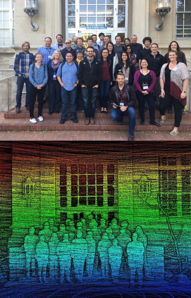
Our third GIF Spatial Data Science Bootcamp has wrapped! We had an excellent 3 days with wonderful people from a range of locations and professions and learned about open tools for managing, analyzing and visualizing spatial data. This year's bootcamp was sponsored by IGIS and GreenValley Intl (a Lidar and drone company). GreenValley showcased their new lidar backpack, and we took an excellent shot of the bootcamp participants. What is Paparazzi in lidar-speak? Lidarazzi?

Here is our spin: We live in a world where the importance and availability of spatial data are ever increasing. Today’s marketplace needs trained spatial data analysts who can:
- compile disparate data from multiple sources;
- use easily available and open technology for robust data analysis, sharing, and publication;
- apply core spatial analysis methods;
- and utilize visualization tools to communicate with project managers, the public, and other stakeholders.
At the Spatial Data Science Bootcamp we learn how to integrate modern Spatial Data Science techniques into your workflow through hands-on exercises that leverage today's latest open source and cloud/web-based technologies.

From NZ no less.
The following management recommendations consider the SNAMP focal resources as an integrated group. These recommendations were developed by the UC Science Team working together. Although each recommendation was written by one or two authors, the entire team has provided input and critique for the recommendations. The entire UC Science Team endorses all of these integrated management recommendations.
Section 1: Integrated management recommendations based directly on SNAMP science
Wildfire hazard reduction
1. If your goal is to reduce severity of wildfire effects, SPLATs are an effective means to reduce the severity of wildfires.
SPLAT impacts on forest ecosystem health
2. If your goal is to improve forest ecosystem health, SPLATs have a positive effect on tree growth efficiency.
SPLAT impact assessment
3. If your goal is to integrate across firesheds, an accurate vegetation map is essential, and a fusion of optical, lidar and ground data is necessary.
4. If your goal is to understand the effects of SPLATs, lidar is essential to accurately monitor the intensity and location of SPLAT treatments.
SPLAT impacts on California spotted owl and Pacific fisher
5. If your goal is to maintain existing owl and fisher territories, SPLATs should continue to be placed outside of owl Protected Activity Centers (PACs) and away from fisher den sites, in locations that reduce the risk of high-severity fire occurring within or spreading to those areas.
6. If your goal is to maintain landscape connectivity between spotted owl territories, SPLATs should be implemented in forests with lower canopy cover whenever possible.
7. If your goal is to increase owl nest and fisher den sites, retain oaks and large conifers within SPLAT treatments.
8. If your goal is to maintain fisher habitat quality, retention of canopy cover is a critical consideration.
9. If your goal is to increase fisher foraging activity, limit mastication and implement more post-mastication piling and/or burning to promote a faster recovery of the forest floor condition.
10. If your goal is to understand SPLAT effects on owl and fisher, it is necessary to consider a larger spatial scale than firesheds.
SPLAT impacts on water quantity and quality
11. If your goal is to detect increases in water yield from forest management, fuel treatments may need to be more intensive than the SPLATs that were implemented in SNAMP.
12. If your goal is to maintain water quality, SPLATs as implemented in SNAMP have no detectable effect on turbidity.
Stakeholder participation in SPLAT implementation and assessment
13. If your goal is to increase acceptance of fuel treatments, employ outreach techniques that include transparency, shared learning, and inclusiveness that lead to relationship building and the ability to work together.
14. If your goal is the increased acceptance of fuel treatments, the public needs to understand the tradeoffs between the impacts of treatments and wildfire.
Successful collaborative adaptive management processes
15. If your goal is to establish a third party adaptive management project with an outside science provider, the project also needs to include an outreach component.
16. If your goal is to develop an engaged and informed public, you need to have a diverse portfolio of outreach methods that includes face to face meetings, surveys, field trips, and web-based information.
17. If your goal is to understand or improve outreach effectiveness, track production, flow, and use of information.
18. If your goal is to engage in collaborative adaptive management at a meaningful management scale, secure reliable long term sources of funding.
19. If your goal is to maintain a successful long-term collaborative adaptive management process, establish long-term relationships with key people in relevant stakeholder groups and funding agencies.
Section 2: Looking forward - Integrated management recommendations based on expert opinion of the UC Science Team
Implementation of SPLATs
20. If your goal is to maximize the value of SPLATs, complete treatment implementation, especially the reduction of surface fuels.
21. If your goal is to efficiently reduce fire behavior and effects, SPLATs need to be strategically placed on the landscape.
22. If your goal is to improve SPLAT effectiveness, increase heterogeneity within treatment type and across the SPLAT network.
Forest ecosystem restoration
23. If your goal is to restore Sierra Nevada forest ecosystems and improve forest resilience to fire, SPLATs can be used as initial entry, but fire needs to be reintroduced into the system or allowed to occur as a natural process (e.g., managed fire).
24. If your goal is to manage the forest for long-term sustainability, you need to consider the pervasive impacts of climate change on wildfire, forest ecosystem health, and water yield.
Management impacts on California spotted owl and Pacific fisher
25. If your goal is to enhance landscape habitat condition for owl and fisher, hazard tree removal of large trees should be carefully justified before removing.
26. If your goal is to minimize the effects of SPLATs on fisher, SPLAT treatments should be dispersed through space and time.
Management impacts on water quantity and quality
27. If your goal is to optimize water management, consider the range of potential fluctuations in precipitation and temperature.
Successful collaborative adaptive management processes
28. If your goal is to implement collaborative adaptive management, commit enough time, energy, and training of key staff to complete the adaptive management cycle.
29. The role of a third party science provider for an adaptive management program can be realized in a variety of ways.
30. If the goal is to implement adaptive management, managers must adopt clear definitions and guidelines for how new information will be generated, shared, and used to revise subsequent management as needed.
31. If your goal is to increase forest health in the Sierra Nevada, we now know enough to operationalize some of the aspects of SNAMP more broadly.


