
What is a Prescription?
Understanding how weather conditions impact the safety, feasibility, and efficacy of your burn and selecting suitable burn windows are essential elements to conducting successful broadcast burns. One element of a broadcast burn is developing a prescription, or a set of specific weather parameters under which you plan to safely and effectively conduct a burn.
When permits are required from your local fire suppression agency, they may require you to develop a written document (or burn plan) that provides a description of the burn area, target weather conditions (a prescription), burn unit preparation, and resources needed. Once you develop your burn plan and identify your weather prescription, you can look for burn windows, or specific periods (hours, days, weeks) when weather, fuel moisture, and environmental conditions allow for controlled, predictable fire behavior that align with your management objectives.
By developing a prescription and establishing a defined burn window, you can ensure the burn meets management objectives, minimize risks of escape or unintended impacts, and closely monitor forecasts as the target season or date approaches. Monitoring the weather within the burn unit can help you understand microsite conditions, daily weather patterns and can help develop your prescription. Monitoring can also mitigate the potential of having to cancel or postpone your burn at the last minute.
Developing Your Prescription
Broadcast burn prescriptions consider several weather parameters. You need to identify weather ranges for each weather parameter that are expected to meet burn objectives. Weather ranges will vary based on location, crew experience or resource availability, fuel type, and burn objectives. For examples of burn plans and associated prescriptions, visit California’s Prescribed Burn Association website (https://calpba.org/). Common weather parameters that often influence fire behavior are included in the table below.
Weather Parameter | Influence on Fire Behavior |
Temperature | High temperatures contribute to increased fire behavior by drying and preheating fuels. |
Fuel moisture content | Impacted by environmental conditions and structure of materials to burn, fuel moisture greatly influences fire behavior. Fuel moisture can be calculated using charts from the NWCG Fire Behavior Field Reference Guide (PMS 437). |
Atmospheric stability | During unstable conditions, fire behavior increases, and smoke dispersion improves, while stable conditions limit vertical motion and therefore suppress smoke dispersion and decrease fire behavior. During stable conditions, warmer air can trap cooler air close to the ground, called an inversion. Smoke can be trapped close to the ground during inversion conditions. |
Probability of Ignition (PIG) | High PIG values indicate that fuels are highly receptive to ignition. Conversely, low PIG values suggest that fuels are less likely to ignite, which may result in the fire not carrying well through the intended burn area. |
Relative humidity (RH) | High RH generally reduces fire behavior while lower RH values typically increase fire behavior. |
Seasonality | High temperatures and low fuel moisture in the summer often make it unsafe to burn. Conversely, low temperatures and high fuel moisture in the winter can inhibit burning altogether. |
Wind direction and speed | Winds directly influence fire spread by accelerating the warming and drying of fuels. Light winds can help move fire in a desired direction and dissipate rising heat, which can reduce damage to trees. High winds further increase a fire's rate of spread and flame length. Consistent wind speeds and direction allow fire practitioners to predict fire movement. Additionally, topographic features such as canyons, gorges, or saddles create avenues for wind to funnel through. |
Finding a Burn Window
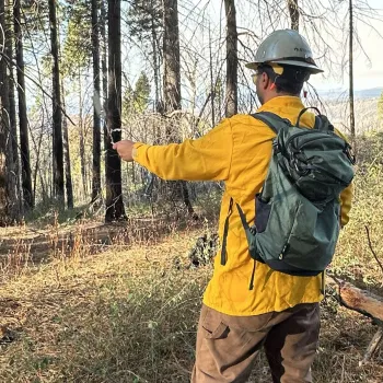
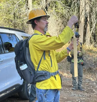
Finding a burn window involves monitoring weather patterns weeks to days before your burn to ensure there are predictable and consistent weather conditions that match your burn plan. Local knowledge and an on-site Kestrel or Weather Station can help confirm real-time conditions. Additional resources to assist with finding an adequate burn window include:
- The Fire Environment Mapping System (FEMS; https://fems.fs2c.usda.gov/ui) is an interactive user interface with maps, tables, and charts that display Remote Area Weather Stations (RAWS) data. This website includes archived observations from each RAWS to track weather patterns as well as a 7-day hourly forecast of weather.
- The MesoWest website (https://mesowest.utah.edu/cgi-bin/droman/mesomap.cgi?state=CA&rawsflag=3) allows you to compare observed forecasts near your burn location (from nearby weather stations, including government- and privately-funded stations) with the day’s hourly weather forecast. You can focus the map to your burn area and manually select the specific weather parameters (e.g., temperature, wind, humidity) you would like to compare and see how the weather models are performing compared with what is actually happening on the ground days before your burn.
- The National Weather Service (NWS) website (https://www.weather.gov/fire/) provides 7-10-day weather forecasts and seasonal outlooks. NWS provides fire weather planning forecasts for specific locations that include forecasts for windspeed, relative humidity, temperature, and more.
- The Northern California Geographic Area Coordination Center (ONCC; https://gacc.nifc.gov/oncc/predictive/weather/index.htm) and Southern California Geographic Area Coordination Center (OSCC; https://gacc.nifc.gov/oscc/predictive/weather/index.htm) provides a 7-day outlook for fire potential, a smoke forecast, and a fire weather webcast that is updated daily.
- The Prescribed Fire Information Reporting System (PFIRS; https://ssl.arb.ca.gov/pfirs/index.php) is a tool developed by the California Air Resources Board (CARB) for individuals to view prescribed fire activity both locally and statewide. Both agencies and individuals can report activities using this tool. PFIRS also provides an outlook on the likelihood of permissive burn days three days in advance. This is very helpful in planning so you do not have to cancel a burn last minute due to a non-permissive burn day.
- Remote Area Weather Stations (RAWS; https://raws.dri.edu/index.html) are a network of strategically placed weather stations across the U.S. that provide reports of key weather parameters including temperature, wind speed, relative humidity, and, importantly, fuel moisture content. RAWS data can be used to monitor weather trends over time because each station contains several years’ worth of archived weather data. You can use this resource to assess historical weather conditions for your region to determine a time of year when conditions may line-up to meet your prescriptions, and to better understand fuel moisture conditions in relation to current weather. If your burn unit is not located near a RAWS, the data may not provide accurate forecasts.
- The Weather Underground website (https://www.wunderground.com/) provides local and long-range weather forecasts, weather reports, maps, and current weather conditions for your given location.
The Windy mobile app and website (https://windy.app/map/) provides a detailed weather forecast and live wind map. Some features are free and others are subscription-based. First, navigate to the location of your burn, then view the “Forecast for This Location” section. Depending on your subscription level, you can use the “Compare” option to view up to six different weather models. By comparing forecasts, you can gauge your confidence in wind forecasts for your burn.
Additional Resources
Much of the information above was borrowed from the Burn Planning: Interpreting Weather and Writing Prescriptions factsheet from the UC ANR Fire Network. Please review the factsheet to learn more about developing your burn prescription and interpreting weather conditions.