- Author: Andy Lyons

From April 9-12, 2019, we'll be teaching the second annual Drones for Biologists workshop at the gorgeous Hastings Natural History Reservation in collaboration with The Wildlife Society Western Section and the UC Natural Reserve System. This training event specifically caters to the interests of natural resource managers, and includes special sessions on using drones for wildlife research, UAV regulations from the US Fish Wildlife Service, and updates from the CA Dept of Fish and Wildlife. New for 2019, participants will have an option to stay for an extra two days to conduct a mentored research project (can you detect turkeys with drones?), that we plan to collectively write up and submit for publication. If you've never been to Hastings, it's a beautiful 2,500-acre oak woodland reserve in the Carmel Valley with onsite accommodation and training facilities. Registration is now open, with discounted rates for TWS members and UCANR employees.


We're thrilled to be providing these two trainings on drone data collection for the public, and even more thrilled to be working with collaborators who complement our areas of expertise with deep dives into technology developments, research, and policy. To use drones effectively involves navigating some deep waters, these workshops will save aspiring drone users vast amounts of time, money and painful mishaps. Hope to see you there!

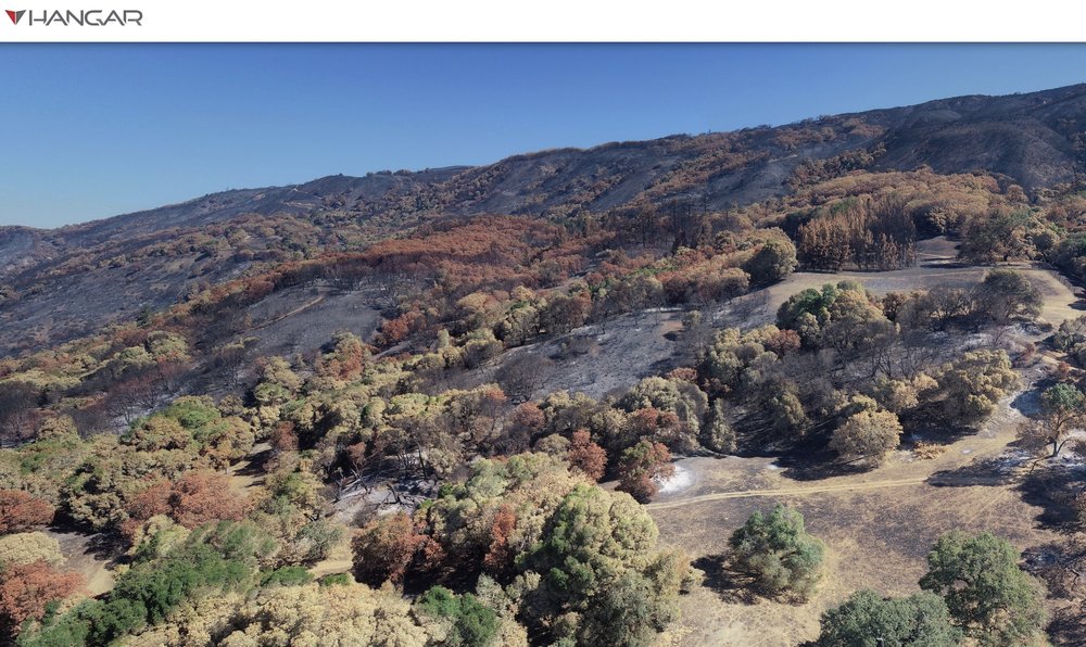
The River Fire began July 27, 2018 at 1pm on Old River Road in Hopland. By the evening it had spread, and was threatening numerous buildings in the area. We have a ANR Research and Extension Center (HREC) there, and Shane Feirer from IGIS lives and works here. Evacuations were ordered quickly, and down in the bay area we all held our breath hoping the fire wouldn’t harm people or animals or consume the HREC buildings. By the time it was contained (as part of the Mendocino Complex), it had burned 48,920 acres. We’ve been flying drones over HREC for awhile, and the last month we did more drone flights to map the post-fire landscape. We flew some Hangar 360 flights with a DJI Phantom to get some sweet overviews of the scene (example1, example2, example3), and flew much of the area with our eBee on the first mission and Matrices on the second mission with both multispectral and RGB cameras.
These pics below compare the eBee imagery (2cm) with Planet imagery (3m).


These are pics of the eBee (far left) and the Matrice (far right) getting ready to fly into the blackened landscape, and some snaps from the Hanger pics.


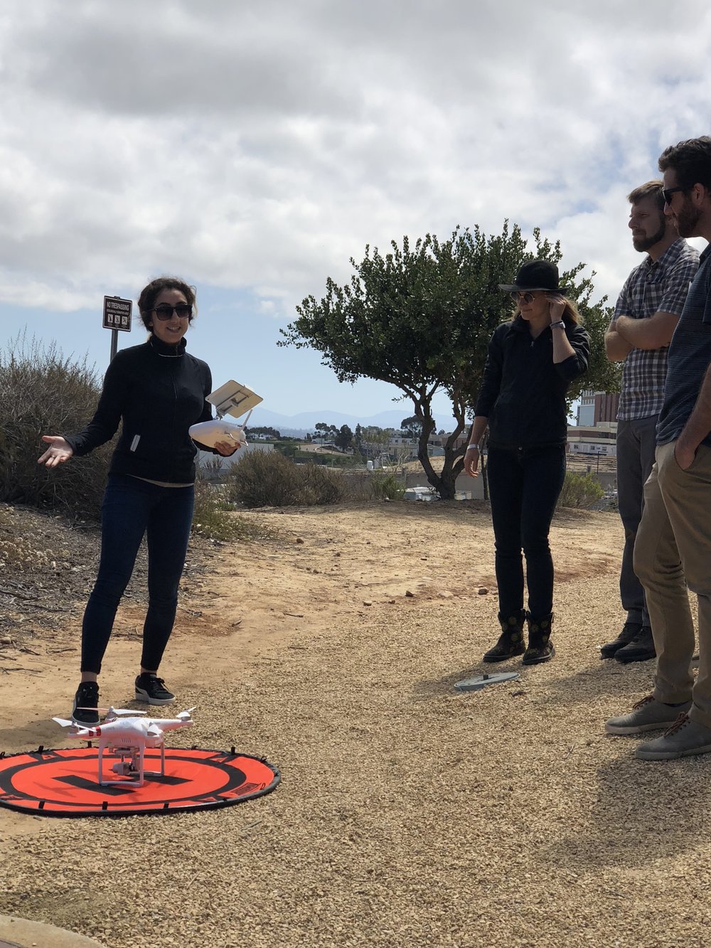
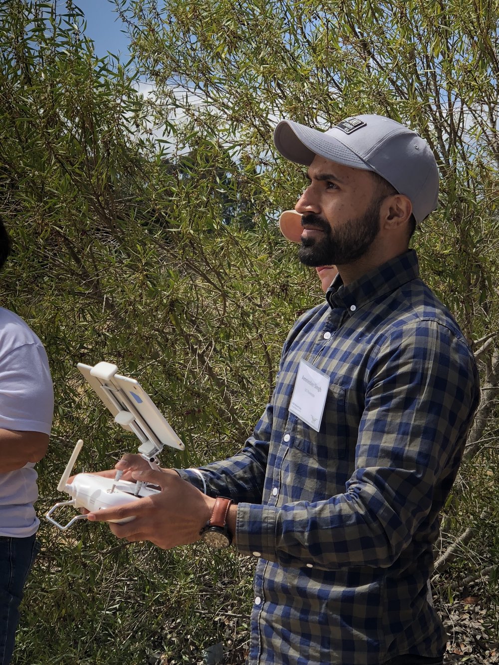
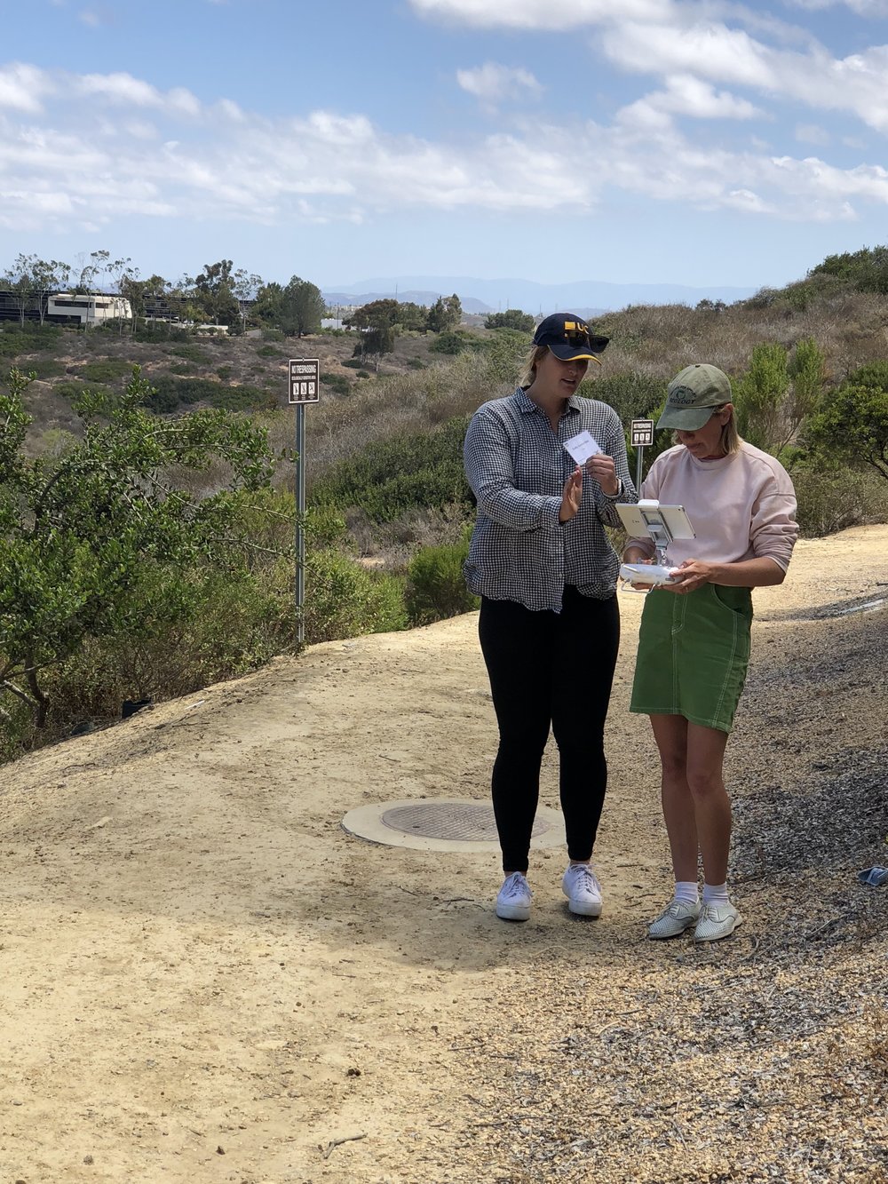
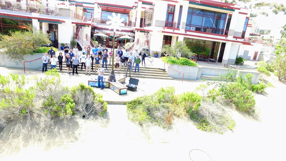
We've just wrapped up #DroneCamp2018, hosted at beautiful UC San Diego.
This was an expanded version from last year's model, which we held in Davis. We had 52 participants (from all over the world!) who were keen to learn about drones, data analysis, new technology, and drone futures.
Day 1 was a flight day from half our participants: lots of hands-on with takeoffs and landings, and flying a mission;
Day 2 covered drone safety and regulations, with guest talks from Brandon Stark and Dominique Meyer;
Day 3 covered drone data and analysis;
Day 4 was a flight day for Group 2 and a repeat of Day 1.
We had lots of fun taking pics and tweeting: here is our wrapup on Twitter for #DroneCamp2018.


- Author: Sean Hogan
Hello Everyone,
IGIS is pleased to announce its second offering of DroneCamp! This three-day intensive workshop will take place at UC San Diego, between June 18th and the 21st, 2018, and will cover everything you need to know about drones for mapping, research, and land management. This intensive bootcamp style workshop will include instruction and hands on training in the following areas:
- Technology - The different types of drone and sensor hardware, costs and applications
- Drone science - Principles of photogrammetry and remote sensing
- Safety and regulations - Learn to fly safely and legally, including tips on getting your FAA Part 107 Remote Pilot Certificate
- Mission planning - Flight planning tools and principles for specific mission objectives
- Flight operations - Hands-on practice with both manual and programmed flights
- Data processing - Processing drone data into orthomosaics and 3D digital surface models; assessing quality control
- Data analysis - Techniques for analyzing drone data in GIS and remote sensing software
- Visualization - Create 3D models of your data
- Latest trends - Hear about new and upcoming developments in drone technology, data processing, and regulations
The cost of this three-day event will be $500 for UC Employees and $900 for everyone else.
Additional information and registration info can be found at http://igis.ucanr.edu/dronecamp/. Registration requires a short application (no fee), that will inquire about your background and learning goals. Anyone interested in attending is encouraged to submit an application by April 15, 2018 for early priority registration. Be aware, last year's event filled up very quickly.
We hope to see you there!
Sean Hogan
UC ANR IGIS
Drone Service Coordinator

- Author: Andy Lyons
- Author: Sean Hogan
Last week at the Hasting Natural Reserve in Monterey County, IGIS joined forces with The Wildlife Society Western Section for a workshop on drone mapping for wildlife biologists. Over three days, 25 participants learned about drone technology, the science behind mapping with drones, regulations at both the federal and state levels, flight operations, data processing and analysis, and 360 drone photography. The workshop was hugely successful.


The workshop once again proved the value of collaboration. The Hastings Natural History Reservation, a UC Berkeley field station under the UC Natural Reserve System, was a superb location for the workshop, and Resident Director Vince Voegeli took good care of us. IGIS team members Sean Hogan, Andy Lyons and Jacob Flanagan, provided the core of the technical material building upon earlier workshops include last year's DroneCamp. Steve Goldman, UAS Coordinator for the California Department of Fish and Wildlife (CDFW) spoke about the use of drones in CDFW including their recently finalized regulatory policies and procedures. Steve Earsom from the US Fish and Wildlife Service recorded a similar presentation for participants. Professor Emeritus David Bird from McGill University educated and entertained the audience with several presentations about UAVs in wildlife research over his long and distinguished career. All of this was put together by TWS Western Section Workshop Coordinator and master planner, Ivan Parr.

We are looking forward to more drone mapping workshops and love the collaborative model that combines institutions, technical backgrounds, and applications. Our next multi-day drone workshop will be another offering of DroneCamp coming this summer. Stay tuned for an announcement in the near future.

