Hi all,
Just trying to get my head around some of the new big raster processors out there, in addition of course to Google Earth Engine. Bear with me (bare?) while I sort through these. Thanks for raster sleuth Stefania Di Tomasso for the leg work.
1. Geotrellis (https://geotrellis.io/)
Geotrellis is a Scala-based raster processing engine, and it is one of the first geospatial libraries on Spark. Geotrellis is able to process big datasets. Users can interact with geospatial data and see results in real time in an interactive web application (for regional, statewide dataset). For larger raster datasets (eg. US NED). GeoTrellis performs fast batch processing using Akka clustering to distribute data across the cluster. GeoTrellis was designed to solve three core problems, with a focus on raster processing:
- Creating scalable, high performance geoprocessing web services;
- Creating distributed geoprocessing services that can act on large data sets; and
- Parallelizing geoprocessing operations to take full advantage of multi-core architecture.
Features:
- GeoTrellis is designed to help a developer create simple, standard REST services that return the results of geoprocessing models.
- GeoTrellis will automatically parallelize and optimize your geoprocessing models where possible.
- In the spirit of the object-functional style of Scala, it is easy to both create new operations and compose new operations with existing operations.
2. GeoPySpark - in synthesis GeoTrellis for Python community
Geopyspark provides python bindings for working with geospatial data on PySpark (PySpark is the Python API for Spark). Spark is open source processing engine originally developed at UC Berkeley in 2009. GeoPySpark makes Geotrellis (https://geotrellis.io/) accessible to the python community. Scala is a difficult language so they have created this Python library.
3. RasterFoundry
We had a great day today exploring ESRI open tools in the GIF. We had a full class of 30 participants, and two great ESRI instructors (leaders? evangelists?) John Garvois and Allan Laframboise, and we worked through a range of great online mapping (data, design, analysis, and 3D) examples in the morning, and focused on using ESRI Leaflet API in the afternoon. Here are some of the key resources out there.
- Main ESRI Open Information: http://www.esri.com/software/open
- Slide deck from today: http://slides.com/alaframboise/geodev-hackerlabs#/
- Afternoon example using Leaflet: http://esri.github.io/esri-leaflet/
- ESRI's developer toolkits: https://developers.arcgis.com/en/, including
- ESRI's javascript API: https://developers.arcgis.com/javascript/beta/
Great Stuff! Thanks Allan and John

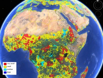
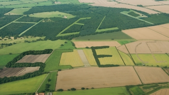
The researchers built the cropland database by combining information from several sources, such as satellite images, regional maps, video and geotagged photos, which were shared with them by groups around the world. Combining all that information would be an almost-impossible task for a handful of scientists to take on, so the team turned the project into a crowdsourced, online game. Volunteers logged into "Cropland Capture" on a computer or a phone and determined whether an image contained cropland or not. Participants were entered into weekly prize drawings.

Open Access Link: http://link.springer.com/article/10.1007/s00267-013-0216-4/fulltext.html?wt_mc=alerts:TOCjournals

This creative project from GeoWiki seeks to get croudsourced feedback on crop types from participants around the world. They say:
By 2050 we will need to feed more than 2 billion additional people on the Earth. By playing Cropland Capture, you will help us to improve basic information about where cropland is located on the Earth's surface. Using this information, we will be better equipped at tackling problems of future food security and the effects of climate change on future food supply. Get involved and contribute to a good cause! Help us to identify cropland area!
Oh yeah, and there are prizes!
Each week (starting Nov. 15th) the top three players with the highest score at the end of each week will be added to our weekly winners list. After 25 weeks, three people will be drawn randomly from this list to become our overall winners. Prizes will include an Amazon Kindle, a brand new smartphone and a tablet.


