- Author: Andrew J Lyons
- Contact: Sean D Hogan

June 24-28, 2024
CSU Monterey Bay
(plus virtual open)
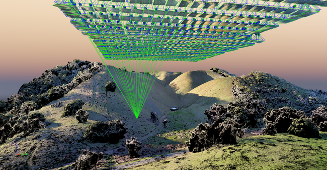
DroneCamp is a premiere five-day training program that covers everything you need to know to use drones for mapping and data collection.
Curriculum at a Glance
- equipment
- safety & regulations
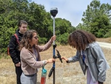
- flight planning
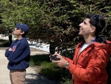
- manual & autonomous flight
- photogrammetry
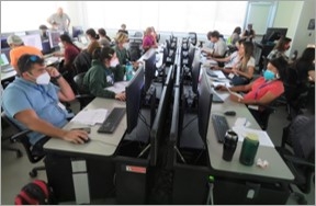
- hands-on data processing with Pix4D, OpenDroneMap & ArcGIS Pro
- data analysis & visualization
- research talks & use cases
- educator track - new for 2024!
Now in its eighth year, Drone Camp 2024 will once again provide a unique drone training opportunity designed for a wide range of skill levels and interests, from complete beginners with little to no experience in drone technology, to intermediate users who want to learn more advanced data processing and analysis.
DroneCamp started out as an IGIS workshop, but has evolved into a highly collaborative program with instructors coming from 8 campuses including UC ANR, UC Merced, UC Santa Cruz, CSU Monterey Bay, UC Davis, UC Berkeley, UC Santa Barbara, Lakeland College, and American River College.
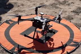
DroneCamp 2024 will be held in-person at CSU Monterey Bay June 24-28, 2024. Scholarships to cover the registration fee are available for all ANR academics and staff - but you must apply soon! More info available at DroneCampCA.org.
 |
 |
 |
 |

- Author: Sean D Hogan
In the past year IGIS has had the pleasure to work with Juniper Unmanned inc. to undertake a proof of concept project interested in mapping cellular broadband speeds at four agricultural sites in the rural Central Valley of California, using a drone equipped to spatially record cellular network speeds for ATT, Verizon and T-Mobile cell phone carriers. Information of this type may be useful for future smart-farming efforts, including allocations of resources and the potential placement of cellular antennas on farms in the future.
For more information, please see the following StoryMap, which reports the project's findings: https://storymaps.arcgis.com/stories/d1f34c829c104c9d9bb0ed4536f39e03

- Author: Andy Lyons
- Author: Maggi Kelly
- Author: Sean Hogan
- Author: Shane Feirer
- View More...
Welcome to the final IGIS year-in-review of the decade! 2019 was another productive and satisfying year, full of innovation, outreach, and collaboration. Our work this year has been guided by ANR Strategic Goals and contributed to the Public Value Statements. In this Part I, we highlight our impact toward ANR's Strategic Goal framework. In Part II, we discuss our contributions toward UC ANR's Public Value Statements.
ANR Strategic Goals
Strategic Goal #1. Strengthen Research and Extension Partnerships
Our work as a technology unit puts us in an enviable position to collaborate widely both within UC ANR as well other UC units, state agencies, and beyond. Our expertise in geospatial technology, combined with the domain knowledge our ANR academics, multiplies the impact and efficiency research efforts. Some of our key UC ANR collaborators in 2019 included:
- Adina Merenlender, California Naturalist Program. We assessed climate literacy by analyzing what is taught in climate change courses in higher education around the country.
- Ali Montazar, UCCE Imperial & Riverside Counties. Assessment of alternative crops and irrigation practices for water conservation in the Imperial Valley.
- Beth Grafton-Cardwell, UC Riverside and Lindcove Research and Extension Center. Web map of distribution of Asian Citrus Psyllid and huanglongbing disease in California. App for growers and homeowners to determine location in relation to HLB detections.
- Brady Holder, Kearney Research and Extension Center. Acquired and processed UAV imagery for use in the evaluation of the potential use of aerial imagery in detecting weedy rice in California rice fields.
- Daniele Zaccaria, UC Davis. Helped update Information on Evapotranspiration of Mature Micro-irrigated Citrus Orchards in the San Joaquin Valley using uavs.
- Dohee Kim, UCCE Los Angeles County. County program distribution maps.
- James Schaeffer, UCCE Fresno County. Alkaliweed reporting tool in Survey 123.
- Jeremy James, Sierra Foothill Research and Extension Center. Online calculator for the financial returns of invasive species management, siting infrastructure for experimental plots.
- Jenny Sowerwine, UC Berkeley. Story Map training for youth, development of mobile data collection tools and drone mapping for agro-ecological resilience.
- John Bailey, Hopland Research and Extension Center. Acquired and processed UAV imagery following the 2018 River Fire.
- Lenya Quinn-Davidson, UCCE Humboldt County. Analyzed historic and current aerial imagery to assess Douglas Fir encroachment in Oak woodlands the Humboldt County.
- Leslie Roche, UC Davis. Acquired and processed UAV imagery for work related to the UC ANR - Rustici Grant, that monitored Post-fire plant succession in Lassen and Modoc Counties, for adaptive management of working rangelands.
- Maurice Pitesky, UC Davis. Developed an app for tracking high density waterfowl and potential avian flu.
- Rick Satomi, UCCE Shasta County. Woody Biomass database, Pond Volume Calculator, GIS training for Foresters.
- Rob Bennaton, UCCE Alameda and Contra Costa County. Bay Area Urban Ag Map.
- Ruth Dahlquist-Willard, UCCE Fresno & Tulare Counties. Mapped Southeast Asian Farms in relation to Disadvantaged Communities.
- Stephanie Castle, UC Davis. Acquired and processed UAV imagery for Tecopa Marsh data to assess endangered vole habitats
- Tapan Pathak, UC Merced. Agro-climatic decision support tools.
- Whitney Brim-DeForest, UCCE Sutter and Yuba Counties. Evaluated the potential for aerial imagery in detecting weedy rice in California rice fields.
Stepping it up a notch, we developed and strengthened several major Institutional Collaborations in 2019. Institutional collaborations start with individuals, but to enable significant amounts of resource sharing add another layer involving sub-awards, MOUs, and laborious project management and reporting systems. There's more overhead to be sure, but the results are worth it!
In 2019 we had the good fortune to continue our collaboration with the UC Natural Reserve System on the California Heartbeat Initiative. This ambitious project is centered around collecting longitudinal multispectral drone images at 10 UC reserves across CA. In 2019 we flew 1300 acres at 7 reserves for the CHI project, and provided additional support training UC NRS employees and helping them develop a data management system for the long-term.
Monterey Bay DART, Cal State Monterey Bay (CSUMB), and UCSC Fort Ord Natural Reserve were our primary partners in putting on our third annual DroneCamp. DroneCamp is our flagship training event, and if you haven't been to one in a while it's continued to get bigger, more comprehensive, and with a more polished curriculum. Monterey Bay DART is a non-profit spearheading technology focused regional development in the Monterey Peninsula, including an industry UAS symposium that we scheduled to align with DroneCamp. CSUMB provided amazing logistic support and modern facilities for the data processing sessions (e.g., imagine a computer lab with 40 high-powered Alienwares!). Our flight practice sessions were held at the beautiful nearby UCSC Fort Ord Natural Reserve. Although it took a lot of effort to coordinate all the pieces, the joint program went brilliantly and we're getting the band back together for 2020.
Our long-term collaboration with the UC Berkeley Geospatial Innovation Facility (GIF) ramped up this year with the launch of a new three-year project funded by the Strategic Growth Council. The goal of the project is to develop new ways to access complex climate data from California's official portal for climate data, Cal-Adapt, also managed by the GIF. Under the new project, we are conducting climate needs assessments for climate data in agriculture and natural resources, and developing new software tools to make it easier to access and analyze both historic and forecast climate data. Maggi, Sean and Andy also continue to be regular instructors at the GIF's GIS workshop series.
We maintain collaborations with the State agencies through a number of projects. We continue to be the lead unit developing the California Adaptation Clearinghouse, with funding by the Governor's Office of Planning and Research and technical work done by the GIF. We are a members of the California Natural Resources Agency UAS Work Group, along with Dr. Brandon Stark from the UC Center of Excellence on UAS Safety. This has led to some valuable collaborations, including the participation of the California Dept of Fish and Wildlife in our drone workshops at Hastings Reserve. Sean is also a regular at the Ag Day at the State Capital, where he talks about applications of GIS and drone data in agriculture.
Strategic Goal #10. Generate Revenue and Optimize Resource Deployment
IGIS was instrumental in assisting ANR and UC partners secure external grants. Some highlights in 2019 include our work with Tapan Parthik (UC - Merced), who received grant support from the USDA Climate Hub to build a Climate App for clientele, and our work with the Geospatial Innovation Facility (UC Berkeley), who received grants from the California Strategic Growth Council and the Governor's Office of Planning and Research for climate change planning. A key part of why these grants were successful was the partnership between the GIF and IGIS, in which IGIS provides content, networking and technical innovation in web mapping. Our drone services program has helped a number of ANR partners secure external funding to complete their mapping missions: Of the 10 drone projects we flew in 2019, mapping nearly 6,000 acres of croplands, rangelands and forests in California, 90% of the support came from external funding sources.
Strategic Goal #12. Modernize Technology and Facilities Infrastructure
IGIS has always had a close connection with the REC system. We've maintained and hosted spatial data for the RECs for years, because making data discoverable and accessible is essential for planning, administration, and coordinating science on field stations. However finding REC data was clunky. In 2019, we used a new data sharing platform from ESRI called OpenData to build a new user-friendly REC System Data Portal. Some of the layers are public, and some of them are restricted to ANR employees, but all of them are documented and discoverable.
Internally, we made a good bit of progress cracking the holy grail of data sharing and discoverability - drone data! Drone data are massive and diverse. Unlike satellite imagery, which is decades old, there are no industry standards for drone metadata, platforms to submit data, or government heavyweights like NASA or USGS to create the incentives to develop and adopt standards to make data findable, accessible, interoperable, and reusable (i.e., FAIR). However this is changing rapidly, and we are trying to be at the front of the wave. In 2019, we finally got all our drone data in one place, and are working to catalog it, archive it, and make it discoverable for future researchers.
RECs are also some of our biggest collaborators for GIS projects. In 2019 we conducted a solar radiation analysis to help Sierra Foothill REC (SFREC) locate experimental warming plots for an exciting study on climate change impacts on forage production. In a similar manner we analyzed the topography on SFREC to help them plan deployment of wireless mesh relay stations.
Building upon what we learned organizing our collection of drone imagery, we built the data architecture for the massive drone mapping mission we flew for Hopland REC after the 2018 River fire. Those data are now available for fire ecology researchers in the coming years in a well-organized and documented platform.
Our network of Cooperative Extension offices are also unfortunately vulnerable to fire, as we came to learn again in 2019. Working closely with David Alamillo (UC ANR EH&S), we did a GIS analysis of the wildfire risk for each of our 54 offices throughout the state and published the results as a web map. The results will be used to help keep our facilities and staff safe by planning risk reduction strategies as well as examine wildfire response plans to.
Strategic Goal #13. Streamline Administrative Functions
The versatility of the GIS and data management technologies we use enables us to help other ANR units plan, evaluate, and communicate their programs more effectively. An example of this is the map we built this year for LA County UCCE (PI Dohee Kim), showing the distribution of their programs and impact. We've done similar projects for the Master Gardener program in Marin County, and hope to do more of this next year to help counties who are feeling increasing pressure to convey their programmatic value to local and regional partners. While we can't take credit for it, we were also thrilled to see the California Naturalist program use what they learned in one of our Story Map workshops to create a Story Map of CalNat Volunteer Profiles and Impact, and provided support to other units in our online Office Hours to create story map versions of annual reports.
At the Division level, we built the UC ANR Footprint web app to visualize the academic footprint of CE Advisors and Specialists. Initially designed as a general planning tool, we then enhanced the map and underlying to support the position call process. Tools like this can help make diverse types of information more manageable, and help leadership direct resources where it will have the most impact.
Strategic Goal #15. Tell UC ANR's Story
Maps and data visualizations are powerful tools for telling stories, and the majority of our web app projects help tell UC ANR's story through our clients. In 2019, we also gave over 25 public presentations reaching over 2300 people. Not included in this number are the dozens of people we met at the World Ag Expo. The 2019 World Ag Expo was notable not only for the rainy weather, but for our on-camera interview with a local TV outfit on applications of drone imaging in agriculture. Over the year we also passed out dozens of copies of the UC ANR Map we designed in 2018, and made plans for an updated version in 2020.

Next: continue reading about IGIS's 2019 contributions toward ANR's Public Value Statements in Part II.
- Author: Andy Lyons
- Author: Maggi Kelly
- Author: Shane Feirer
- Author: Sean Hogan
- View More...
This is the second of a two part series on IGIS impacts in 2019. See also: IGIS 2019 Year in Review Part I. Impact on UCANR's Strategic Goals Framework
ANR Public Values
PV #2. Developing a Qualified Workforce for California
Training and professional development continue to be two of the pillars of our mission. We started off 2019 with a needs assessment for ANR staff and academics on GIS training, broadly defined. We last did a survey like this in 2014, so were curious about where the demand has shifted. With a healthy 360 responses, the results revealed strong demand for GIS training across the board, including traditional desktop software, as well as newer online platforms and tools to collect and work with data.
In 2019 we were pleased to work with UCCE Forestry Advisor Ricky Satomi to develop and implement a new curricula on GIS for foresters. With support from a RREA Grant, we developed a brand new two-day Forest GIS workshop, and offered it in five locations: Santa Rosa, Humboldt State, South Lake Tahoe, Redding, and Berkeley. Each workshop sold out within 48 hours, and nearly as many people were on the waitlist (85) as participated (118) - more signs that natural resource professionals everywhere want to upgrade their GIS skills. The reviews were excellent, with an overall rating of 4.5/5, with the biggest complaint being that we should have made it longer!

Our drone mapping and regulations workshops continue to be popular as well. This is not a surprise as the technology is still rapidly evolving, has a wide range of applications, and we are one of the few outfits that can bring together all the equipment, a half-dozen flight instructors, and vetted data processing exercises needed for a comprehensive multi-day training. We repeated our partnership with The Wildlife Society Western Section, UCNRS Hastings Reserve, and California Dept of Fish and Wildlife with another offering of Drone Technology and Regulations for Natural Resources, reaching 26 participants. This year we added a capstone project, which allowed participants to practice everything they had learned over the past three days to complete a simulated ‘turkey census' mission. It was a great model we hope to use again.


DroneCamp 2019 was our biggest training ever, with 65 participants. To handle such a large group, we held concurrent indoor and outdoor sessions, with flight practice at the UCSC Fort Ord Reserve. It was hugely successful, but we never could have pulled it off without the support from CSU Monterey Bay, the UC Center of Excellence on UAS Safety, Monterey Bay DART, and a team of flight instructors from UC Davis, UC Merced, UC Berkeley, and UC NRS.


Some of our favorite workshops in 2019 were with the Karuk Department of Natural Resources (KDNR) in northern Humboldt County. This is part of a larger project studying and managing forests for agro-ecological resilience, in collaboration with CE Specialist Jennifer Sowerwine. In May, we adapted our standard Story Map training for a youth audience, then made the long drive to Orleans to teach two groups of middle school students to how to make Story Maps. This was part of school project and play the kids produced on Coyote's Journey, one of the Karuk Tribe's traditional narratives. On that and another trip in the fall, we held field training on drone mapping, and collected imagery for two monitoring plots. Two other workshops for the Karuk Tribe focused on mobile data collection apps, which will go a long way toward helping manage several ambitious monitoring programs. These efforts will continue and expand in 2020, when KDNR gets their own ArcGIS Enterprise server.

We continued to upgrade our training materials to keep up with the latest developments in software. There's been a huge shift in the world of desktop GIS in the last couple of years, with industry giant ESRI announcing the retirement of the venerable ArcMap suite in the early 2020s, and pumping out new features for ArcGIS Pro. The transition has been bumpy for a lot of people, but is a lot easier with a workshop that explains the layout of the new software. With the assistance of our GIS Service Center, Maggi upgraded all the labs for her undergraduate GIS class at UC Berkeley, giving us a rich pool of material to build upon. The Forest GIS workshop series we pioneered with Rick Satomi also featured the newer version of the software, and highlighted its interoperability with cloud based storage, visualization, and processing. Andy also did a major upgrade to his Spatial Analysis with R workshop, which he offers every semester at Berkeley, incorporating standards from the new sf R package, which has been a game changer in the R world.
PV #3. Safeguarding Abundant and Healthy Food for all Californians
Many of our GIS and drone projects support research and extension in food systems, both on and off-farm. Some of the notable examples in 2019 include:
We continue to develop and maintain web tools like the Marin County Master Gardener Community Gardens Map that help people connect with healthy food systems and build communities. The latest project to join the fold is a pilot web app for Alameda Urban Agriculture in collaboration with Rob Bennaton (UCCE Alameda & Contra Costa Counties). Still a work in progress, underneath the web map was a year-long process to build consensus and gather input from the east bay urban ag community, and an innovative data architecture whereby site managers give permission to have their garden appear on the map and update their garden info. This work will continue in 2020.
We also expanded our collection of GIS projects that safeguard food safety and help producers cope with a changing climate and pest threats. We built the Huanglongbing Proximity web app for Beth Grafton-Cardwell (UCR / LREC) to help homeowners assess their risk for HLB infection and consider replacing their citrus trees. In a similar vein, we built the California Waterfowl Tracker for Maurice Pitesky (CE Specialist UC Davis) to help poultry producers, regulators, and risk managers in the Central Valley assess their risk for avian influenza from migrating waterfowl, and take protective action. Under the hood, the map uses a machine learning approach developed by Jeff Buler at the University of Delaware to predict waterfowl density, updated daily based on remotely sensed temperature, precipitation, soil moisture content, flooded rice cover, and wetland cover. Even more cool, historical patterns are derived from weather surveillance radars stations that can measure the densities of waterfowl near their roosting locations.
An invasive species that impacts the bottom line for ranchers is the hideous Medusahead weed. To help ranchers make choices about what type of management strategy to use (or none at all), in 2019 we developed a calculator to estimate the returns on managing Medusahead for Jeremy James (SFREC).
Early detection is a critical component of managing invasive species, but is particularly difficult when the invasive species is similar in appearance and traditional field inspections are resource intensive. To assess whether multispectral drone imagery might play a part in early warning systems, we flew 5 acres of fields infected with weedy rice with a Matrice 100 drone for Whitney Brim-DeForest (UCCE - Sutter and Yuba Counties). The answer is...it's complicated. Check back in 2020 for details.
Another challenge growers must contend with is increasingly variable weather conditions. Short term seasonal forecasts are available, and getting increasingly accurate, however delivering this data into a form useful to growers remains a big bottleneck. In 2019, we started a new multi-year project with Tapan Pathak (CE Specialist UC Merced) to develop agro-climatic decision support tools for growers. Although not yet ready for public release, we've already cracked the two most daunting technical pieces - tapping into live seasonal forecast data from NOAA, and integrating these data streams in a user-friendly interface via the industry standard Django open-source web development platform. These technological building blocks will reap dividends for years to come.
Water scarcity and variability is arguably the most worrisome consequence of climate change for California agriculture, and an active area of ANR research. We had several drone mapping projects in 2019 to better understand the complex relationships between genetics, irrigation, crop management, productivity, and climate. We flew and processed over 300 acres of orchard data for Ali Montazar (CE Specialist Davis) for a project investigating the response of orchard trees to irrigation practices in the Imperial Valley. In a similar vein, we processed and analyzed drone images for 70 acres of almond orchard for Brady Holder (Kearney REC), including the notoriously difficult thermal band. We also collected drone data for over 40 acres of mature micro-irrigated citrus orchards in the San Joaquin Valley for Daniele Zaccaria (CE Specialist, UC Davis) to improve models of evapotranspiration.

Other drone mapping projects supported more basic research on the complex relationships between plant genetics, growth, phenotypes, and soil and water conditions. Drones have a real niche in measuring interactions between system components due to their remarkable ability to generate both 3-dimensional and multispectral models of vegetation. In 2019, we mapped nearly every individual plant over 50 acres for a spatial database of crop and flowers species, under Karl Krist (UC Davis Foundation Plant Services). The data will be used to compare productivity and phenotypic expressions in relation to genotype, soil, and water conditions.
We also flew a pistachio orchard at Russell Ranch for Ewelina Jacygrad (UC - Davis) - eight times! These time series data can be overlayed thanks high accuracy ground control points, and will be used to quantify structural changes in the orchard over the growing season.
PV #4. Protecting California's Natural Resources
Managing natural resources is getting increasingly more sophisticated. Part of our technology mission is helping managers take advantage of new tools and data for better management and to comply with increasingly technical regulatory requirements. In addition to the series of GIS workshops for professional foresters (see PV2 above), we worked with Ricky Satomi and Larry Forero (both UCCE Shasta County) to create an online stock pond volume calculator that helps landowners comply with new reporting requirements under SB588. As described in a technical paper about the project, the calculator generates a depth-capacity curve based on very simple measurements, from which the landowner can report pond volume based purely on the current water depth from a simple staff gague.
Also in support of sustainable rangeland management, Andy Lyons was coauthor on a paper that looked at the differences in grazing pressure between heritage and conventional cattle in semi-arid rangeland. Using the tlocoh R package he wrote to analyze movement patterns, we were able to quantify that heritage breeds are better equipped to take advantage of dispersed resources during periods of water scarcity.
Another long-term thread our research approach is revisiting historic imagery and map data to better understand the present and manage for the future that we wish to see. This continued in 2019 with an extremely ambitious and challenging analysis of a 53,000-acre watershed in Humboldt County with Lenya Quinn-Davidson and Yana Valachovic (both UCCE Humboldt County). Starting with literally dozens of scanned 1948 aerial photos, Sean Hogan began the painstaking task of orthorectifying them (not easy in mountainous terrain with sparse roads!), and then classifying the landscape into coniferous and broadleaf forests. This later step required developing new classification workflow due to the lack of spectral information. The hard work paid off, and for the first time ever we can do a detailed comparison with vegetation classes from contemporary remotely sensed data.
Post-fire landscape recovery is another area of active research where the fine spatial resolution of drone data provides a unique lens. In 2019 we completed analyzing the data from the extremely large mapping mission (3500 acres) we flew at Hopland REC for John Bailey (UCANR HREC), after the River Fire burned over half the property in July 2018. Those data are now available for researchers. We completed another post-fire monitoring project in 2019 for Leslie Roche (CE Specialist, UC Davis), mapping over 570 acres of rangeland in Lassen and Modoc Counties. That area had also burned a few years back, and the classified imagery will be used to better understand plant succession after a fire and strengthen guidelines for adaptive range management.
Other drone projects focused on basic ecology and development of new analytical techniques. Our collaborative monitoring program with the UC Natural Reserve System (Becca Fenwick, UCNRS) remains our largest ongoing drone project. Under the California Heartbeat Initiative (funded by the Gordon and Betty Moore Foundation), we are helping NRS collect time series drone data at 10 of the 40 NRS sites in California to better understand the interaction between plants, soil, and water. In 2019 we mapped 1300 acres at 7 NRS sites, and supported the NRS team with training, equipment maintenance, and data management. We also built a data portal for NRS and started to populate it with processed drone imagery as well as other baselayers.
To capture lessons in addition to data, we published a paper in 2019 where we experimentally tested how precisely drone imagery can detect changes in plant water content. Using an experimental design we ran at Blue Oak Ranch, we tested different altitudes, times of the day, and vegetation indices. The results reveal that drone imagery is in fact fairly effective in picking up differences in plant water content (much better than satellite imagery, which we tested also), but there are some best practices to follow. For details see Easterday et al (2019).

Another natural resource project examined wildlife habitat for endangered voles in the Mojave Desert. We flew over 500 acres for PI Stephanie Castle (UC Davis) in the ironically named Tecopa Marsh, about half way between Death Valley National Park and Mojave National Preserve. Although we've mapped habitat in desert areas before, but this was an especially challenging project as the extreme heat required us to land the drone every 15 minutes. Eventually we got it all done, and the data are illuminating resource requirements and behavior of this charismatic yet endangered species.
PV #5. Building Climate-Resilient Communities and Ecosystems
We continue to be the administrative lead for developing and maintaining the Climate Adaptation Clearinghouse, California's official information portal for climate adaptation, which we launched in 2018 with the UC Berkeley Geospatial Innovation Facility. In 2019, we added additional local and regional planning resources to the Clearinghouse, as well climate risk assessment guidelines developed for the financial sector by powerhouse firms like Moody's Investor Services and S&P Global Ratings. In 2020, look for even more California endorsed adaptation resources, including a digital version of the California Adaptation Planning Guide.
We were excited to launch in 2019 a new three-year project with Cal-Adapt with funding from the Strategic Growth Council to develop decision support tools with Cal-Adapt data for agriculture and natural resources. This is part of a broader wave of extension efforts in ANR around climate adaptation, of which we participated in a number of initiatives in 2019 including the Ranching and Range Management in a Drying Climate workshop at Sierra Foothill REC, where Andy presented on climate data for rangelands, the Advancing Climate Change Policy and Environmental Justice Symposium at Elkus Ranch, the Rangeland Climate and Drought workshop series, and the Climate Change Program Team annual meeting. Our piece of the new Cal-Adapt project is to conduct needs assessments in agriculture and natural resources, and develop programming tools to make it easier to work with Cal-Adapt data outside the website. We already have working prototypes of extensions for R and Python, and are currently seeking beta testers (if you're a R or Python user and would like try them out, let us know!).
Also building steam in 2019 was our continued support for the Karuk Tribe in northern Humboldt County, who made significant progress establishing a longitudinal monitoring system for agroecological resilience in forested areas home to traditional food and fibre resources. Supported by a USDA grant, this work addresses one of the most vexing and important questions about climate change - how local ecosystems will respond to expected changes in the macro environment, and how holistic management approaches that native people have practiced for generations can also adapt. Our role has been to provide technology support and innovation for the Karuk - UC Berkeley Collaborative team, including training and development of mobile data collection apps, and drone data collection.
PV #7. Developing an Inclusive and Equitable Society
IGIS is actively involved in efforts to address the lack of diversity in geospatial technologies through the provision of workshops that focus on underserved clients. We have conducted workshops in Spanish and English that included students from Mexicali, Mexico, and we have delivered several workshops with several Native American Tribes. In 2019, IGIS developed and delivered workshops in collaboration with Jennifer Sowerwine (CE Specialist UC Berkeley) on geospatial technology (Story Map training for youth, development of mobile data collection tools and drone mapping for agro-ecological resilience) in concert with the Karuk Tribe's climate change adaptation project. Additionally, at our annual DroneCamp, we developed a student scholarship program aimed toward under-represented groups, and we actively include women instructors in the program.

