UC ANR is committed to providing an accessible and inclusive web experience for all users. If you encounter an accessibility barrier or need content in an alternative or remediated accessible format, please contact anraccessibility@ucanr.edu.
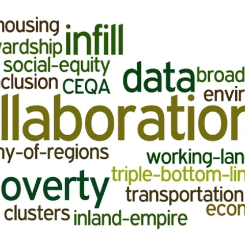
my wordle cloud on topics commonly discussed at the summit I spent two days at the California Economic Summit, held this year in Ontario, heart of the "inland empire".
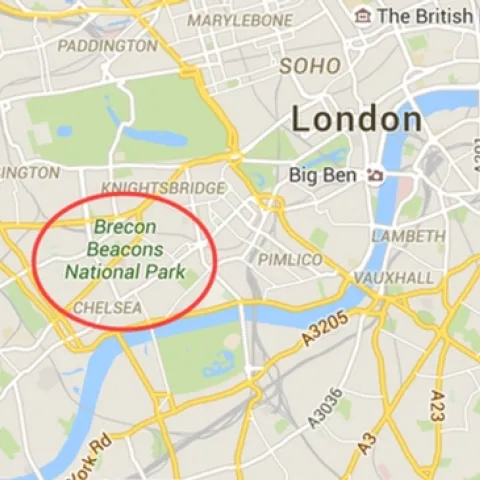
Here is a funny response to a major map error on Google Maps, found last month. From BBC Wales: http://www.bbc.com/news/uk-wales-mid-wales-34410736 The gorgeous Brecon Beacons was erroneously positioned outside of downtown London.
The GIF began in November 2015 on a wave of excitement around geospatial technology. In the months leading up to our first GIS Day in 2005, Google Maps launched, then went mobile; Google Earth launched in the summer; and NASA Blue Marble arrived.
A bit late, but better late than never. Our October trip to Hopland with IGIS and 3DRobotics was great fun, and very informative. We tested the Solo UAV with three different cameras: the typical GoPro, NIR GoPro (with post-market monkeying with filters to get IR), and a high res Canon lens.
The University of California, Division of Agriculture and Natural Resources (UC ANR), Informatics and Geographic Information Systems (IGIS) Program is seeking a Statewide Program Coordinator for both local and statewide program development and delivery.