UC ANR is committed to providing an accessible and inclusive web experience for all users. If you encounter an accessibility barrier or need content in an alternative or remediated accessible format, please contact anraccessibility@ucanr.edu.
Hello everyone in extension! Our IGIS workshop schedule for the fall is here. We have some great workshops scheduled for your geospatial pleasure. These are coordinated with the workshops provided through the GIF.
Andy Eschbacher, Map Scientist with CartoDB, will visit the GIF to teach this special hands-on workshop.CartoDB.com is a versatile cloud-powered spatial database, mapping, analysis and visualization engine that facilitates the process of building spatial applications for both web and mobile devices.
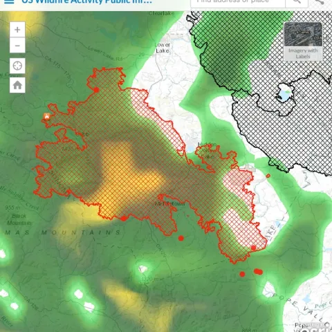
Been addicted to the ESRI fire feed for its integration of numerous data sources. Here is the Valley Fire currently, and the rain that just hit us has moved north. For more: http://www.esri.
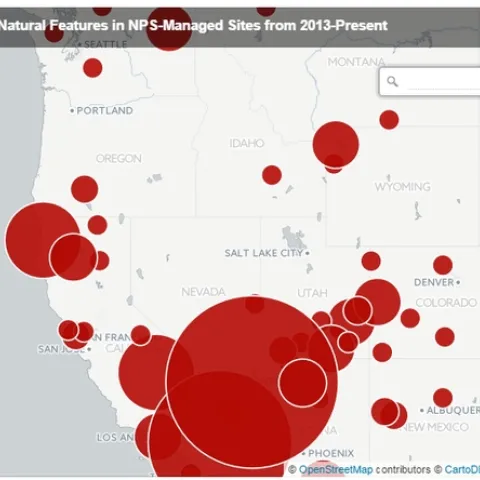
A webmap featured in an article in the High Country News shows where vandalism has been reported most in protected areas across the West since 2013. As the article associated with the map states, the areas most impacted are those closest to urban areas, particularly in the desert parks.