Despite some not-very-flattering-but-taken-with-really-rad-tintype-photography pictures of us all, this is an interesting article that focuses on our public participation in the SNAMP project. Check it out! http://cnr.berkeley.
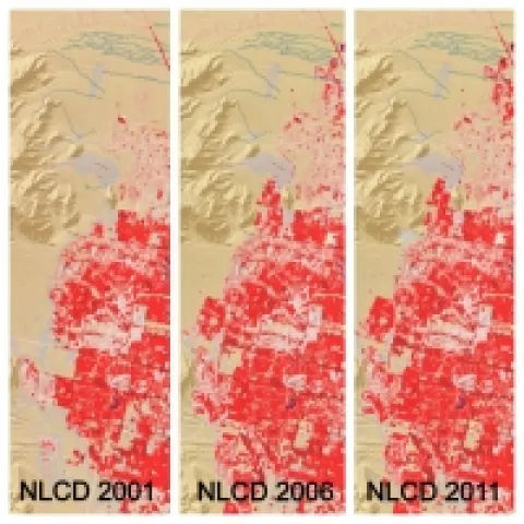
These three panels of cyclical data (2001, 2006, 2011) from the National Land Cover Database depict intervals of land cover change in the vicinity of Spring Valley, a suburb of Las Vegas, NV.
Former student and GIS expert Chippie Kislik alerted me to this video. She is working with others at NASA Ames on a Sierra Nevada DSS Ecological Forecasting Project. A video about the project is here.